Friday, August 11, 2023
On my second day in the Wallowas I hiked to the Russel Mountain Lookout.
Yesterday I hiked to Mule Peak, which is inside the Eagle Cap Wilderness. Today’s hike to Russel Mountain was mostly outside the wilderness boundary, except for one short stretch. There are three ways to reach Russel Mountain: 1) drive Road 450 up to the lookout, 2) hiking approximately 2.2 miles on Deadman Trail #1869 from Fish Lake, then turning east onto the Sugarloaf Trail for another 1.5 miles, or 3) hike Sugarloaf Trail #1887 from the east, starting at the Sugarloaf Trailhead on Road 66 just south of Twin Lakes. I went with the third option. Doesn’t look like this parking area sees much action:

The only way to know you’re at a trailhead is this one newish-looking sign up on a tree where the trail begins:

The first stretch of the trail follows an old roadbed:

I was pleased to see signs of recent maintenance:

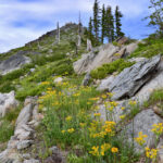
The wildflower show here would have been great several weeks ago, but most things were bloomed out. Lots of pearly everlasting around still:


At times the trail was faint, but I never had trouble following it:

Even though it’s been 29 years there are still snags standing from the 1994 Twin Lakes Fire that burned through here:


The roadbed reached a meadow where a sign facing the other direction pointed the way to the Sugarloaf Trail:

Hiking across the meadow:

I continued to see signs of recent maintenance:

The trail emerged from the trees and into a huge meadow where it was hard to tell where I should go. The trail pretty much disappeared in the grass. I spotted a distant log with a cut in it, indicating the trail passed through there, and I made a beeline for that spot. Incredibly, I forgot to take pictures at any point in this large meadow! From the cut log the trail was still faint, but I could see where I should go. Eventually I made it back to the trees where the trail was much easier to follow. 1.9 miles from the trailhead I reached the lookout access road, turned right, and 0.2 miles later I was at the lookout:


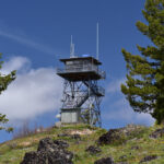
The 82′ tower was built in 1949 and is no longer staffed. There are signs telling you to stay off, but incredibly the lower stairs have not been removed as they usually are in such situations:


Well this is troubling:

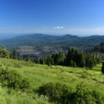
I poked around in the trees north of the tower to see if I could get a view from the ground, and indeed I could:

Looking behind me up at the tower:


The Forest Service apparently considers this a trailhead. The Sugarloaf Trail continues west from here along a former roadbed:

Looking back down the road I hiked up there’s another newish-looking sign:

There’s a nice little meadow just south of the lookout and I was dismayed to see that some jerks had driven across it sometime recently:

I set off back down the road:

Then turned onto the trail and began my descent down to the large meadow I forgot to photograph:


I made it back to the car and drove my way back down to Halfway. From the road you can just barely see the lookout poking up above the trees on Russel Mountain:

This was a nice hike and it was great to see that it gets maintenance!
Gaia stats: 4.8 miles, 970′ elevation gain
