Sunday, April 26, 2020
Today we hiked to Bedford Point. We drove down Highway 224 and at Promontory Park we turned left onto Road 4610 (also called North Fork Road on some maps), where there is a “no target shooting” sign that is pretty much universally ignored:

After crossing the North Fork Clackamas River the road becomes 4613. We parked at this berm. Based on the lack of vegetation on the berm and the state of the road beyond I’d guess that the Forest Service only closed this off within the past year:


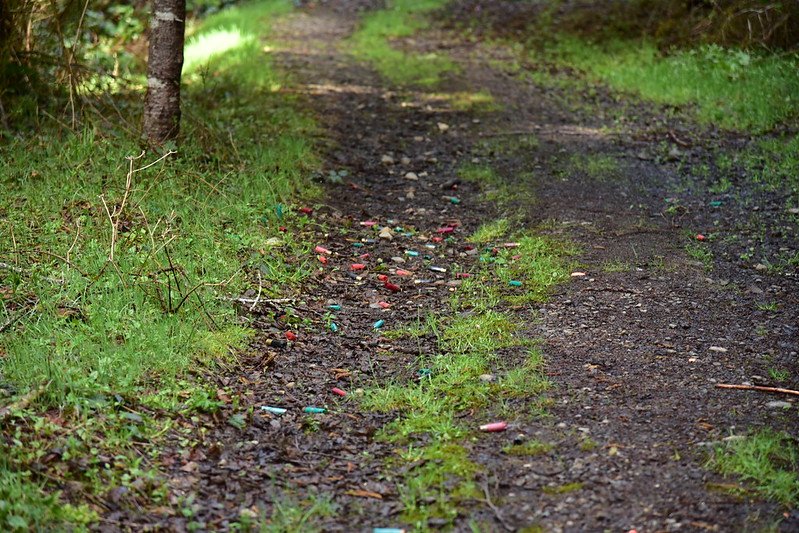
The target shooters have been here. We found their litter all over the place near the berm:

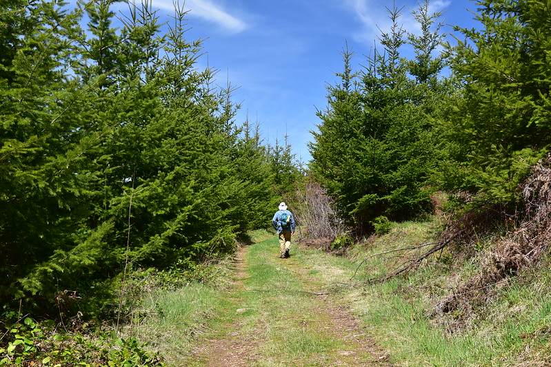
We walked the road through a recovering clearcut. There was a fence on the right, thought I’m not sure what it indicated:

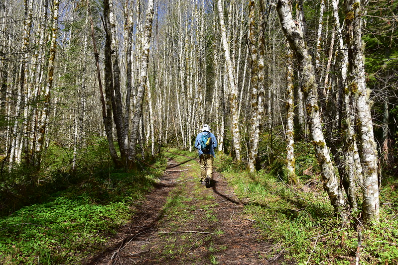
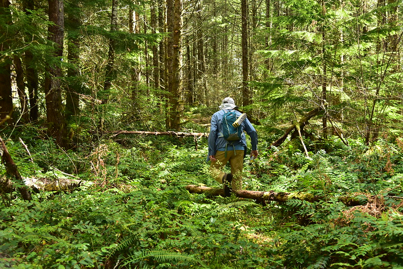
We made a hard right and started hiking northwest. The 2003 Mt. Hood National Forest map and the USGS map call this Road 120, but some maps call it Road 4610. As you will see, it also seems to have been 4613 at one time.


We reached Whisky Creek after hiking 0.75 miles. It was a pleasant gurgling creek:

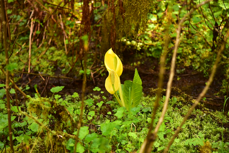
Skunk cabbage was blooming there:
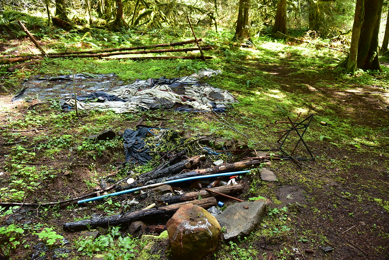
Unfortunately just past the creek was a large campsite on the right that was pretty trashed. There was a large collapsed tent, a broken chair, and lots of random trash in the huge fire pit. I’m guessing this happened before the road was closed:
At 1.2 miles we entered an old clearcut:
The regrowth was too tall to allow views, but we did get a glimpse of Goat Mountain:

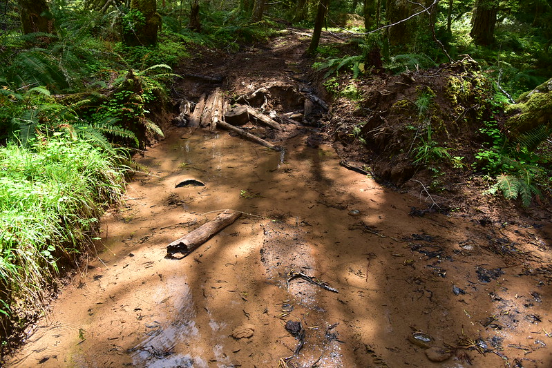
At 1.5 miles we reached a really muddy spot where the road crossed a small stream. The culvert that allowed the stream to flow beneath the road had been removed and berms erected on either side:

The ATV crowd had constructed a detour, though:

It’s hard to tell in the photo below, but that is a pretty deep ditch with several inches of water in it. What a mess:

Looking back the other way:
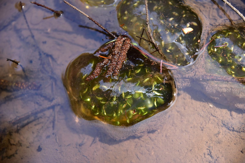
In that puddle we spotted some weird gelatinous blobs that we think were some kind of amphibian egg sacks:

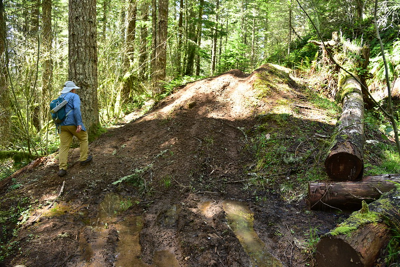
Until that berm was erected back where we parked and started hiking, people could drive a vehicle up to this point. But with the culvert removal only dirt bikes and ATVs could get through, and the next stretch of road was pretty grassy:

At 1.8 miles we reached a huge ditch and a berm:
At 2.2 miles we reached the short spur road up to Bedford Point. We knew there would be no views up there. It was lunchtime and the satellite view showed what looked like a possible open spot a bit further up the road so we headed that way. This stretch of road can be accessed through private Weyerhaeuser land to the north and it looks like it does seem some traffic, although I doubt the road is open to the public:

Turns out the spot I had in mind did not have any kind of view, but it was open enough to be in the sun so we sat there on the road and ate our pasta salad lunch before hiking back up to check out Bedford Point:

The spur is Road 011 and the sign indicates that the main road was once 4613, adding further confusion to the road’s identity:

The spur road is pretty overgrown, but mercifully short:
You can just make out the driveway loop up here on the right and left:
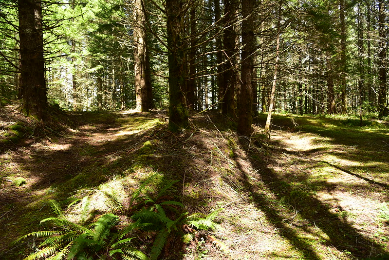
The summit is totally overgrown with no views:
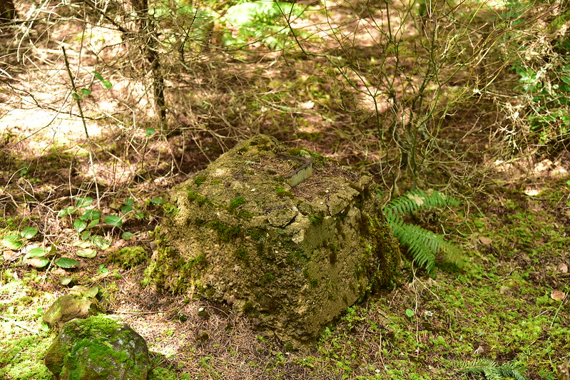
We found the old concrete footings, one of which has toppled over:

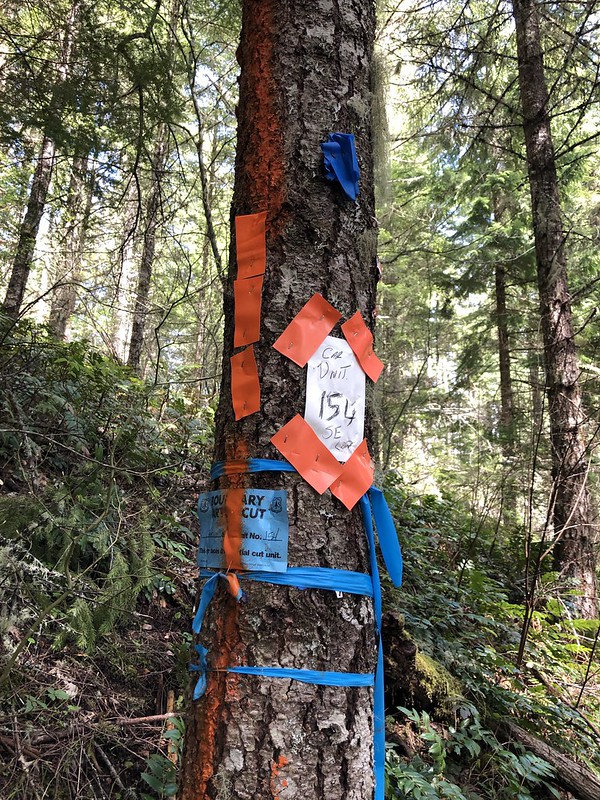
We saw signs for the Car Timber Sale (about which I could find no info online) with lots of flagging and spray paint:

This was along the road near Bedford Point:
The remains of a rock wall:

An old cable:

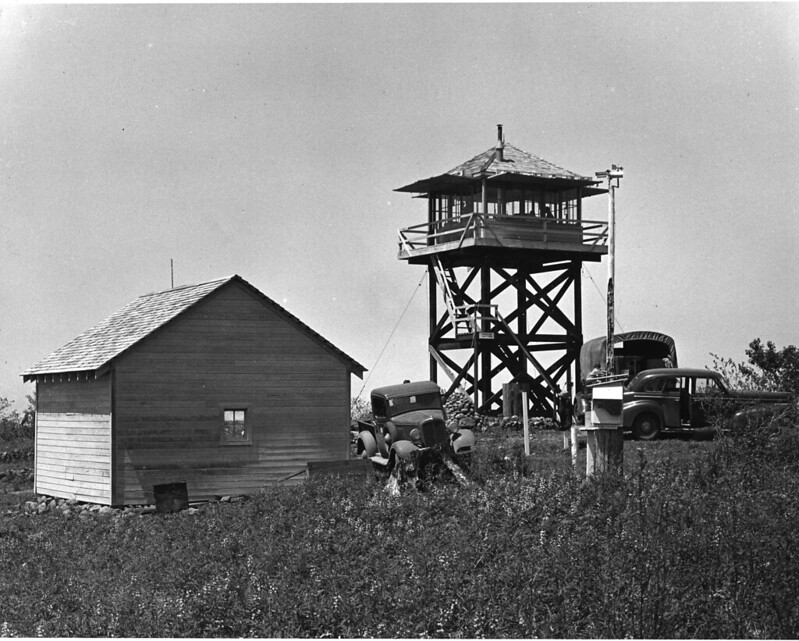
This undated photo shows the 20′ tower that was built here in 1939. Even though it was removed in the 1960s, the map still says “Bedford Point Lookout”.
Hard to believe this was ever a lookout site with a view of the surrounding area, but back before wildfires were so thoroughly suppressed the landscape was a lot more open. Panorama photos from 1933 show how things looked back then. (High res versions available on this page.) Here is the view to the north:

To the southeast (with the driveway turnaround visible at the bottom):

To the southwest (that’s the short access road coming up from the right, with the turnaround loop out of sight on the left):

We filled a plastic grocery bag with trash at Bedford Point and filled another on the hike back. It was mostly beverage containers, but also other things like shotgun shells. We also pulled out what we could from the trashed campsite. This was our trash haul, which was about 12 pounds, not including the broken chair:

We didn’t see a single person the whole time. Total mileage: 5.6 miles


