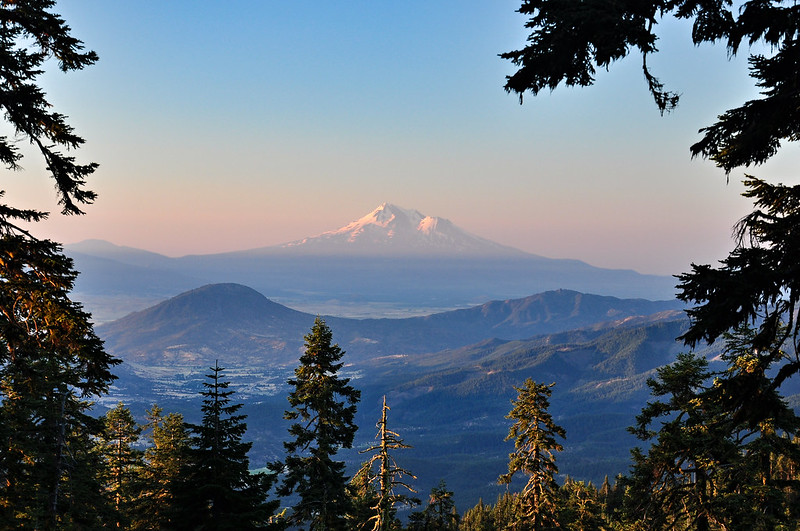
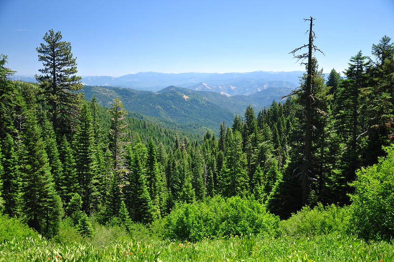
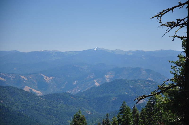
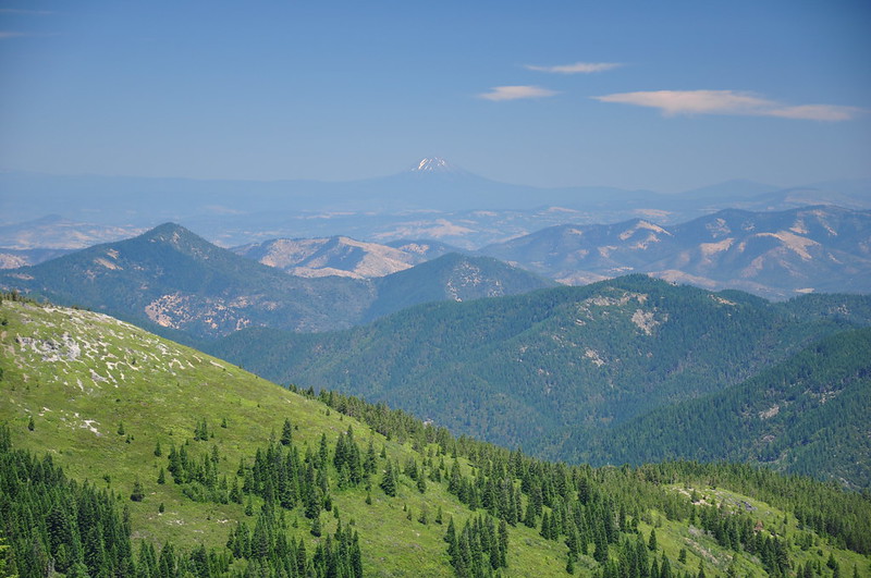
We had to change our plans due to snow, after paging through the hiking book and looking over the maps, we decided to spend Monday and Tuesday over near the Applegate Lake area. We got up EARLY so we had time to drive over there, find a campsite, and still get a good hike in. Our early wake-up call meant a lovely morning view of Mt. Shasta from our campsite at Mt. Ashland Campground:
We planned to camp near Applegate Lake, which would put us closer to our trails, but the person at the Star Ranger Station said all the campgrounds were full. We grabbed a spot at Jackson Campground instead (which we were also told was full), which added an extra 20+ minutes onto our drive to the trailhead, and later when we drove through the Carberry and Watkins campgrounds both had available spaces. It was the second time in one weekend that misinformation from the Forest Service caused us grief.
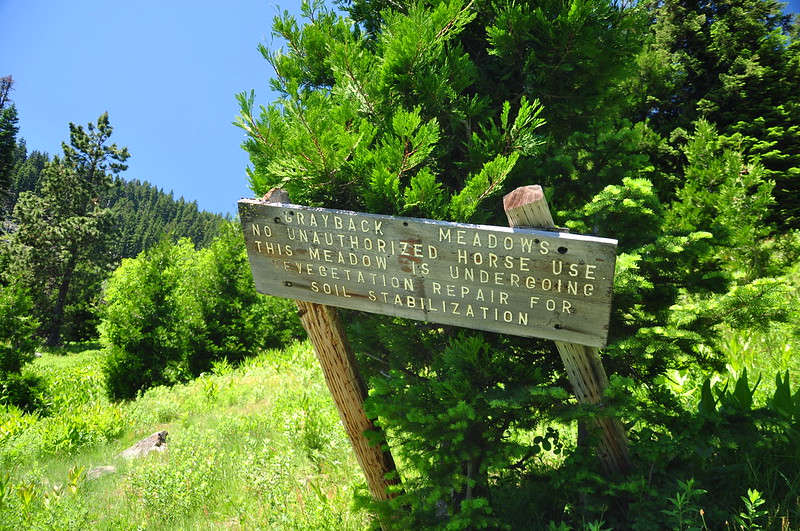
So off we headed towards Grayback Mountain. It is the highest peak in Josephine County, although there is no trail to the summit. It gets its name from 1850s gold rush miners who named the peak after the itchy lice commonly known as “graybacks.”
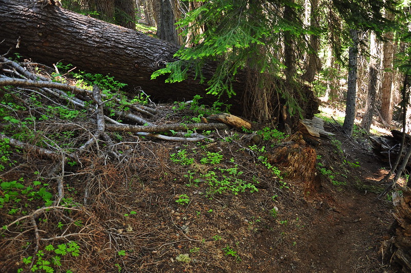
We drove to the Upper O’Brien Creek Trailhead, which was mostly fine except for the last stretch was very rough and very rocky. Good tires required! The trail starts out on was once a continuation of the road. It’s so rough and rocky and it’s hard to imagine it was ever drivable.
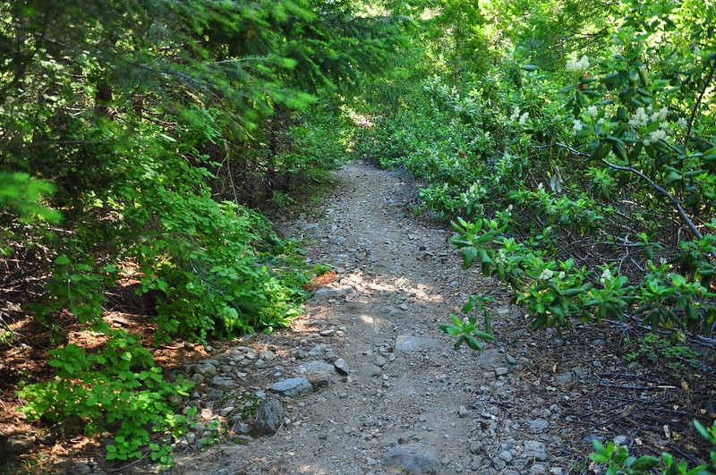
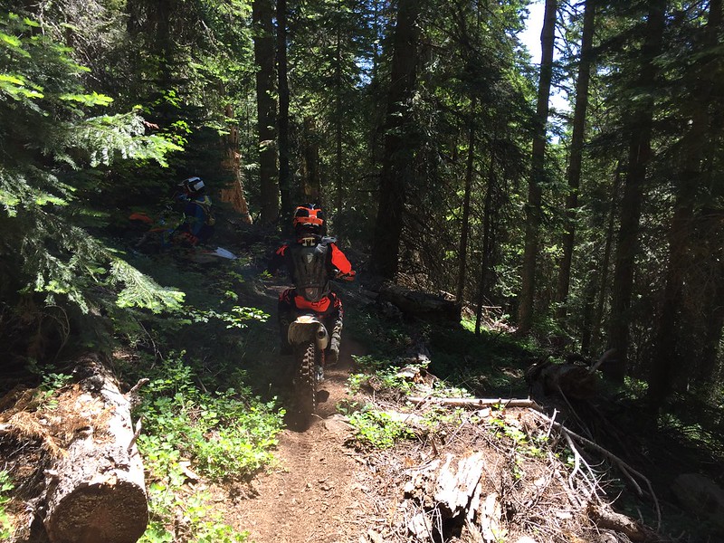
Then the old roadbed ends and the trail begins. The trail is in bad shape. For one thing it’s poorly-graded and very steep. And it doesn’t look like it’s received maintenance in at least a decade. Lots of deadfall to negotiate. At one point we heard a noise up ahead and realized it was dirt bikes. A few minutes later two of them came down the trail. Here they are detouring around a fallen log:
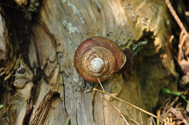
We saw a snail!
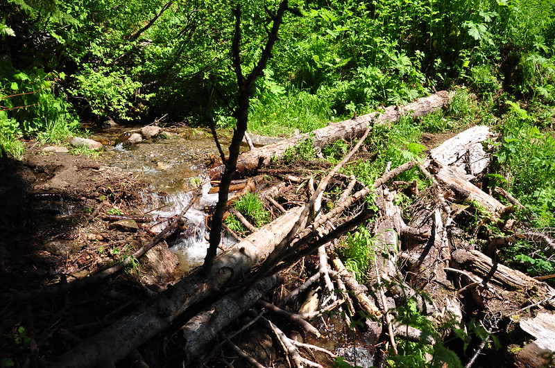
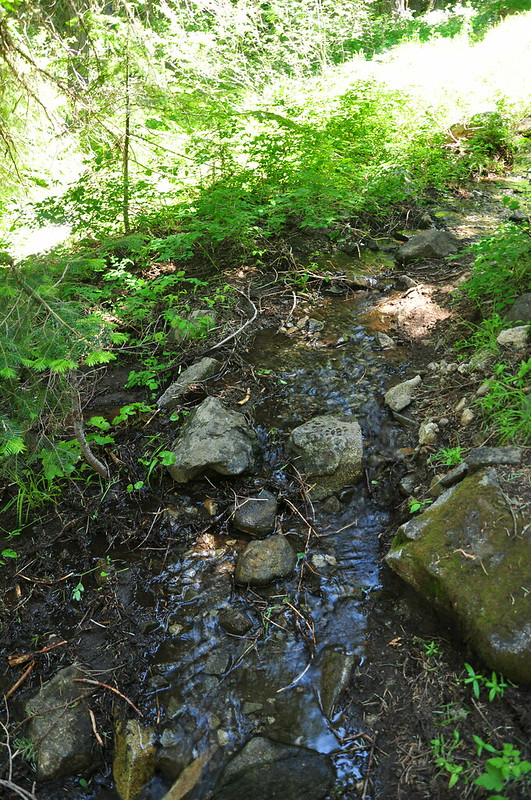
The trail crossed O’Brien Creek, where the ground was all chewed up from the dirt bikes.
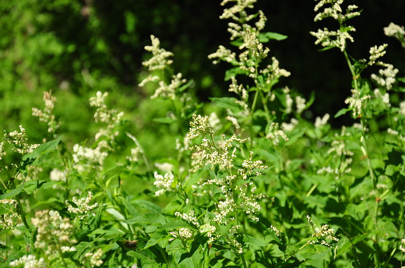
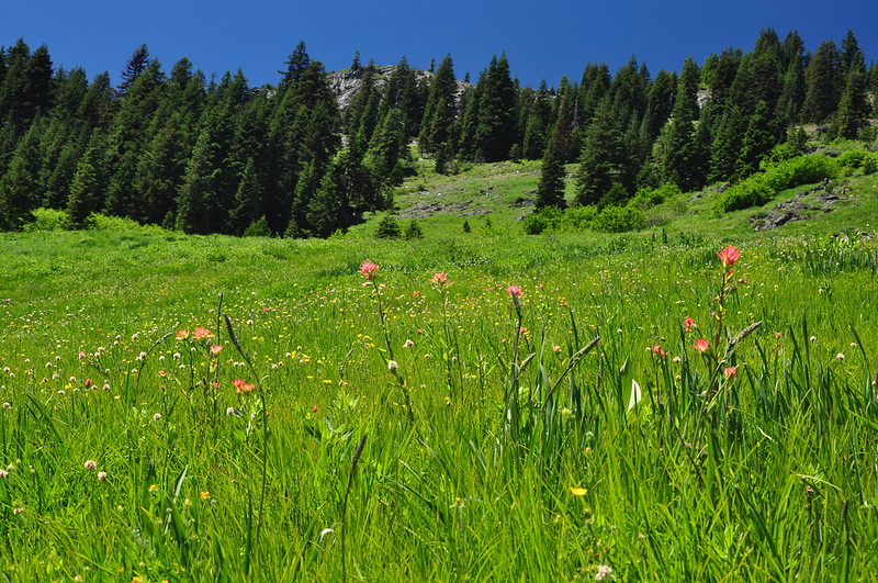
Lovely flowers near the creek:
Just after the creek crossing the trail splits. The main trail goes to the right and a spur trail to the left goes to the Grayback Snow Shelter. We went that way to check it out.
According to this article…
“The cabin was built in 1944 for surveyors who’d hike up the mountain to measure snow depth and moisture, helping to give farmers and ranchers accurate forecasts for the summer’s water supply. The cabin still serves its original purpose, but it’s also become a sort of communal bunkhouse for weary Grayback travelers seeking shelter from the night.”
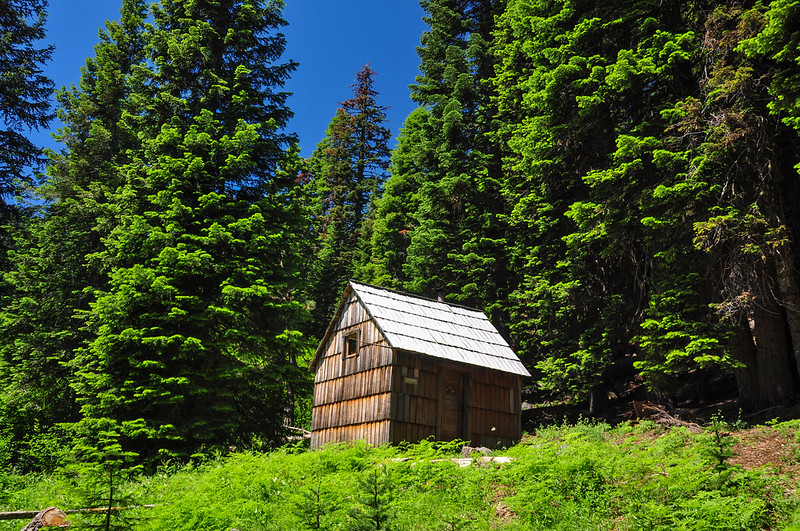
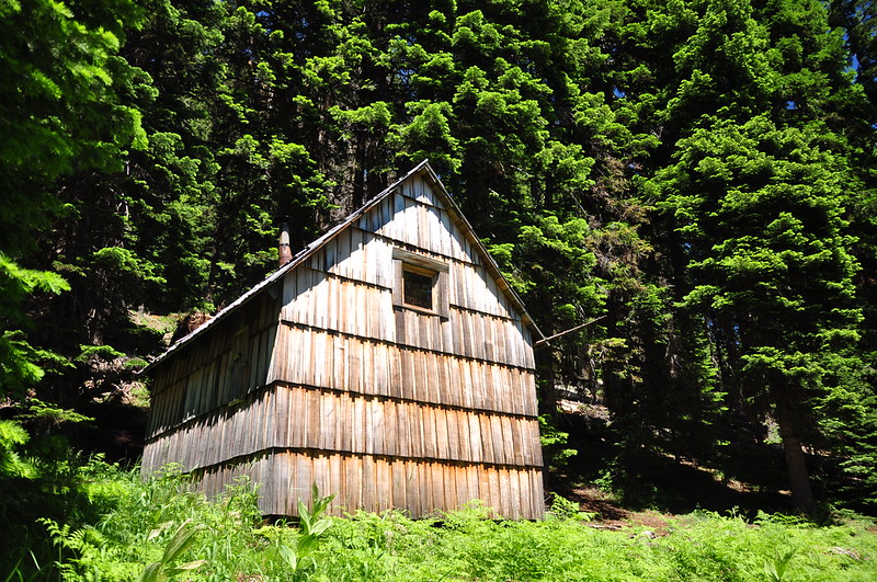
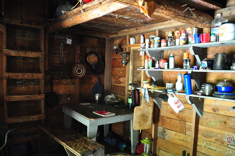
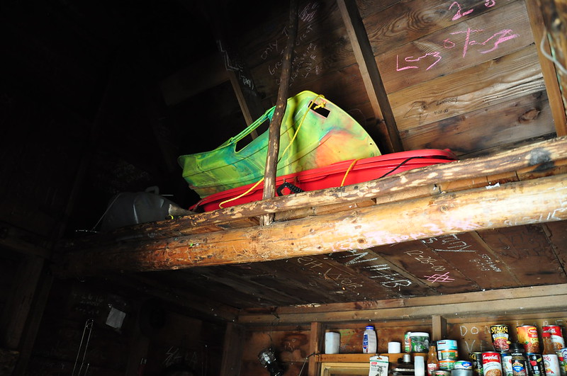
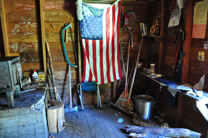
Indeed, the logbook indicated that the cabin received regular use, even in the winter. One entry mentioned how the family had tried numerous times to stay at the cabin but always found it occupied, and were glad to finally luck out and find it vacant. The cabin was chock full of stuff inside:
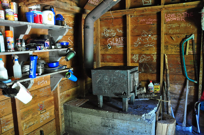
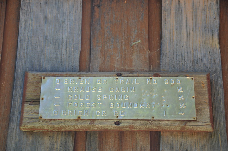
Old sign by the door:
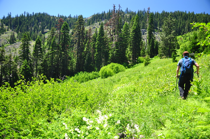
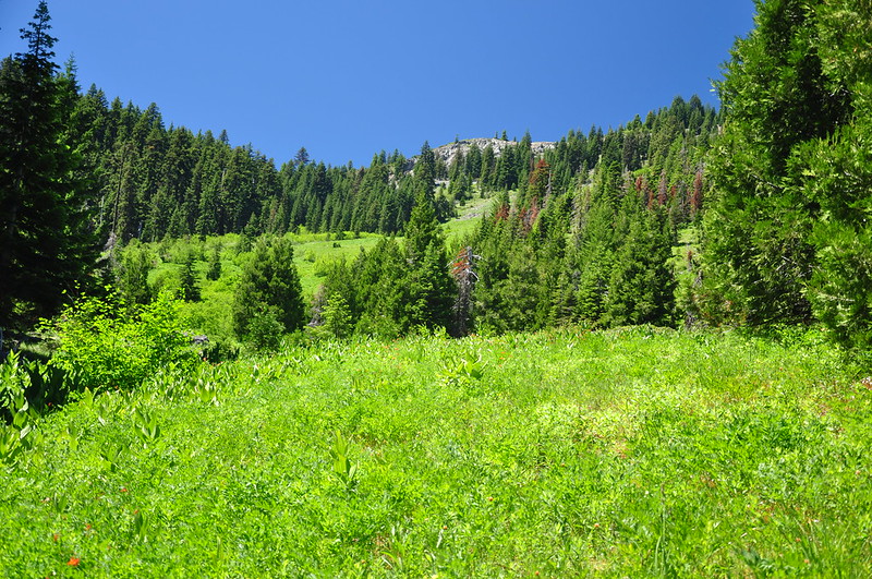
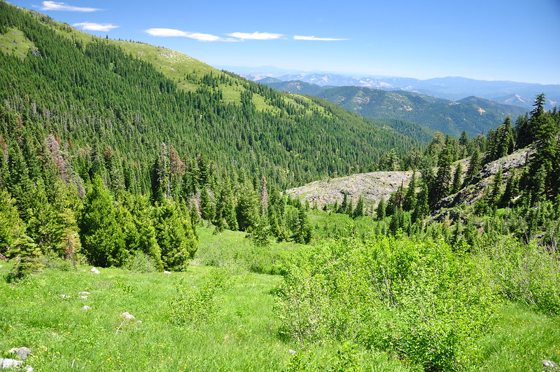
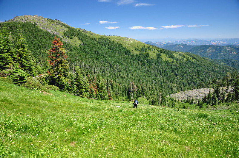
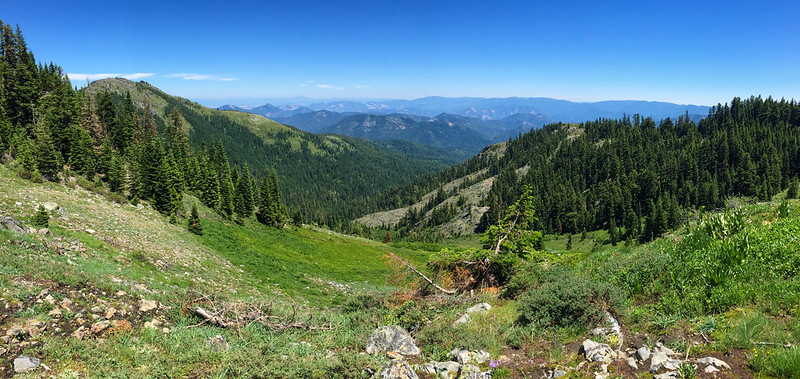
Just around the bend the trail dead-ends at the bottom of a huge sloping meadow that stretches up towards the summit (not visible from down here). We were soon to get better views, but even from down here the views weren’t too shabby:
We found the site of the old Krause (or Krouse, depending on your source) Cabin. All that’s left is this:
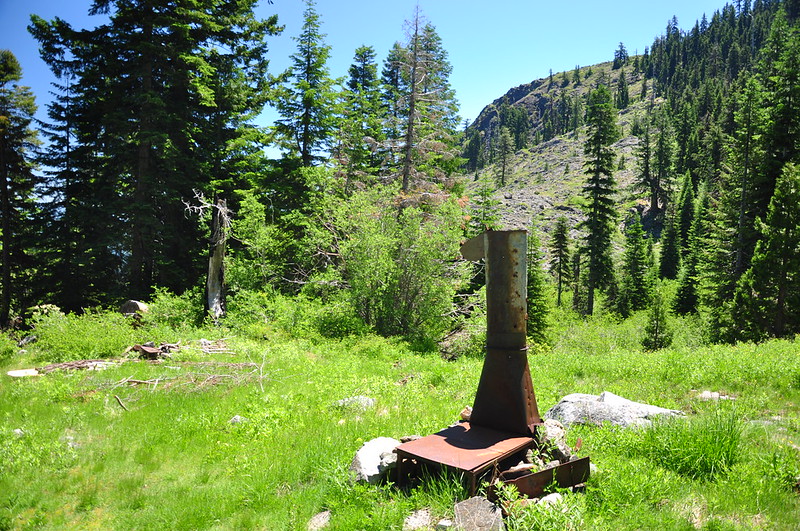
Again from the article above: “The stove is all that remains of the Krouse Log Cabin, a famous Josephine County destination that was built by Phil Krouse and his father, and finished on the same 1945 day the Japanese surrendered to the United States in World War II. Five generations of the Krouse family enjoyed the cabin — their small children bouncing through the wildflowers and old men watching sunsets over the mountains — and it also housed equestrian groups, hikers, hunters, and Forest Service employees passing through for the night. But one night in 2001, three teenagers from Medford were spending the night at the cabin when its logs were accidentally ignited. The 56-year-old structure burned to the ground during the early morning, leaving behind only the iron stove.”
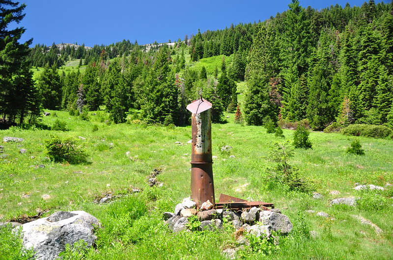
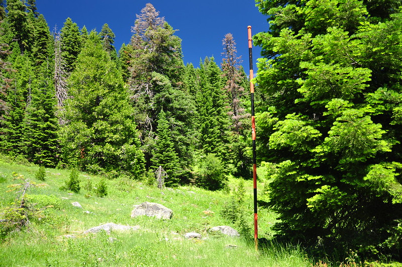
There’s also a snow survey pole here:
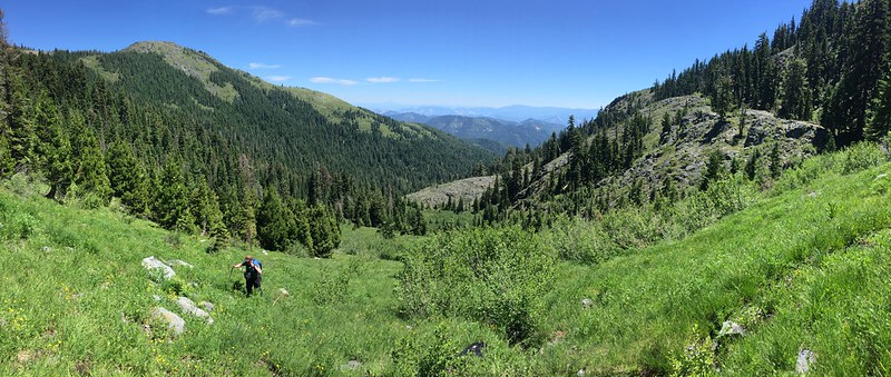
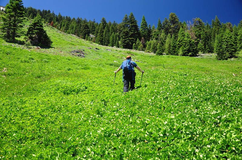
We wanted to go up to the Boundary Trail, but rather than go back to the main trail, which switchbacks up to it, we foolishly decided to go straight up through the meadow, which turned out to be way harder than it looked. The hot sun beat down on us as we struggled up the steep slope.
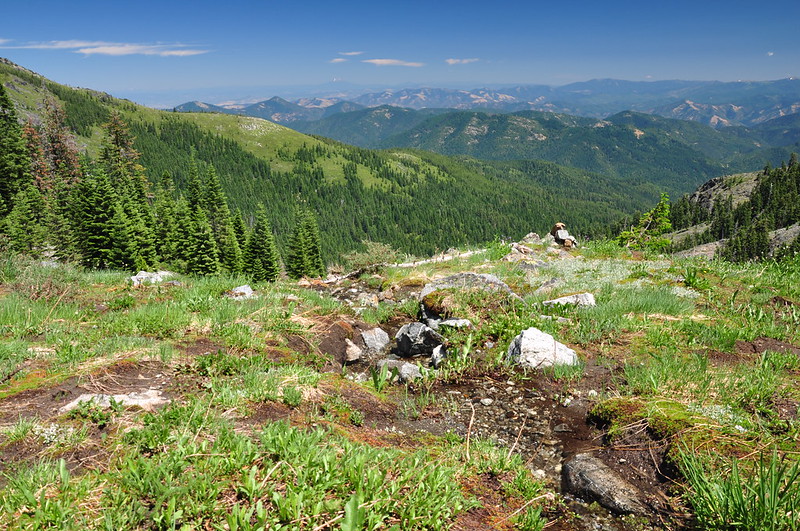
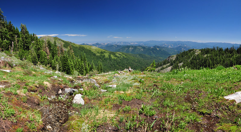
Finally we made it to the Boundary Trail.
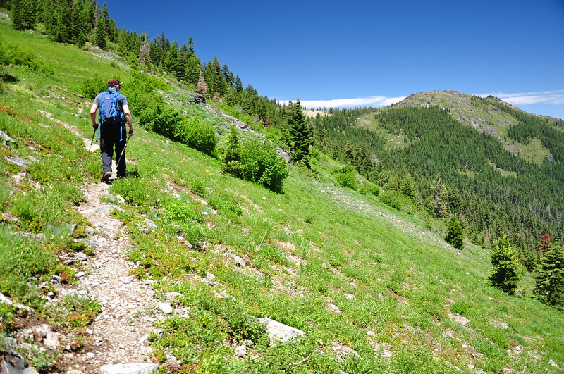
The views were pretty great.
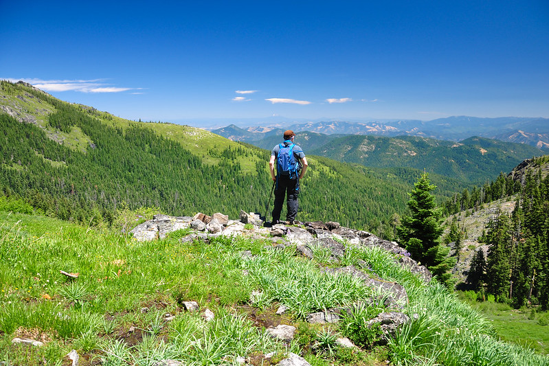
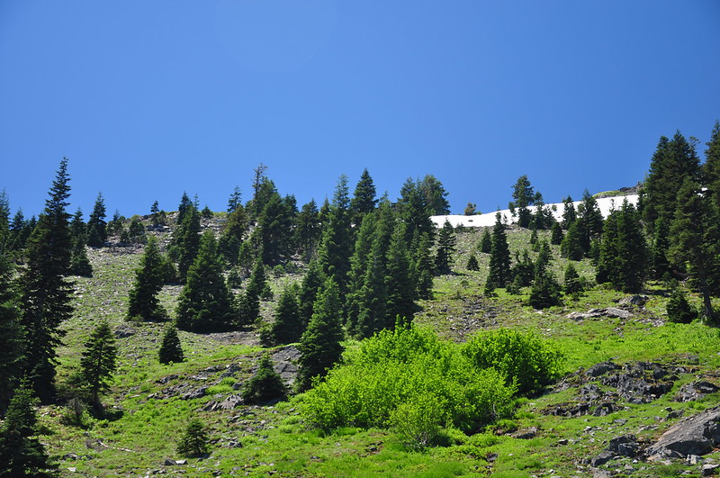
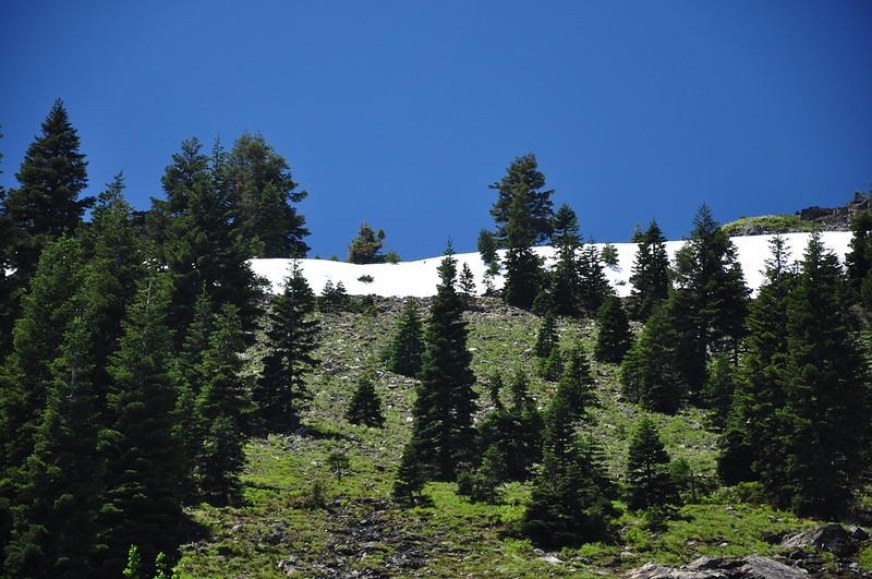
Sullivan describes a way to get up to the summit, which was 900′ above us. “Bushwhack straight uphill to the right. Scramble through a gap in the cliffs, follow a ridgecrest, and push your way through the manzanita brush for 0.2 mile to the rocky summit.” It didn’t look passable due to snow, but we scrambled about 150-200 feet uphill from the trail to get a better look. It turned out to be a soggy slog:
We got to a flat rocky area and scoped things out above. It looked to me like Sullivan’s suggested route would take us right where that snow was.
This hike had not been part of our original plan and we hadn’t done any research on this off-trail scramble, plus we’d gotten a late start on this hike and we had already done a tiring 700′ vertical bushwack through the meadow, so I was reluctant to give the scramble a go. (See end of this post for more on the scramble to the summit.) So we sat here and enjoyed the view and the gurgling meltwater creek:
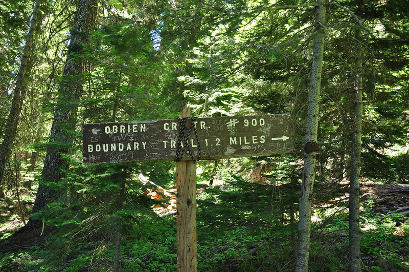
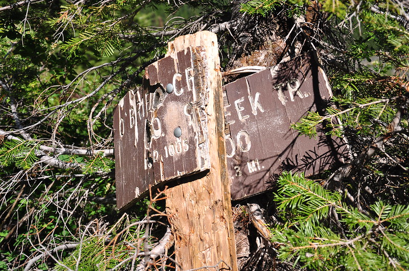
Hiking back down we took the “easy” way: the trail. The Boundary and O’Brian Creek junction had a big dilapidated sign. I’ve never seen trail signage in this style before. Interesting.
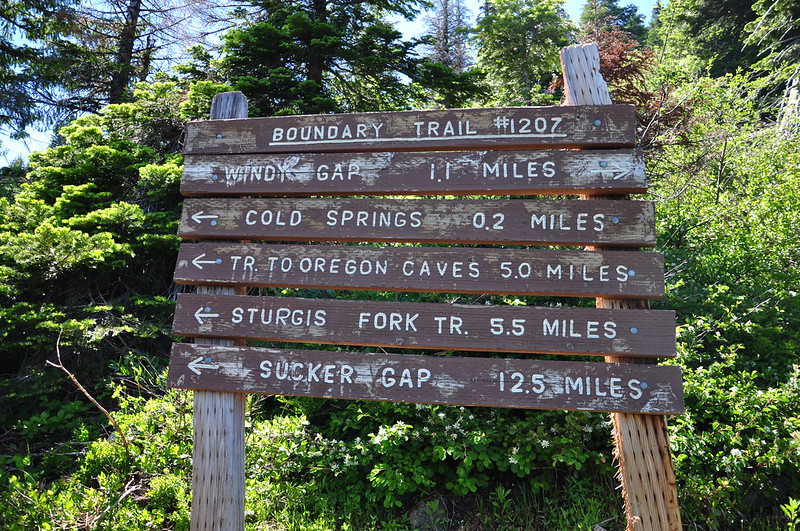
This poor sign has seen better days:
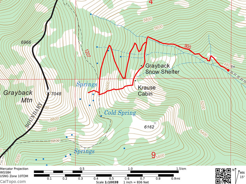
We got back to the car at 4:00. I didn’t take a track of our hike, but here is more our less the route we took:
We only saw one other hiker and the two dirt bikes. It looked to us like dirt bikes are not uncommon on this trail, and we were dismayed by the damage done by them.
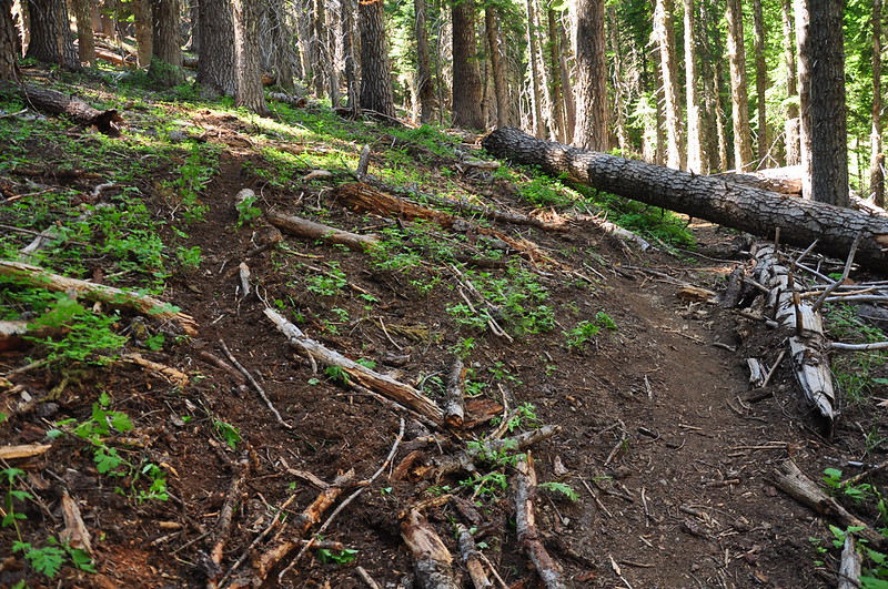
The dirtbikes have established re-routes around the numerous fallen trees, but unlike a hiker re-route these paths are often a chewed-up mess.
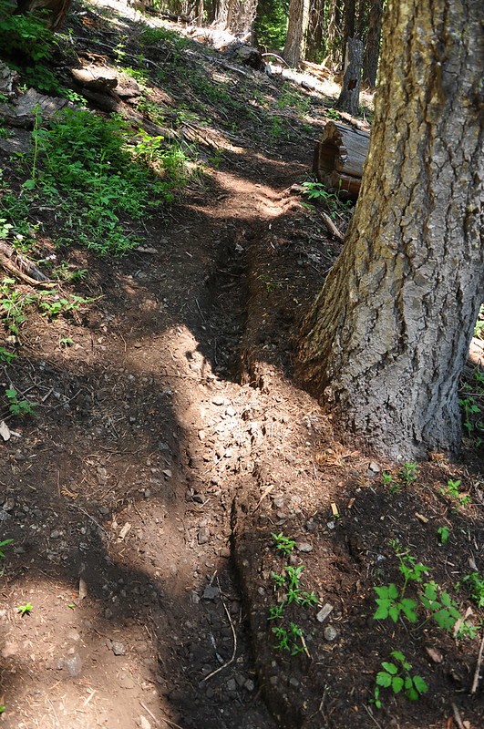
The area seemed neglected at best, and abandoned at worse. The trails here need some TLC. Besides the dirt bike damage and fallen trees there were numerous places where the trail served as a creekbed, further eroding the condition of the trail:
As for that summit scramble, later when we got home and referred to Hiking Oregon’s Southern Cascades and Siskiyous (Art Bernstein), it recommends taking the Boundary Trail 0.7mi from the junction. “You arrive at a saddle with a sharp ridge rising to the right. To attain the summit, merely walk up the ridge. There is no trail. It’s 0.5 mile from the saddle to the hogback summit.”
And in 75 Scrambles in Oregon (Barbara Bond) it says once you enter the meadow on the Boundary Trail “continue on the trail about 10 or 15 yards, then turn right and start heading up the rocky section of the meadow toward the summit ridge. Here, scramble on the rocks to avoid crushing the fragile wildflowers. Scramble up the steep slope, or traverse, until you reach the prominent rocky ridge. Turn right (north) onto this ridge and head up, scrambling over the blocky gray rocks about 500 feet to the summit.”
When I posted this report over on Oregon Hikers, someone recommended the following: “Take the Boundary Trail north to Windy Gap, then go west through the trees for a short ways to the ridge, which is rocky and open with great views. Follow the open ridge south to the summit.” So if we’re ever back in this area, we’ll try that.


