Saturday, October 8, 2022
Today we chose a hard workout hike.
We first visited Devils Peak in September 2012, almost exactly two years ago. That time we hiked in from the end of road 2613. The hike is quite short, but that road is awful. I’ve always been curious to try the more common route that people take, the Cool Creek Trail. I knew it was steep but I was right.
The trailhead is on Still Creek Road:

We entered the Salmon-Huckleberry Wilderness immediately:

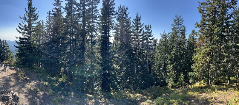
The day was warm and sunny and we were grateful for the shade:

We saw signs of trail maintenance this season which was good:
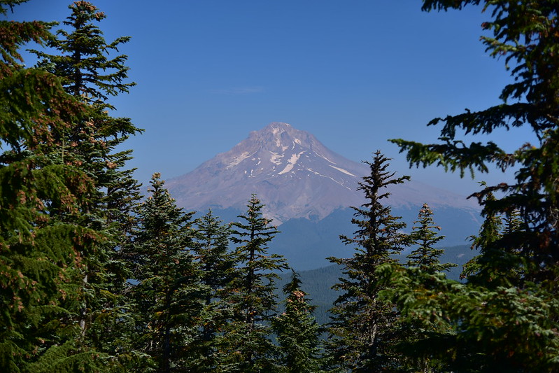
About 1.2 miles into the hike we had a nice view of Mt. Hood:

That’s Zigzag Mountain to the left of Mt. Hood

Tom, Dick, and Harry Mountain to the right of Mt. Hood:
Climbing steeply:

We saw old trail blazes on the trees. This is how they used to mark the route of trails back in the day:

There is a lot of rhododendron here. This would be beautiful when it blooms in June:


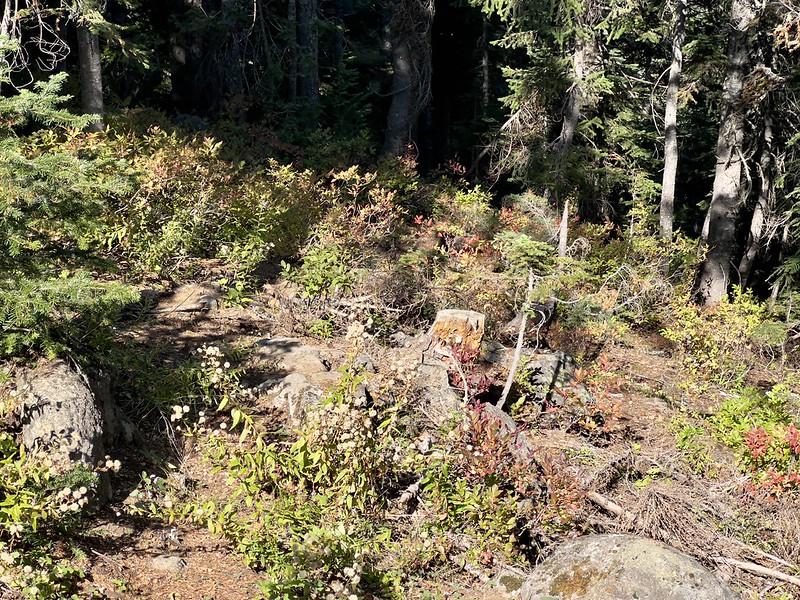
A few trees here and there had fallen since the trail crew came through and we had to climb over:

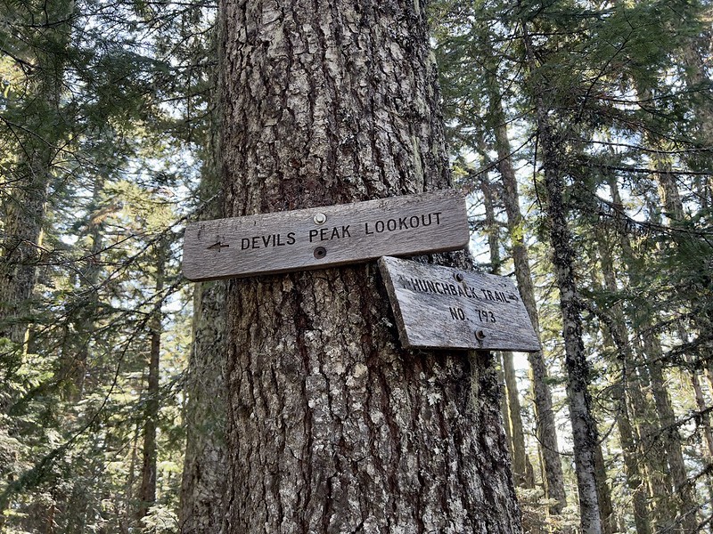
After 3.5 miles and 3,070′ elevation gain I reached the junction with the Hunchback Trail. (Greg had stayed behind to talk to some friends we ran into. After conversing with them a bit I had continued so I didn’t lose my momentum.) Ie turned right, then almost immediately turned left for the spur trail to the lookout:
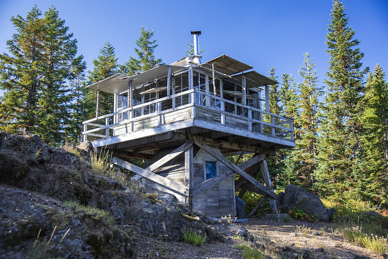
After 3.6 miles and 3,140′ elevation gain I reached the lookout:
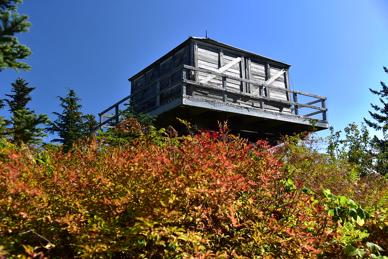
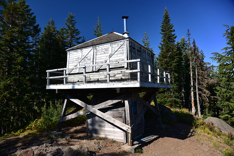

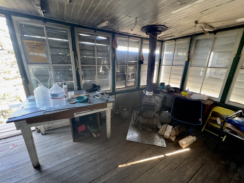
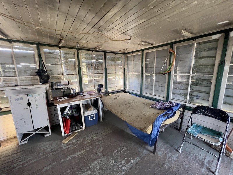
The lookout is available to stay in first-come first-serve. I think people try to keep it somewhat clean, but it’s still pretty grungy inside. There are two beds and a woodstove:
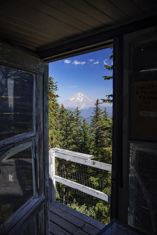
Although it’s getting pretty overgrown, you can still see Mt. Hood from the doorway:
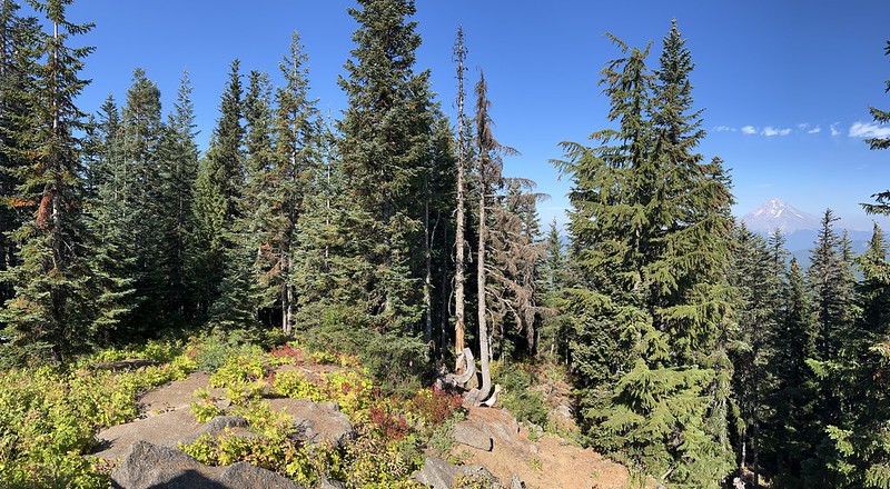
The only other view is to the southeast:

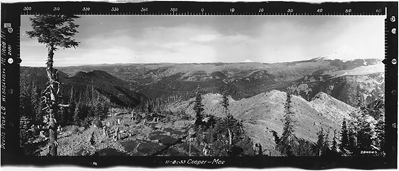
It’s interesting to compare the panorama photos from 1933 to how the “view” looks today. Looking southwest:

Looking southeast:

Looking north:
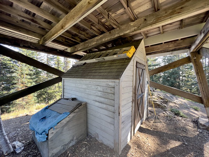
There’s a storage shed under the cabin:
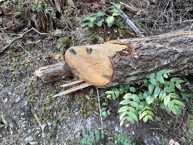
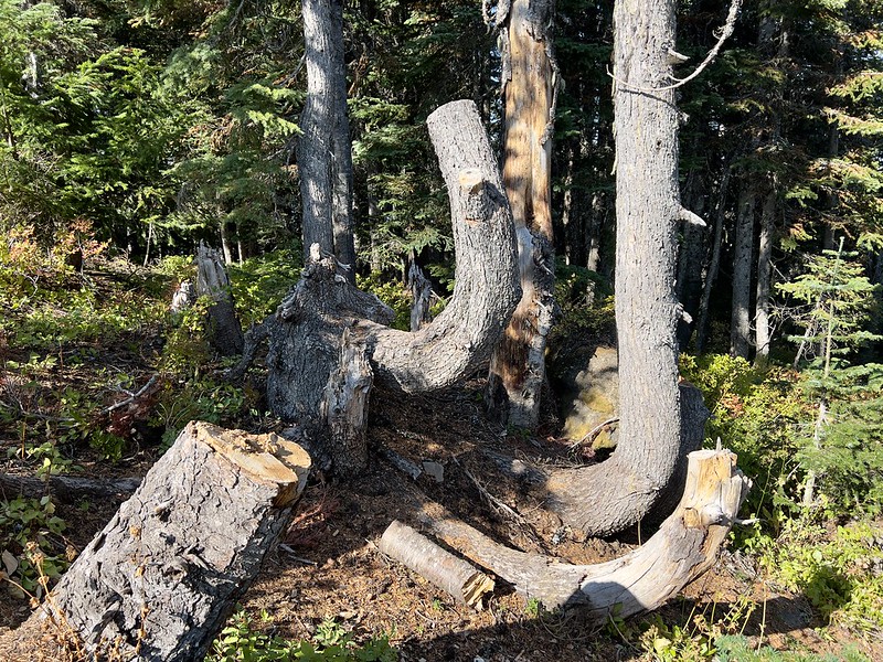
There are tree stumps all over the place, presumably from people cutting down trees for firewood:
A group of four backpackers arrived and started propping open the shutters, which made the cabin look nicer:

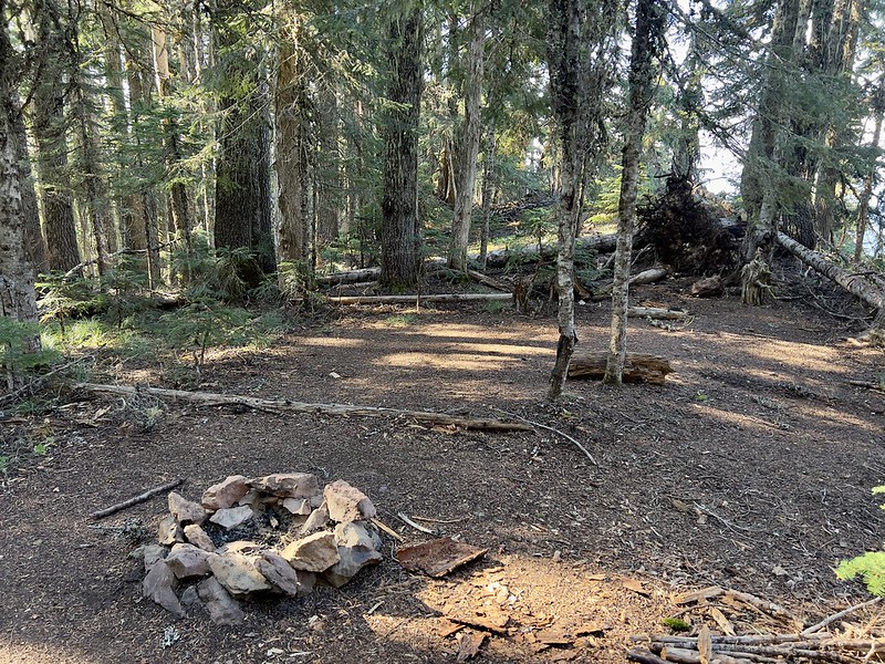
Greg arrived not too long after me and we sat on the summit for awhile taking a nice break. On the way back down we took detour north along the Hunchback Trail to find the nearby campsite and spring I had heard about. We found the campsite, but couldn’t find the spring:
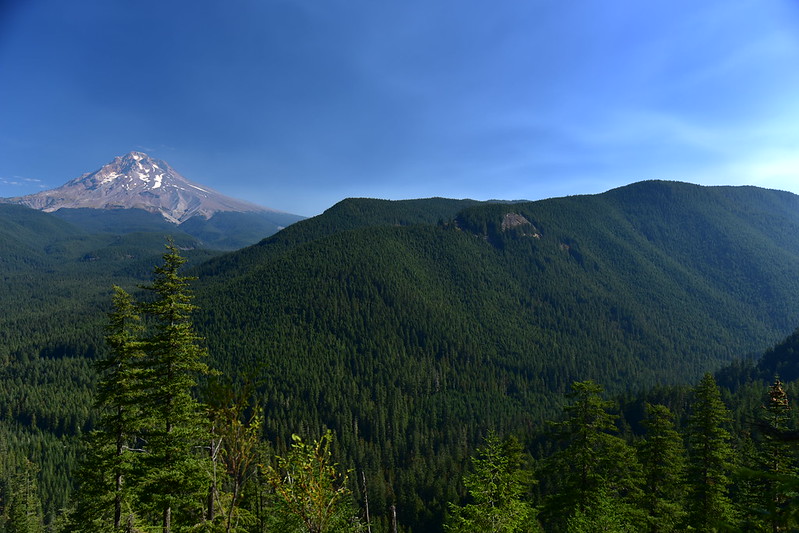
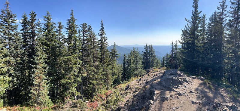
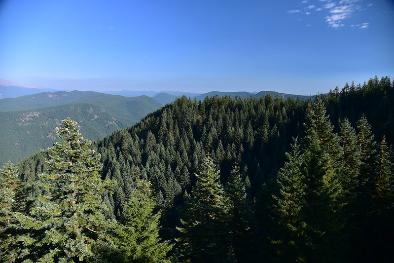
We headed back to the Cool Creek Trail and began our descent. On the way down we took a short side trail to a viewpoint:

The views here are WAY better than at the lookout. Mt. Hood is clearly visible to the northeast. A layer of haze hung out on the horizon:

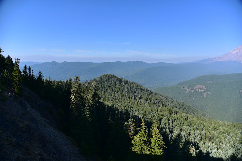
Southeast of Mt. Hood:
The long ridge of Zigzag Mountain to the west of Mt. Hood:
The descent on the steep trail was pretty punishing, as we knew it would be. We were very glad to get back to the car!
Gaia stats: 7.5 miles, 3,240′ elevation gain


