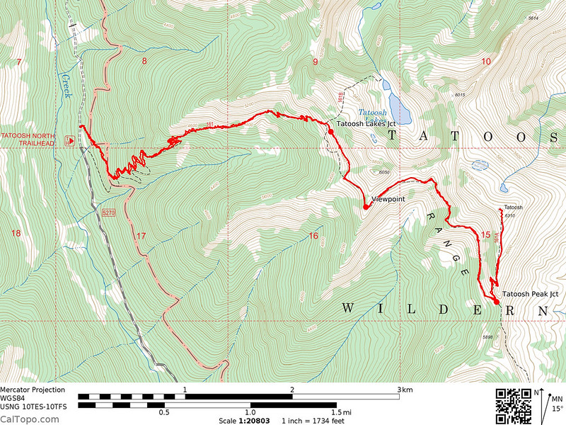
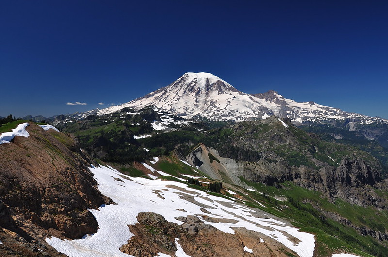
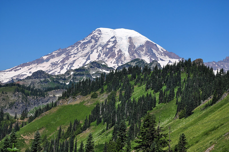
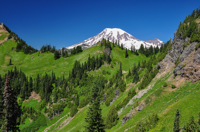
On Saturday Greg and I hiked up the Tatoosh Trail to the site of the old Tatoosh Lookout. I believe this summit is commonly called Tatoosh Peak, although on the topo map it is simply labeled “Tatoosh.” (Also, to confuse things, I believe this ridge is called Tatoosh Ridge, whereas the peaks just north of here are the Tatoosh Range.) From Tatoosh Peak one gets amazing views of Mt. Rainier and other peaks.
We had intended to stay in Packwood on Friday night so we could get an early start in the morning. We made the mistake of using Expedia to book a hotel and the hotel got overbooked. Expedia was not able to find us a room anywhere in the vicinity so we chose instead to stay in Portland and get up at 4am to hit the road at 5am. By the time we hit the trail at 8:50 we had been awake for nearly five hours already.
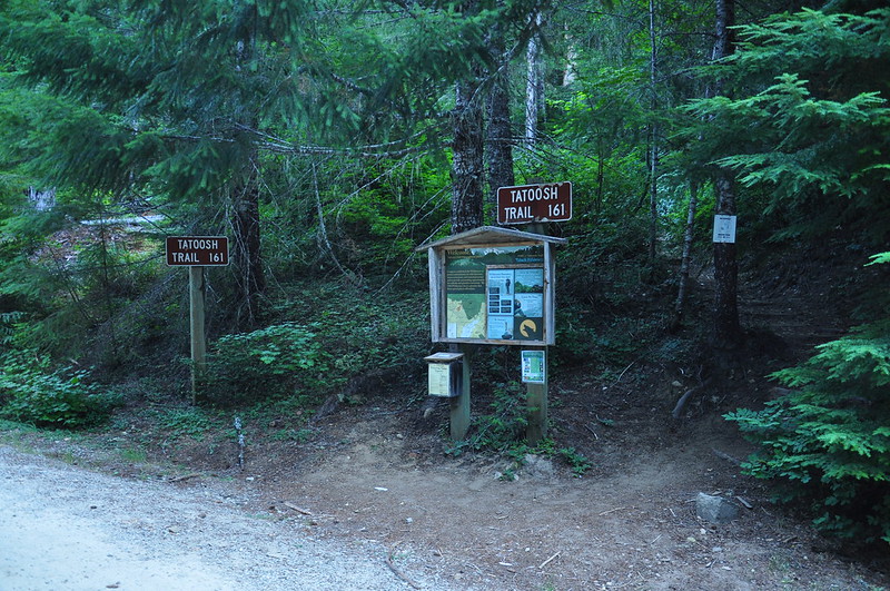
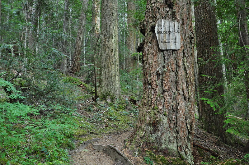
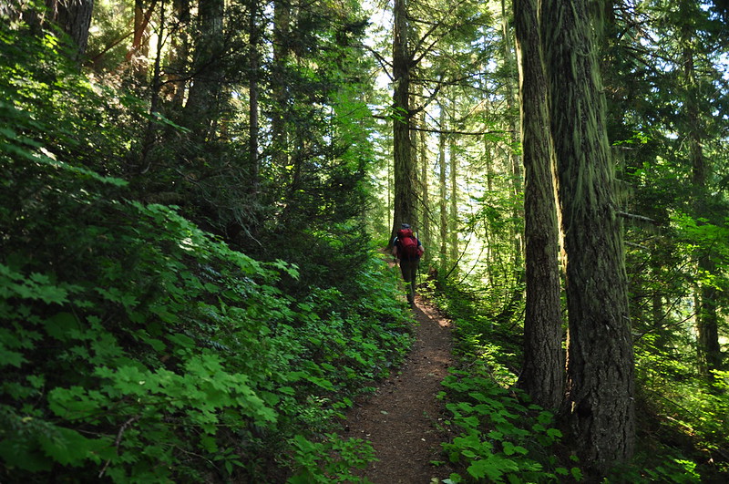
The first two miles climbs relentlessly uphill through the trees.
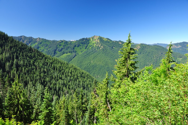
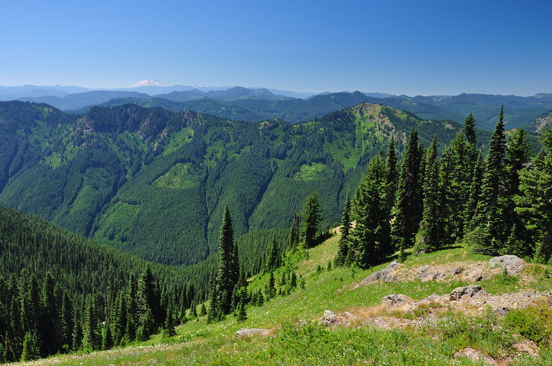
Then things started opening up and we started getting views of Dixon Mountain:
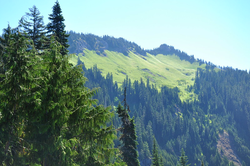
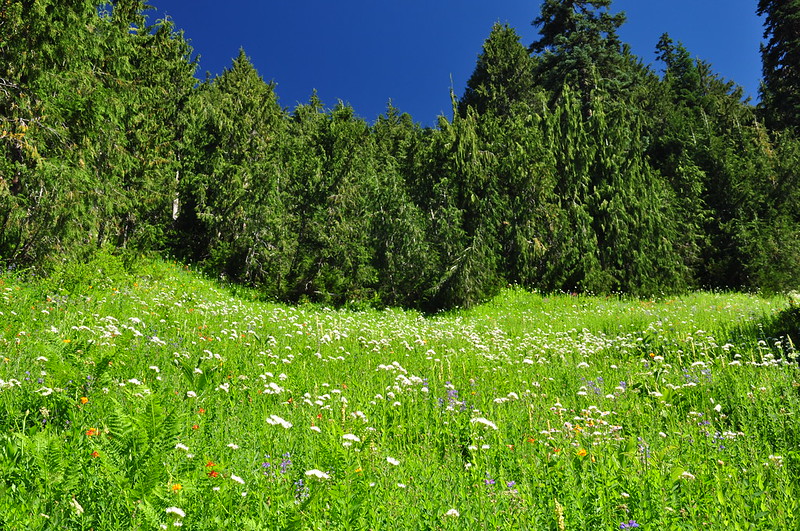
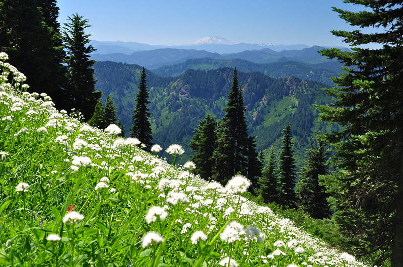
And we got a glimpse of the huge meadows we would be traversing soon:
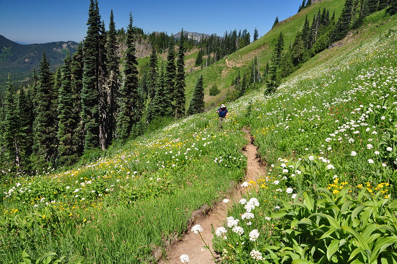
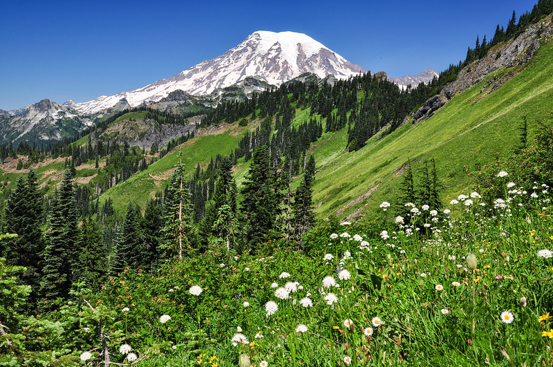
We started passing through nice meadows of wildflowers including beargrass that was WAY past peak. We never would see beargrass that was still blooming on this hike, but the other wildflowers more than made up for it.
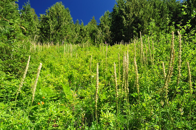
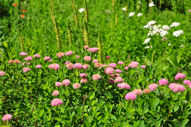
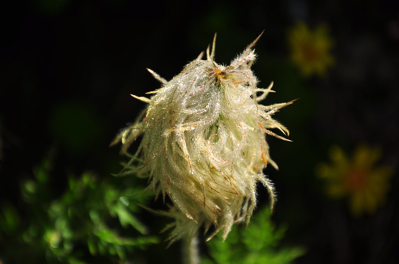
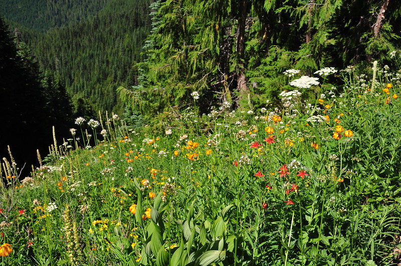
As we climbed, we started to see quite a lot of valerian in bloom. We didn’t know it yet, but we would see thousands of this wildflower along the entire trail:
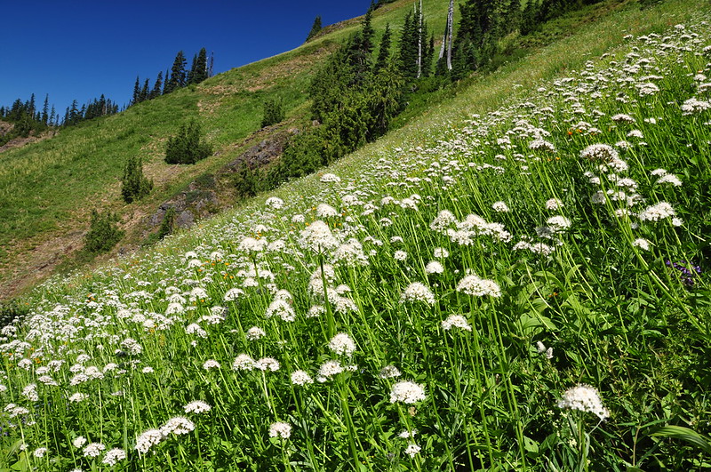
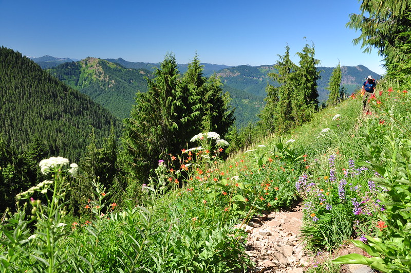
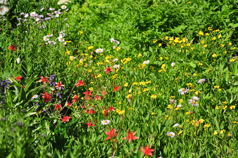
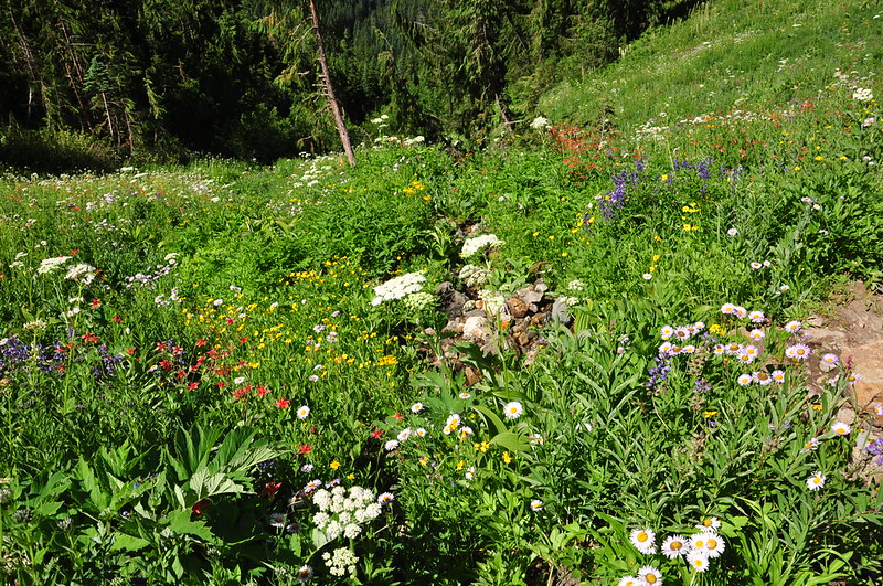
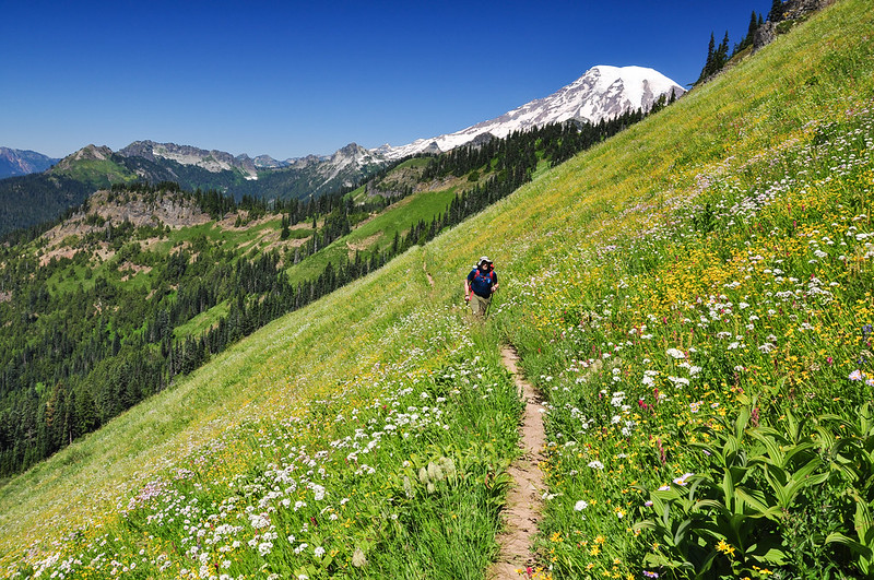
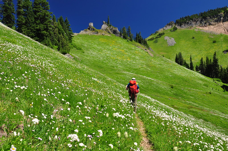
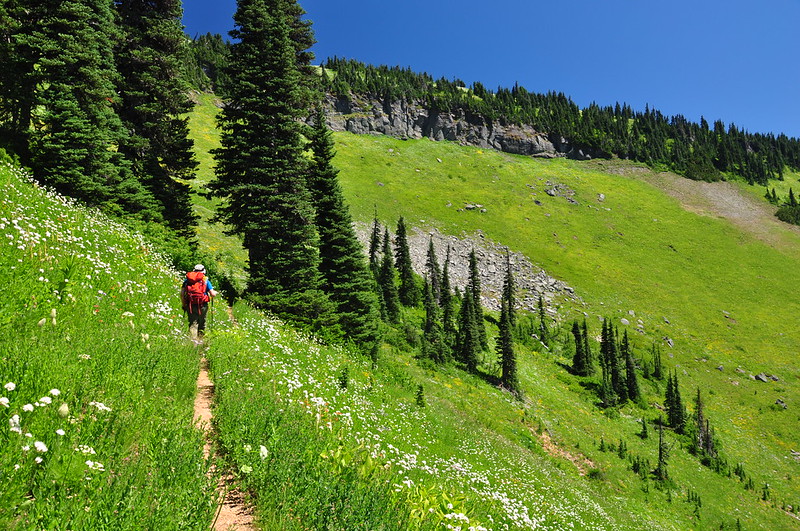
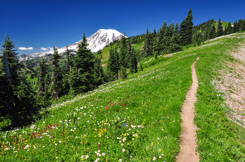
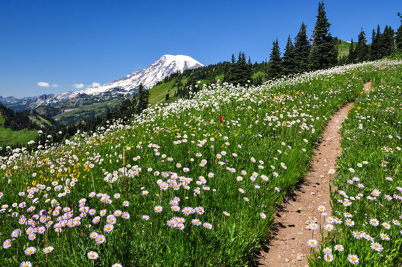
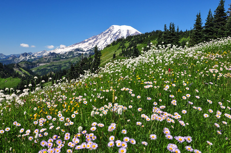
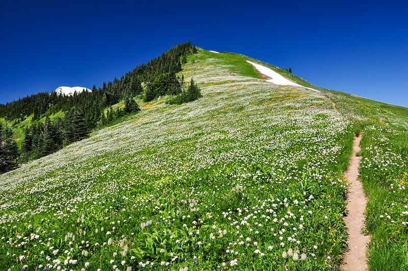
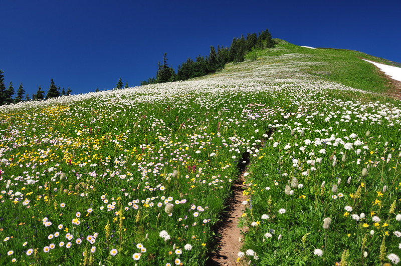
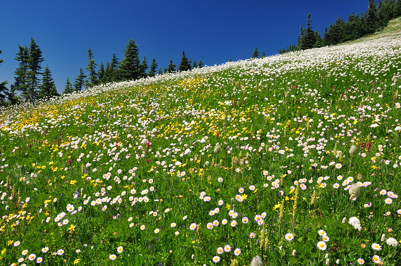
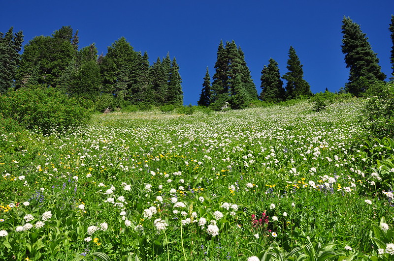
We started leaving the mixed tree/meadow zone and emerged into the big sloping meadow we saw earlier. The wildflower show continued:
At 2.7 miles we reached the junction with the Tatoosh Lakes Trail. It’s 1.4 miles round-trip to go to the lakes and back to the main trail and we hoped to do this on our way down.
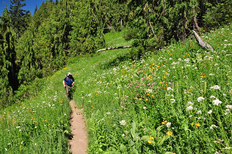
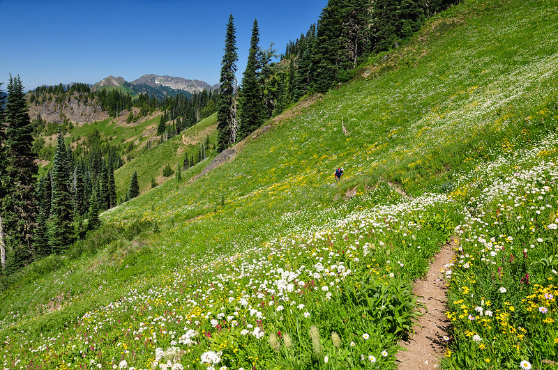
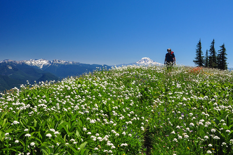
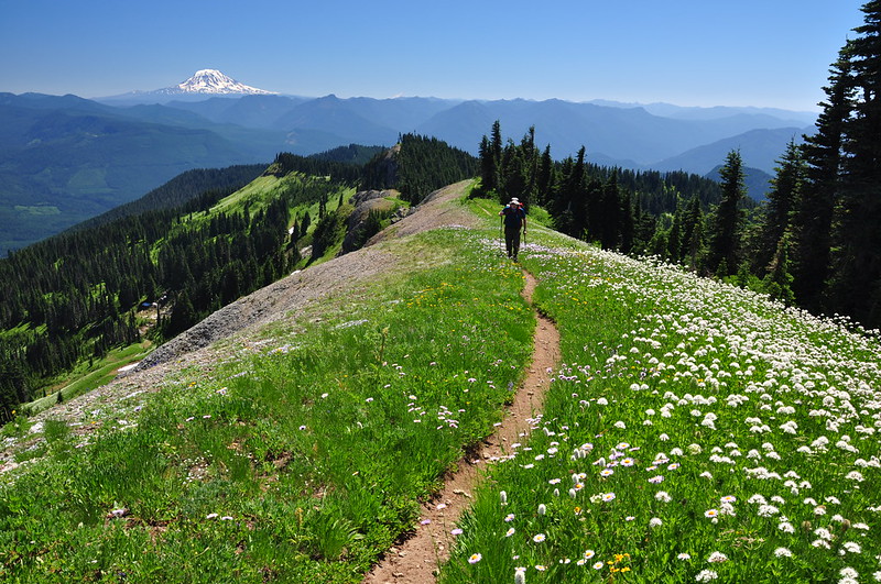
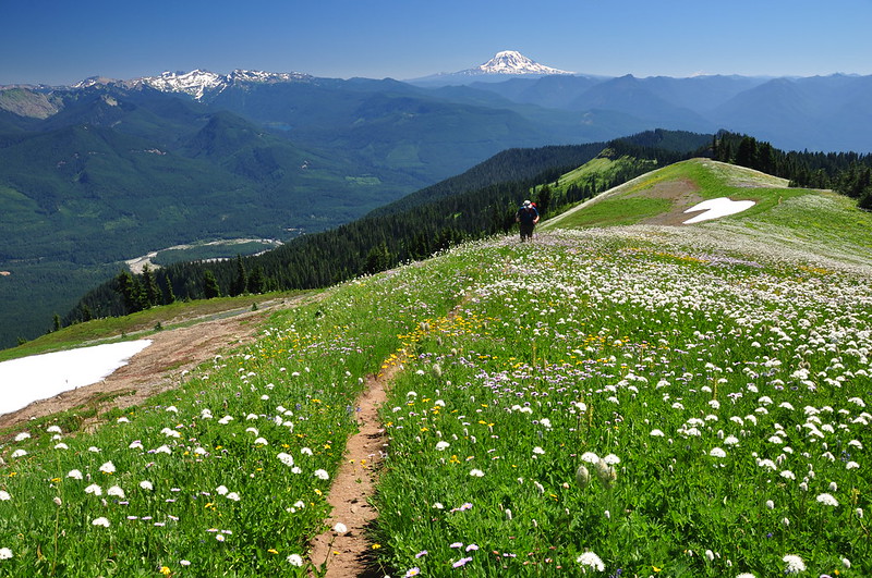
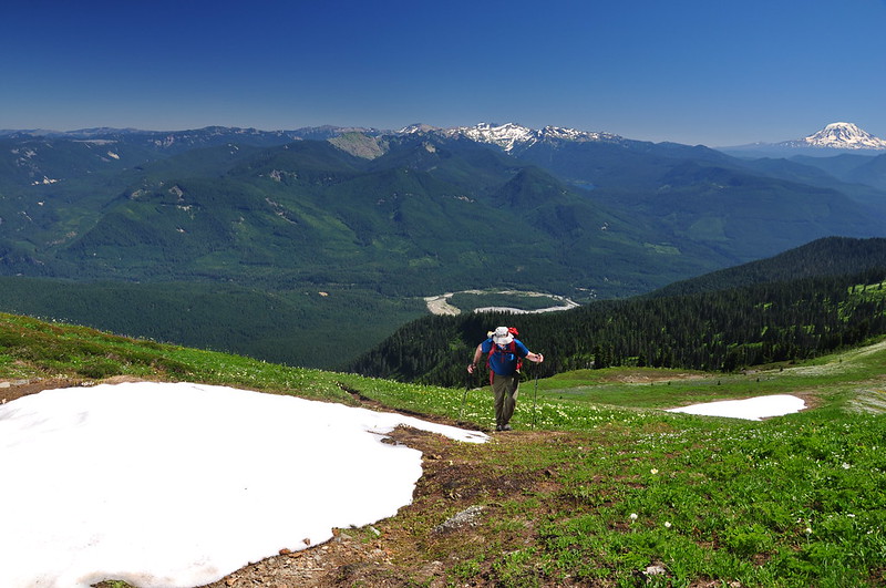
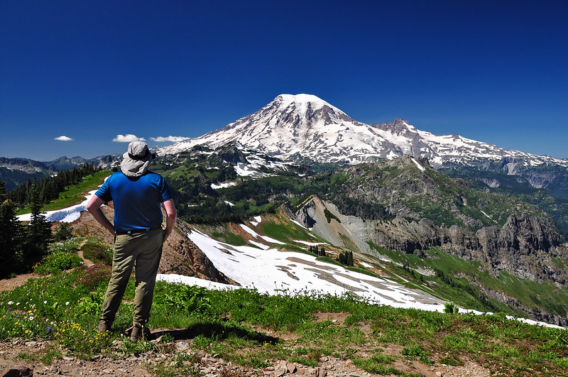
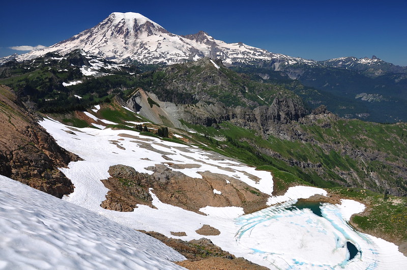
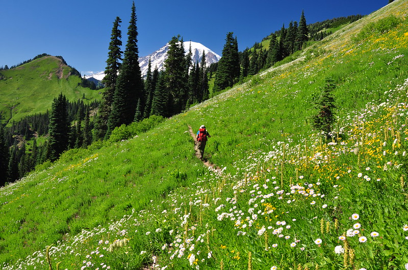
Past this junction is when things really started to get jaw-dropping. Behind us Mt. Rainier loomed over the ridge and the further we went, the more of the mountain we could see. We kept turning around to look at it.
At around three miles we passed this nice spot that would make a good campsite (and indeed it looks like people have camped here). We stopped here briefly for a snack but didn’t pause long due to the numerous biting flies. It would be great to backpack up here, but there is no water whatsoever and those first two miles of steep uphill loaded down with enough water for two days would be grueling.
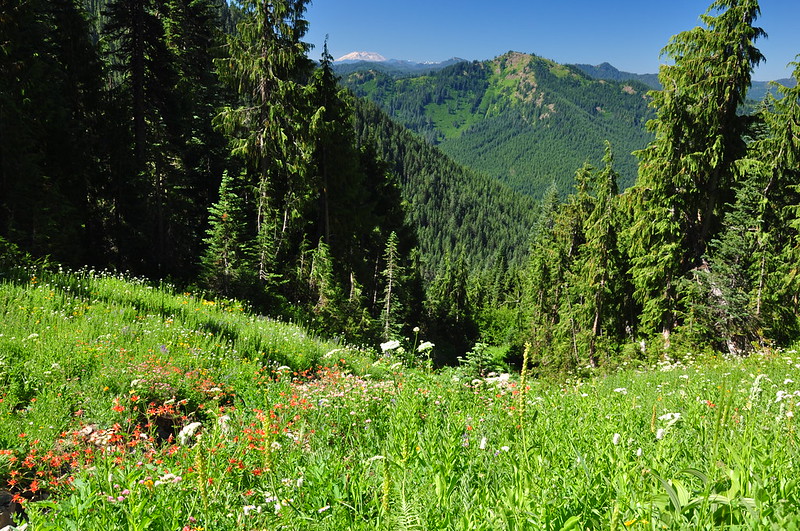
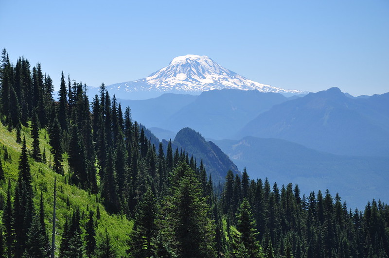
We could see Mt. Adams:
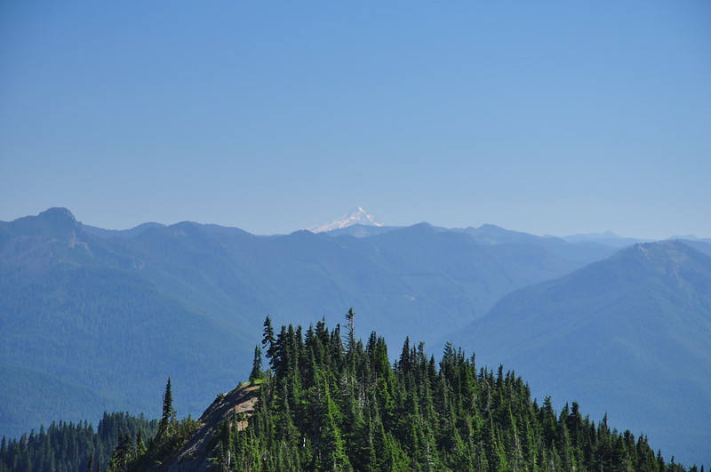
And Mt. St. Helens:
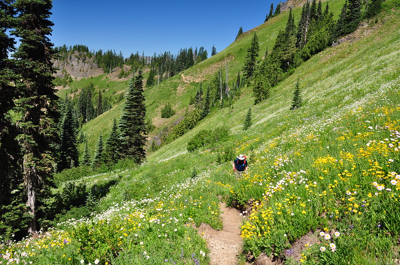
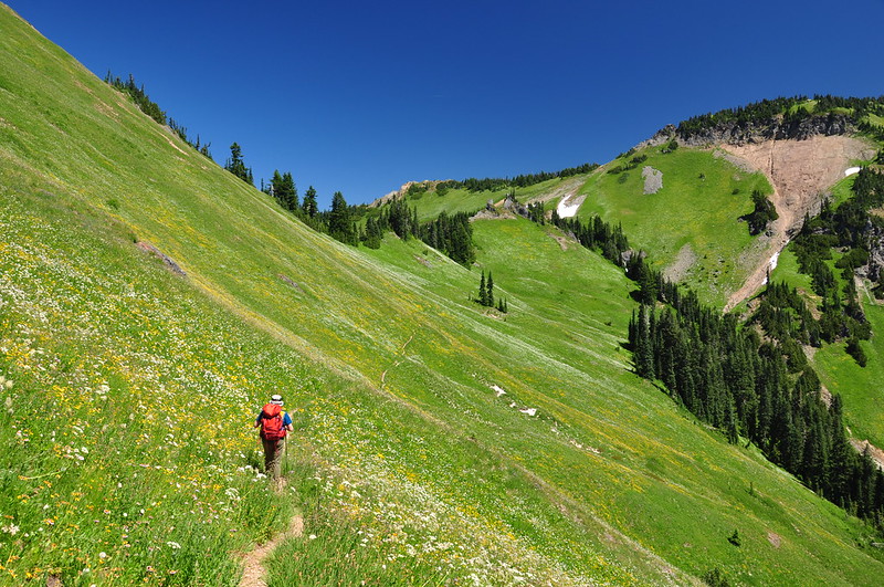
A quarter mile beyond the campsite is a confusing intersection where a user trail on the left ascends an unnamed 6,050′ peak and another user trail on the right goes to a good viewpoint and lunch stop. We went straight to continue on the Tatoosh Trail, which traverses yet another huge meadow:
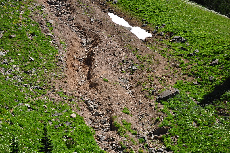
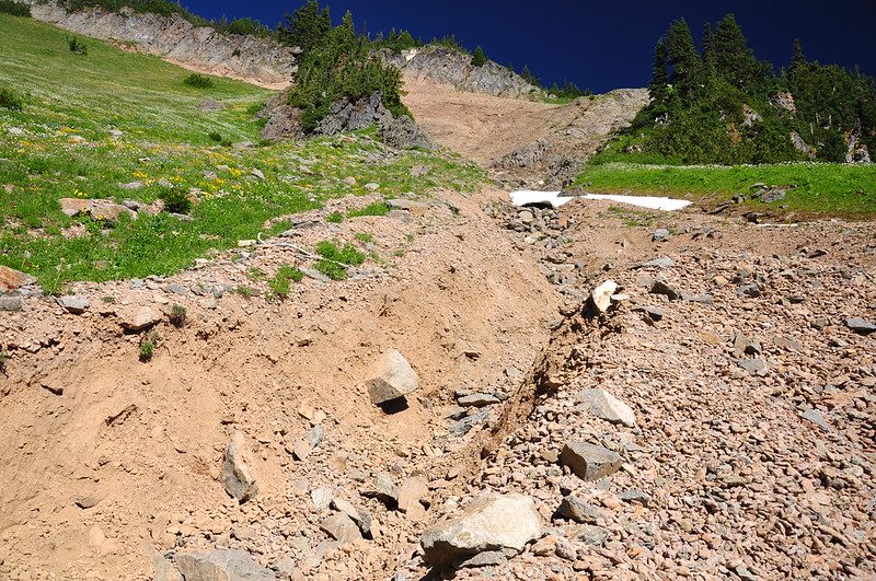
Notice the huge scar of a landslide on the right:
I can’t find any information about when this landslide happened, but it seems to have been at least a few years ago. The trail across it has not been fixed and it’s a bit of a scramble to get across:
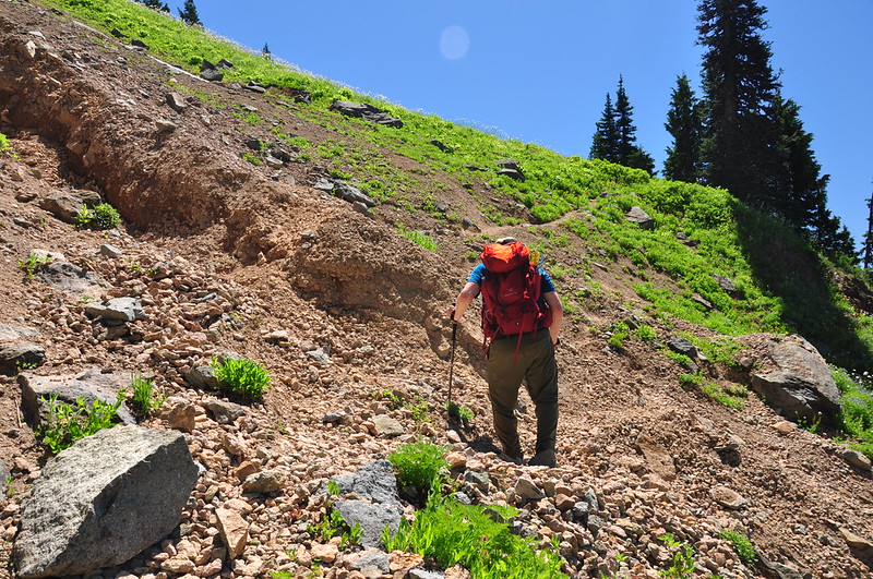
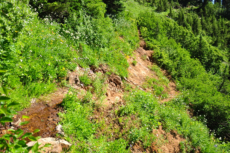
There were a few other sketchy sections where the trail needs some serious maintenance:
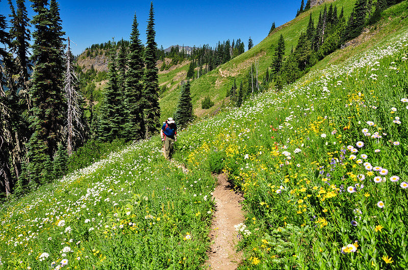
Onward we hiked, looking back for the occasional glimpse of Mt. Rainier:
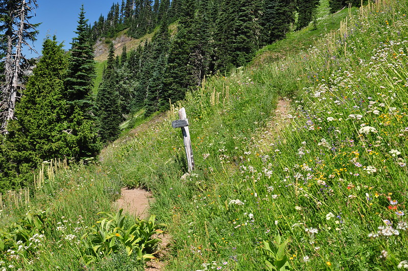
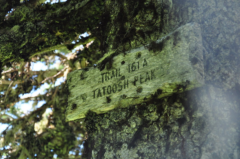
At 4.8 miles we reached the junction. From here the Tatoosh Trail continues south to a trailhead on Road 5290 but we would be doubling back and climbing up to make the last 0.7 mile push to the peak. The junction appears to be unsigned but then we spotted an old weathered sign on a tree:
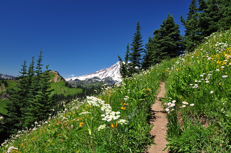
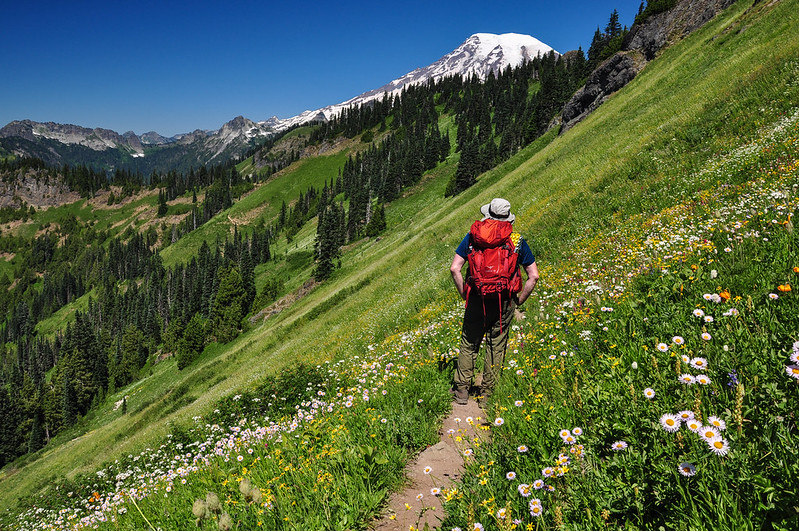
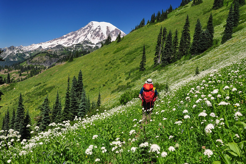
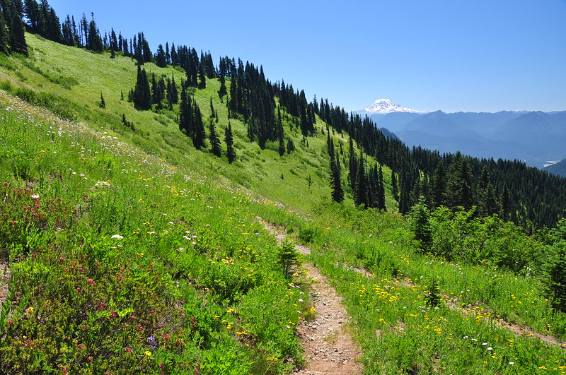
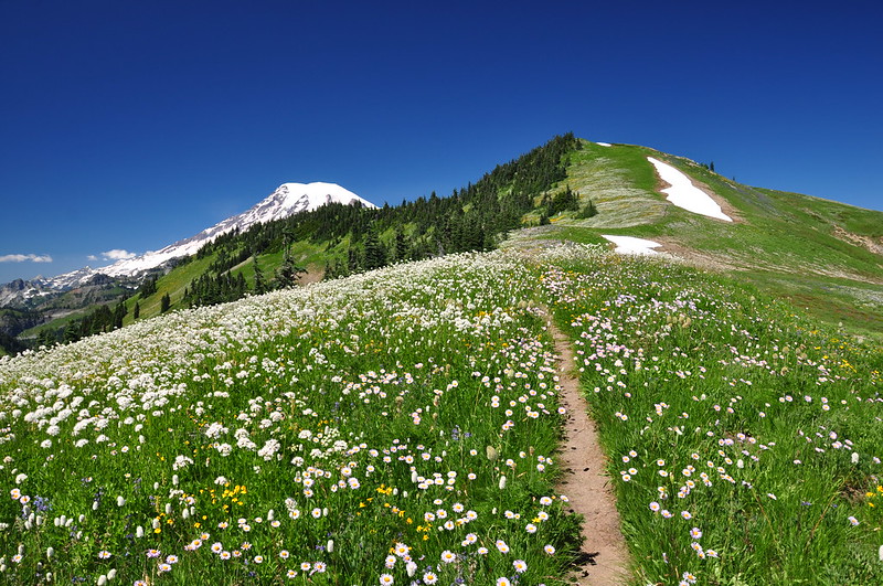
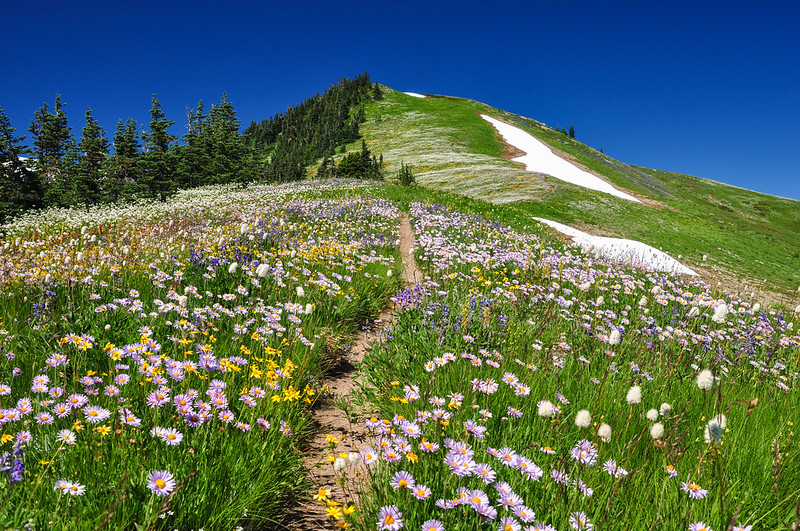
The last bit of climbing to the summit proved to be incredibly spectacular as the trail followed a ridge bursting with millions of wildflowers. It was incredible!
Looking back, we could see the Goat Rocks and Mt. Adams:
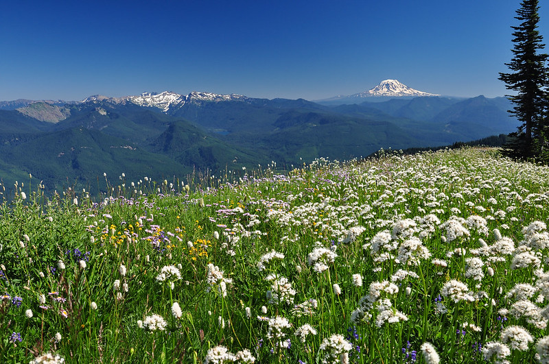
And Mt. Hood way off in the distance:
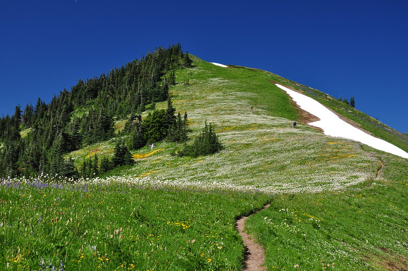
Last push to the top, which had one lingering snowfield across the trail right at the summit:
5.5 miles of hiking and 3,500′ of elevation gain and we made it!
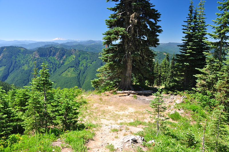
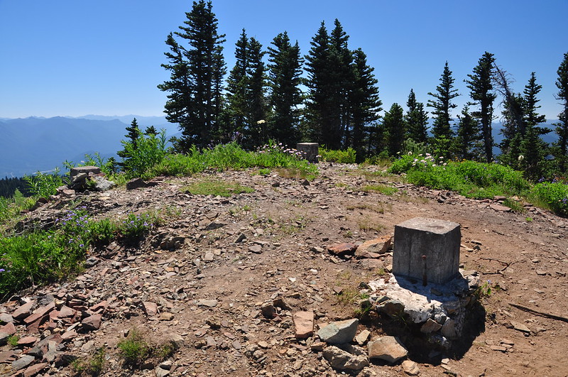
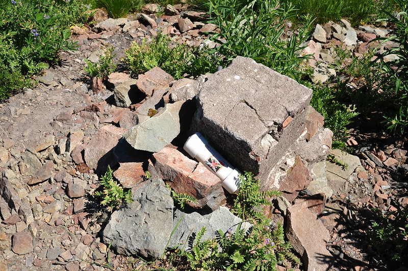
The old Tatoosh fire lookout is long gone. All that remains are the concrete footings and melted glass:
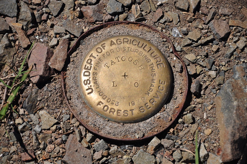
I found a summit register near one of the footings. It had no log inside so I added a few sheets of paper:
There is a heart-shaped tarn below the summit which I suppose could be a water source if one camped up here, although I’m not sure how one would safely get down there:
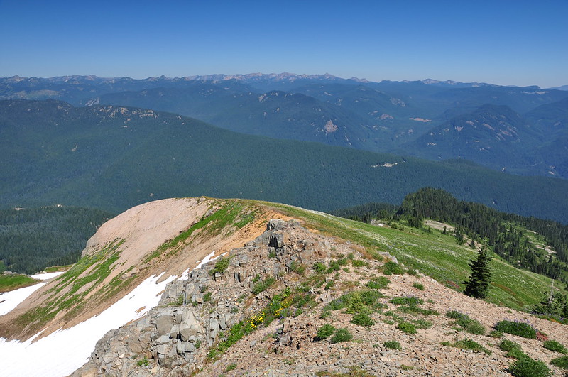
Looking east:
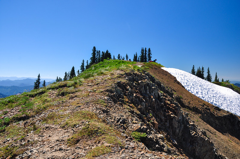
Looking back at the summit:
We stayed here for an hour enjoying the view but the biting flies were AWFUL and we had a long hike back down, so we reluctantly departed and began our trek back down through the wildflowers.
I really wanted to do the side trail to Tatoosh Lakes, but we were running very low on water (and hadn’t brought the filter) and we were very very tired. As it was, my feet were really sore the last few miles descending back to the car. Hopefully we can come back someday and see the lakes. On the way down two guys passed us heading back to their car and they were carrying fishing poles. I asked if they had gone to the lakes and they said they had. I asked how the bugs were and they said the bugs were really bad. So I didn’t feel as bad about missing the lakes on this trip.
This is definitely a hard hike. Our GPS stats came out to 11.2 miles with 4,000′ elevation gain (there is uphill in both directions). Plus there is virtually no shade except for that first two miles of trail. But I’ve been wanting to do this one for years and it was even better than I hoped it would be!