Headed to the trailhead for Three Pyramids on Saturday, right at the spot where I turned on Road 560 from Road 2067, the road crossed a gorgeous little creek with a partial view west to where I was headed. The sign at the bridge said it was Parks Creek, but the topo map says it is Park Creek. I’m inclined to believe the topo. I’m not positive, but I think that’s Middle Pyramid you can see here. If not, it’s North Pyramid.

There were six other cars at the TH when I arrived at 11:15. I set off the trail and was surprised to see a sign stating that the distance to the lookout was 2.1 miles. The lookout has been gone for more than 40 years and yet this sign hasn’t crumbled or rotted away.

The trail started climbing immediately. A little creek near the trail provided nice background “music” for the climb. There’s even a small waterfall at one point.

The forest here is really nice. I don’t think it was ever logged because there are a good number of very large trees.

Here is a cross cut of one of the trees that fell across the trail some years back. My hiking pole gives some perspective. I didn’t count the rings, but there had to be several hundred!

The trail crossed the gurgling creek on a broken but still usable bridge.

And then the source of the little creek comes into view: a lovely lush green meadow in a bowl below South Pyramid and Middle Pyramid (neither of which you can see in this picture). This must also be the source for all the mosquitoes that I was fighting off.

And then it was more, more, more climbing. Up and up and up in the hot afternoon sun. Every time I stopped to catch my breath or take a picture the mosquitoes descended, so I tried to keep moving. Finally I reached the junction where the main trail continues on to North Pyramid and beyond, and a side trail goes up to the summit of Middle Pyramid, which was my destination.
As I approached the summit of Middle Pyramid I passed five different hikers on their way down, yet there were still a dozen people crowded onto the tiny summit. They created quite a cacophony. It seemed like everyone was talking and no one was listening. I waited them out, though, and eventually they all left and I had the place to myself and it was peaceful and wonderful. The views were AWESOME.
Mt. Rainier and Mt. Hood. The two near mountains that flank the snowy peaks are Coffin Mountain and Bachelor Mountain, where Greg and I hiked last year. With binoculars I could just make out the lookout on top of Coffin.

Mt. Jefferson:

A side note: compare the photo above to the one below, which was taken from Bachelor Mountain on August 12 last year. The amount of snow is about the same, despite the three-week difference. Man, I’m SO glad we’re not having another late snowmelt year again!!!!

Three Fingered Jack:

Hoodoo Ski Area:

Mt. Washington:

The Three Sisters (and some peak south of there that I’m not sure about; anyone know?)

South Pyramid (and although you can’t see it in this picture, I could see the very tippy top of Diamond Peak in the distance):

The deep canyon of the Middle Santiam River, surrounded by the Middle Santiam Wilderness:

I could also see the meadow that I had seen earlier from below:

As you can see, the summit isn’t very big, yet they crammed a fire lookout up here in 1934.

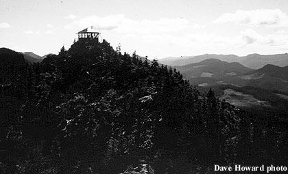
Besides the metal equipment on the summit, the only other evidence of the long-gone lookout is a pile of wood just below the summit.

With the glorious weather, a gentle breeze to keep the bugs away, and views all around me, I stayed up on the summit for an hour and a half, just soaking it all in. At one point a butterfly kept me company.

Middle Pyramid has another rocky point, which you can see in the foreground of the photo below. The trail dumps you in a saddle between that point and the summit where I am, and it’s a little confusing about which direction you could go. Just before I packed up to head down, I saw a couple over on that rocky area trying to clamber up and not succeeding. Their voices carried easily over to where I was sitting. They finally looked south and saw me sitting on the summit and I heard the guy say to the woman “There’s someone over there.” She didn’t understand and he said, “See that guy over there?” Hey, who are you calling a guy? I almost burst out laughing. I suppose that with my hair under a bandana and a hat, my face in shadow and half covered by sunglasses, it would be hard to tell my gender. In any case, they reversed direction and found their way to the true summit just as I was leaving. They were quite relieved to finally get there, having made several wrong turns on their hike.

On the way back down I still had views for awhile before I got too low to see the mountains anymore.

Away from the breeze, I was once again eaten alive by mosquitoes as I made my way back to the car, which I reached at 3:30. I itch like crazy as I type this report. Damn bugs.
Saw quite a few wildflowers on this hike.


At 4 miles round trip and 1,800 feet elevation gain, this is a steep hike. But the views on a clear day are pretty damn awesome. And if you wait a few weeks you can do this one without getting chomped on.


