On Saturday I headed up to Duffy Lake (map) in the Mt. Jefferson Wilderness. I got to the TH at 9:20 and there were a dozen cars there. They had morning dew on the windows and all looked to belong to backpackers.
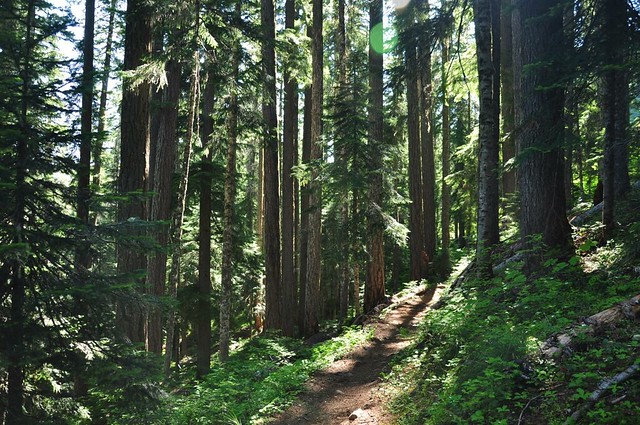
The entire 3.3 miles to Duffy Lake is through forest. No views. But since it was a warm day the shade felt nice. I also saw quite a few huckleberry bushes along the trail. That’ll be yummy in August!
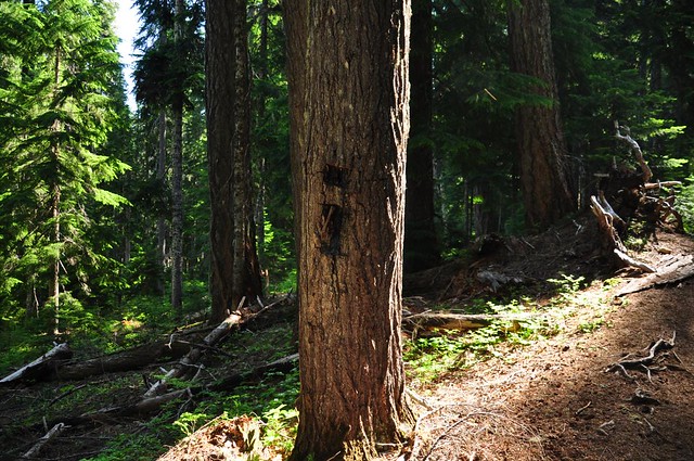
Many trees along the route had the old blazes on them.
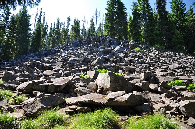
The trail passes by the foot of two different rockslides, one of which is surrounded by vine maple, which must look awesome in fall.

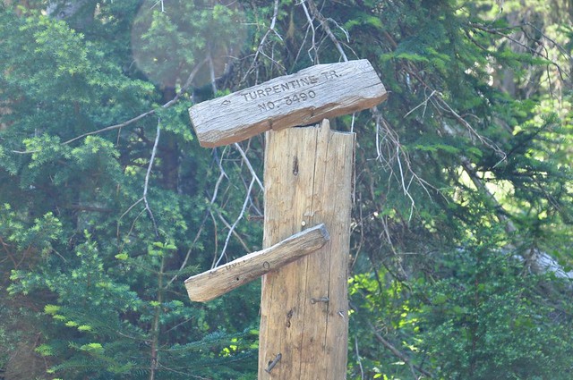
Passed the junction with the Turpentine Trail, which heads north. It is named after nearby Turpentine Peak, I assume, and I’d love to know the story behind THAT name!
The trail roughly follows the North Santiam River, although there are only a few spots where you can see it. It flows out of nearby Santiam Lake, and of course it eventually ends up flowing into Detroit Lake many miles downstream. Up here it’s an absolutely gorgeous charming little stream. I fell in love with it!
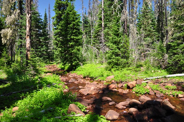
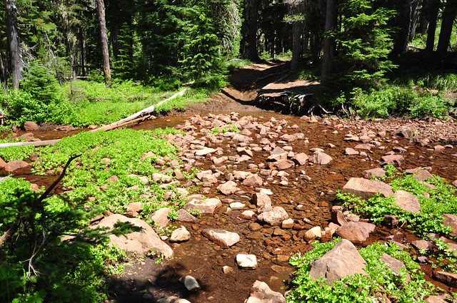
Eventually the trail crosses it. It was no problem to cross now, but I imagine you can’t rock hop easily earlier in summer.
Backpackers who had spent the night at Duffy Lake passed me in a steady stream on their way out as I hiked in. One of them was a woman about my age who was covered head to toe. She had on a sweatshirt, long pants, and a stocking cap. It was pretty warm and I couldn’t imagine how she could stand having all that clothing on. Maybe it was mosquito protection, but still. She also had a bear bell. 🙄
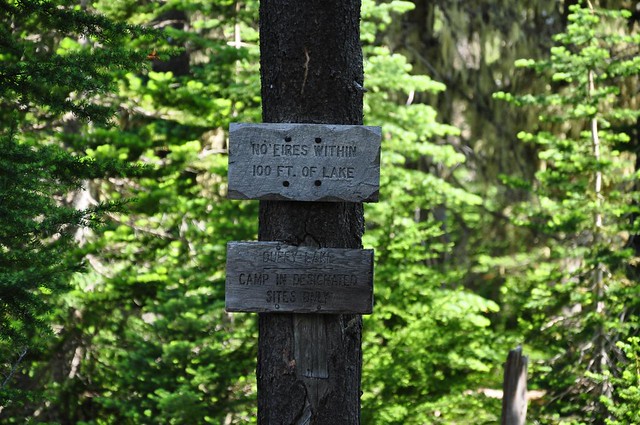
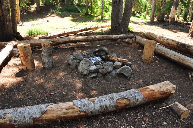
I reached the lake at 11:15. The signage could use some improvement. This is at a somewhat confusing trail junction and if you’ve never been here before it’s not immediately clear which direction the lake is in. Turns out that the shortest way to get there is to go straight here, but turning left or right will also take you to other parts of the lake. Incidentally, it seems that many backpackers completely ignore the two rules on these signs. I saw campfires close to the lake and I saw MANY campsites that were nowhere near the designated campsite markers. I also saw trash piled in fire rings, of course. 😡
And here’s the lake, with Duffy Butte towering over it The water was so clear and gorgeous!

I knew that Three Fingered Jack was not far, so I worked my way around to the west end of the lake to see if I could see it. Voila!

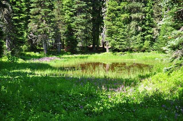
The backpackers had all cleared out by this point so it was really peaceful here. I enjoyed the lake as long as I could before the mosquitoes forced me to keep moving. Since the day was young and the hike up to this point had been so tame, I decided to continue one more mile up the trail to Mowich Lake. Along the way I passed a pretty little meadow with a pond and hundreds of shooting stars.
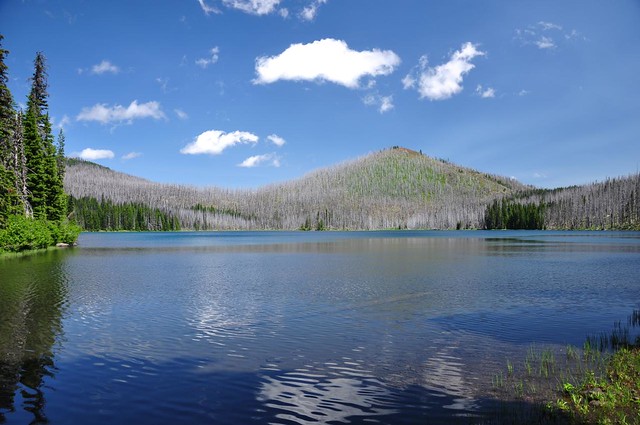
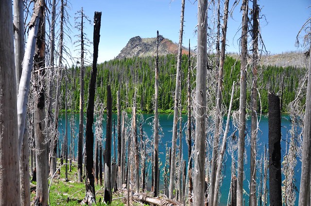
I reached Mowich Lake and followed a use trail down to the shoreline at the southern tip of the lake. That’s Red Butte on the other side of the lake. As you can see, this area was burnt to a crisp in the 2003 B&B fire.
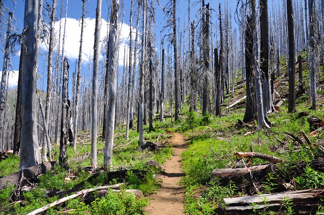
I hiked a little further and quickly left behind the intact forest and entered the burn area.
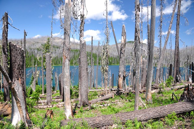
The trail climbs up and up away from the shoreline and I could see on the map that it wasn’t going to ever rejoin the lake, so I didn’t go very far. You can see the lake through the burnt trees.
Through the trees I could also see the backside of Duffy Butte, which I had seen earlier from Duffy Lake.
On my way back out the breeze had picked up enough that I was able to hang out by Duffy Lake for awhile and not get chomped on. Delightful!

The hike out was uneventful. I hadn’t seen any other day hikers, but finally started seeing some as I hiked out. Back to the car at 3:00, followed by pizza in Detroit. YUM.
This was not a hard hike, and in fact was a little easier than I was expecting. At least I got a lot of miles in. Duffy Lake is quite lovely and is probably a very nice place for backpacking. But mid-July would NOT be the best time for that because of the bugs, and a weekend outing would mean sharing the lake with lots of other campers.
9 miles
1,100 feet elevation gain.


