August 13, 2011
Browder Ridge is the big monolith just south of Iron Mountain. (Here is a photo of Browder from Iron Mountain, as photographed by Greg a few years ago.) The route that Sullivan recommends is from the east side. Greg wanted to do the route on the west side because there were a series of geocaches along that route. I said sure, why not. But since this hike wasn’t in the book, I had no knowledge of what to expect. (I would later discover that the people who hid the geocaches clearly state on geocaching.com that the hike is 5.75 miles one-way. Very dumb of me to not read up beforehand.)
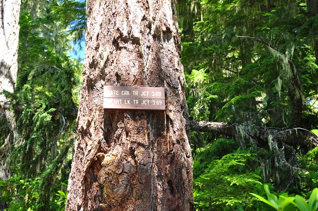
We hit the trail at noon (which, we would later discover, was FAR too late for this hike). There was a sign at the trailhead with the most precise mileage I’ve ever seen on a trail sign. Precise, yes. Correct, no. (It was actually 4 miles to the junction, not 3.69.)
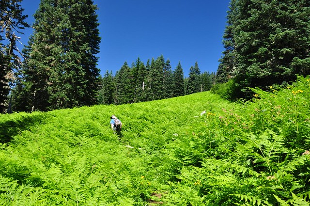
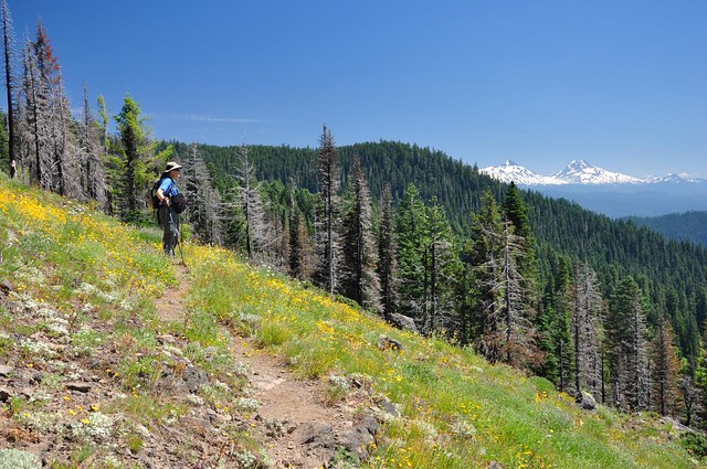
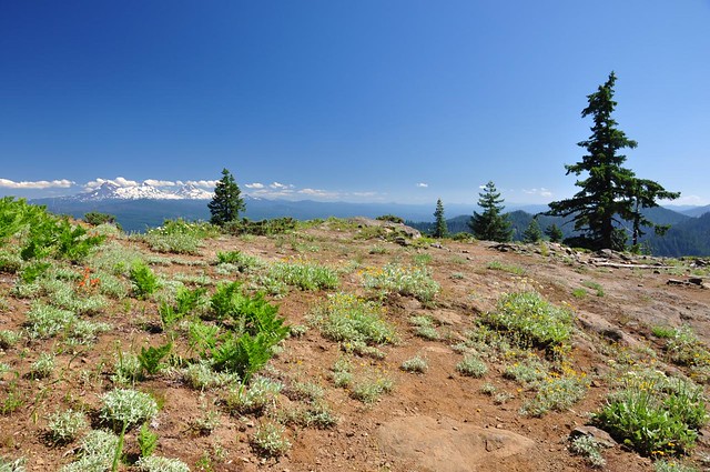
After less than a mile we reached an ENORMOUS meadow that was 99% ferns and 1% wildflowers. The ferns were as tall as us in some spots! The meadow stretched far up the hillside, and our trail switch-backed up to the very top of this meadow.
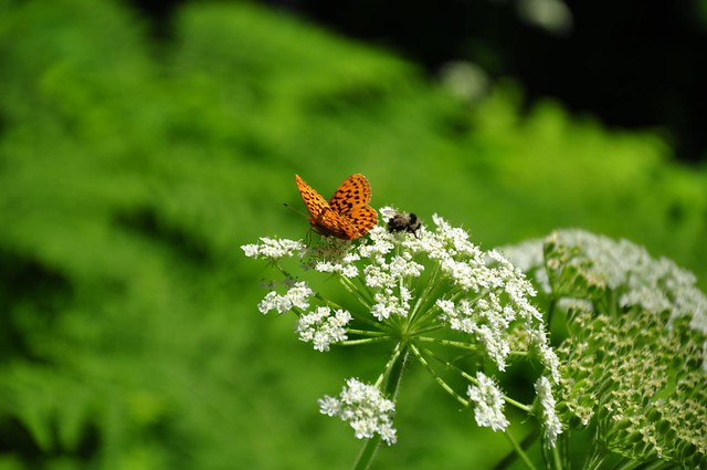
There were plenty of butterflies and bumblebees on this hike. I even got a shot of them together!
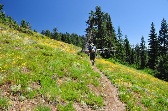
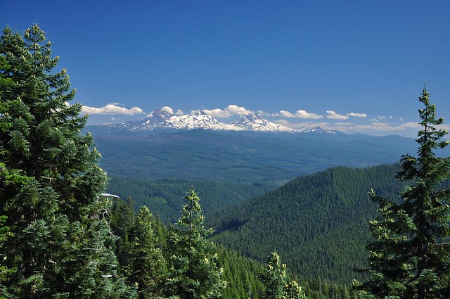
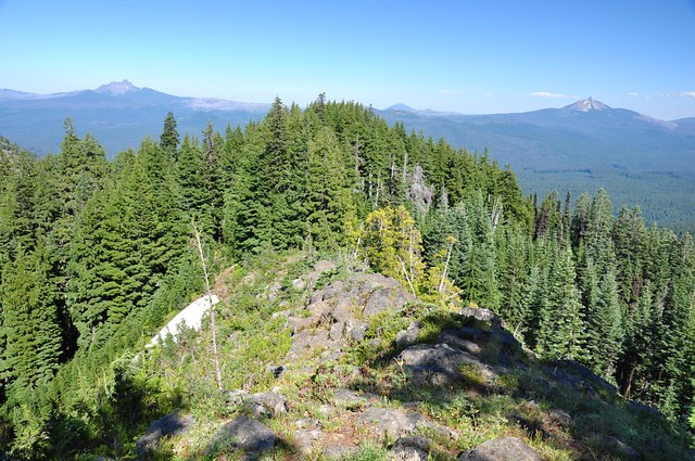
After climbing up through the fern meadow, the trail leveled out a bit for awhile, passing through one meadow after another, with occasional views of the Three Sisters.
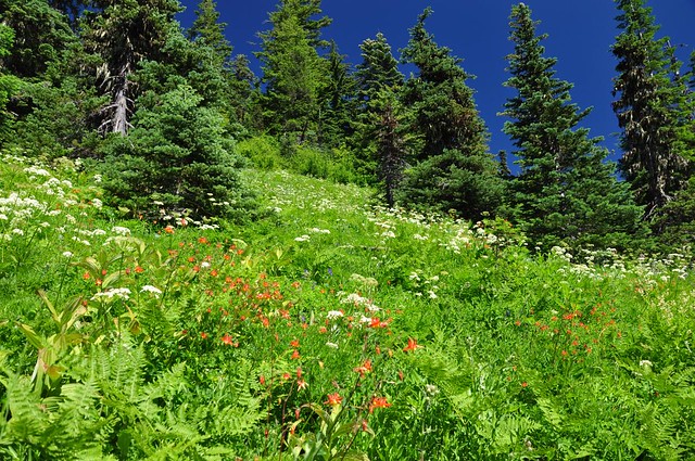
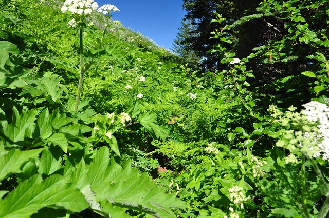
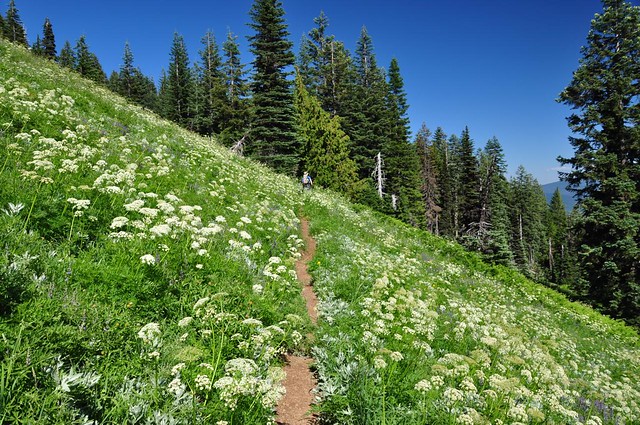
Some of the meadows were nice little flower meadows, and some of the meadows were full of those huge ferns. The fern meadows were exhausting because the vegetation was growing all over the trail. Not so bad that we couldn’t find our route, but bad enough to slow us down. Plus we couldn’t see the trail beneath our feet and there were numerous holes and rocks to watch out for. So it was slow going through those fern meadows. This is a shot of the trail in a fern meadow. Hard to see, isn’t it?
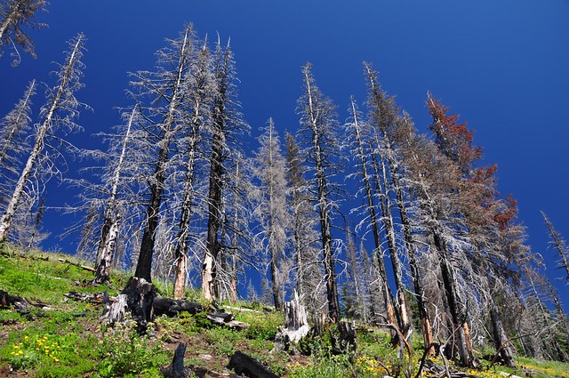
We hiked through a small burned area that looked like it was only a few years old.
After several miles we reached a flat rocky area that had a nice view of the Three Sisters. This would be a nice spot to camp, methinks!
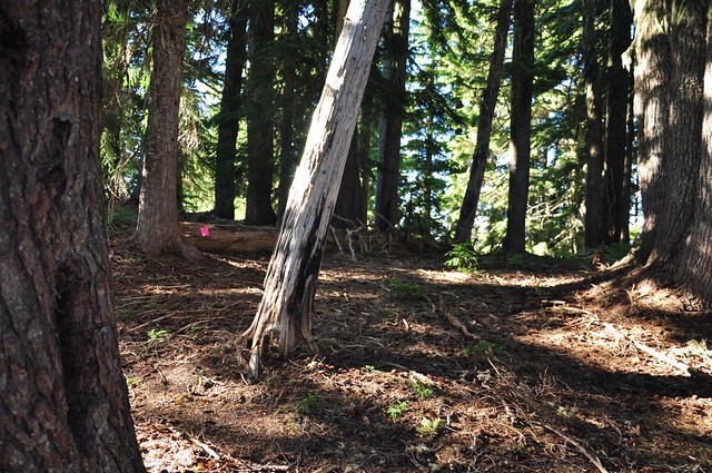
After four miles we reached the junction with the trail to Heart Lake and the summit. The trail thus far had clearly not been maintained in awhile, but this next stretch was even worse. There were a number of blowdowns, most of them old snags, some of which had been there so long that the detour trails around the fallen trees were far more prominent than the old trail underneath them. Crawling over one of these blowdowns I scraped up my thigh on one of those pokey branch stubs.
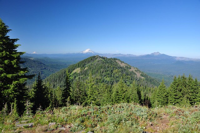
But then the trail left the forest and passed through still more meadows, with ever-better views of the Three Sisters.
As of the junction, we were now on the same route as described in Sullivan’s book. His suggestion for getting to the summit (the official trail doesn’t go there) is to cut cross-country uphill through a meadow until you hit the hiker-established use trail that follows the ridge to the summit. The geocachers described a different route, which turned out to be far easier. Right after re-entering the trees look for this snag on your left.
Behind that snag is a big fallen log and beyond that log is the ridge trail to the summit. It’s fairly easy to follow. There are a few spots where it seems to end in a wall of trees, but if you go left around the trees it’s possible to keep going. This is halfway up the spine, looking back down:
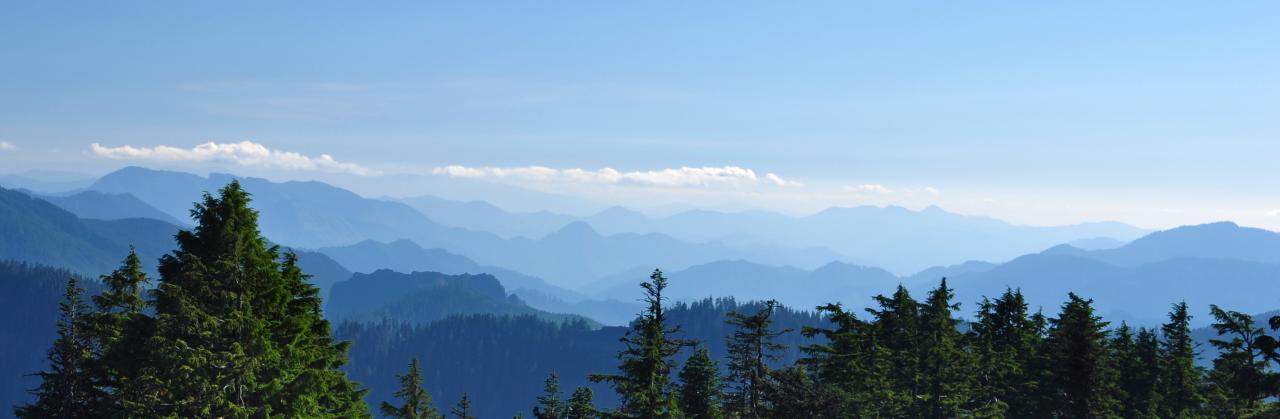
We reached the summit at 4:30, where we had amazing views in nearly all directions (this hike is advertised as having 360-degree views, but trees block your views in some directions).
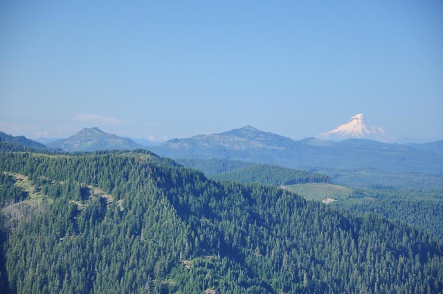
Echo Peak in the foreground, with Mt. Hood, Mt. Jefferson, and Three Fingered Jack beyond:
Coffin and Bachelor Mountains (where we hiked the day before) and Mt. Hood:
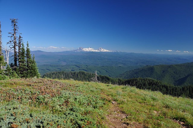
The Three Sisters again:
Greg taking photos. You may notice some lupine here. There was a lot of it, but unfortunately nearly all of it was well past peak.
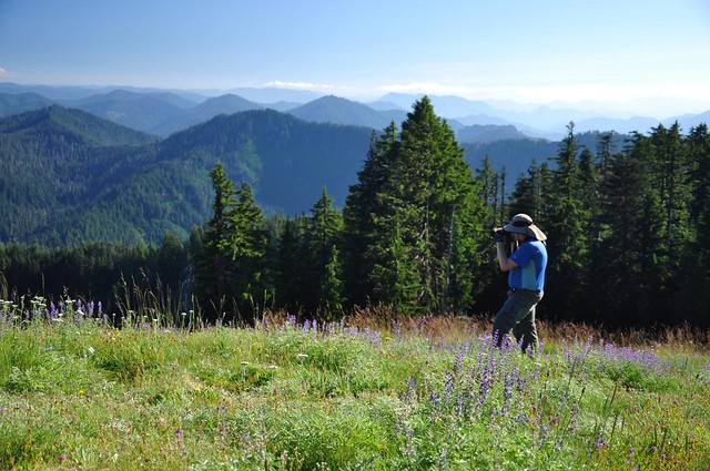
The layers of hills to the southeast looked cool in the afternoon light.
We were both running dangerously short on water. Fortunately we found a snowbank just below the summit and we stuffed Greg’s bottles and my Camelbak with snow, which made for cold refreshing water on the hike back down. If we hadn’t found that snow, we would have run out of water about two hours before getting back to the car.
It didn’t seem like an hour had passed, but it was 5:30 by the time we were able to tear ourselves away from our well-earned rest and head back down. With sunset approaching and more than 5.5 miles to go before we reached the car, our hike out was as quick a pace as we could manage.
At some point on the way down, we could hear what sounded like baying dogs way down in the canyon of Browder Creek below us. There were no campgrounds or anything down there, so we concluded we were hearing coyotes. The sound continued off and on for about half an hour.
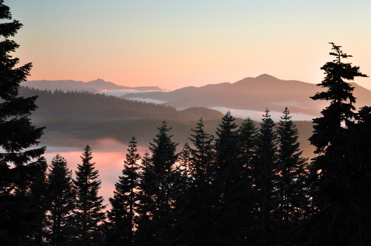
Sunset occurred while we were still making the long traverse back. We didn’t have a clear view west, but I still got a pretty nice shot. A thick layer of low clouds was coming in from the west, and the leading tendrils of this cloud bank had already reached into the valleys and canyons below.
It was dusk by the time we tackled the last mile of trail through the trees. Another 20 minutes and we would have needed our headlamps. We were back to the car by 8:30 and boy was I happy to see it! I was totally wiped and very hungry, facing a 45-minute drive back to Riverside CG and then dinner prep. (We ended up eating at 10:00.)


