Greg and I had a nine-day vacation scheduled for the end of August, and decided with two weeks left until departure time that we should go to Glacier National Park, with a day to drive there, seven days in the park, and a day to drive back. So our planning and prep was pretty hurried, but the trip went extremely well. Glacier is STUNNING. No pictures can ever do justice to the magnificent and spectacular scenery in this park. We already have a long to-do list for the next trip!
Sunday, August 21: Apgar Lookout (map)
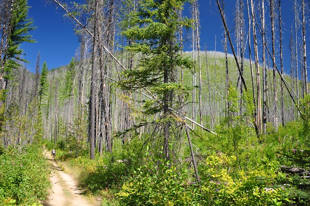
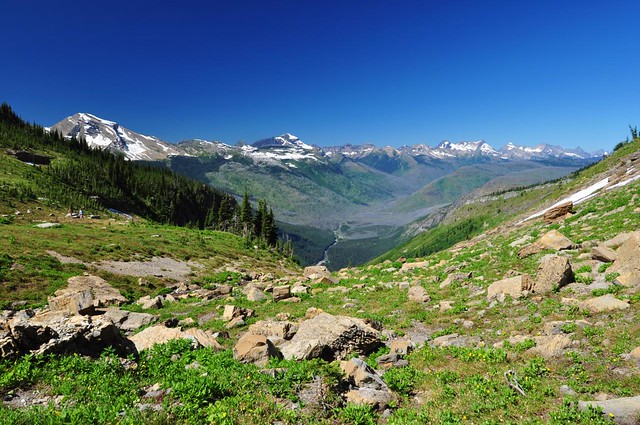
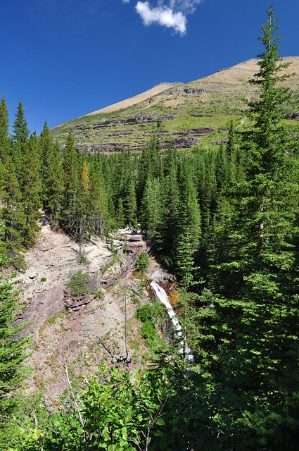
This is at the far western edge of the park, right outside Apgar Village. The trail climbs up Apgar Mountain to the Apgar Lookout, which was constructed in 1929 and is now on the National Register of Historic Places. I don’t think it is staffed much (if ever) these days, but there sure is a lot of equipment up on the summit. Greg posed for the webcam at the top, but we have no way of knowing if anyone was watching at that moment. The trail is 99% shadeless since it passes through forest that was burnt to a crisp in the 2003 Robert Fire. Since it was a hot afternoon, it ended up being a two-hour dusty trudge to the top. Not a lot of people, though. At least not compared to later hikes. We probably saw less than two dozen people the whole hike.
Hiking through the burn, with the mountain in the background:
Apgar Lookout, a nice source of shade on this hot afternoon:

Views to the northeast, which encompass a big swath of the burn:

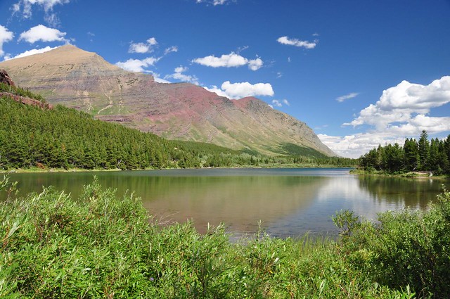
Views to the southeast, including Lake McDonald:

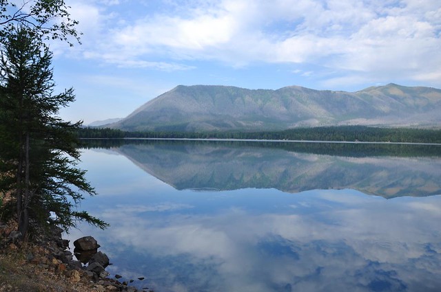
The next day from the shores of Lake McDonald we could see the lookout site where we had been the day before, that point on the left side of that ridgeline:
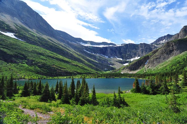
Monday, August 22: Snyder Lakes (map)
The hike to Snyder Lakes is a lot less crowded than many of the other lake hikes in the park. This is probably because there is NOTHING to see along the way. It is entirely in the forest, and although we appreciated the shade after the previous day’s non-shade hike, hiking four miles without views was kind of sucky. The destination, though, was quite worth it. My only regret is not being able to spend more time at the lake, which was so peaceful and pretty. We had an hour there, but we had gotten a late start and we didn’t want to get back too late since we wanted to go into town and shower, then make dinner at camp, then catch sunset at Lake McDonald. On our way back to the TH we saw a trio of black bears from about 50 feet away as they crossed the trail. This was too close for comfort if you ask me, but fortunately they were very interested in getting away from us.
Hiking through the forest:

Almost to the lake:
Lower Snyder Lake (there’s an upper lake that you can bushwhack to, but we decided this was scenic enough for us):

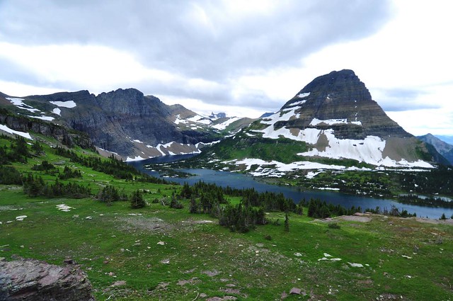
Tuesday, August 23: Hidden Lake Overlook (map) and St. Mary & Virginia Falls (map)
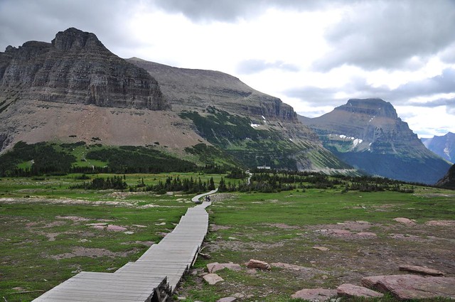
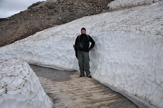
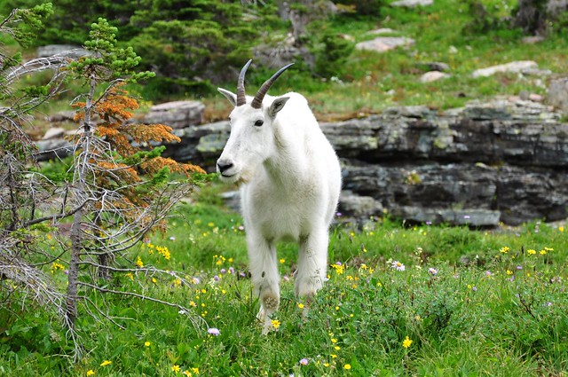
We had crummy weather this day: overcast and VERY windy. We broke camp and drove the Going To The Sun Road up to Logan Pass, where we did the 3-mile round-trip hike to the Hidden Lake Overlook. This is a popular trail, so the portion passing through the meadows is all boardwalk. After that we actually had several snow patches to cross! (Keep in mind that we were at about 6,500′ in LATE AUGUST.) Since this trail is pretty short and easy and starts from the Logan Pass visitor’s center (where it seems like every park visitor wants to go), we saw plenty of unprepared people on this trail. Not enough clothing for the cold day, inappropriate footwear, etc. On the way back one desperate young woman asked if she was almost there and we had to break the news that she was only about halfway (meaning she’d hiked 0.75 mi and still had 0.75 mi to go). We were only able to go as far as the overlook. The trail continues past there down to the lake, but that section was closed due to bear activity. No matter, we still had some pretty spectacular scenery from the overlook. I think most of the people there were more interested in the nearby mountain goat than the scenery, though. It was like wildlife paparazzi!
Hiking the boardwalk:

Looking back towards the visitor’s center:
Phenomenal amounts of snow for late August:
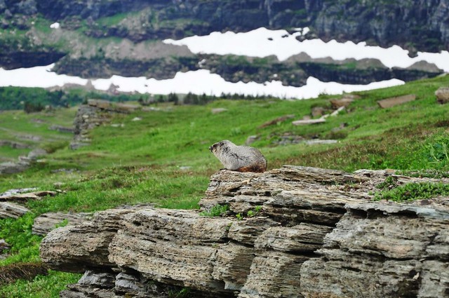
A windblown marmot:
Mountain goat:
Hidden Lake in terrible light:
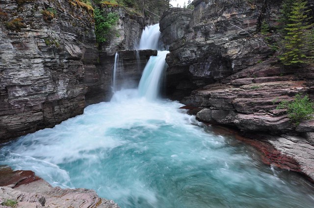
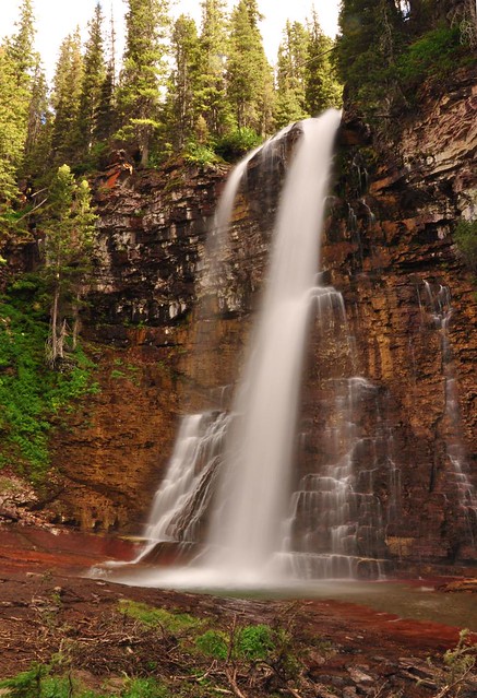
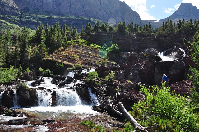
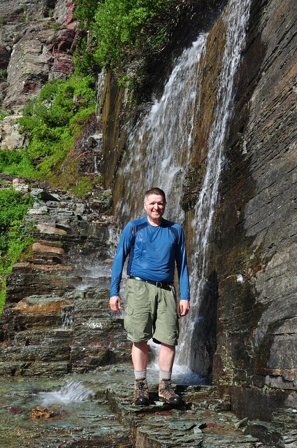
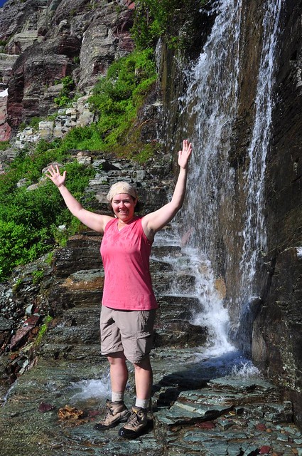
After leaving Logan Pass we snagged a campsite at Rising Sun Campground and then did the St. Mary and Virginia Falls hike.
St. Mary Falls:
Virginia Falls:
Wednesday, August 24: Highline Trail from Logan Pass to The Loop (map)
We got up at dawn on Wednesday to shoot sunrise at St. Mary Lake and Wild Goose Island. It’s a very iconic shot; you’ll see it on postcards all over the place. But it was not to be. The wind from the day before was still hanging around, so the lake had no reflection. And we also had to deal with harsh shadows on the south side of the lake. Oh well.

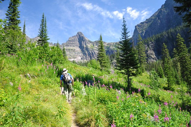
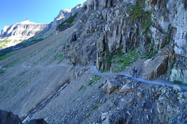
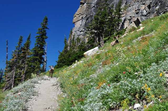
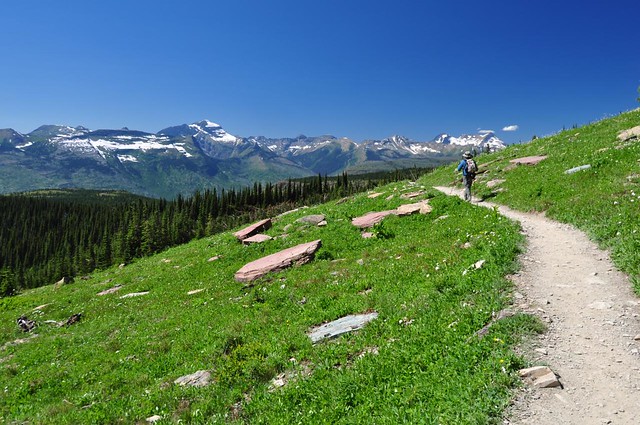
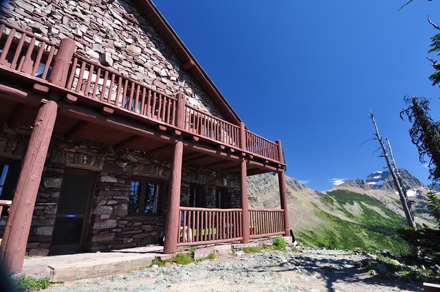
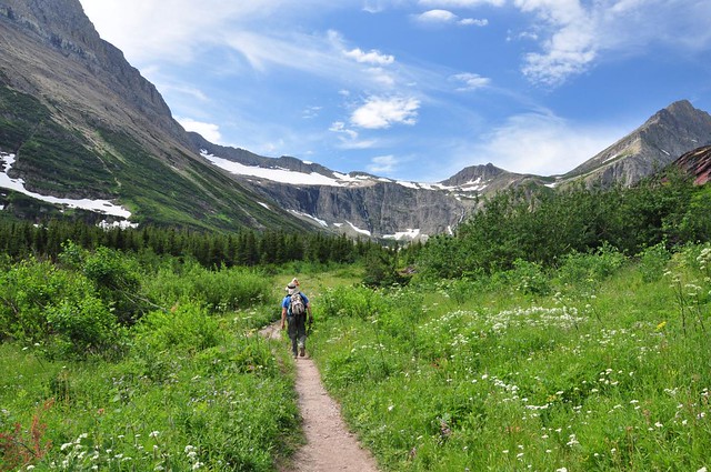
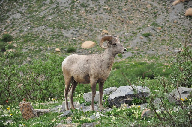
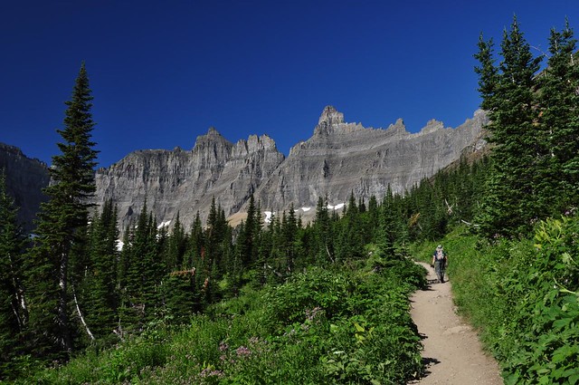
The Highline Trail heads north from Logan Pass, carved out of a hillside known as The Garden Wall. You know those parts of the Eagle Creek trail where the trail is carved out of the rock? It’s kind of like that on a much bigger scale. This hike was freakin’ SPECTACULAR and we had awesome weather too. We had amazing views of the Lewiston Range, and the views just got better and better the further we went. During the first part we were high above the Going-to-the-Sun Road, so we could hear the traffic and construction, which is annoying. But we eventually left that behind. The wildflowers were pretty amazing too, although I have almost no pictures of them since I was so mesmerized by the scenery. The only wildlife we saw were two bighorn sheep who were coming towards us on the trail and fortunately got off the trail to get around us. After seven flat miles on the Highline Trail we reached the Granite Park Chalet, a backcountry “inn” for backpackers that we’d like to go back to and stay at someday. After a rest break at the chalet we had to tackle the hard of the trail. The trail descends four steep dusty miles down to the Going-to-the-Sun Road where we picked up a park shuttle to take us back to our car at Logan Pass. Those last four miles were horrible, but the scenery from the previous seven miles still made this hike WELL worth the effort.
Carved out of the hillside:
Mt. Oberlin:
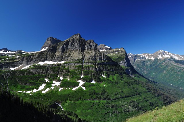
View of the Lewiston Range from Haystack Butte, where we had lunch. Be still my heart!
One amazing view after another:

Bighorn sheep, trying to decide how to get around us (while we were trying to get out of their way!):
More views, hee! hee!
Granite Park Chalet:
Hiking down, down, down to the road, through the 2003 Trapper Fire:

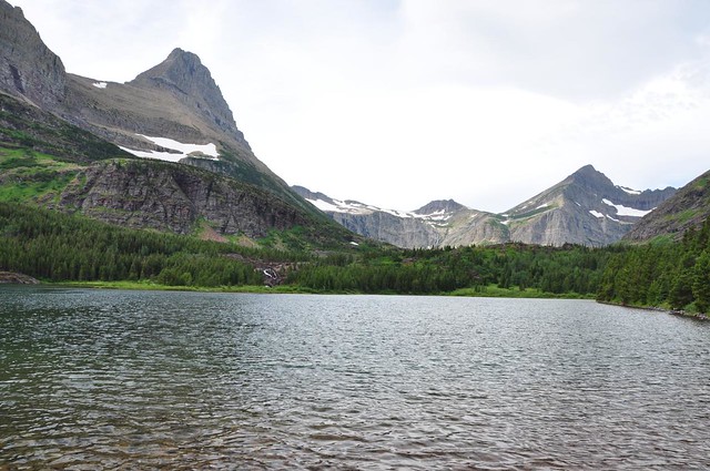
Thursday, August 25: Bullhead Lake (map)
Our original plan had been to race over to Many Glacier and do day hikes there on Thursday and Friday, then squeeze in a day hike in Two Medicine on Saturday. But we were pooped, and realized this plan wasn’t going to work. So we reluctantly decided to skip Two Medicine on this trip and spend time there next time. After snagging a campsite at the Many Glacier Campground (which usually fills up before noon in late August), we did the very easy flat hike to Bullhead Lake (6.6 miles, 200′ elevation gain).
Lake Sherburne, which we drove past on our way into the Many Glacier area that morning:

Redrock Lake:
More wildflowers (we saw so many during our week here!)
Bullhead Lake, where we ate a very peaceful lunch and I soaked my feet in the cold lake. Wonderful!
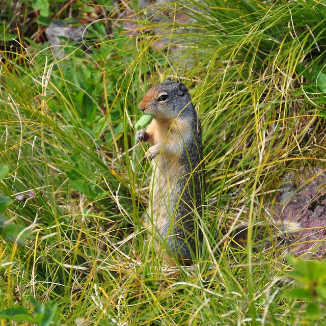
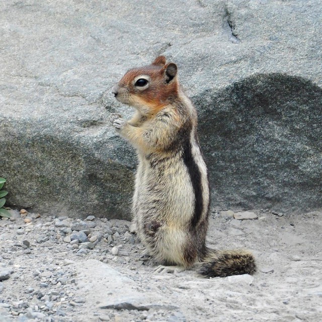
One of two ground squirrels who were begging for handouts:
Redrock Falls, at the head of Redrock Lake, where we stopped for a water refill:
Redrock Lake again, from the other end and under sunnier skies:
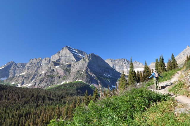
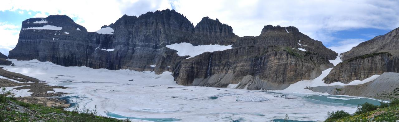
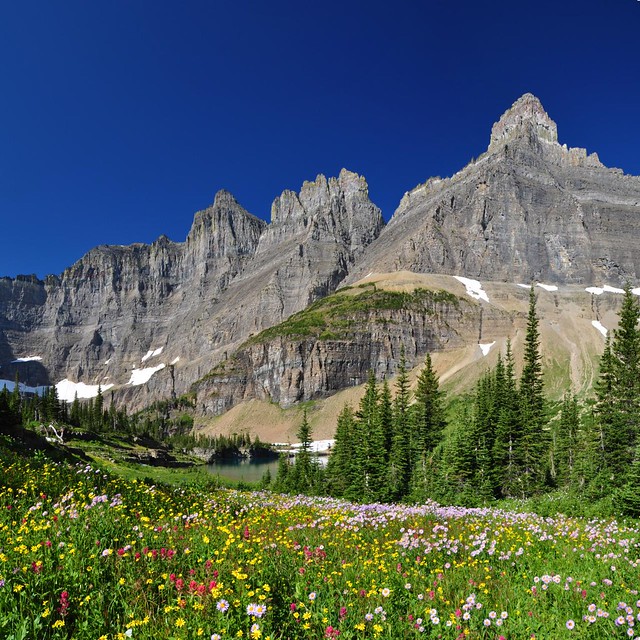
Friday, August 26: Grinnell Glacier (map)
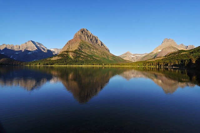
This trail had been closed in the weeks leading up to our trip, due to bear activity. It reopened just a few days before we wanted to hike here. Score! There are two options: 1) hike along Swiftcurrent Lake and Lake Josephine and then up to the glacier, which makes for an 11-mile round-trip hike, or 2) take the boat shuttle across both lakes and start from the end of Lake Josephine to hike up to the glacier, which shaves off five hiking miles. After shooting sunrise at Swiftcurrent Lake we went to the boat dock before the 8:30 shuttle to see if they had any space left. We were not crazy about spending 23 bucks each for the shuttle, so we decided that if they had space on the boat it was meant to be and we would splurge. They had space, we splurged, and we were grateful for it later.
The hike climbs up and up above Grinnell Lake, which you can see below. The mountains tower all around you and there is scenery in every direction. It is simply stunning. The trail ends at an overlook of the Grinnell Glacier and Upper Grinnell Lake (still frozen over during our visit). It’s about as close as you can get to a glacier in the park, but for me the real attraction of this hike was the scenery.
Sunrise at Swiftcurrent Lake:
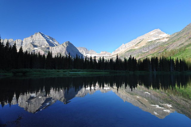
The view of where we’re headed as seen from the boat dock at Lake Josephine:
In-your-face views along this whole hike!
Beargrass and other wildflowers:

A waterfall right on the trail provided a refreshing way to cool off!
View of Grinnell Lake below us (that’s a one-mile hike from the boat dock):
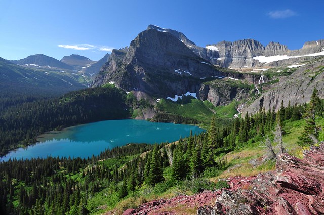
Panorama of Grinnell Glacier (on left) and the still-frozen Upper Grinnell Lake:
One of two bighorn sheep we saw at the overlook:
Insufferably cute!
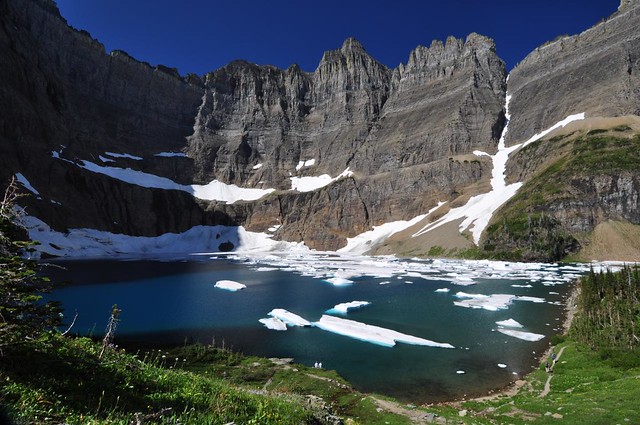
Saturday, August 27: Iceberg Lake (map)
This was another trail that had been closed due to bear activity and reopened a few days before we wanted to hike here. Great timing! Iceberg Lake sits in a bowl at the base of the Iceberg Ptarmigan Wall, so we could see our destination nearly the entire hike. We saw hundreds of hikers on this hike (it’s one of the most popular trails in the park), but we saw no wildlife, but by now we were pretty well in the habit of at shouting “Hey bear!” every minute or so. We did see some great wildflowers though! The lake gets its name from the numerous icebergs that float around in the lake. Apparently they do melt at some point in late summer, but since everything is late this year they may not have a chance to melt before the snow starts falling again.
The jagged Iceberg Ptarmigan Wall (we were hiking just on the other side of that on the Highline Trail a few days before):
Ptarmigan Falls (no better views than this, unfortunately):
A patch of wildflowers just before the lake:
Iceberg Lake from the shore:
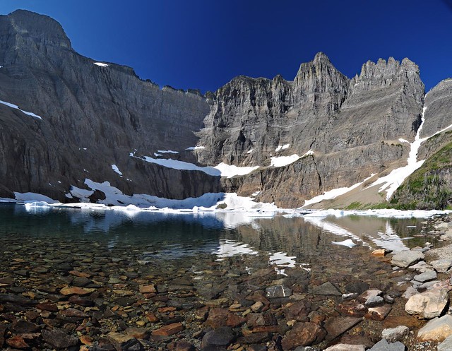
Iceberg Lake from above:
Sad to be winding up our trip, but happy for the awesome week we had:

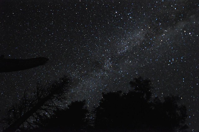
A note about stars. Woo hoo, were the stars awesome out here! Away from city lights and with no moon, it was pretty amazing. We tried some star photography one night, which I’ve never done before. I will have to experiment with this more. All the shots I took this night were blurry on the right side thanks to a faulty lens I had rented for this trip. Didn’t discover that problem until I got home, though.
A few tips if you go
Pros
- The scenery: The landscape here is nothing short of stunning. Everywhere you turn you’re faced with another postcard scene. Beautiful mountain lakes, sweeping mountain vistas, roaring waterfalls…this park has it all.
- No clearcuts: Most of my hiking at home, in Washington and Oregon, is on National Forest land. Unfortunately these forests are now peppered with clearcuts that spoil the view in all directions when you get up high. But Glacier has no clearcuts and it is amazingly refreshing to look out over vast swaths of unspoiled forest.
- No dogs: There are some responsible dog owners out on the trails, but there are also many irresponsible dog owners. I encounter them every time I go hiking at home. But dogs aren’t allowed on the trails in Glacier, which is a huge blessing. The trails are already pretty crowded with people. Dogs would just make the situation worse.
- Ranger talks: Most of the campgrounds in the parks have ranger talks every night in the summer. They are fun, highly informative, and often interactive. We went to three of them and learned cool and unusual facts about the ecology of the park, the history and function of glaciers, and the lives of bears. Anyone can go the talks, whether you’re staying in the campground or not.
Cons
- Bears: There are hundreds of black bears and hundreds of grizzly bears in Glacier. Fortunately the park staff do a pretty good job about educating visitors about the presence of bears. And they will temporarily close off trails that have had too much bear activity, which may be annoying for hikers but these closures help prevent unpleasant human-bear encounters. Fortunately, the vast majority of human-bear encounters that do occur end peacefully. The best thing is to carry bear spray, which is a strong pepper spray that you can spray in the bear’s face if it charges you. The spray and holster will set you back about $60 or so, but it’s worth it to have a little peace of mind. Bear bells are not recommended. Park Rangers call them “dinner bells” saying that they sound too much like a marmot or ground squirrel to a bear’s ears. Plus they’re annoying as hell. We used them on just one hike and it nearly drove me mad. After that we used our voices to shout or sing. You feel silly at first, but it’s better than surprising a bear. And I saw two different park rangers doing the same thing on the trail, so that made us feel a little less silly.
- Helicopters: Unfortunately the Park Service allows helicopter tours over the park. You will hear the helicopters overhead AT LEAST once per hike, but usually more than that. It’s a jarring and terrible noise to hear when you’re out trying to enjoy the wilderness. It feels like you’re in a war zone. I’m writing a polite but strongly-worded letter to the park service about this, which will probably result in nothing, but I can’t just let it slide because it was so bad.
- Crowds and traffic: Glacier is one of the most popular national parks which results in crowded trails and traffic congestion on the Going-to-the-Sun Road. The best way to travel the road is by shuttle or by taking one of the roofless red sightseeing buses. Let someone else do the driving and deal with the traffic so you can enjoy the views! As for trails, if you really want to avoid crowds, it’s best to avoid the more popular trails, but even then you will probably encounter plenty of people in summertime. Unfortunately, many of the hikers you’ll see are inexperienced and unprepared and don’t have any trail manners at all: walking side-by-side so people can’t get around them, not stepping aside when they’re holding up other hikers who want to get around, and listening to iPods so loudly that everyone around can hear. Thank goodness dogs aren’t allowed on park trails or it would be even worse.
- Camping: The park has a major problem with RVs, namely that there are far too many of them and they usually make terrible neighbors for tent campers. And since none of the campgrounds have electrical hookups for those RVs, there are lots of noisy generators creating an awful racket. On the up side, there are rules about which hours of the day you can run a generator, and some campgrounds have whole loops where generators aren’t allowed. However, I think the Park Service really needs to create separate RV and tent loops so that tenters don’t have to camp next to RVs.
By the way, we found two guidbooks to be immensely helpful in the planning of our trip. Moon Glacier National Park and Frommer’s Montana and Wyoming. For hiking, most of the trails in the park are covered in Hiking Glacier and Waterton Lakes National Parks.


