Last year when Greg and I did the Lakes Basin loop we had hoped to summit Eagle Cap but the hot weather and hard hiking the previous day left us with not enough energy. So this year after finishing our very fun llama trek on the south side of the mountains, we drove ALL the way around to the north side to complete this unfinished business.
Whereas last year we approached Mirror Lake from the direction of Horseshoe Lake since we were doing the loop, this year we took the direct route up the East Fork Lostine River. This route was MUCH MUCH better than the route up the West Fork Wallowa River. (Yes, it is popular too. There were 30 cars at the Two Pan trailhead when we started on a Wednesday morning.)
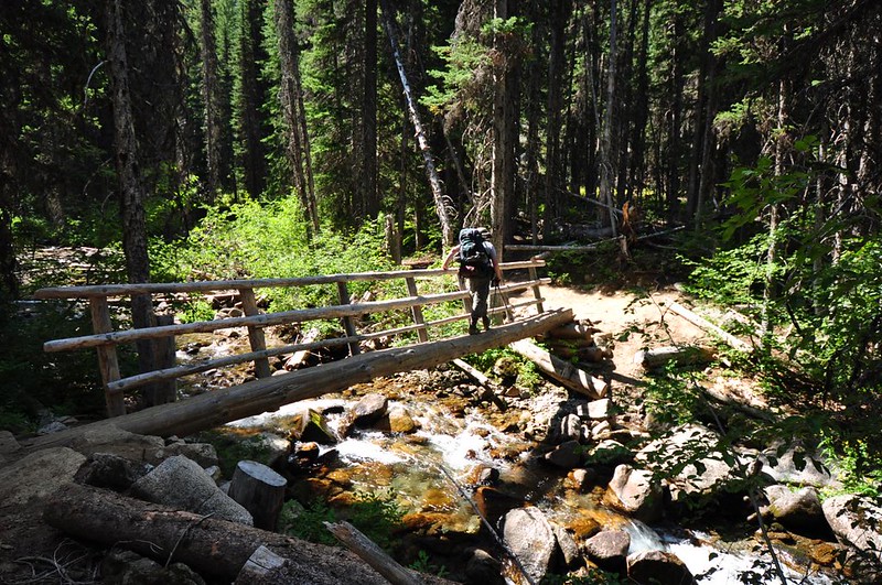
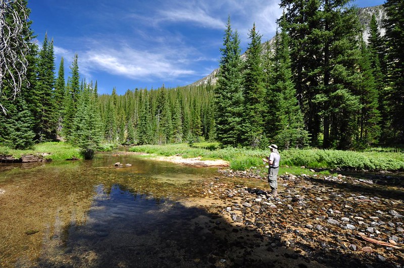
Crossing the river. All of this shade was nice since it was a warm day.
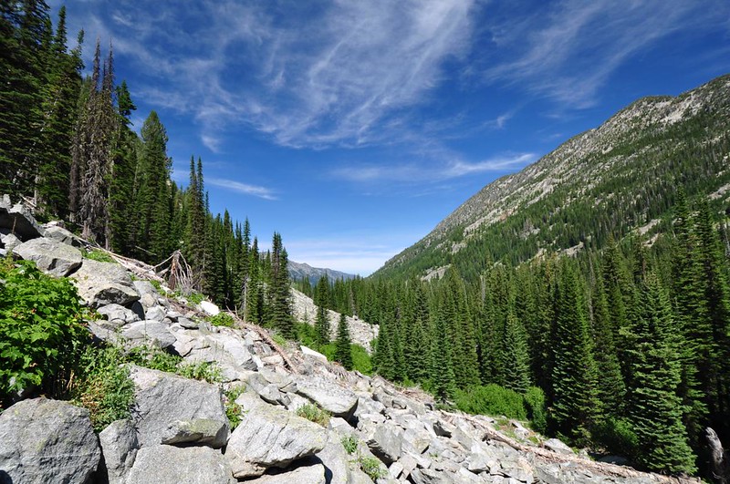
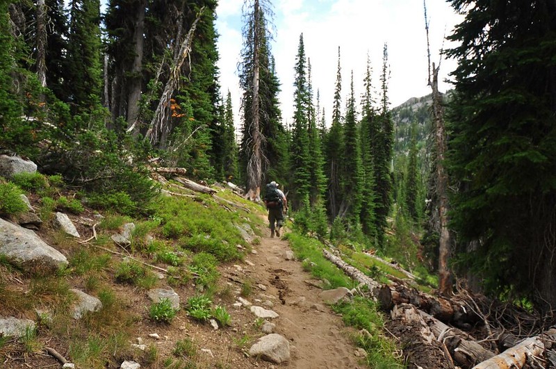
Then we started climbing those switchbacks and getting better and better views.
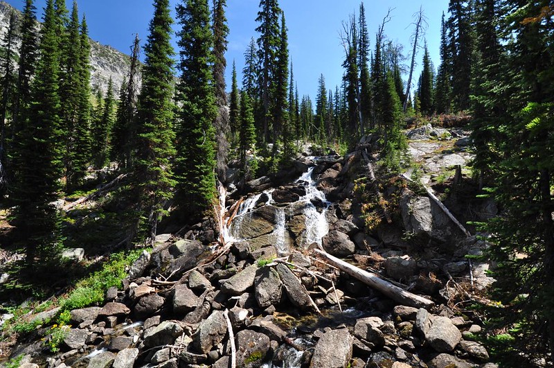
Nice waterfall, though I’m sure it looks much more impressive earlier in summer. Possibly Lostine Falls?
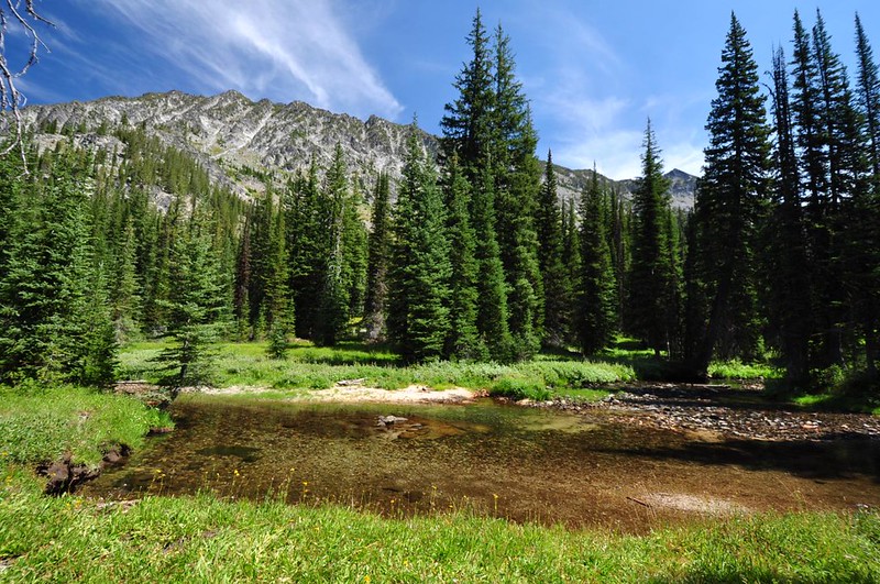
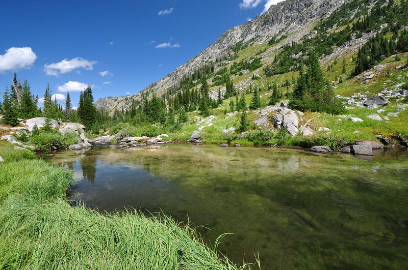
We came to several areas where the river spread out into pond-like areas.
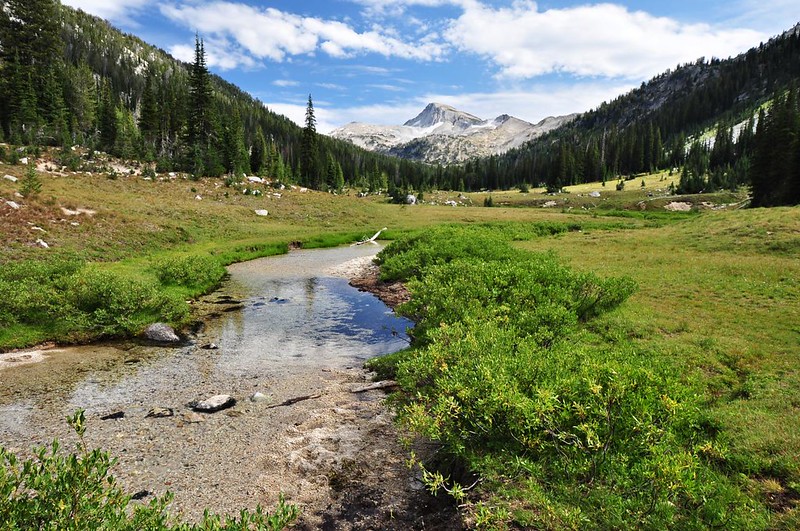
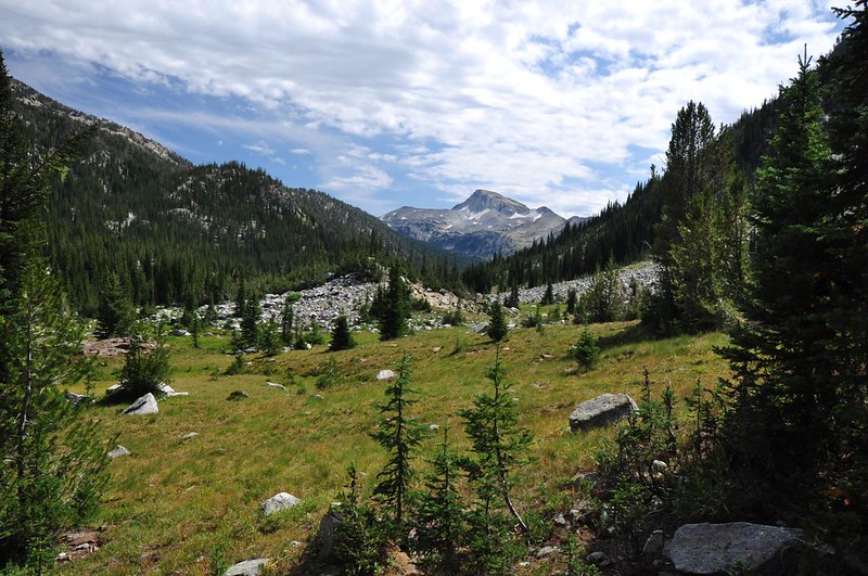
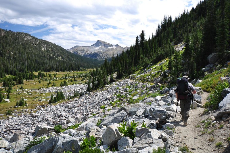
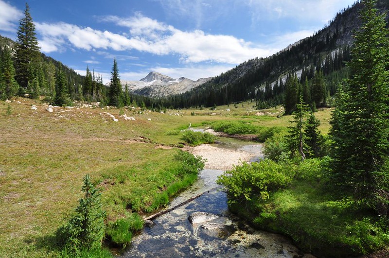
The first of MANY views we’d have of Eagle Cap. Tomorrow we hike up there!
Passed an almost perfectly-round snowmelt pond. I saw the large mound of dirt on the other side of the pond and wondered if this is some kind of old landslide.
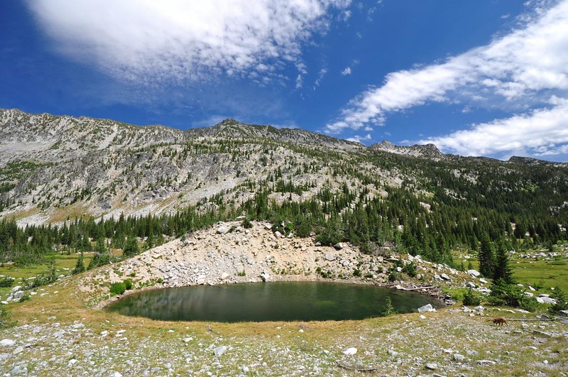
Looking back to the pond.
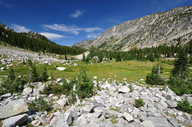
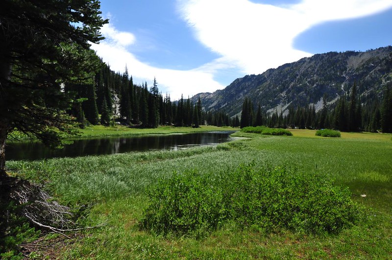
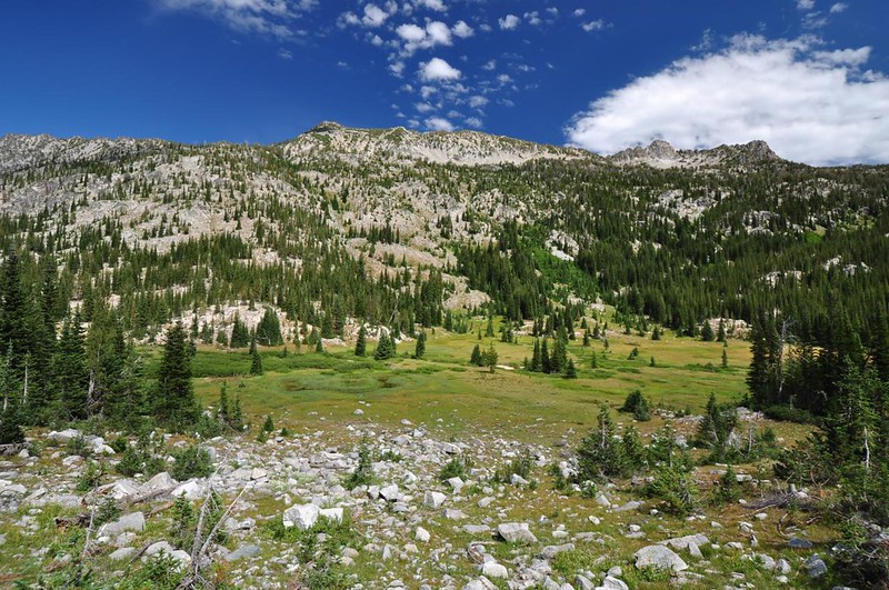
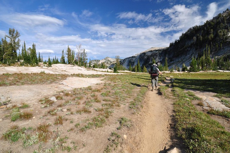
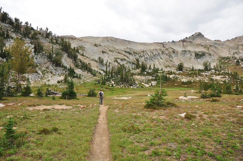
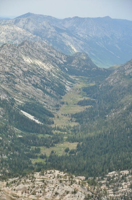
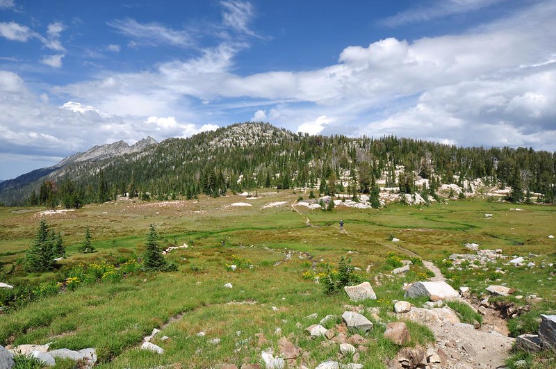
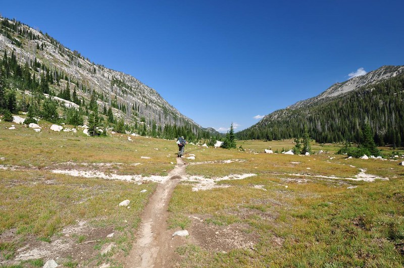
The trail follows the river south along this big glacier-carved U-shaped valley. Beautiful!
The river snaked its way through the meadow just below the trail.
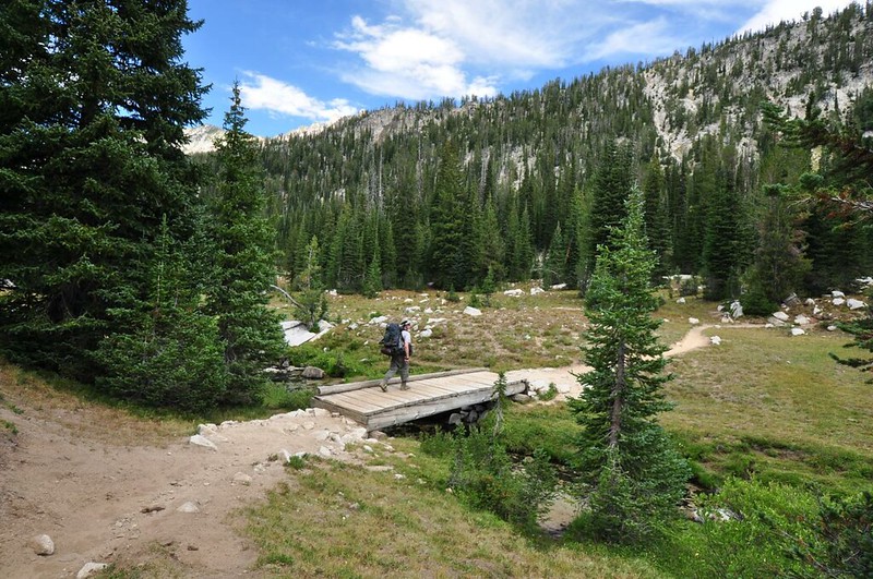
The trail crosses the river on a nice footbridge. In our the 2008 edition of Sullivan’s 100 Hikes in Eastern Oregon he mentions that this bridge is collapsed. Obviously it’s since been replaced.
Looking downstream from the bridge.
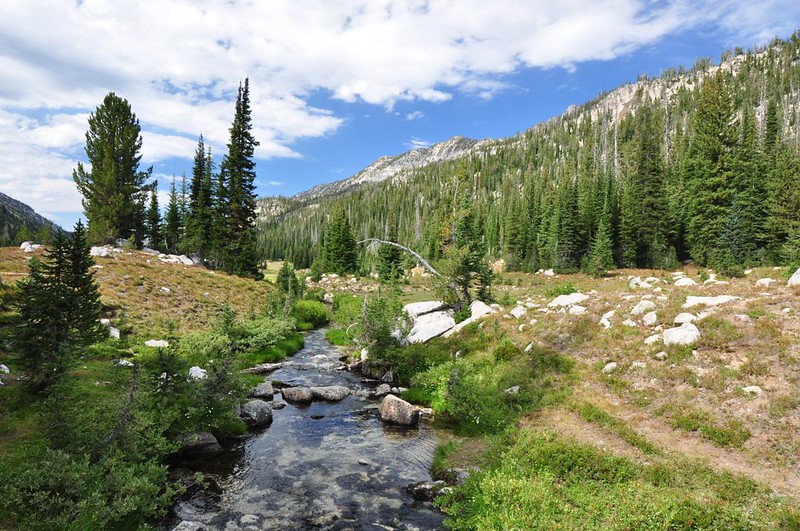
Looking upstream.
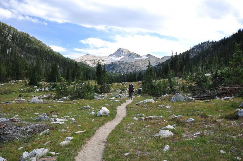
Although there is an obvious trail that continues south through the meadow, the official trail leaves the meadow and enters the trees at this point.
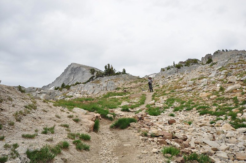
Almost there!
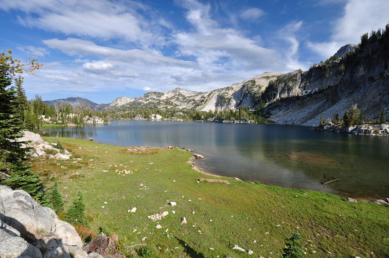
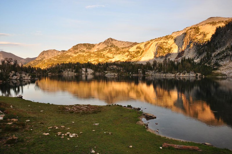
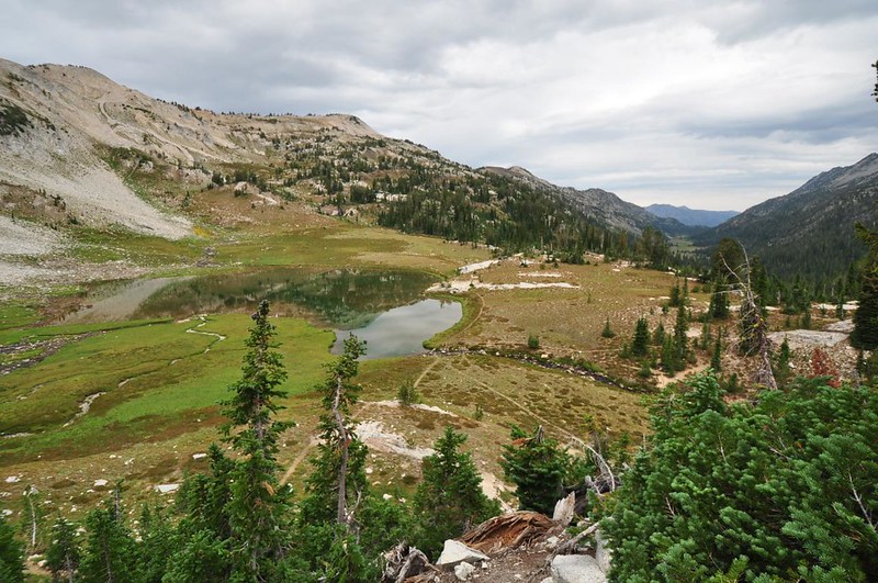
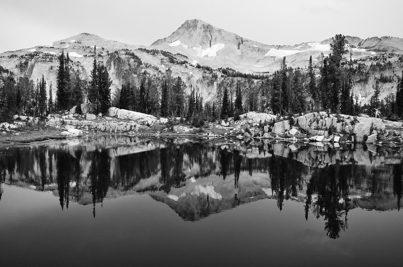
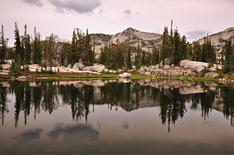
Ah, Mirror Lake. A beautiful sight.

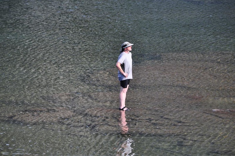
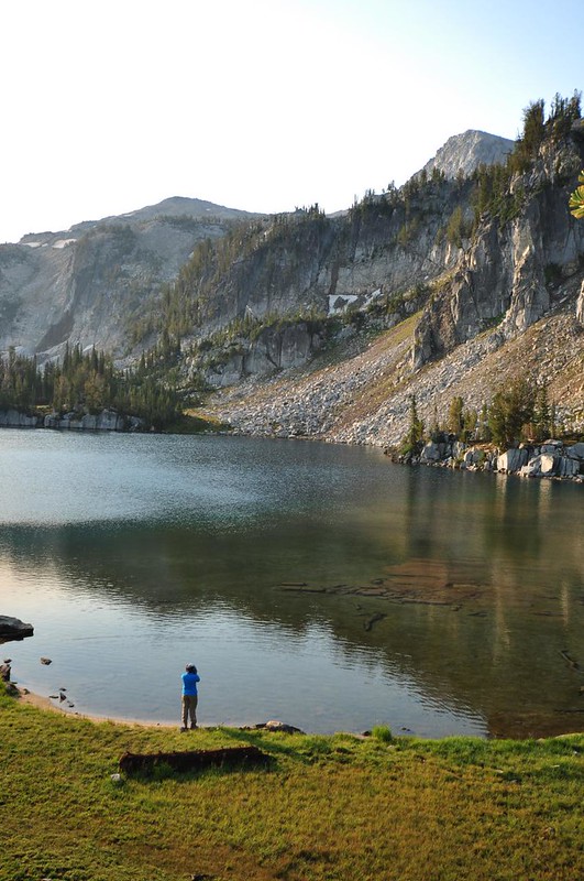
It wasn’t quite hot enough for a full-on swim, but we did go out in the water. Hey, Greg is standing on the water!
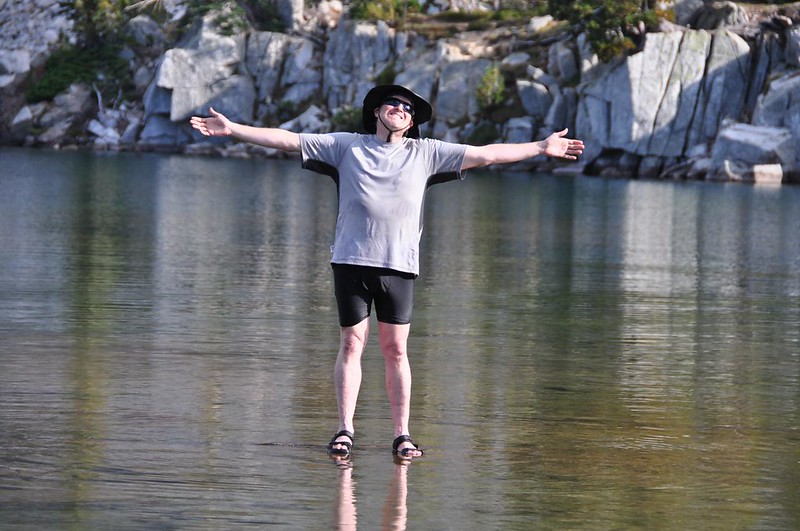
Nah, he’s just standing on submerged rocks.
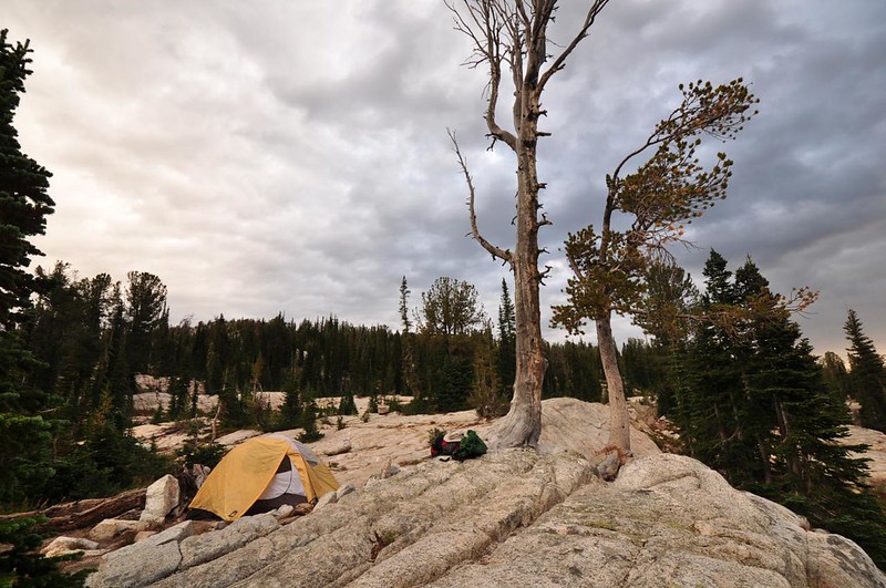
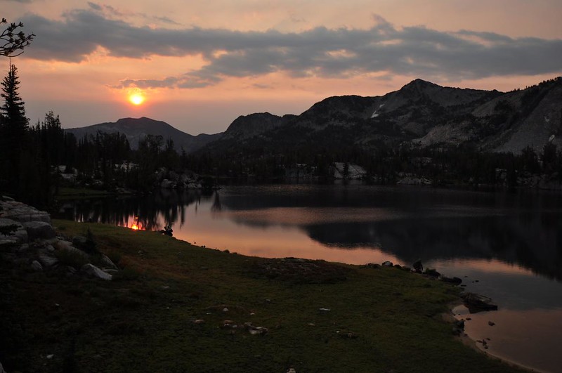
We took it easy, puttered around camp, and made dinner. Evening was lovely.
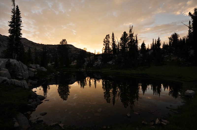
This is a little pond near our site. I was really hoping that all those clouds would light up red and gold, but it didn’t happen. Oh well, it’s still very lovely.
It rained off and on all night, and sometimes it was quite a downpour. When we woke up the skies were completely overcast. Hey, that wasn’t in the weather forecast!
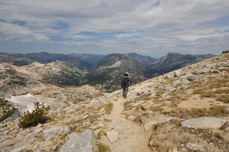
After breakfast we started up to Eagle Cap, hoping that the weather would clear soon.
Where we’re headed! You’d never know from this angle that there is a hiking trail all the way to the summit. No climbing or scrambling required!
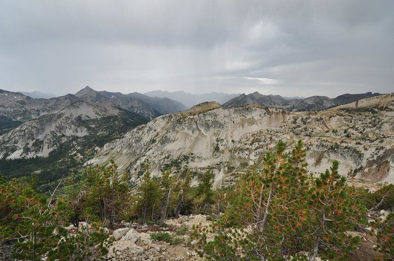
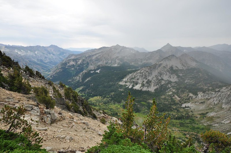
Fortunately the clouds were high enough that we still had views as we climbed.

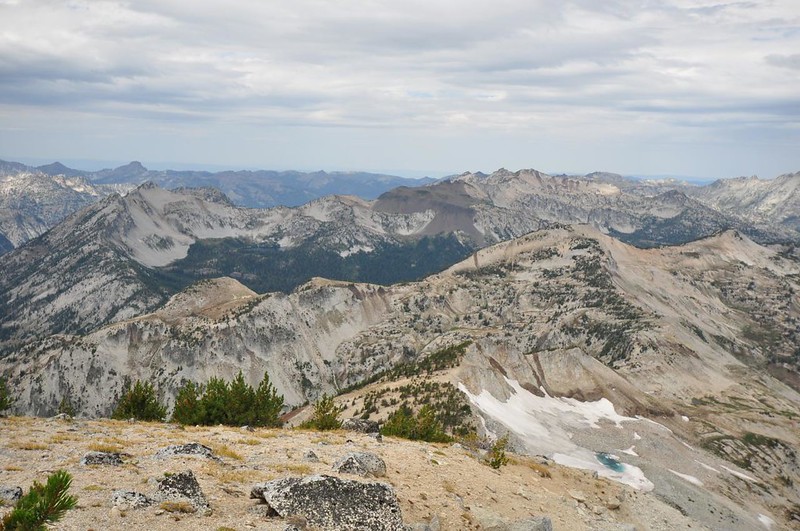
Soon our views encompassed approaching rainstorms. Drat! There was no evidence of thunder and lightning, but we were prepared to turn around immediately if we started hearing thunder. There were small rain storms in every direction. Looking west:
Looking south:
Looking north:
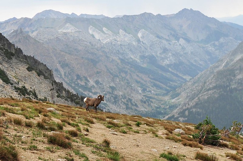
I had no idea there were bighorn sheep in the Wallowas, but we saw a small herd. I only managed to get a picture of one. Cool! (Actually, you can just see a second sheep at lower right, behind a small tree.)
Almost there!

Yay, we made it!
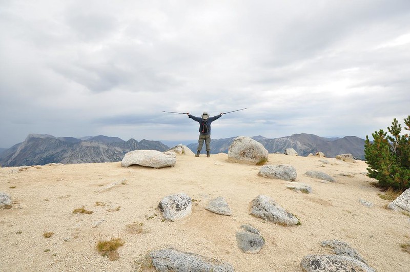
I did not find the hike up to Eagle Cap very difficult. It definitely helped to not be doing this hike on a hot sunny afternoon since there is no shade along the way. I think I was also fueled by the adrenaline that came from my frustration with the weather (yeah, it’s totally pointless to be frustrated by something I can’t control, but if it helped me summit the mountain at least it was a little productive!)
Despite the weather the views were pretty amazing. So here we go…
Looking down on Glacier Lake to the east with Glacier Peak on the right side (with the snowfield on it):
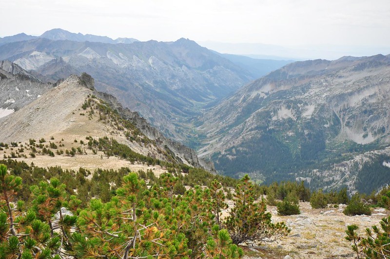
Looking south down the valley of East Fork Eagle Creek:
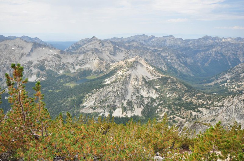
Looking west, with Minam Lake left of center, Needle Point above it, and the forested valley of the Minam River at right:
A zoomed-in view of the peaks to the west with Mule Peak at center and Granite Butte on the right (Mule Peak’s 1924 lookout is a ground cabin, not a tower, so you can’t really see it in this shot, but wow the views they must have up there!):
Looking west in the direction of Minam Lake (out of view), but you can just make out Blue Lake left of center:
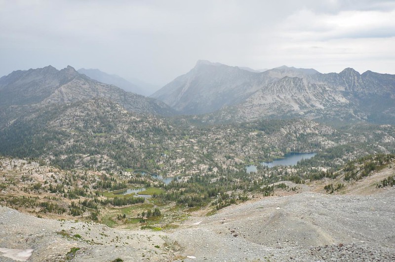
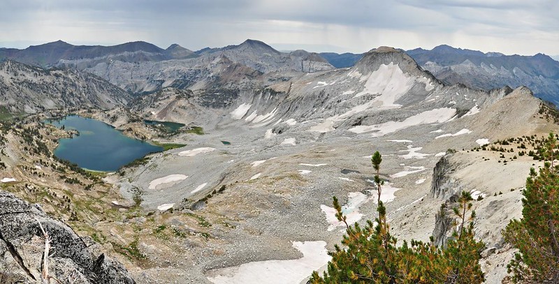
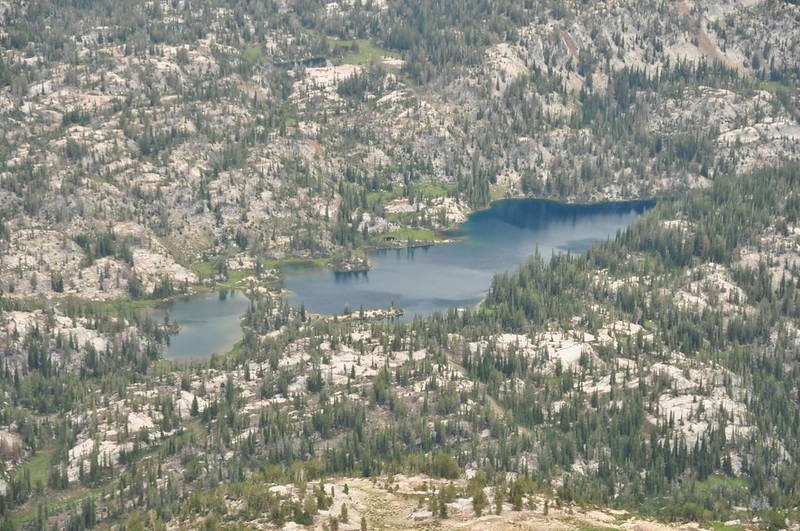
Looking north with much of the Lakes Basin spread out below, with the valley of the East Fork Lostine River Valley on the left, Mirror and Moccasin Lakes in the lower foreground, the Matterhorn at upper center, and the valley of the West Fork Wallowa River at far right.
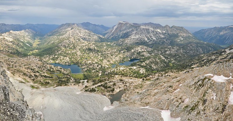
A close-up of the East Fork Lostine River, which we hiked up the day before and would hike back down the following day:
A close-up of Mirror Lake, with tiny Sunshine Lake at right:
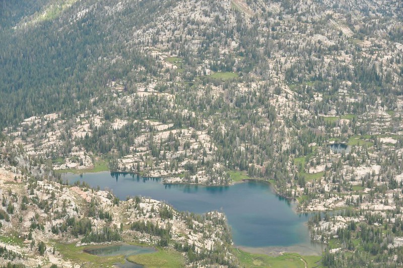
A close-up of Moccasin Lake:
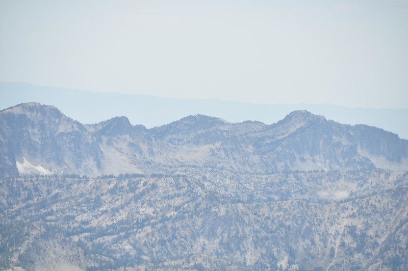
Looking northeast at Horseshoe Lake (you can make out the flat brown valley north of the Wallowas at upper right):

We spent about 30 minutes alone on the summit before another couple showed up. The rain had stopped and the skies were starting to clear up a bit, yay! A short while later another couple showed up. We spent about an hour up soaking up the stunning views and identifying landmarks on the map. On the way down we passed a couple coming up and they turned out to be trail runners. I can’t imagine trail running up here!
They spent just a few minutes on the summit and then came right back down, passing us slowpoke hikers as we moseyed along. They were in such a rush that they were cutting the switchbacks, sending rocks and sand skittering down the slope.
By early afternoon the rain was nowhere to be seen and the skies were finally clearing up. About time!
With our clothes still a little damp from the morning drizzle, Greg laid his out on the rocks to dry. It looks like a hiker laid down here for a rest and then evaporated, leaving behind his boots and clothes!

We spent the afternoon relaxing, napping, and playing gin rummy. Before dinner we went for a little jaunt over to Sunshine Lake, which is tiny but very beautiful. The clear skies were quickly vanishing, but the view was still incredible.
Back at our campsite we had just boiled hot water and poured it into our dehydrated dinner packets when rain drops started falling. We had seen the dark clouds gathering so we were prepared and had already stowed all our gear away. We grabbed our wine and dinner and scrambled into the tent just a few minutes before the skies opened and it POURED. I took a quick video to record the sound of the rain on the tent. Holy moly! (Click here to see the video.)
There was some thunder and lightning with this storm too, which wasn’t too scary because it didn’t last long and it was still daylight. All in all the storm was over in less than 20 minutes, and then the skies cleared up like it never happened!
We went to bed at dusk and fell asleep only to be woken up around 9pm by another downpour pounding on the tent. A few minutes later the thunder and lightning started up again. Only this time it was pitch dark and the storm lasted a FULL HOUR. This was not fun. It was actually scary. We weren’t camped on a high point, and indeed we were surrounded by many things much higher than us. So we weren’t worried about getting hit. But thunder is very loud and it echoed and boomed around the mountains and the darkness made it seem even louder. We’d see a flash, or sometimes several flashes in direct succession, and then the crack and boom of the thunder. It was intense. Finally it ended at 10pm and the ensuing quiet was a sweet relief.
I tried in vain to find some information online about how many lightning strikes we had that night of the 22nd, but I could find nothing. It seems that unlike lots of other weather history, lightning strike information is not as freely available. My guess is that there were 70+ strikes in that hour, probably much more. There was never more than a minute between strikes and it lasted a full hour.
The sunrise in the morning was weird and spooky since the sun was shining through smoke from wildfires in the Hell’s Canyon area. We hadn’t seen it the morning before because of all the clouds.
Except for the smoke a few scattered clouds, the morning was gorgeous and calm. You’d never know about the violent storm we experienced nine hours earlier.
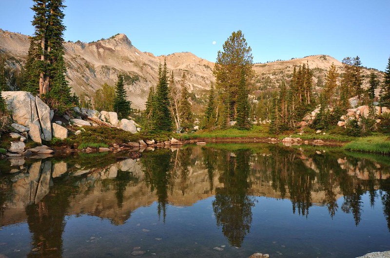
The little pond near our site:
Goodbye, Mirror Lake! It’s been fun!

Hiking out under beautiful blue skies.
A stop at the ponds for a break before the final descent to the car.
Since we were hiking out on a Friday we expected to pass a lot of incoming backpackers and we did. Some of them we passed quite early on because they’d been camped somewhere along the trail the night before. Every one of those people asked us how we weathered the storm and we swapped stories. I didn’t count how many incoming backpackers we saw altogether, but there were quite a few. Even when we got back to the car around 2:30 they were still starting out. We were very glad that we’d been able to time our visit for mid-week to avoid the crowds!
This is the third time I’ve visited the Lakes Basin and it never ceases to blow my socks off. If we’d had more time we’d have loved to make a three-night loop out of this and go camp over at Minam Lake for the last night. Maybe next time! Despite the wild swings in weather we still had a great time on this trip. The Eagle Cap Wilderness has to be one of the most gorgeous areas in Oregon. It’s just amazing.


