September 15, 2023
We were supposed to do this trip over Labor Day Weekend but had to cancel due to bad weather. Fortunately we were able to make it happen this weekend instead.
There were 13 cars at the trailhead when we arrived at 11:50am. It was a pleasant 66 degrees. After Greg finished packing we hit the trail at 12:25. This is one of the only unburnt areas of the Mt. Jefferson Wilderness and it was a pleasure to walk amongst these big trees.


Jumbled rocks from the flood:

After an easy two miles we reached Pamelia Lake. This is a very popular spot to camp in the summer:

Because the lake is so low right now we were able to walk the west shoreline a bit to get a view of Mt. Jefferson:

Fall color starting:

After a quick break at Pamelia Lake we continued on, connecting up with the Hunts Creek Trail:


A glimpse of the far southern end of Pamelia Lake:


There were several easy creek crossings:


Looking down the slope to Hunts Creek:

The trail crosses Hunt’s Creek, but there is no bridge. This tree has fallen in just the right spot and made it easy to cross:

The trail started climbing and Greg started slowing down. We decided he would go slow and take his time and I would hike ahead to get a campsite. We had the radios so we could stay in touch. I reached the junction with the Hunts Cove Trail and turned left. There were lots of downed trees that fortunately had been cleared:

Passing above a nice little meadow:

The tip of Mt. Jefferson:

6.3 miles from the trailhead I reached Hanks Lake, one of two lakes in the cove (the other being Hunts Lake):

I found a campsite, dumped my pack, and started filtering water. Greg showed up and we set up the tent and started making dinner. We walked down to the western side of the lake to a spot where we could see Mt. Jefferson and we sat there while we ate:


I wish I could say it was quiet and peaceful but it turns out we were right under a major flight path and we had to deal with the constant sound of commercial jets overhead.
The next morning we sat by the lake and ate our breakfast with this fine view:


After we ate breakfast we set off for a day hike. We backtracked up the Hunts Cove Trail to the Hunts Creek Trail, where we turned left and started switchbacking uphill:


A peek at Mt. Jefferson:

A view of the Three Pyramids:

And Coffin Mountain:

Three Pyramids on the left and Coffin Mountain on the right:

The Cathedral Rocks:

The trail then traverses a slope high above Hunts Cove:

A view of Mt. Jefferson from above Hunts Cove:

Looking down on Hanks Lake

Mt. Jefferson and Hanks Lake:

Continuing on:


Looking back at Mt. Jefferson:


We arrived at the top of the unsigned Hunts Cove Trail that descends into the Cove from here. We’d be going down that later:

And just after that we reached the junction with the PCT:

Now we headed north on the PCT:


Looking down on Hanks Lake in Hunts Cove from the northeast:


This is Hunts Lake, the other lake in Hunts Cove:

Both lakes:

5.4 miles after leaving our campsite we reached Shale Lake along the PCT:

On the map there’s a big lake just north of here and I went to check it out. All dried up!


We sat by Shale Lake for awhile and took a break:


After a long break at the lake we packed up and got ready to head back. We spotted this cute little frog on the shore:

As our time at the lake wrapped up we could tell that the sky was getting hazier:

And as we headed south we definitely noticed the air had gotten quite smoky. I had enough of a signal on my phone that I was able to look up what was going on. The hot dry weather was causing the fires to the south – Bedrock, Lookout, and Pete’s Lake Fires – to pump out more smoke. Shifting winds were bringing that smoke our way. Yuck:


Greg stayed behind to utilize the signal for awhile and I continued on towards Hunts Cove. Still smoky:


Descending into Hunts Cove on the trail we passed earlier:


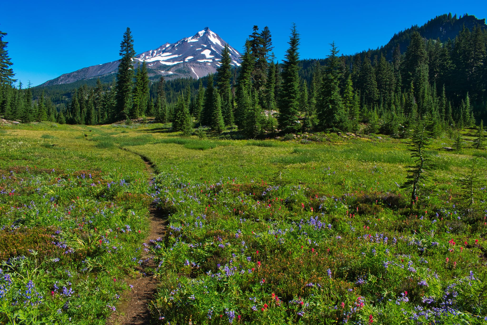
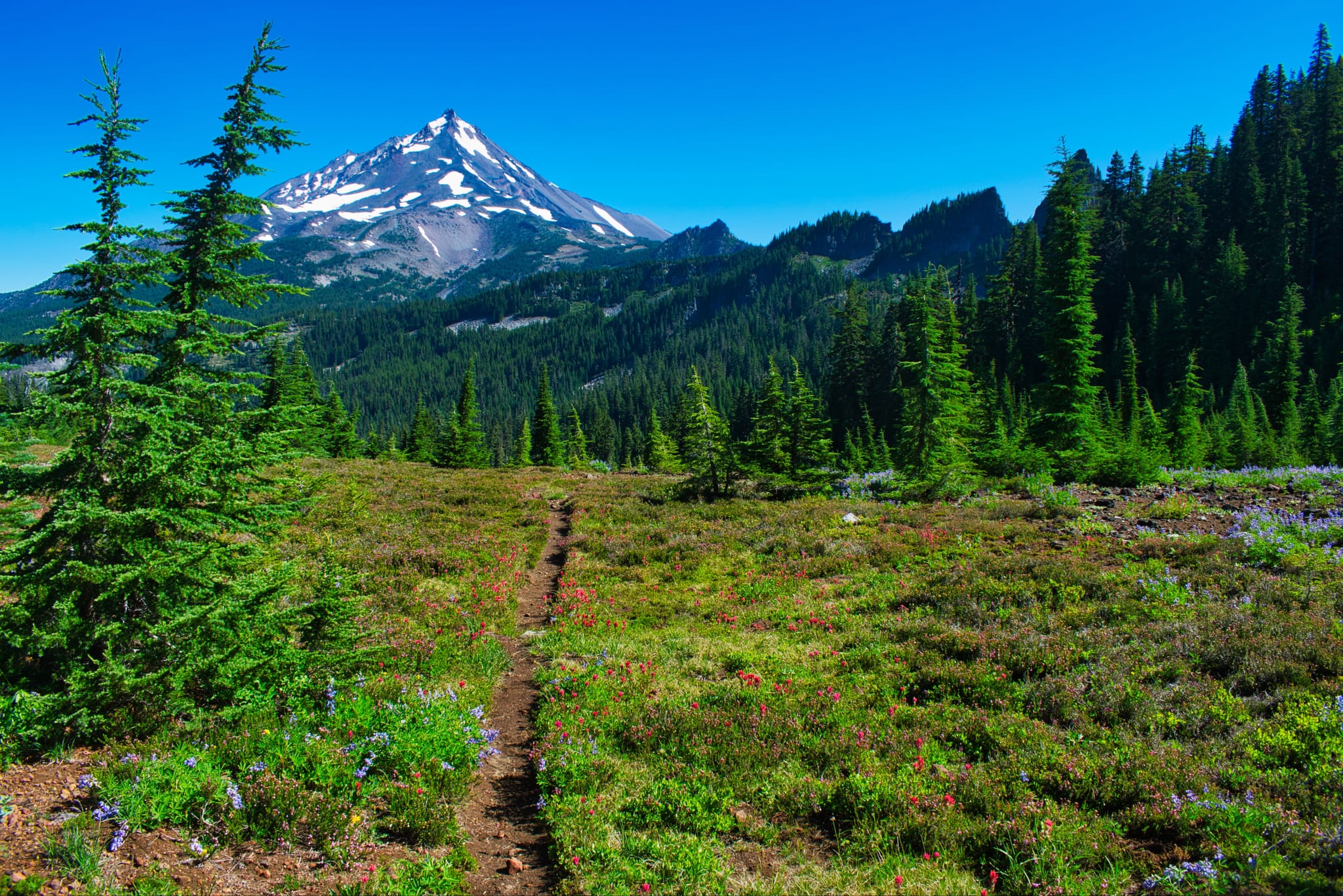
It was too late in the season for wildflowers on that trail, but a few months ago it would have been really pretty. Here’s are photos from AllTrails showing what that descent looks like in July:
I continued my descent through the smoke:

Fall colors:

Crossing a little creek that flows into Hanks Lake:

Greg caught up with me and we continued our way down into the cove:


The trail brought us to the north side of Hanks Lake, which we had not yet seen. There were a few people camped here. There were also a whole bunch of fallen trees here. Looked like some kind of microburst windstorm in the past few years, I think:


Before going to our campsite we took the detour over to Hunts Lake. One of the people camped there showed us a black spot high up on the hillside (out of frame on the left) that was a black bear. He said the bear had been up there for several hours, roaming around and foraging:

More broken trees:


Making our way back to our campsite through a sea of blowdown that had fortunately been cleared:


As we settled in at our lakeside viewpoint to eat dinner we could see the smoke starting to clear:

After hiking 9.2 miles today this chocolate mousse tasted pretty dang good:

Clearing skies:

The smoke did not return overnight and we woke to some scattered clouds:


We picked some huckleberries before packing up and heading out:

We stopped to admire this nice cascade again on the hike out:


Great backpacking trip! I would do it again. This area is beautiful.
Gaia stats: 23 miles, 4,150′ elevation gain


