My sister and I had attempted a loop of the Barlow Road and the Barlow Creek Trail while snowshoeing in January. We were unable to find the Barlow Creek Trail in all the snow, so one of my missions this summer was to find it sans snow. Since I still needed some exercise after the really short Lookout Mountain hike earlier in the day, I headed over to the Barlow Pass trailhead and set off on foot down the bumpy Barlow Road.
(Quick story: A guy who appeared to be a leader for a mountain bike touring company was talking to his group at the trailhead and told them to bring their “sunnies.” “Their what???” I thought to myself. Fortunately I wasn’t the only clueless person around since one of the group asked what “sunnies” were. “Sunglasses,” the guide replied. I have never heard this nickname for sunglasses before, and I hope I never hear it again. It reminds me of the ever-growing popularity of the nickname for lenticular clouds: “lennies.” DRIVES. ME. BONKERS.)
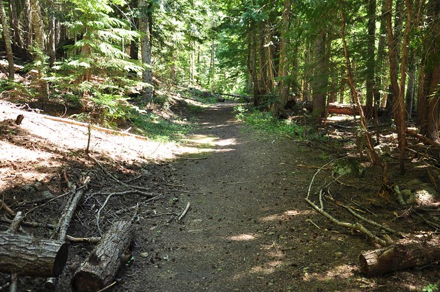
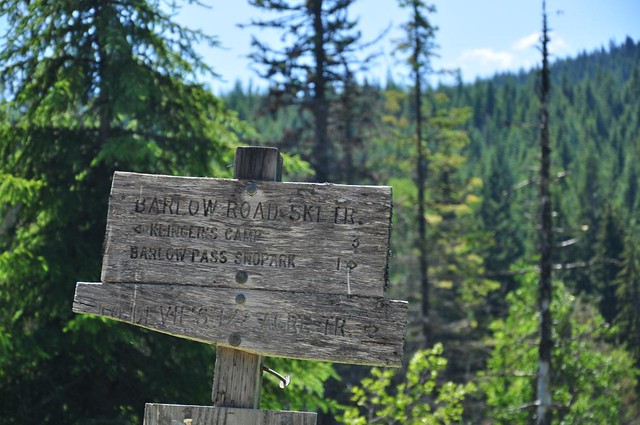
After a short distance, the Barlow Creek Trail heads off into the woods on the left (east) side of the road. There is a trail sign here (which we did see in the snow, although we were attempting to connect with the trail from the other end).
The trail came to a small meadow and a junction, where another trail headed north. There are signs here, although I didn’t think to take a picture of them, and I don’t remember what they said. I kept straight.
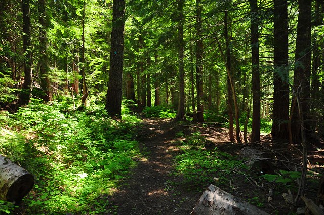
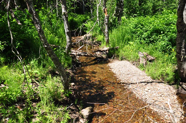
The trail crossed several lovely little creeklets. The forest was full of big hemlocks (thanks for the shade, hemlocks!), with some huckleberry bushes along the way (no berries yet, of course!)
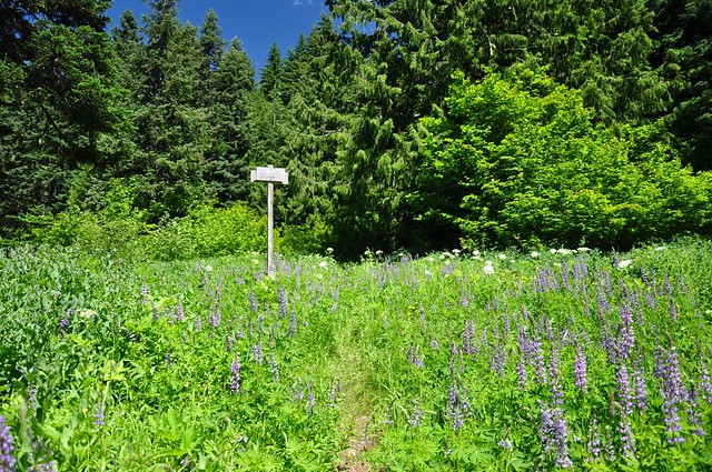
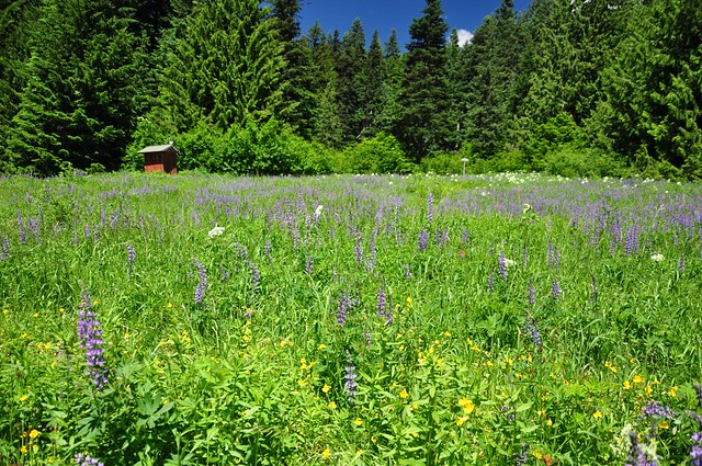
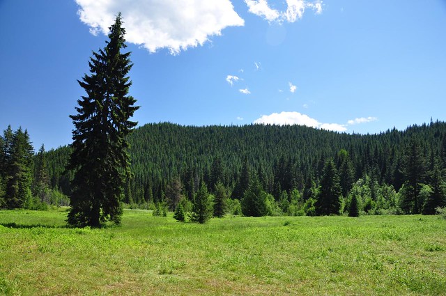
The trail ended in a lovely meadow at the edge of the Devil\’s Half Acre Campground. There’s a tall trail sign in the middle of the meadow.
A ramshackle red outhouse sat on one side of the meadow.
On the far side of the meadow is the campground and the access road. I hiked the access road a short distance down to the Barlow Road. This access road is in really crappy shape. There were several sketchy sections and some crazy-looking topography that would be hard to navigate in a low clearance car. You have to REALLY want to camp here.
Down at the road, there is a disintegrating sign. I never saw any sign of the Devil’s Half Acre trail that it mentions, although it does show up on the topo.
I hiked west on the Barlow Road, crossed over bubbling Barlow Creek.
No sign of the ubiquitous jays that followed us when we were here in January! I was hoping for good wildflowers in Devil’s Half Acre, but it doesn’t appear to be that kind of meadow. It was still pretty interesting to see it all lush and green, after having seen it buried under snow six months ago.
I hiked back to my car via the Barlow Road. It’s A LOT different than snowshoeing up it in winter, of course. For one thing I was passed by several trucks heading down. It’s really amazing how drastically snow can change a landscape.
Here’s the GPS track from my Droid. The Barlow Creek trail on the topo is not accurate, which makes me think the placement of Devil’s Half Acre trail on the topo is also inaccurate.
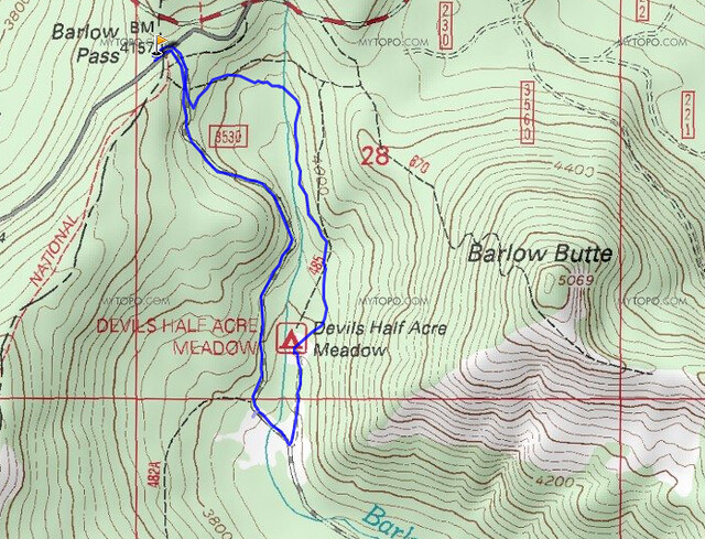
Even now that I know where the Barlow Creek Trail is, I’m still not sure I could follow it in the winter. The blue markers on the trees are too spread apart. Unless you were following in the tracks of someone who went before you, it would be pretty difficult to follow. Of course, you could just make your own path, I guess. With the GPS you could guess your way through the forest and back up to the trailhead.


