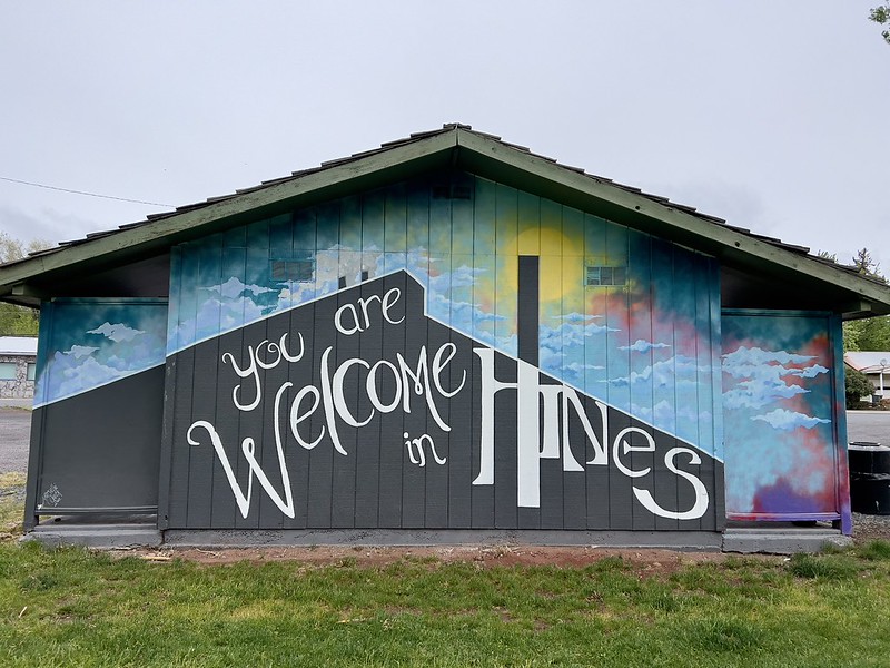
Echo

Date of visit: May 27, 2012
Population: 699 (2010 Census)

The town of Echo sits on the east side of the Umatilla River. Before the town even existed the Umatilla Indian Agency (for the Cayuse, Umatilla, and Walla Walla tribes) was established on the west side of the river in 1851. However during the Yakima Indian War of 1855 Indians destroyed it. The Oregon Mounted Volunteers built a stockade on the site, called Fort Henrietta. It was abandoned in 1856, and all that remains of the old fort is the blockhouse that you can visit at Fort Henrietta Park.


Welcome to Echo

Echo main street
Main Street

Teel Building
Teel Building

H&P Cafe
H&P Cafe

Post office
Post Office

Blockhouse
Blockhouse from Fort Henrietta

Echo Methodist Church

Ross House
The Ross House, built in 1910

Map of Echo

Oregon Towns Project

Umatilla

Date of visit: May 27, 2012
Population: 6,906 (2010 Census)

Oregon Women won the right to vote in 1912. In 1916 in Umatilla they exercised that right to elect some of their own into city government. Citizens were dissatisfied with the way the all-male city council was running things (or rather, not running things). So on December 5 they voted seven women into power: four city council members, a recorder, a treasurer, and a major. Laura Starcher was elected mayor, defeating her incumbent husband, E.E. Starcher. In her victory speech she said “We believe the women can do many things and effect many reforms in this town that the men did not dare to do.” The press called it a “petticoat coup.”

The Umatilla government continued to be female-dominated until 1921. The women felt that they had accomplished what they wanted done and bowed out that year. No other women stepped up to replace them and the government returned to being all-male.

Welcome to Umatilla

Dam
McNary Dam on the Columbia River

City Hall & Library
City Hall and Library

Divine Dining
Divine Dining

Java Junkies
Java Junkies

Giant cowboy
Giant cowboy

Umatilla Museum
Umatilla Museum

Map of Umatilla

Oregon Towns Project

Hermiston

Date of visit: May 27, 2012
Population: 16,745 (2010 Census)

Watermelons are famous in Hermiston even though they are not the biggest crop in this area. Back in the 1960s the Hermiston mayor, Frank Harkenrider, was looking for a way to promote his town. Potatoes and alfalfa weren’t very interesting, but watermelons were. So he decided to market Hermiston as a place that grew quality watermelons and even started delivering Hermiston watermelons to the mayor of Portland. Eventually the melons started becoming so popular around the Pacific Northwest that the name Hermiston became synonymous with watermelons. Umatilla County produces 45,000 tons of watermelons annually. Well-drained sandy soils, long growing season, and plenty of sunshine make for good growing conditions. High daytime temperatures and cool nighttime temperatures make for a sweeter melon as well.

Welcome to Hermiston

Hermiston Watermelons
Advertising the watermelons

Hermiston Main Street
Quiet Main Street on a Sunday morning

Clock
Clock in McKenzie Park

Peaceful evening
Riverfront Park

Roemarks
Roemark’s Men’s Wear

Maxwell Siding
Old trail cars at Maxwell Siding

Flowers
Florist shop in historic building

Hermiston Library
Hermiston Public Library

Map of Hermiston

Oregon Towns Project

Ione

Date of visit: May 26, 2012
Population: 329 (2010 Census)

The little town of Ione was established in the 1880s. An early resident of the town, Joseph A. Woolery, moved there in early 1890s and set up a general store. He became a successful merchant and served as the town’s postmaster. He was elected as the town’s first mayor. He built a beautiful house in 1900 which still stands today (serving as a B&B). He was so respited and revered that when he died in March 1908 an estimated thousand people gathered for his funeral.

Welcome to Ione

Main Street
Ione’s main street

City Hall and library

Crossroads
Old street signs as artwork in the city park

Woolery House
The historic Woolery House is now a B&B

Old house
A crumbling old house

Quiet
Old grain elevator

St. Williams Catholic Church

FIrst fire hydrant
Ione’s first fire hydrant

Map of Ione

Oregon Towns Project

Lexington

Date of visit: May 26, 2012
Population: 238 (2010 Census)

Morrow County was created in 1885, carved out of the western part of Umatilla County and a small part of eastern Wasco County. It was named in honor of Jackson Lee Morrow, an early settler in the area. Heppner became the temporary county seat until an election could be held to determine the permanent county seat. The election was to be held in 1886 and both Lexington and Heppner were vying to win.

Heppner citizens donated land on which to build the courthouse and contributed money towards the cost of building it, even though the vote hadn’t happened yet. Lexington residents were not amused and they countered with a building site of their own as well as $3,000 in building funds. On the day of the vote Heppner’s youth rode out to surrounding sheep ranches so the ranchers could go into town and vote. That night during the ballot count Lexington was beating out Heppner by a wide margin. The ballot counters called it a night at 2am, posting a guard until counting could be resumed in the morning. The guard, so the story goes, was drugged via his coffee and in the morning all the ballots had disappeared. The issue went to court, which ruled that Heppner would become the county seat since it had already been serving as the temporary location anyway. So Lexington lost its bid to become the county seat of Morrow County.


Entering Lexington

Community Bible Church

Steak house
Steak House

Mercantile
A closed store in Lexington bearing the name of the nearby town of Heppner

Fire station
City Hall and Fire Station

Morrow County Grain Growers

Map of Lexington

Oregon Towns Project

Lonerock

Date of visit: May 26, 2012
Population: 21 (2010 Census)

Lonerock is a tiny little town in the middle of nowhere, named after an enormous 35-foot-tall rock behind the church. The community was established in 1881 as a service center for the surrounding ranches, then incorporated in 1901. The town is so tiny that its population peaked at 82 in 1930 and has been in decline ever since.

The nearest town is Condon, about 20 miles away, about half of that being gravel road.

Welcome to Lonerock
Welcome to Lonerock

Post office
The “post office”

Old Community Hall
Old community hall

New Community Hall
New community hall

The lone rock
The famous rock behind the church

Former schoolhouse
The old schoolhouse is now a private home

Town jail
The old town jail

Map of Lonerock

Oregon Towns Project

Heppner

Date of visit: May 26, 2012
Population: 1,291 (2010 Census)

Heppner is a little town with a picturesque creek (Willow Creek) flowing through it. That creek wasn’t so lovely on June 14, 1903. A severe thunderstorm hit the area, producing lightning, rain, and hail. A flash flood raced through town, a wall of water sweeping away homes and businesses. The flood carried along trees and other debris which only made the devastation worse.

Some residents were able to escape to high ground and some were able to climb trees to escape the raging water. But the flood happened so fast that about 250 people were killed. When the water receded two-thirds of the houses in Heppner were gone and all but three businesses were destroyed. The railroad spur line from Lexington was also destroyed, along with the telegraph and telephone lines. Clean-up took weeks.

Willow Creek flooded again in 1948 and 1971, but much less severely than in 1903. In 1983 a $55 million dam was built on Willow Creek just outside of town to help control future flood events.


Welcome to Heppner

Welcome to Heppner

Morrow County Courthouse

Judge Ellis House
The 1885 Judge Ellis House

Blarney Stone
Heppner’s very own Blarney Stone

Post office
Post Office

Library and museum
Library and Museum

Flood control
The dam that on Willow Creek

Morrow County Agricultural Museum
Morrow County Agricultural Collection

Mural
Mural

Map of Heppner

Oregon Towns Project

Jordan Valley

Date of visit: May 18, 2012
Population: 181 (2010 Census)

The Jordan Valley area was mostly settled by Basques. The Basques come from Spain and France and claim to be the oldest unmixed race in Europe. They first started arriving in the United States in large numbers during the California Gold Rush, which began in 1849, and many Basques settled in eastern Oregon after the gold mines played out. Most of the Basques in the area came from the Bizkaia province of Spain. Usually men immigrated first and once they had established a home the wife and children would follow. In the 1920s there were about 600 Basque families around Jordan Valley. They were known as an energetic but peaceful people, often wearing bright colors in the Basque tradition. They mostly tended to be herders of sheep and other livestock. A popular recreational pastime was Pelota, which is the Spanish word for “ball.” The game is similar to squash and racquetball and a pelota court known as a fronton was built in Jordan Valley in 1915. It still stands today.

Welcome to Jordan Valley

Fire trucks
Old fire trucks

Main Street
The main drag

United Methodist Church

Pelota court
Pelota court (pelota is a form of handball)

Jordan Valley post office
Post office

Map of Jordan Valley

Oregon Towns Project