Monday, July 4, 2022
After staying at the Drake Peak Lookout for three nights we headed east for a few days to check out Steens Mountain.
We drove over from the Lakeview area on Sunday and set up camp at Page Springs Campground. This campground is notoriously buggy and the mosquitoes made themselves known pretty much immediately. We set up the bug tent and then we were able to hang out comfortably, safe from the swarms:

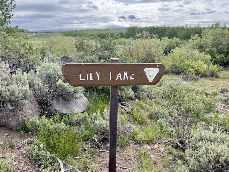
On Sunday we set out to drive the Steens Mountain Loop Road. Our timing was lucky as the road had only opened a few days prior. We stopped at primitive Lily Lake Campground to check it out:
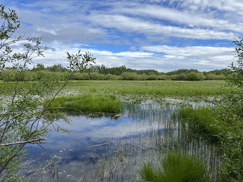
Lily Lake is more like a swampy pond. It may be worse in morning and evening, but it wasn’t super buggy here when we stopped. There are a few campsites here and there was only one person camped here:
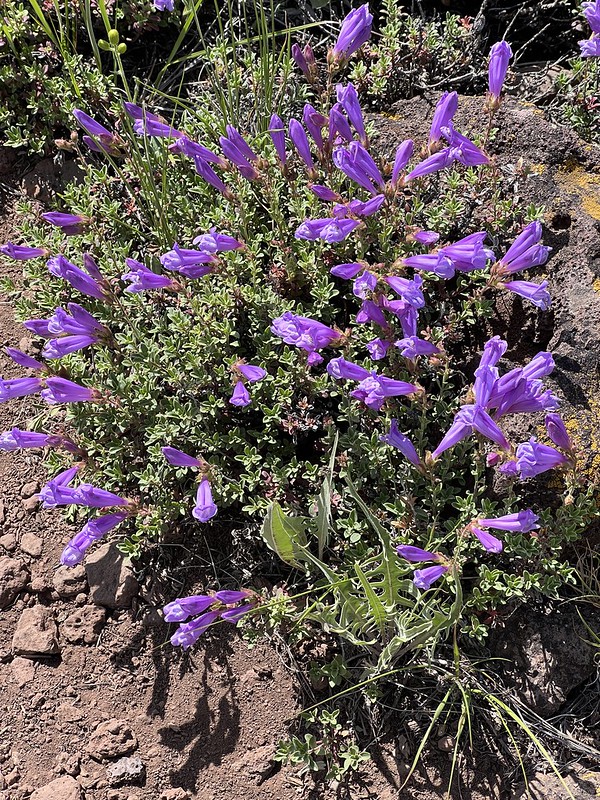
We saw these paintbrush there:

Then we drove on to Fish Lake. There is a campground here and it was pretty full and busy:

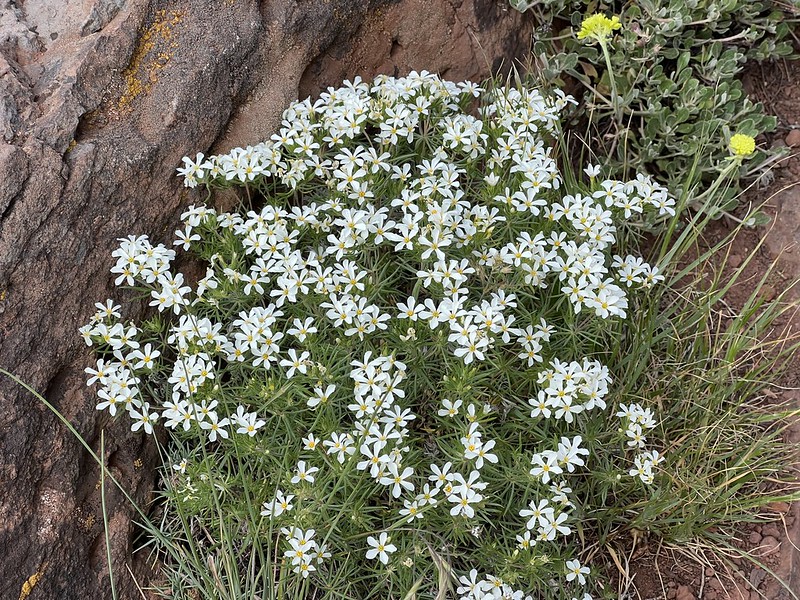
This doesn’t seem like a place camas would bloom, but we saw some:

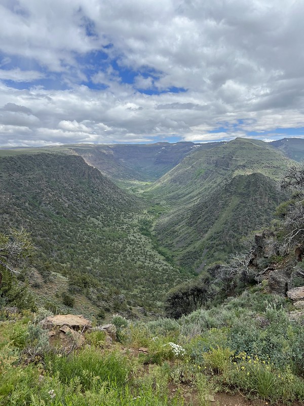
Up the road we stopped at this unsigned viewpoint that looks down on Fish Creek:

Balsamroot in bloom:

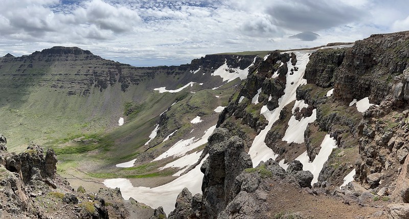
Our next stop was Kiger Gorge, which might be the most popular and well-known spot on Steens Mountain. And for good reason. I mean just look at it:


This gorge was carved by a massive glacier during the ice age one million years ago. Snow compressed into masses of ice over a thousand feet thick. The weight and downward motion of the glacier carved out this U-shape valley through which Kiger Creek now flows.


This is the headwall of the valley:
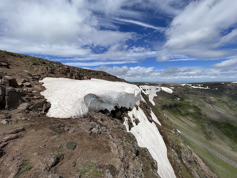
Lingering snow:
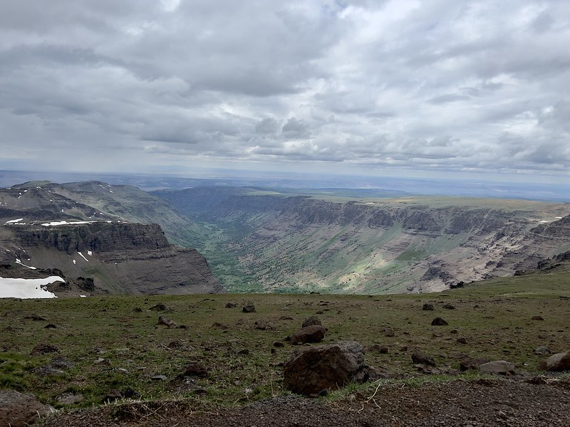
We stopped at another roadside viewpoint to get a view down Little Blitzen Gorge:
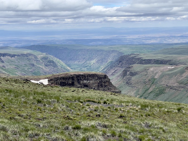
On the other side of the road we could see east down to the desert below:
Although there is a road all the way to the summit of Steens Mountain, the public can’t drive the whole way. We parked at this gate and started walking:

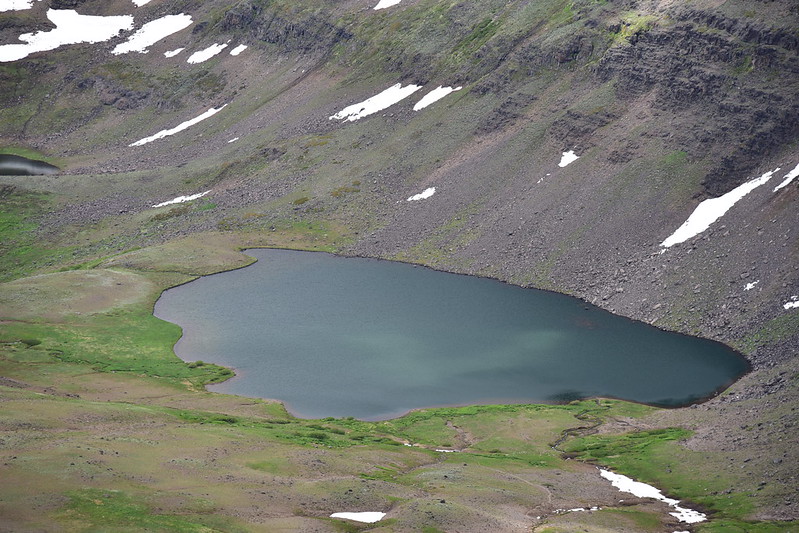
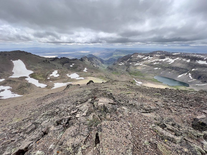
From the summit road we could see Wildhorse Lake below:


There’s a trail that goes down to that lake and we could see snow lingering on the upper part of that trail:


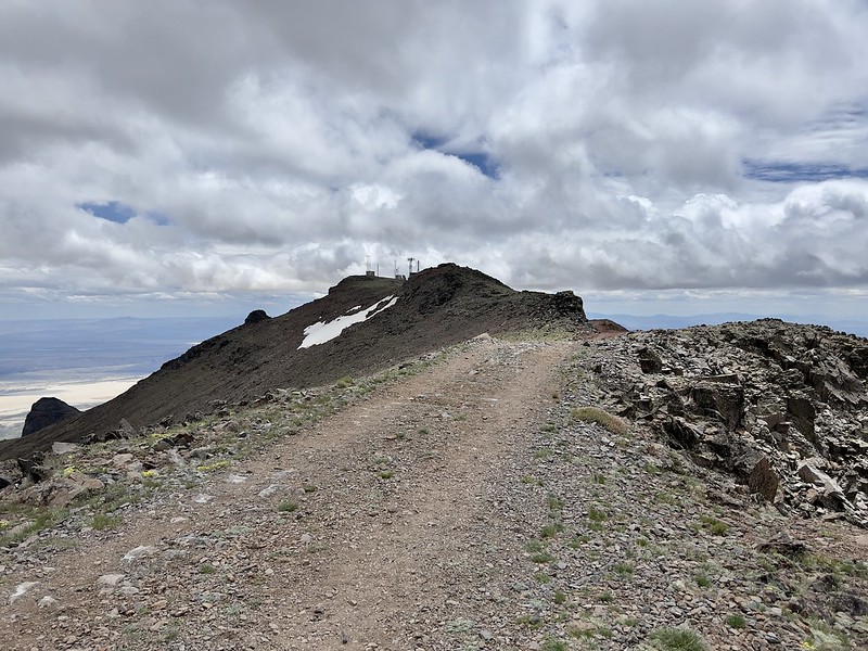
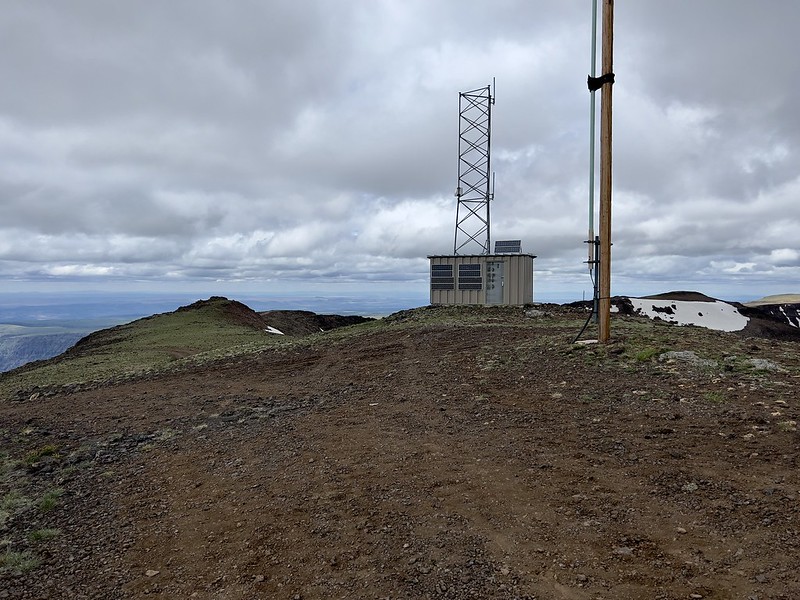
The summit is home to a lot of communications equipment:

View of Wildhorse Lake from the summit:

Closeup of Wildhorse Creek:

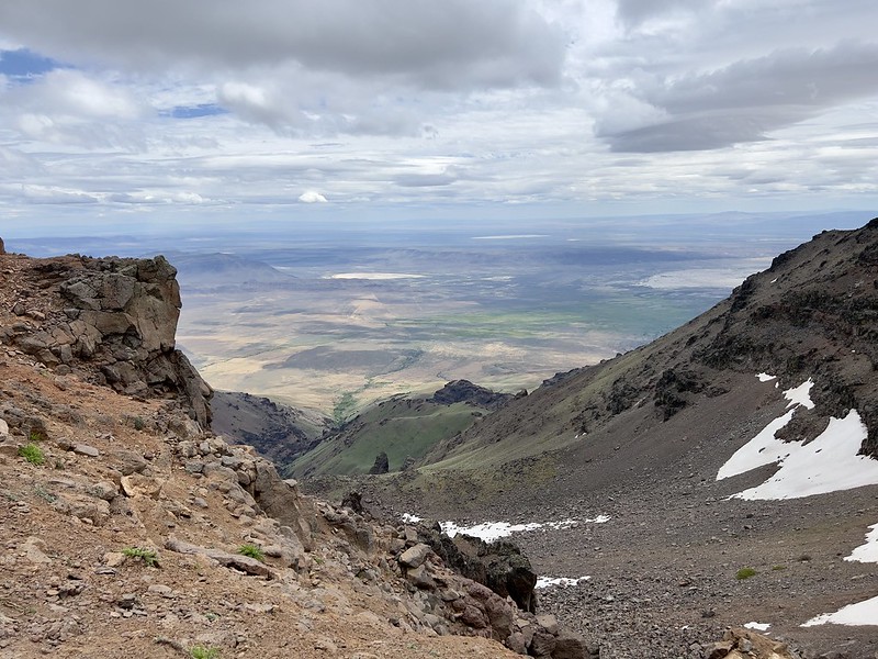
Looking east from the summit:

Looking southeast. You can see a bit of the Alvord Desert down there:

Looking northeast:
Looking south:
We found the geocache on the summit (the highest geocache in Oregon!) then we hiked back down to the car. From there we hiked part of the way to Wildhorse Lake, as far as this trail register:

A view of the snow on the trail that we saw from above:

Looking down on the lake:

We didn’t go any further than this for several reasons, but we were also getting short on time, since Greg had spent A LOT of time with the wildflowers on our drive so far today. We drove on and stopped at the East Rim Viewpoint, with a view down Little Blitzen Gorge:

And a view to the east of the Alvord Desert:

View to Steens summit and its radio towers:

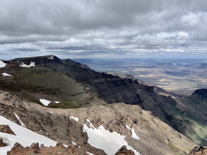
Looking down the rugged east flank of Steens Mountain:

We continued down the road and stopped at this viewpoint looking up Little Indian Gorge:


View of the road snaking its way along:

Just down the road was a viewpoint for Little Blitzen Gorge. There was a short walk to the viewpoint and we saw some nice wildflowers along the way:


When my family went on a trip here in 1992 we drove this road in our Astro minivan. The road was much rougher than my parents were expecting. We ended up with a flat tire, had to put on the spare, and limp our way into Burns to get it fixed. On our 2009 map this section of the road was labeled “rough, rocky, steep, and narrow.” But at some point in the last 13 years they must have done some improvements, because while some sections were still steep and narrow, there were no sections that were rough or rocky.
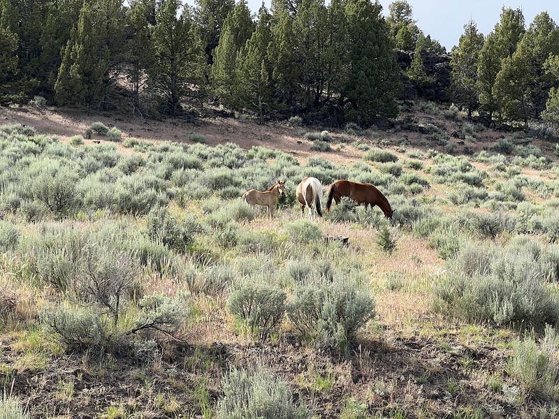
We saw wild horses on the drive out, which was pretty neat:

So that was our whirlwind one-day tour of Steens Mountain. We’d love to come back and take a more leisurely pace and do some of the hikes here, including Wildhorse Lake.


