Thursday, July 4, 2019
We stayed at the Squaw Peak Lookout in the Siskiyous over the holiday weekend (read more about that here) and on the 4th we decided to drive over to the Siskiyou Crest area and visit Big Red Mountain, which is thought to be the oldest exposed serpentine outcrop in the Siskiyous, according to Luke Ruediger (whose excellent book, The Siskiyou Crest, is a must-have guide for visiting this area.)
According to the Forest Service, Big Red Mountain “gets its name from the reddish orange soil and rock; this color is caused by the weathering of iron in the peridotite and serpentine bedrock. The unusual chemical make-up (low calcium/high iron and magnesium) of serpentine soil is toxic to many kinds of plants. Because of this, places like Red Mountain support a distinctive plant community dominated by Jeffrey pine, western white pine, and incense-cedar over a ‘carpet’ of beargrass.”
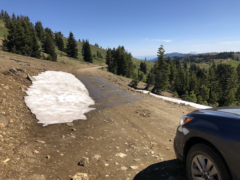
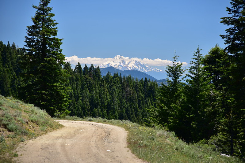
We encountered snow on Road 20 at Jackson Gap, just north of the junction with Road 800 up to Dutchman Peak. This looks like it would have been impassible about a week ago, but we had no problem today:
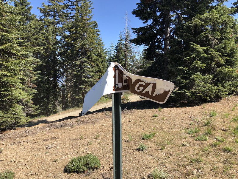
We continued up Road 20 and parked at Wrangle Gap, where there is an old mangled sign:
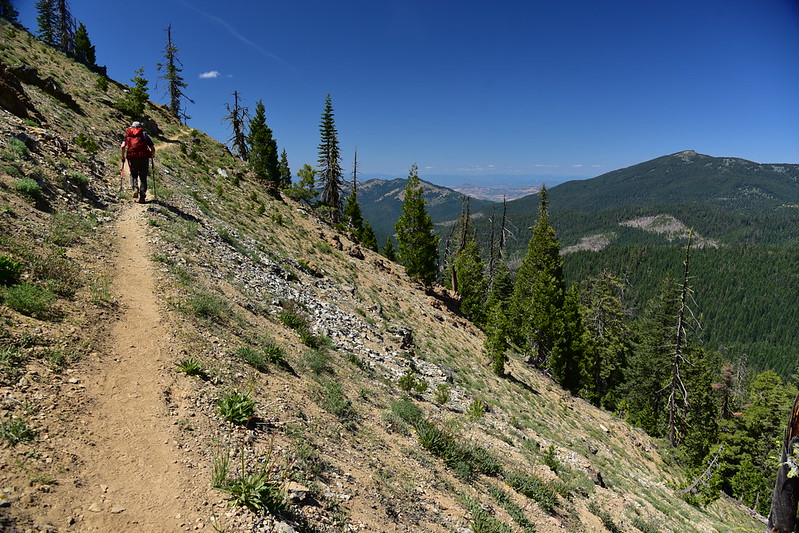
The PCT here swings north to go around Big Red Mountain, but we were headed cross-country straight up. While Greg was getting his stuff together at the car, I started up. Right away I got great views of Mt. Shasta:

Looking back down at Greg on Road 20:

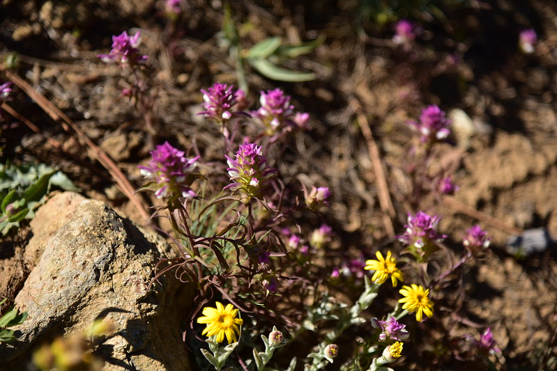
We saw all sorts of wildflowers on the mountain and along the trail later. Siskiyou Paintbrush:

Lewisia leana:


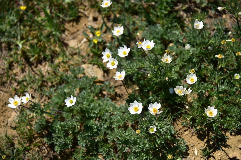
Anemone:
Phlox:

Mountain owl clover:
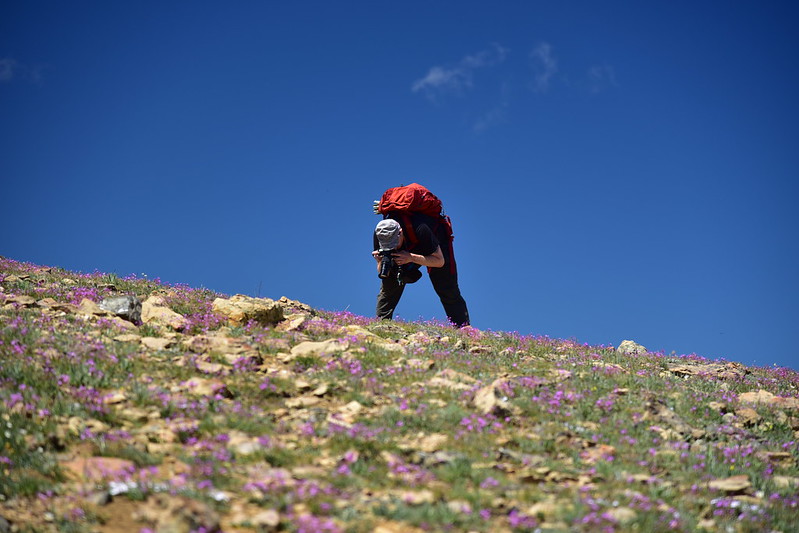
Greg was in wildflower heaven and this was his stance for much of the day:
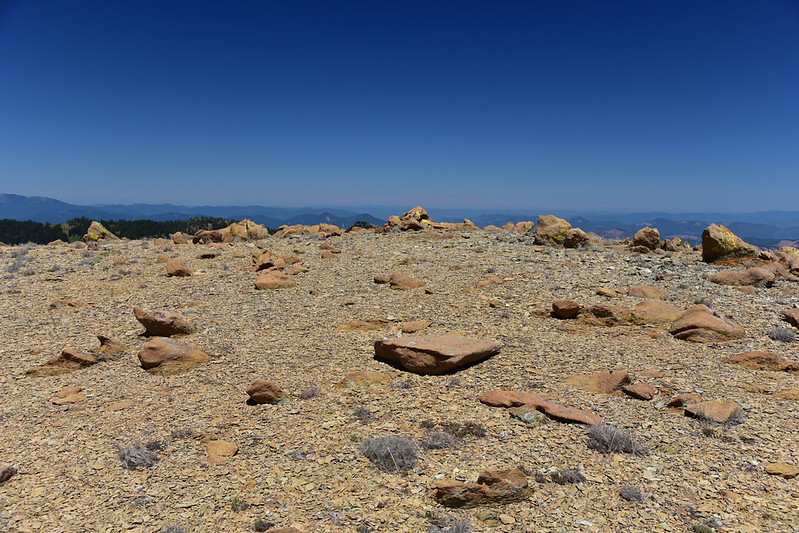
The top of Big Red Mountain is a pretty large area:

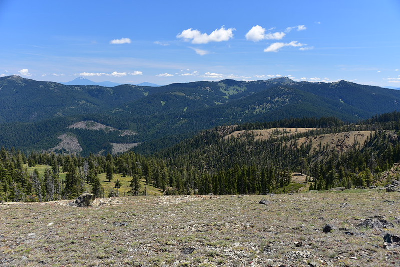
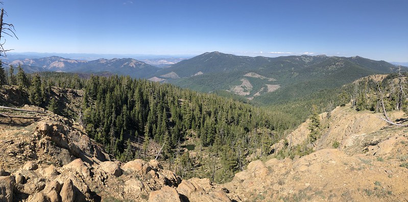
And of course the views were great up there. We didn’t know it, but this would be the clearest day of our trip and we could see for miles. Sure beats last year when we arrived at the Mt. Ashland campground and were surrounded by wildfire haze. Looking west:

Looking southwest; that’s Road 20 left of center, and Dutchman Peak on the right:

Looking south to Mt. Shasta, and the snowy Trinity Alps on the right:

Looking north, with distant Mt. McLoughlin on the left and Mt. Ashland on the right:
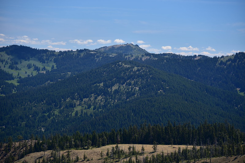
Close-up of Mt. Ashland and it’s big ugly weather ball:
Greg was being thorough and methodical in his wildflower documentation, so I descended the north side of the mountain while he kept taking photos. There were still patches of snow on this side:

There was a bit of beargrass on the PCT:
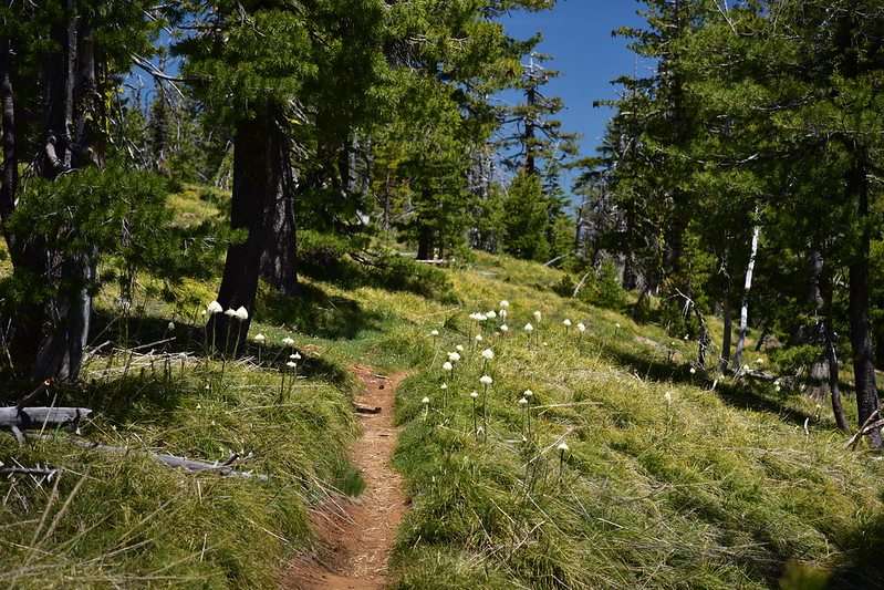
But it looks like last year or the year before was the banner beargrass year here, based on all the dried up flower stalks we saw:

Greg descended and we hiked north along a very pretty stretch of the PCT:

We had a good view of Wagner Butte, which we hiked last July:

There were some trees along this stretch, but a lot of it was pretty open:

The trail lost elevation as it headed toward Siskiyou Gap. We knew this would be the case, but we hadn’t wanted to drive the three extra miles of Road 20 to park at Siskiyou Gap and start the hike from there, since those three miles are reportedly very rough. We reached the trailhead at Siskiyou Gap:


There was a view of Mt. Shasta here:
After a break we turned and headed back, trudging uphill in the afternoon heat:


This time we went around Big Red Mountain on the trail instead of over it. We passed a spot where we could see down on the tiny Monogram Lakes:

This is a panorama from that same spot, looking north. Wagner Butte at center:
A cold beer with chips and salsa really hit the spot after our hike!

Our total for the day was 6.7 miles with 1,400′ elevation gain. Tomorrow we would be back in this area to visit Dutchman Peak and Observation Peak.
Back at the lookout that evening we celebrated our wedding anniversary with pesto pasta and white wine. Our anniversary was yesterday, but we postponed our celebration to tonight since we rolled in so late last night. Eating out at a nice restaurant is fun, but I think this is the best way for two outdoor-lovers to celebrate:


