August 5, 2016
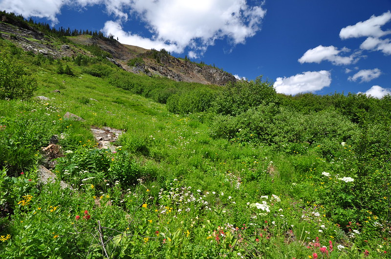
There are numerous hiking trails in the vicinity of Radium Hot Springs, where we stayed for the last three nights of our trip, but we were light on books and maps that described those hikes. I had done 100% of the planning for this trip since Greg was so busy, and I had run out of time to plan for this final leg before we left home. So we stopped in at the information center in town this morning after breakfast to see what we could find out. Long story short: Greg saw the following photo in a book called Hikes Around Invermere & the Columbia River Valley:
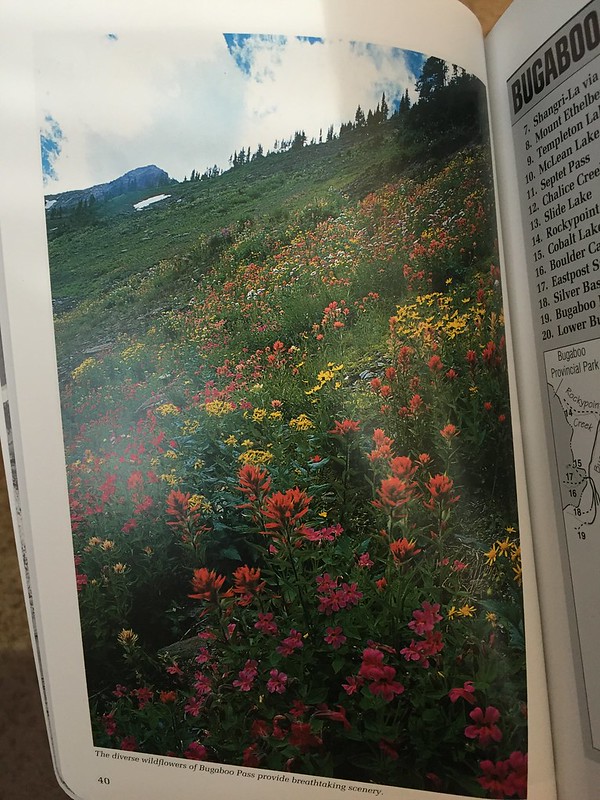
The Bugaboos are in the Purcell Mountains. Bugaboo Pass is below the Quintet Peaks just beyond Bugaboo Provincial Park’s southern boundary. The trailhead was at least an hour and a half drive from our hotel but the picture was definitely tantalizing, so we bought a copy of the book, went back to our room to gather our hiking gear, and hit the road at 9:50.
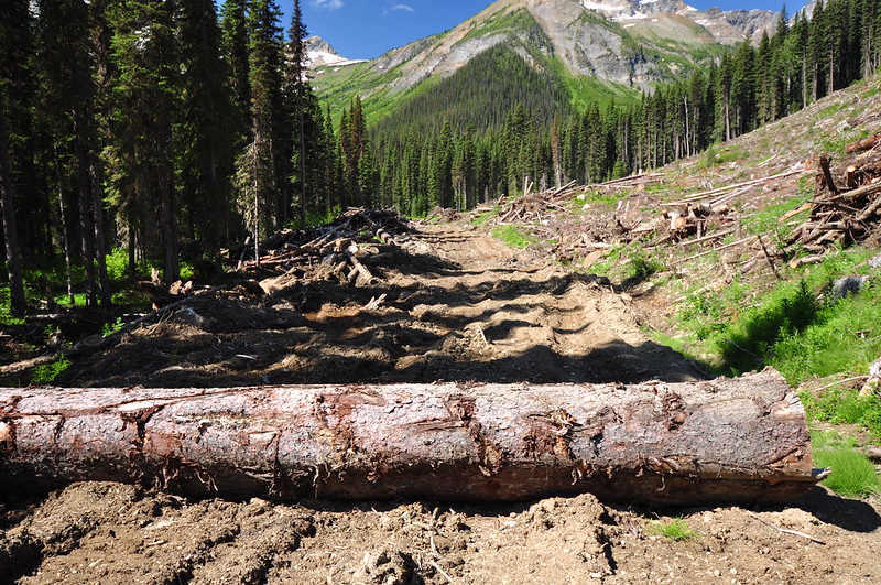
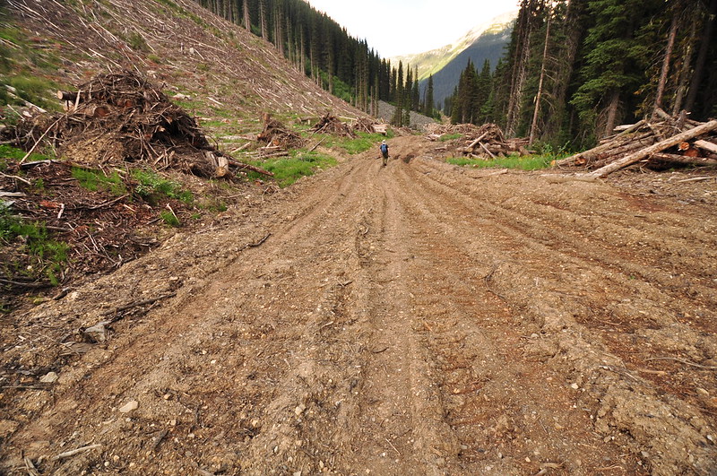
After 15 minutes of driving north on paved highway, the rest of the way was on dirt or gravel. The last stretch was pretty rough thanks to the road being chewed up from a logging operation, but we finally arrived at road’s end at 11:50. Road’s end was simply a large log laid across the road, beyond which point it would have been undrivable even without the log blocking our way.
There was another vehicle there and we asked the driver how much further the trailhead was beyond the log. He said he wasn’t sure. It turned out he was volunteering his time on his day off to clear the trail with a weed whacker. (I realize this sounds like the start of some kind of hiker horror story, but we didn’t get any creepy vibes from this guy at all. He was very nice.)
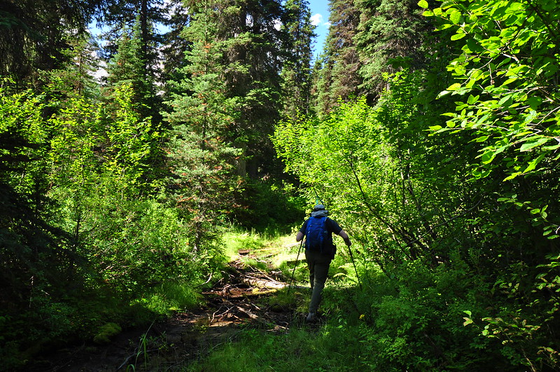
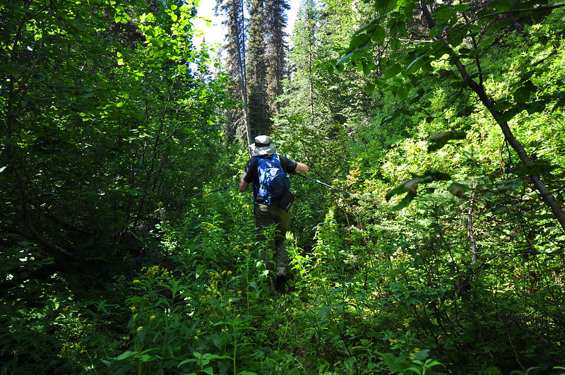
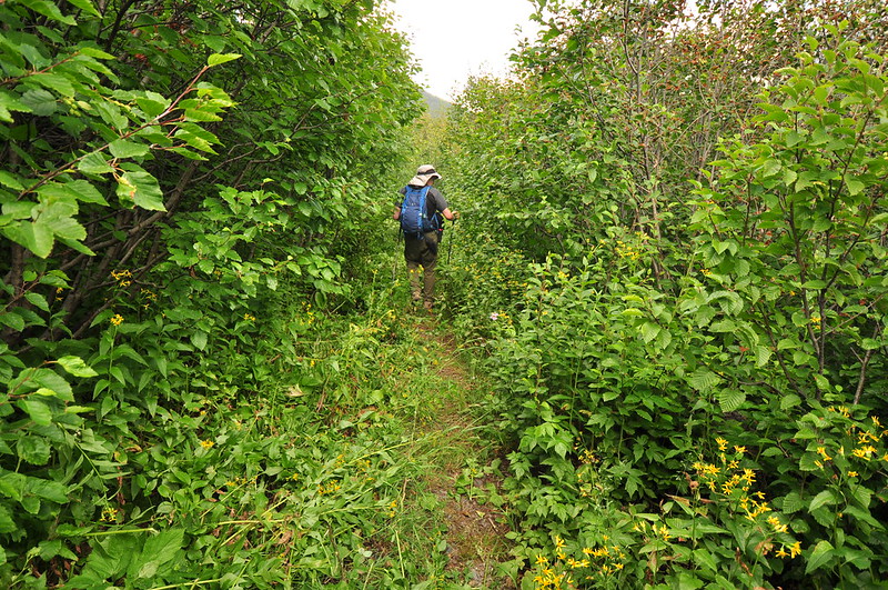
It turned out the end of the road and the trailhead was just a short ways past the log, and we entered the forest, heading down the brushy trail:
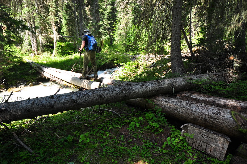
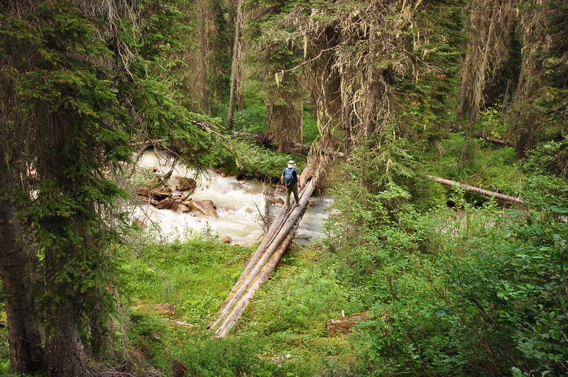
We had to cross Bugaboo Creek on two parallel logs. Note the crude sign on the near side of the creek, the only sign we saw all day:
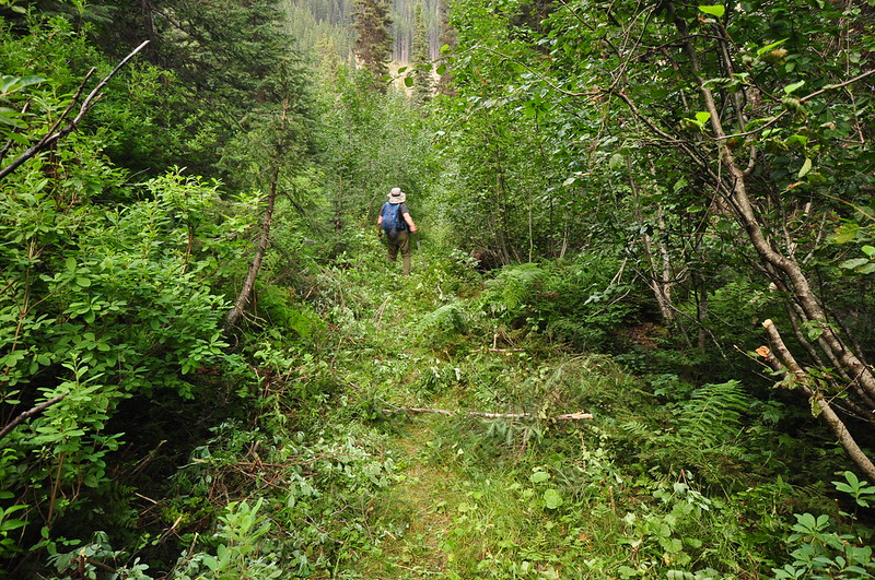
On the other side of the creek we climbed up a brushy slope, and then joined up with the old mining road. Although pretty choked with alder, it is still passable here. According to Northwest Trails: A Hiker’s Guide to National Parks and Wilderness Areas (1982): “The prospector’s road to the 7400-foot pass can be driven only partway so hiking distance varies from 1/2 – 3 miles.” It’s hard to imagine that this road was ever drivable at all. Actually, it’s incredible that this road was even built in the first place.
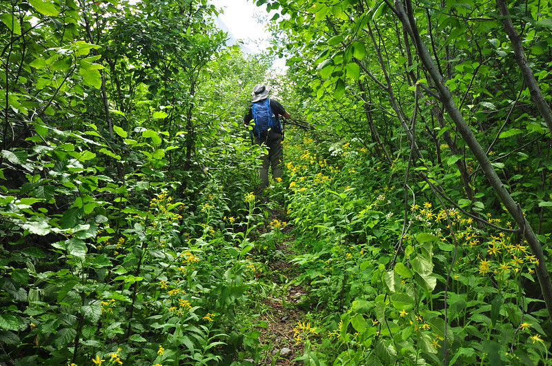
According to the book we bought that morning (which was published in 1998), the hike stays with the old road, but things have changed in the past 18 years. We didn’t say with the old road for long before a very clear user trail headed uphill to the right and the way forward on the road looked impassible. So we followed the trail. It was easy enough to follow, but quite steep in spots. At least it wasn’t as brushy as the road. The biting flies were AWFUL, though, and it was a pretty warm day, so the going was tough. This part of the hike was really not fun.
The trail met back up with the road and we continued on toward the pass. This is bear country and our visibility was very low because of the vegetation, so we hollered “hey bear!” as we hiked.
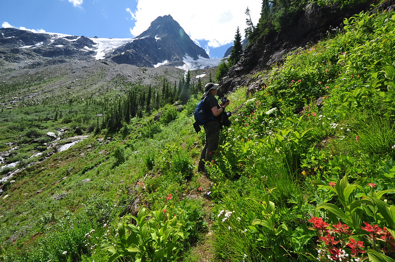
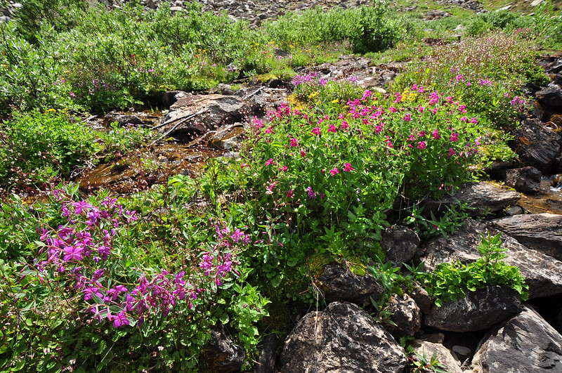
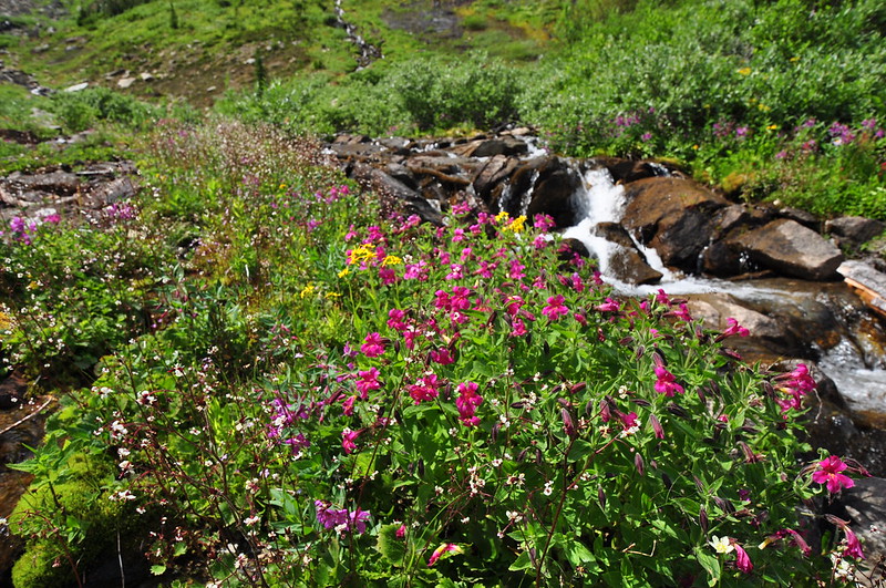
Then we finally emerged out into the meadows on the slope below the pass.
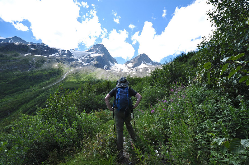
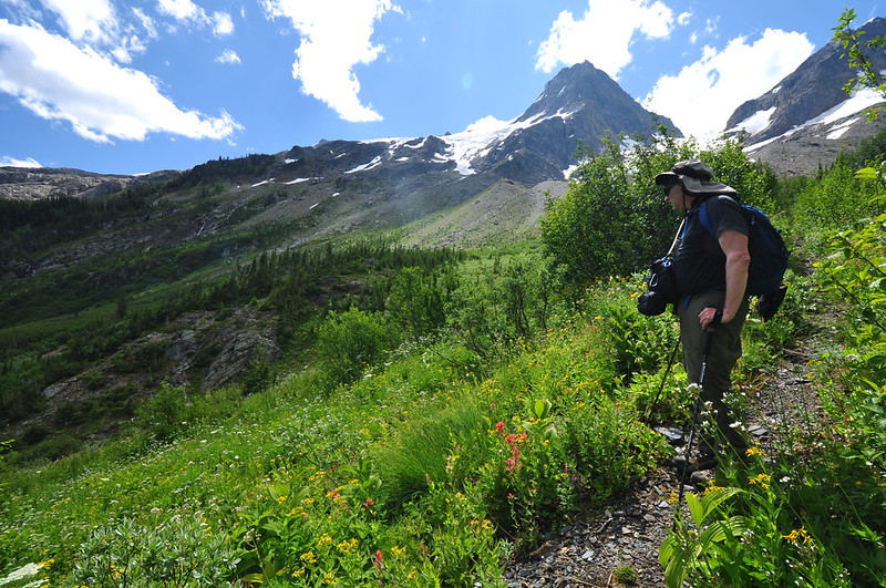
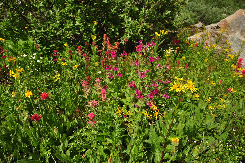
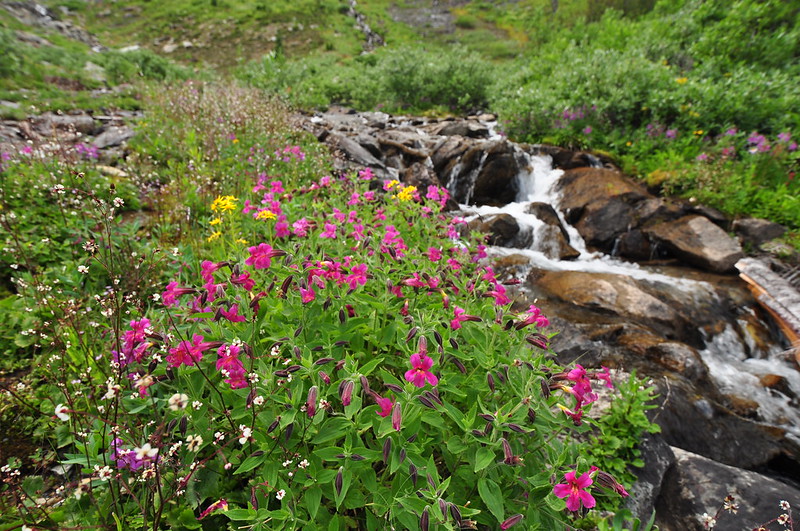
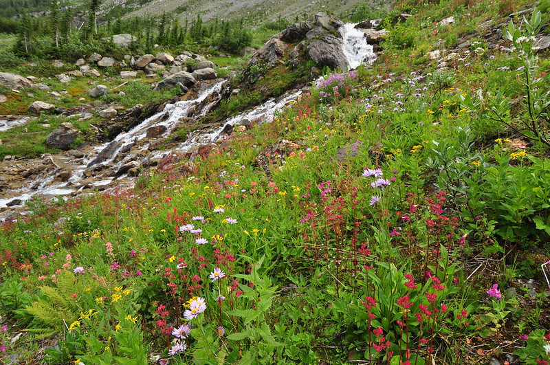
The old road kept switchbacking up, but we went straight following another boot path parallel to and uphill of the creek. The book description in no way reflected reality at this point, and we had no map of this hike (even if we did it too would not have reflected reality), so we simply meandered as we liked. Our late start meant the light was not great for photography (note for you photographers out there: this slope faces east and the best light would be first thing in the morning), but the wildflowers were still a sight to behold.

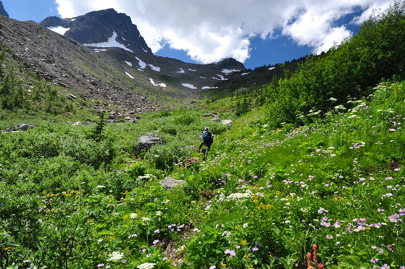
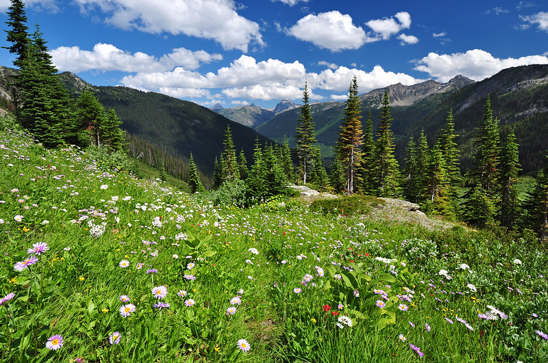
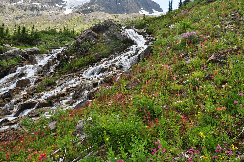
The wildflowers we had encountered thus far were beyond satisfactory and after the steep buggy climb we were too tired to go all the way up to the pass proper, but if we did the view over the other side would have looked something like this (with a heck of a lot less snow). That’s Rory Creek down there:

As we started to head back down, weed-whacker guy emerged from the tree-choked road. We couldn’t believe he had made it all the way up! We thanked him for his hard work, and enjoyed the fruits of his labor on the way back as we hiked down the less-brushy road. It’ll only be a matter of time before nature starts encroaching again, though.
Crossing back over the creek near the trailhead:
Navigating the horribly chewed-up road back to the car:
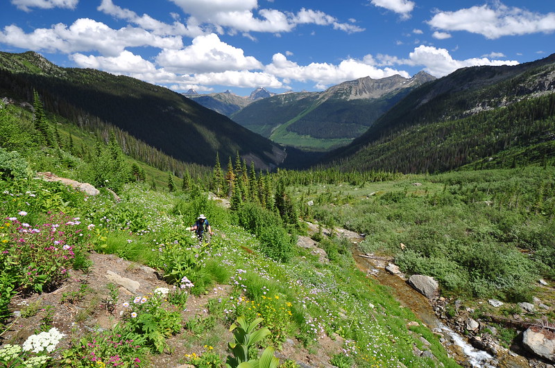
This was by far the most adventurous hike of our entire trip. So far all our hikes had been in national or provincial parks on signed maintained trails. This hike was not in any park, not officially maintained, with no signs. We have been on trails like this before; we’ve certainly done our fair share of these kinds of hikes back home since the Forest Service doesn’t have much of a trail maintenance budget. This was also the only hike of our trip where we weren’t sharing the trail with hoards of other hikers, which was refreshing. Except for that guy, we didn’t see anybody else on the trail.


