I had plans on Saturday so Sunday was my day to hike this weekend. The forecast called for 90% chance of rain. Bah! I’m not a fan of hiking in the rain, but I really needed to get out for a hike. So Dawn, Buddy, and Timmy, and I headed up there with our rain gear. Fortunately when we got to the trailhead it wasn’t raining, just very overcast. So we shoved the rain gear in our packs and headed out.
The bridge over the Sandy River is in a different spot than the last time (2009) I was here. Last time with Greg:

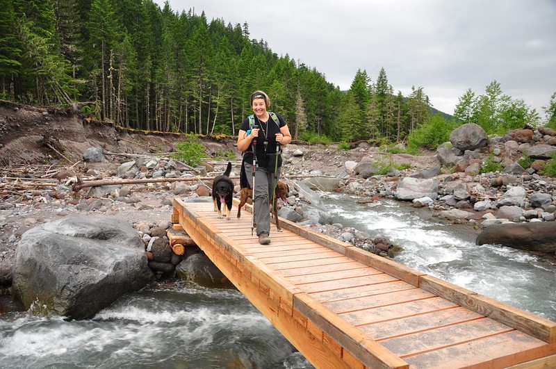
This time:
Mt. Hood was just barely visible through the clouds. (See the yellow tent? Someone camped here the night before.)

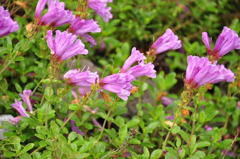
We saw quite a few pentsemon in bloom:
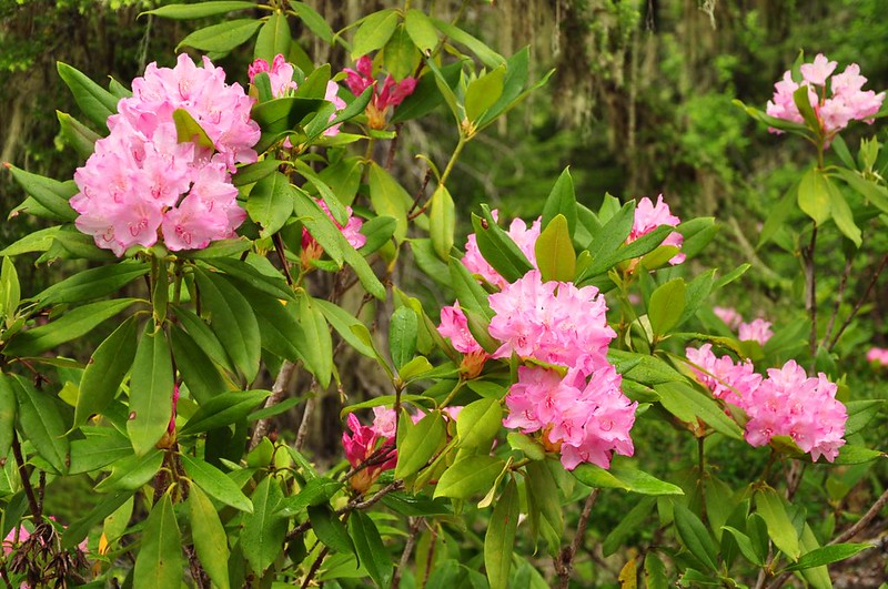
And LOTS of rhododendrons in bloom (yay!). I think we hit them at just the right time. Beautiful!

There’s a spiffy new bridge over Ramona Creek that I don’t remember being there four years ago.
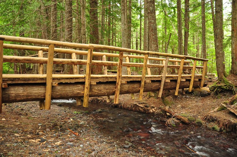
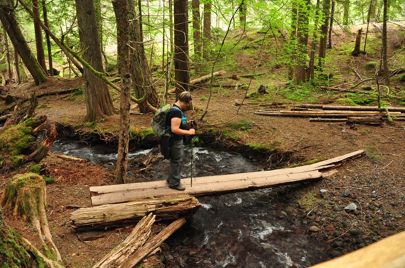
Dawn tested out the old bridge:
Ramona Creek is SUCH a lovely creek. I was too lazy to get out the tripod for these shots, but I couldn’t resist taking some pictures of this prettiest of creeks.

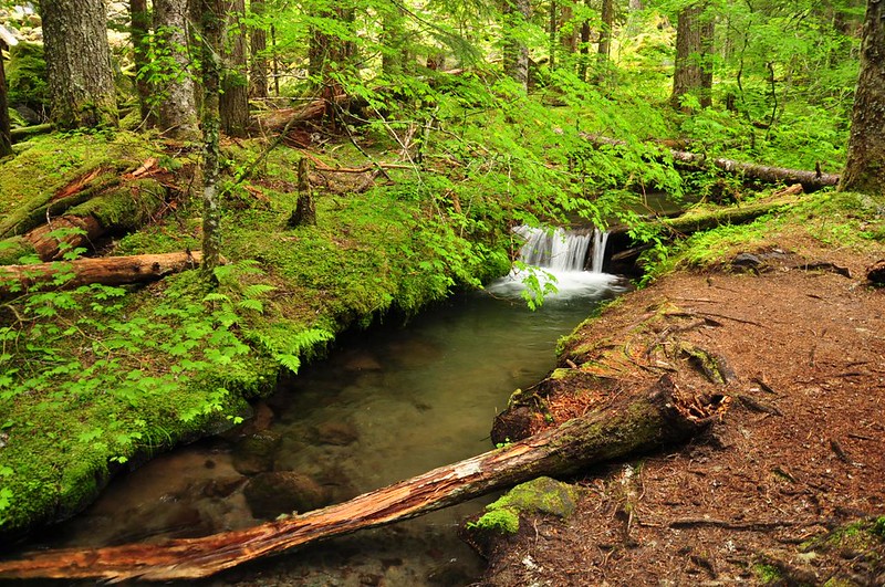
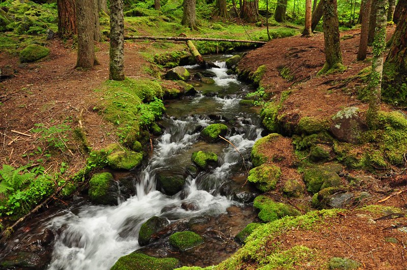
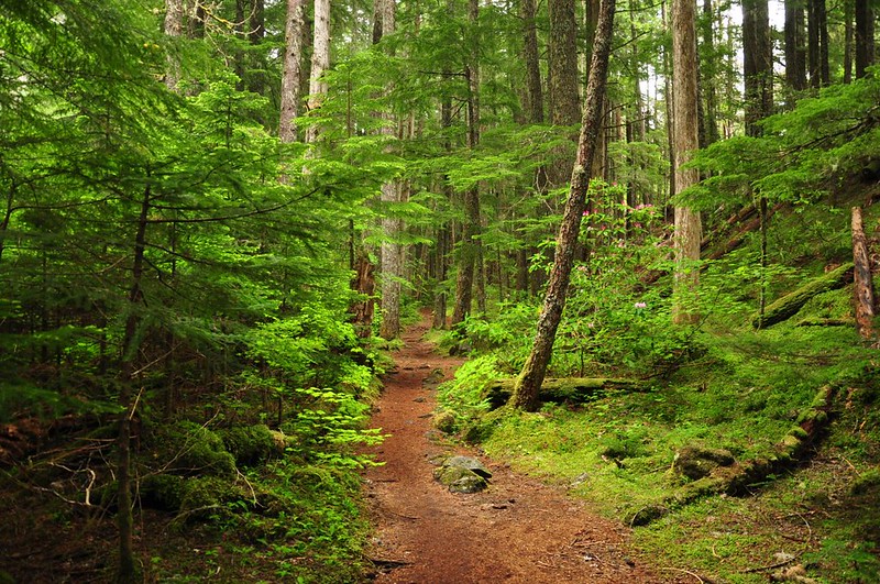
The forest along here is just so beautiful.
There was a large Meetup group that we kept encountering. At one point they were all coming back to the trail from the forest and we asked what was back there. They said the old PCT was over there and they had been checking out an old footbridge. Anyone here know the scoop on that?
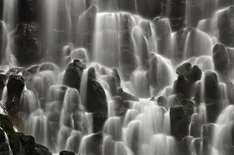
And then we were at Ramona Falls! I always kind of “forget” just how huge this waterfall is. Every time I see it in person I’m just as blown away as I was the first time I saw it. It’s one of my faves!
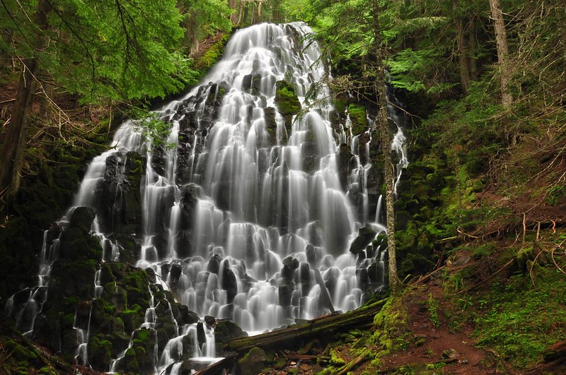

By the way, if you’ve ever been curious about how this waterfall got its name, Oregon Geographic Names says that John E. Mills, a USFS employee, discovered and named the falls on August 8, 1933, while locating trail. He was courting his wife-to-be and his head was full of the romantic song “Ramona”.
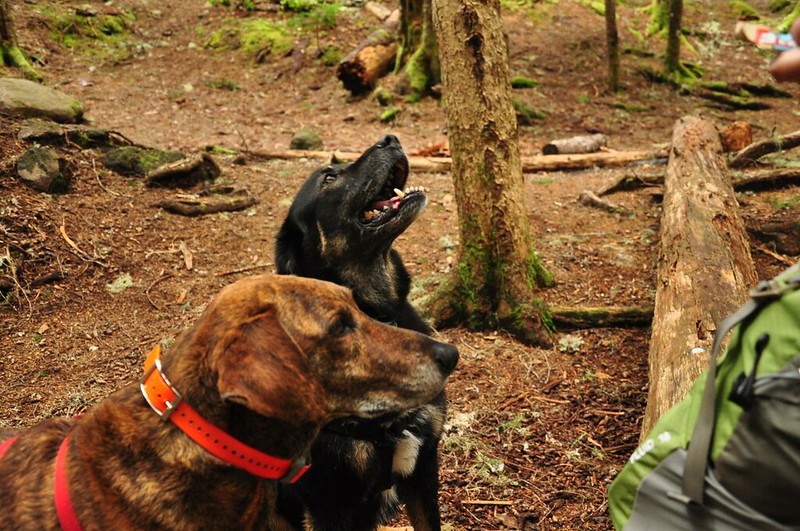
We all enjoyed some snacks at the falls, including the dogs. Did someone say “treats”?
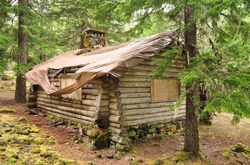
After a break and some waterfall admiration we continued down the trail towards the Sandy River to complete our loop. We took a short detour to check out the old 1935 Upper Sandy Guard Station on our way back. The building was listed on the National Register of Historic Places in September 2009, but it hasn’t been preserved. (Read the nomination form here for lots of great history.)
Funded by the Emergency Relief Appropriations (ERA) Act of 1935, and cooperating funds from the City of Portland, the cabin was built along the newly constructed Timberline Trail specifically to provide housing for an administrative guard to protect the Bull Run Division watershed, the source of the City of Portland’s drinking water supply, from public entry.
The cabin has been abandoned for a long time and the roof is in bad shape. The tarp that was put up there several years ago is now in tatters and a gaping hole in the roof is letting in the elements.
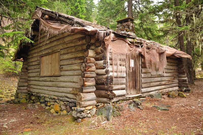
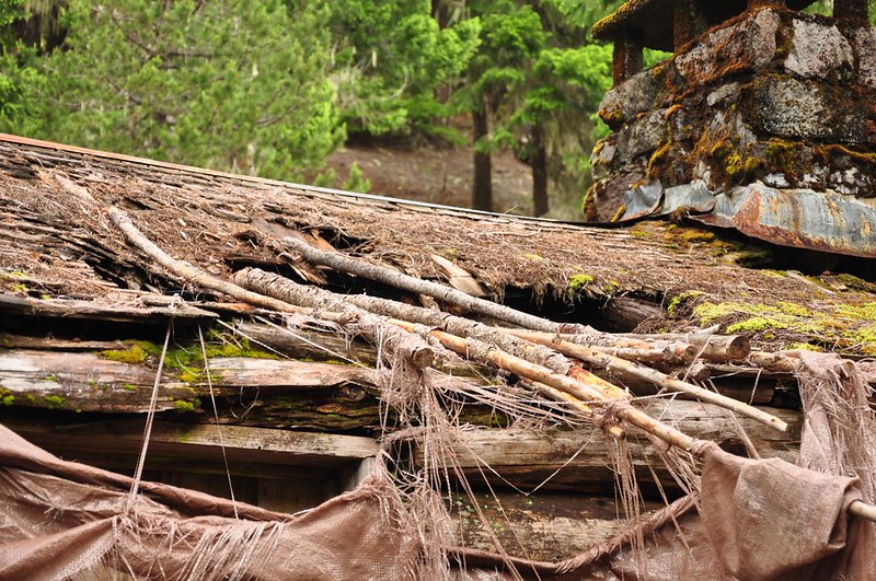
I’ve been told by the current Forest Service historian that because it sits inside a wilderness area the wilderness laws trump the historic preservation laws, so the building is being allowed to deteriorate. (Although, I was under the impression that if a building already existed in a wilderness area the Forest Service was allowed to perform maintenance/upkeep on it. Am I wrong?)
It’s a real shame, especially since the Forest Service seemed willing to preserve the building back in 2009 (see a March 16, 2009 article here). The Northwest Forest Conservancy, the group that was interested in seeing the building preserved, seems to be defunct/inactive.
It’s also interesting that the building doesn’t show up on current topo maps anymore.
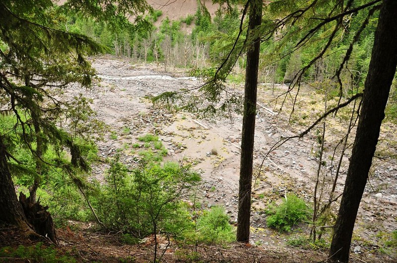
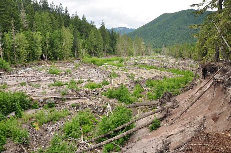
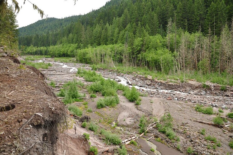
After that little side trip we had an uneventful hike back to the car. Got a good view of some of the flood destruction along the Sandy River. Never underestimate the power of Mother Nature!
About halfway back to the footbridge over the Sandy we came across three women who were hiking in and they asked us if they were headed in the right direction for Ramona Falls. They said they had gotten turned around and had been hiking for a long time. We told them they were on the right track and Dawn gave them her photocopy of the hike description and map from Sullivan’s book, but I’d be real surprised if they actually made it all the way to the waterfall. One of them was wearing sparkly flip-flops and I was surprised she had made it even that far.
Back at the river crossing the mountain was showing a little bit more, but was still mostly in the clouds.

There had been spits and sprinkles all day, but nothing significant. And it was super mild, in the 60s at least. I had on long sleeves and wished I had my tank top instead. We were both pleasantly surprised that the crummy forecast hadn’t come true. And then as we were driving away from the trailhead the skies opened up. By the time we crossed the Sandy River the windshield wipers were going full speed. Wow, did we time that well or what?!
Great hike! It was nice to get out here again after a four-year absence.


