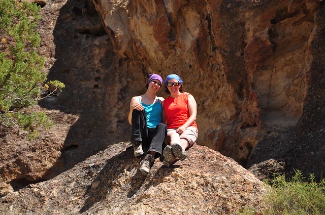
My sis had a week off between her old job and new job so we headed to southeast Oregon for a vacation.
Day 1: Portland to Frenchglen
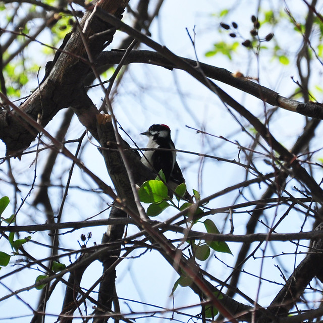
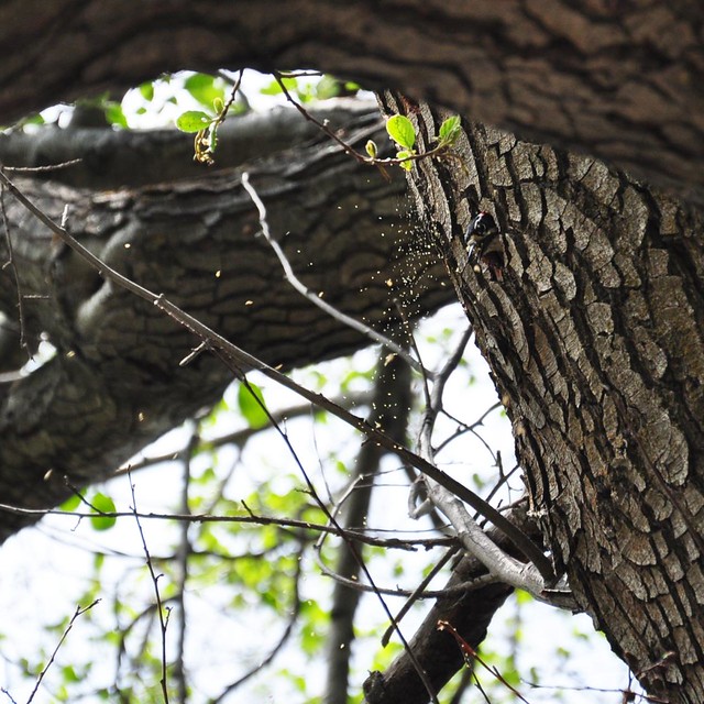
We left Portland and began the long 7 hour, 330 mile drive down to Frenchglen. We were visiting the wildlife refuge the next day, but the bird-watching began sooner than we thought it would. At a lunch stop along the Deschutes River we watched two woodpeckers mating and then making a nest in the tree. Awesome!
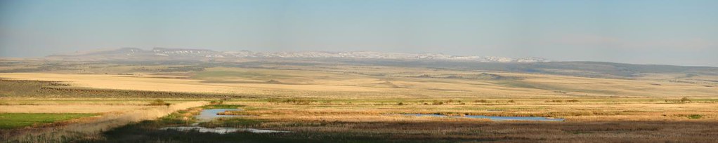
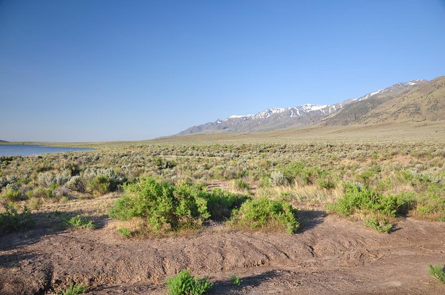
Just before reading Frenchglen we stopped along Highway 205 to admire the view out over the wildlife refuge to snowy Steens Mountain beyond.
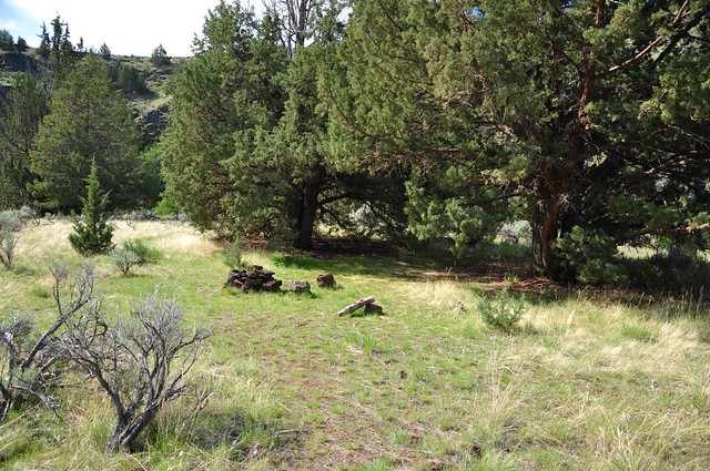
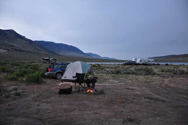
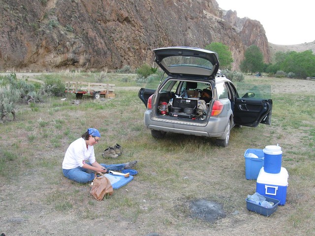
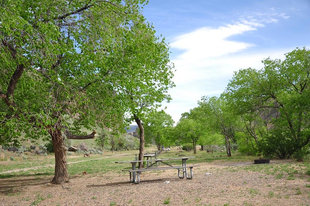
We reached Page Springs Campground about 7:30, set up our tent, ate dinner, and headed to bed.
Day 2: Malheur National Wildlife Refuge
While eating breakfast at the campground we noticed a cute little wren making a nest in a tree right in the middle of our campsite. Breakfast entertainment!
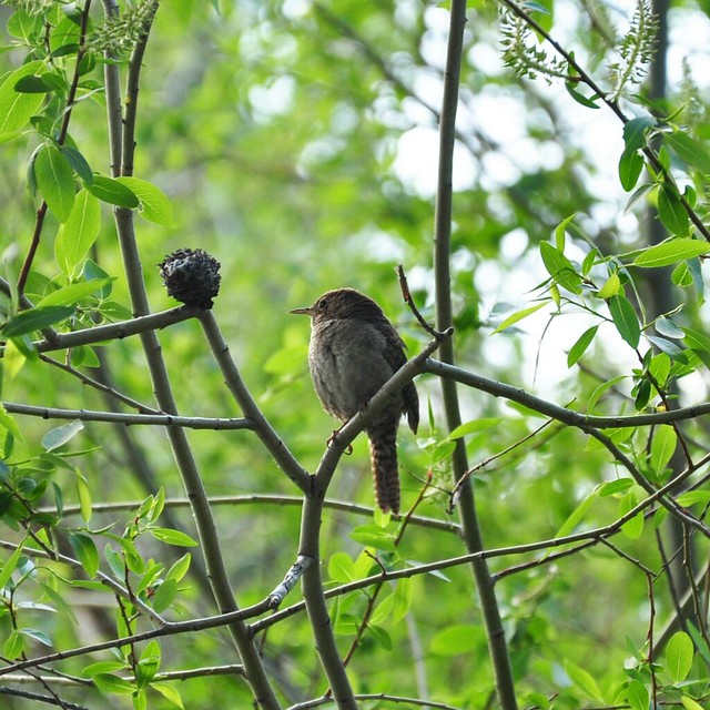
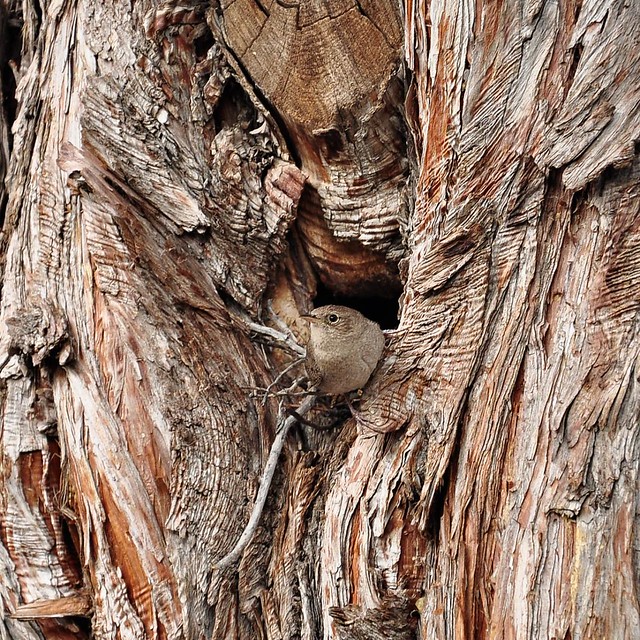
Here’s a video of the nest-building: http://youtu.be/VPVULWVQZ94
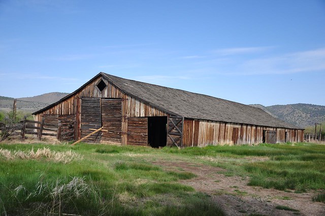
Our first stop of the day was at the P Ranch Long Barn. In the late 1800s, Peter French established a huge ranch in this area. His practices of adding land to his holdings weren’t always met favorably by the locals, one of whom ended up shooting French dead in 1897. (Read the whole story here.) Anyway, this barn, which is well over 100 years old, was restored in 2008 and you can wander in and look around. There are lots of swallows nesting up in the rafters.
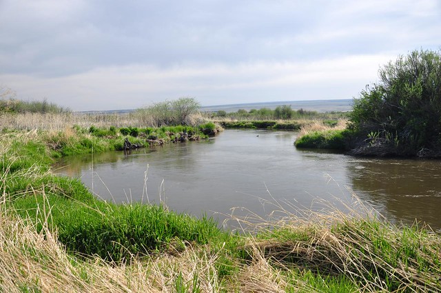
This is also where the River Trail begins. It’s a short and pretty hike along the shores of of the Donner und Blitzen River. In addition to seeing a number of birds we were attacked by mosquitoes. 🙁
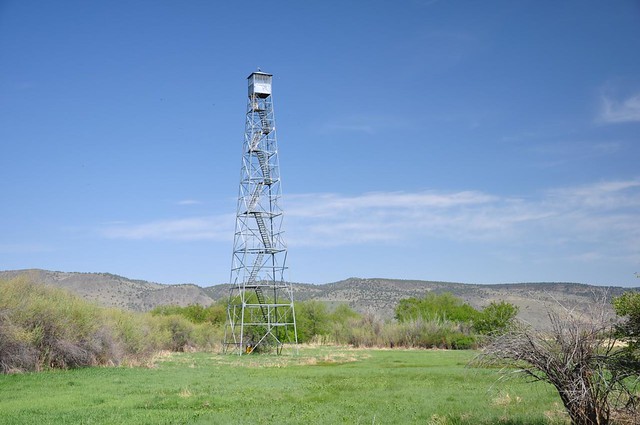
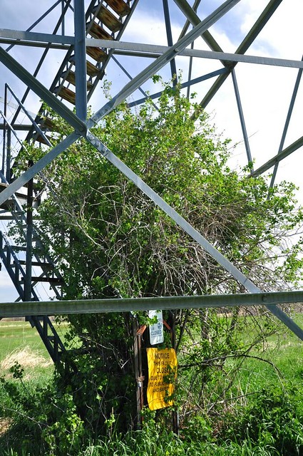
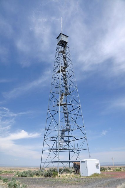
There’s also a long-abandoned lookout tower. I bet the views up there are pretty sweet, but clearly no one has gone up there in quite some time as the lowest flight of stairs is completely overgrown with vegetation.
Our next stop was the Frenchglen Mercantile, where a half tank of gas for my Subaru Outback cost $38. Cash only.

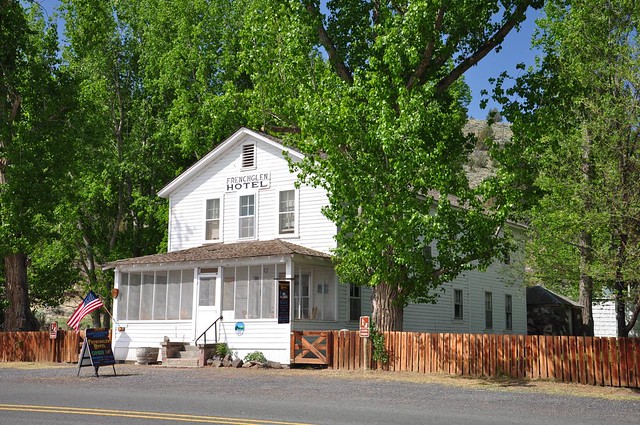
We also took a gander at the historic Frenchglen Hotel, which is now run by Oregon State Parks and where you can stay the night and/or get a hot meal (vegetarians need not apply).
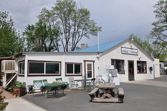
This service station hasn’t been in service for quite some time.

On to the Peter French Round Barn, which Peter French used to train horses back when all this land was part of his ranch. There was a bird’s nest with baby birds in it, way up in the rafters.
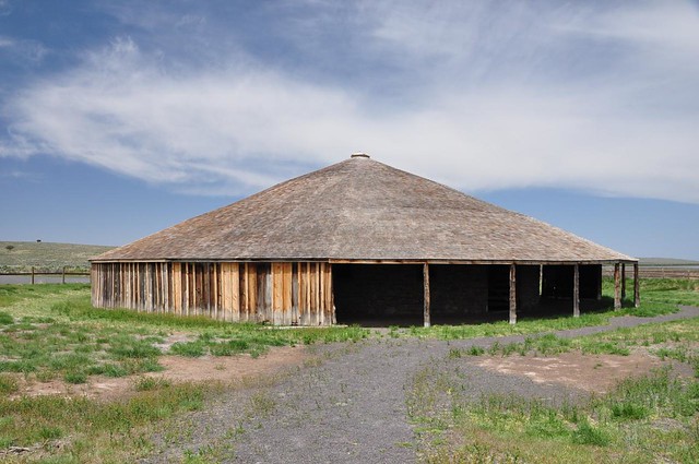

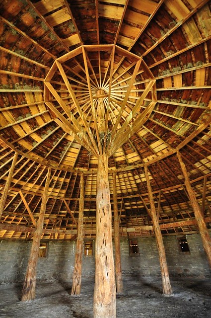
The round barn is way out in the middle of nowhere, but definitely worth a visit. The barn is cool, but the visitor’s center is amazing, considering the remote location. They have some historical displays, plus a huge impressive gift shop and book store, and it’s not just a bunch of kitschy crap. They also sell beer, wine, and cold drinks, which you can enjoy in nice cushy chairs in the center of the building or take away with you.
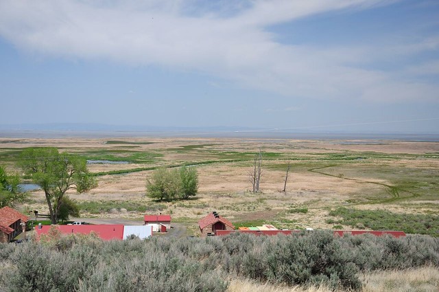
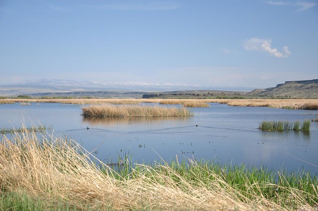
And then on to the headquarters for the Malheur National Wildlife Refuge. These buildings were built by the CCC in the 1930s, and one of the buildings contains a small museum with several hundred mounted/stuffed birds. They also have a the tiny gift shop and provid guided bird walks. We sat on a bench with a view towards the lake, watching and listening to the many many birds.
Headquarters buildings below with Malheur Lake off in the distance:
Lookout tower near headquarters, with bottom staircase removed:
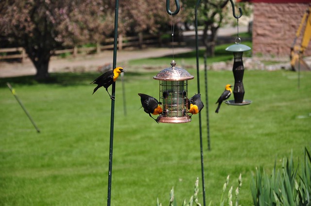
Bird feeder at headquarters:
Then we drove around doing some bird-watching, driving on Ruh Red Road and then following the self-guided auto tour down the Center Patrol Road. While paused at the side of the road observing birds, another car drove slowly past and the driver paused to exchange a few words with us. It was his second day of bird-watching and he had noted over 100 different species of birds in two days. He was very relaxed and laid-back, finding his bird zen out here at the refuge.
Pelican:

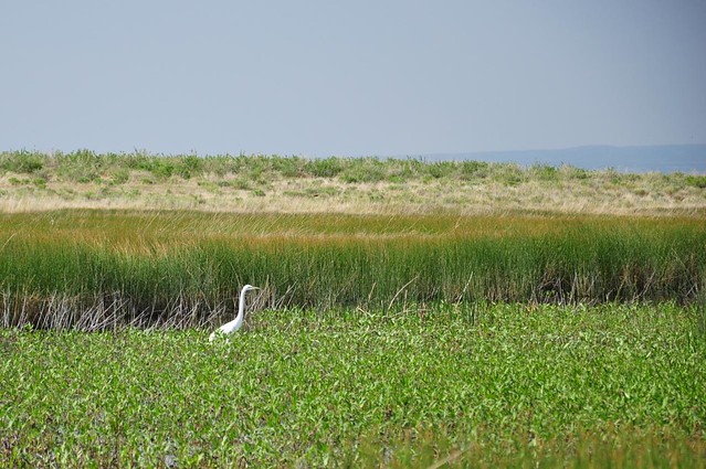
White egret:
Ducks, I think:
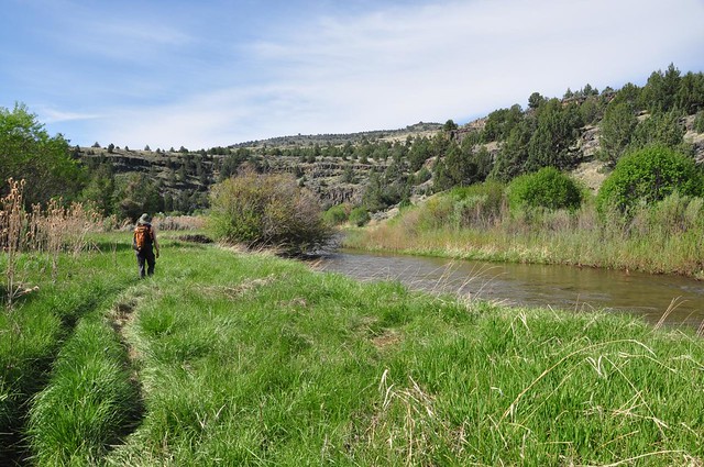
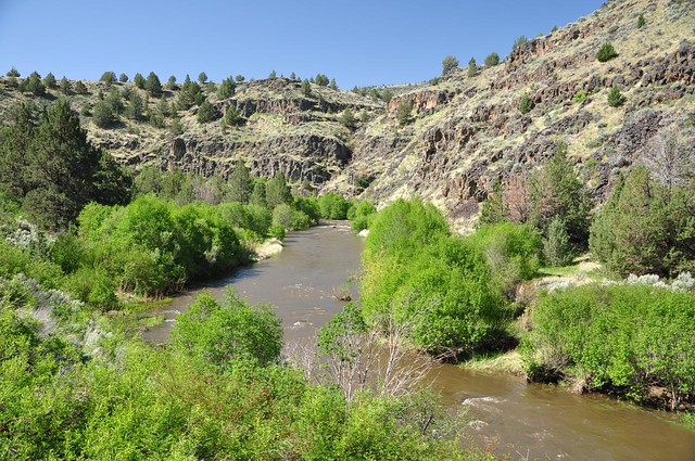
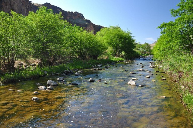
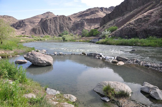
Day 3: Hiking along the Donner und Blitzen River
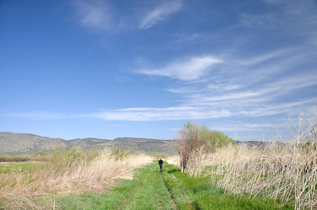
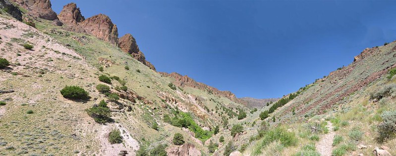
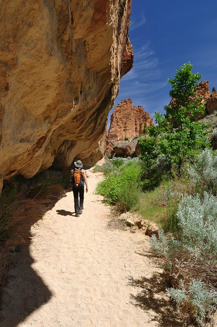
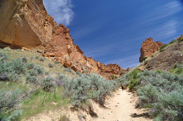
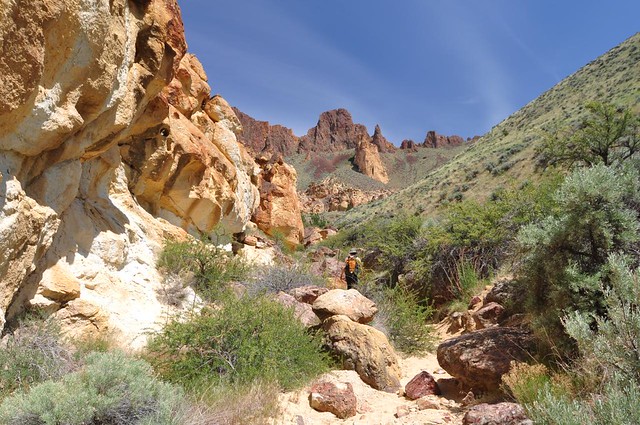
The hike I really wanted to do this day, along the Little Blitzen River, was inaccessible because the trailhead is 20 miles up the Steens Mountain Loop Road, which is still gated down at the highway. (Which doesn’t make sense to me, because the TH for this hike is 4,000 feet lower than the Steens summit and wouldn’t have had any snow.) The BLM office told us we could start at our campground and hike four miles south along the DB River, so that’s what we did. This turned out to be a TOUGH hike. There wasn’t a lot of elevation change since we were near the river the whole time, but there wasn’t much of a trail. We had to clamber up/over/around rocks, traverse rock slides, and push our way through brush. I couldn’t convert my hiking pants to shorts because of the brush, which caused me to overheat. I had left my poles at the campsite (DUMB), there was virtually no shade for the whole hike, and I went through my three liters of water so fast that I had to ration it for the last half of the hike. But despite all that, the scenery was quite pretty.
(By the way, the river got its name in 1864 when Col. George B. Currey crossed it during a thunderstorm. He gave it the German name for “thunder and lightning.”)
Some of the rare spots where we had a trail:
Campsite (If you’re ever looking for a spring backpacking destination, here you go. We saw a number of campsites scattered along our route.)
See the trail? No? That’s because there isn’t one.
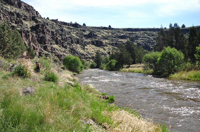
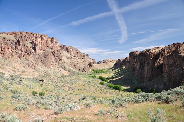
This sure is a pretty river canyon, though:
We saw some scattered balsamroot in bloom:

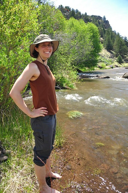
The “trail” ends at a big flat area where Fish Creek flows into the river. We went down to the shore and soaked our feet to cool off on this very warm day. Oh that felt good!
I struggled along on the hike back, looking forward to our shady campsite and my soft sleeping bag. When we got back, I had Deb fill up our water jug and dump it on my head. AWESOME! (It’s hard to tell here, but I’m drenched.)
That evening after dinner we finished the last part of the auto tour that we hadn’t had time for the day before. It was a beautiful evening, full of birdsong and croaking frogs (and mosquitoes).

Day 4: Fields and the Alvord Desert
We packed up and sadly bid adieu to the lovely campground, then headed south to Fields. It’s famous for it’s milkshakes, so I got a root beer milkshake. And yeah, it was pretty fantastic. While I ate, we watched the activity of people coming and going for gas and milkshakes and thought to ourselves that this tiny little outpost was busier than the whole big town of Burns, which we had driven through on Monday and which had seemed like a ghost town.
Then it was on up the east side of Steens Mountain to the Alvord Desert.
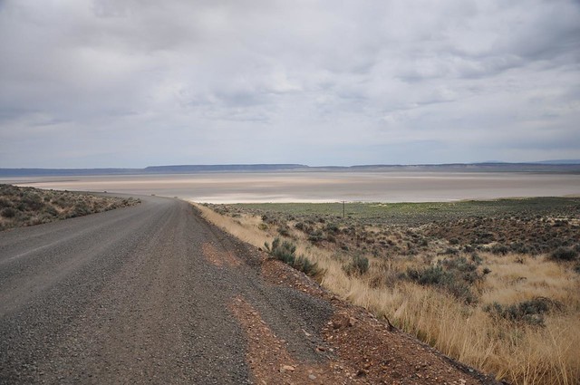
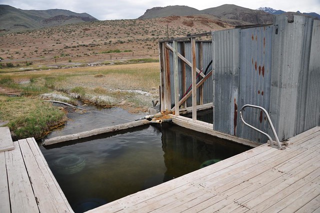
The Alvord Hot Springs are on private land owned by the Alvord Ranch, who used to charge admission, but don’t anymore. There are two side-by-side pools, one of which has walls and the other is completely open. It was an overcast day and the wind had really picked up, so we stayed in the water for two hours, knowing we’d be cold once we got out into the bad weather.
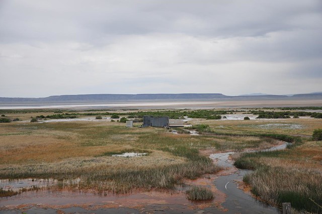
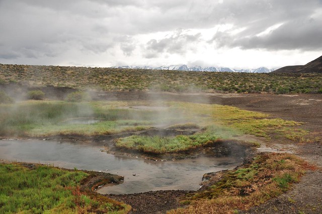
We headed over to check out Mickey Hot Springs too. Mickey has some REALLY hot water, like bubbling boiling water. There is apparently a bathtub-sized pool suitable for soaking, but we never found it.
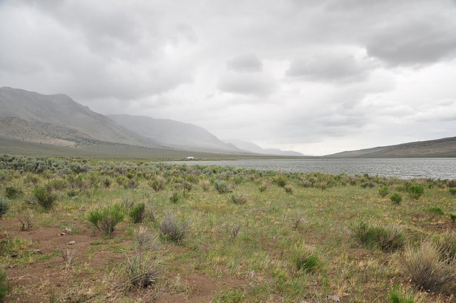
We set up camp at Mann Lake that evening, a “campground” that’s so primitive it’s free. No water, no picnic tables, no shelter/shade:
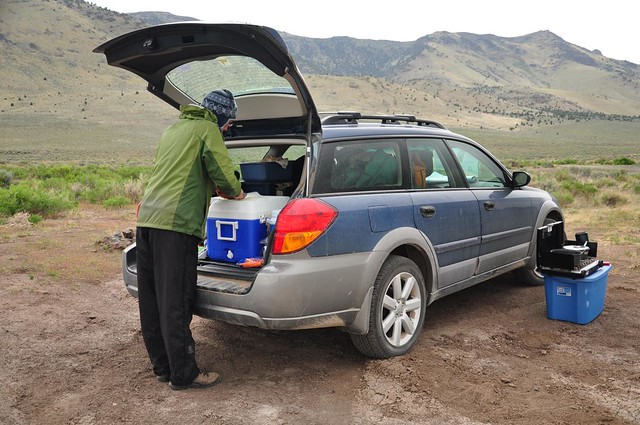
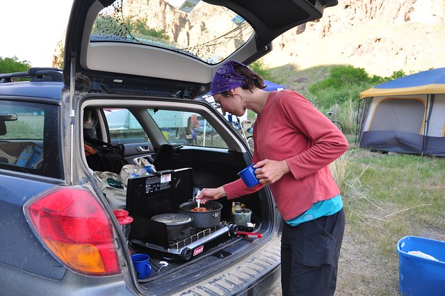
Without a table, we had to improvise when we made dinner:
After a VERY windy day with some rain, evening was calm and dry, thankfully, and we built ourselves a campfire. Our neighbors were all in RVs. They had noisy generators and one of them even had a satellite dish! If you need 100 TV channels, why not just stay home?
Notice the position of the car in relation to the tent. This was our attempt at blocking the wind overnight. It didn’t work.
Day 5: Pike Creek Hike
After a long rough night (the wind buffeted the tent from 1am on and at one point two of the four tent stakes came out), morning was beautiful and sunny. (And noisy. The generators were fired up first thing.)
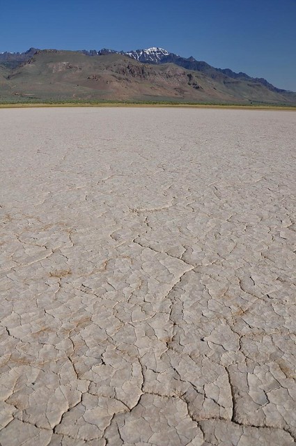
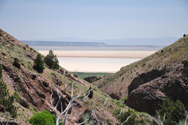
After breaking camp we drove down to the Alvord Desert to walk on the cracked dry earth.
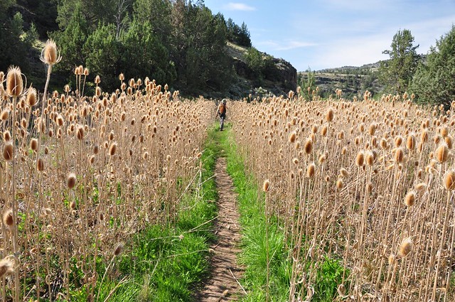
There’s not much in the way of hiking on the east side of Steens, but the trail up Pike Creek, which Sullivan describes in his book, sounded nice. The hike follows an old mining road 1.4 miles up the canyon of Pike Creek and the scenery is quite lovely.
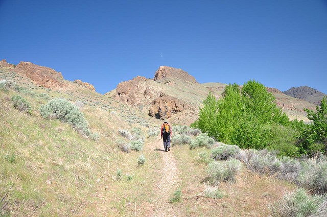
We could see the Alvord Desert behind us:
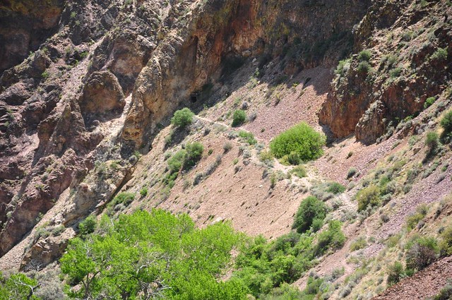
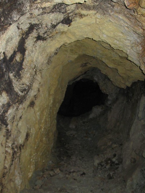
And we also saw the entrance to the old uranium mine, whose access road we had been hiking on. The entrance has bars across it so people can’t go in.
Deb climbed up there to take a peek through the bars. Spooky.
The road ends at a certain point, but there’s a rough boot path that keeps going further up with more views. My ankle was bothering me, but Deb kept going a little further and said the views up there were indeed nice.
Before leaving the area we returned to the hot springs for one last soak. A group of five men who were cyclists were already there, and listening to them banter back and forth was totally entertaining.
We had debated where to go after leaving the Alvord Desert. Should we go west to the Fort Rock area, or east to the Owhyee River area? Since we were already so far east, we decided to keep going and set our sights on Leslie Gulch. We thought it would take about two hours to get there. It took three. Oh well.
We camped at Succor Creek State Recreation Area. We were astonished at how busy this place was when we showed up. People with tents and RVs had staked out spots all over the place, in an area that wasn’t all that large. Fortunately we found ourselves a spot, and none too soon since people kept showing up as the evening went along.
Succor Creek:
Looking down on the camping area from the road:
Once again we had no picnic table. Good old Subaru to the rescue again.
The ground works too:
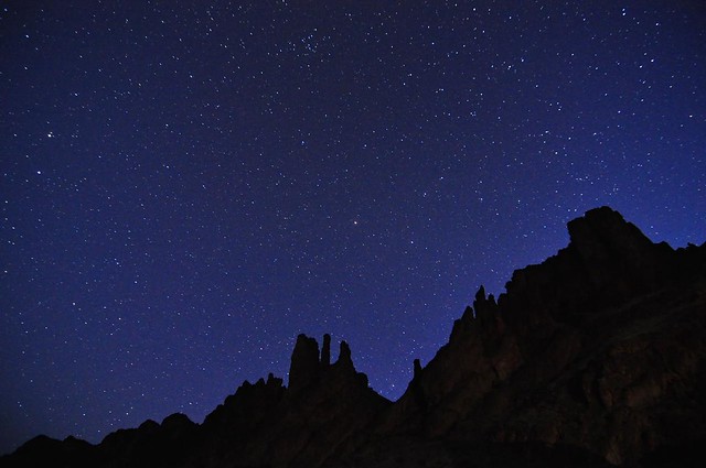
That night I took a shot of the stars above us. The stars in this corner of the world are AMAZING.
Day 6: Leslie Gulch
Despite all the people camped around us, it was a surprisingly quiet night. They were mostly families, so I’m sure that helped. In the morning we noticed that a bunch of people from the Canyon Country ATV Club were gathering there and heading out into the hills to pick up trash. Thanks guys!
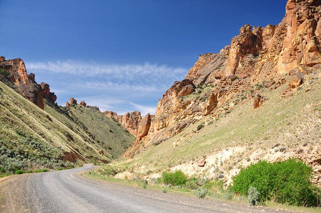
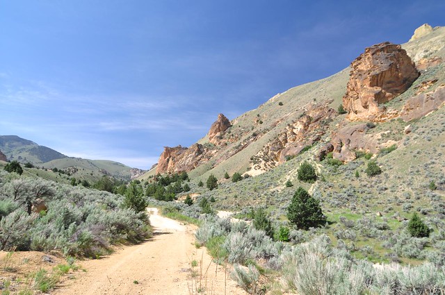
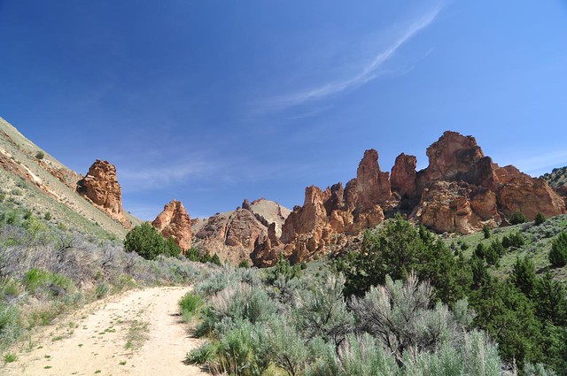
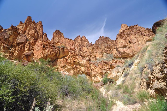
This is one cool place. A winding road travels the narrow canyon of Leslie Gulch and there are several side gulches that you can hike up and explore, which is what we did.
Our first stop was Dago Gulch, where, despite all the signs forbidding camping, we saw two different parties camped out there. We followed a road up Dago Gulch 0.8 mi until we reached a gate at private property and had to turn around.

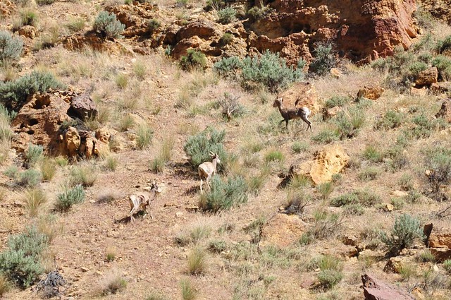
Driving to our next stop we saw a trio of bighorn sheep up on the hill:
The trail up Juniper Gulch follows a dry wash for about 0.8mi, ending in a a big amphitheater of rocks. Way cool.
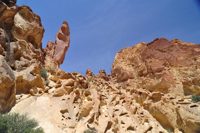
And lastly we visited Timber Gulch, which was a bit more of a challenge since the dry wash we hiked up was a lot more choked with sagebrush and boulders than Juniper Gulch had been. the afternoon was getting warm and there was little shade, so when we did find a bit of shade I had to stop and take a long rest to keep from overheating.
A great day!
After all the hot shadeless hiking we wanted to cool off at the reservoir, which is at the western end of Leslie Gulch. Alas, there is no day use area here, just a boat ramp. So we sat off to the side of the ramp, out of the way, and dabbled our feet in the cool water before heading back.
Back at the campground we found that 75% of our neighbors from the previous night had left. We did some exploring and discovered that the real campsites were actually across the creek. Shade, picnic tables, and proper campfire pits. Nobody was camped over there since the sites were walk-in only.
Day 7: One last hot springs
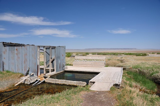
Before the LONG drive home on Sunday we made one last stop, at Snively Hot Springs. The hot creek flows into the Owyhee River where a rock-lined pool contains the warm water. The setting was really lovely and it was hard to tear ourselves away to spend the next seven hours in the car.
We had a really fun time on this trip and got to seem cool and different scenery from the usual forests-and-mountains scenery where we spend the majority of our outdoor time. If you can make it to the SE corner of our lovely state, I recommend it!


