Wednesday, July 24 – Saturday, July 27, 2019
I’ve been hearing about the Sawtooths for a long time. It looked like a beautiful place and it’s been on my wish list for awhile. So I moved it to the top of the list for our vacation this year, and after our stay at the McCart Lookout in the Bitterroot National Forest, we drove down to the Sawtooth National Forest, stayed the night in a campground on Tuesday, and packed up Wednesday morning for our hike.
DAY 1
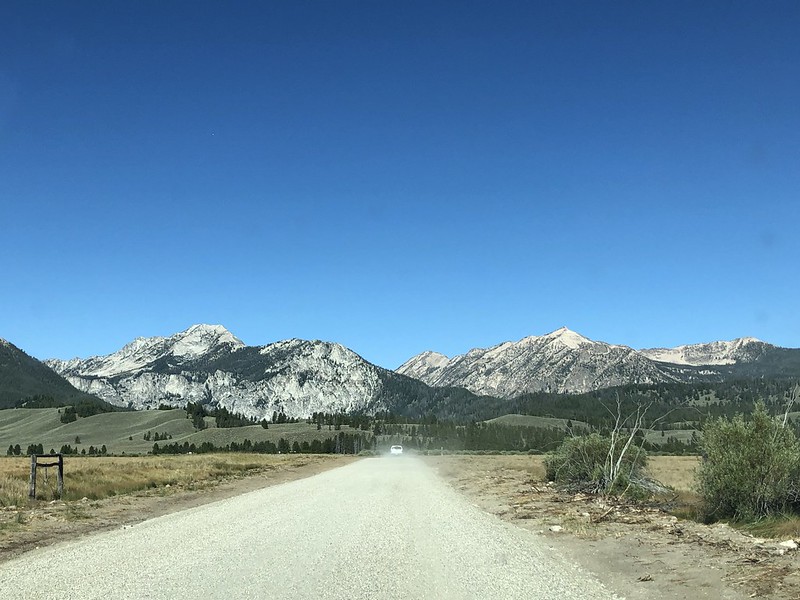
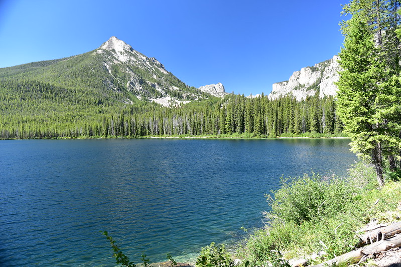
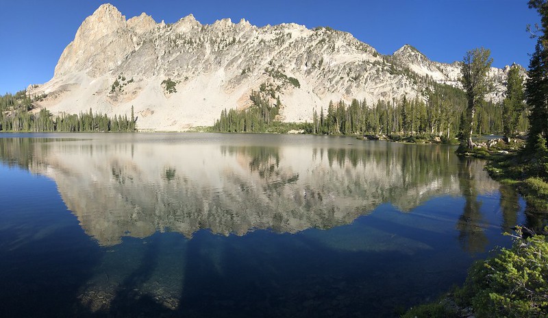
It was a gorgeous day as we approached Pettit Lake:
I picked one of the most popular hikes in the whole Sawtooth Wilderness, a loop that visits Alice Lake and Toxaway Lake and is frequently referred to as the Alice-Toxaway Loop. I was amazed at how many cars we saw at the Tin Cup Trailhead on a Wednesday morning. It felt like a weekend, or a national park.

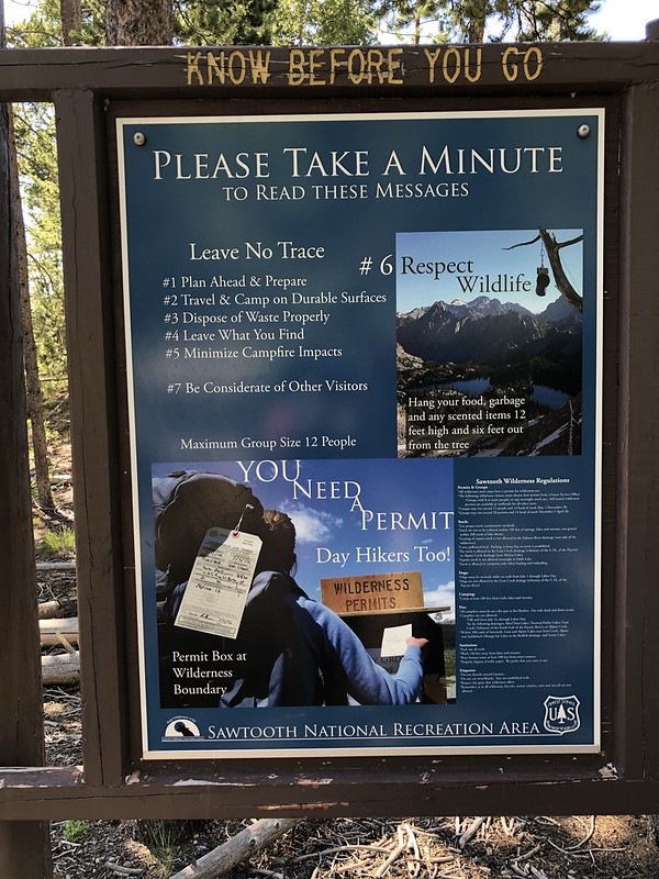
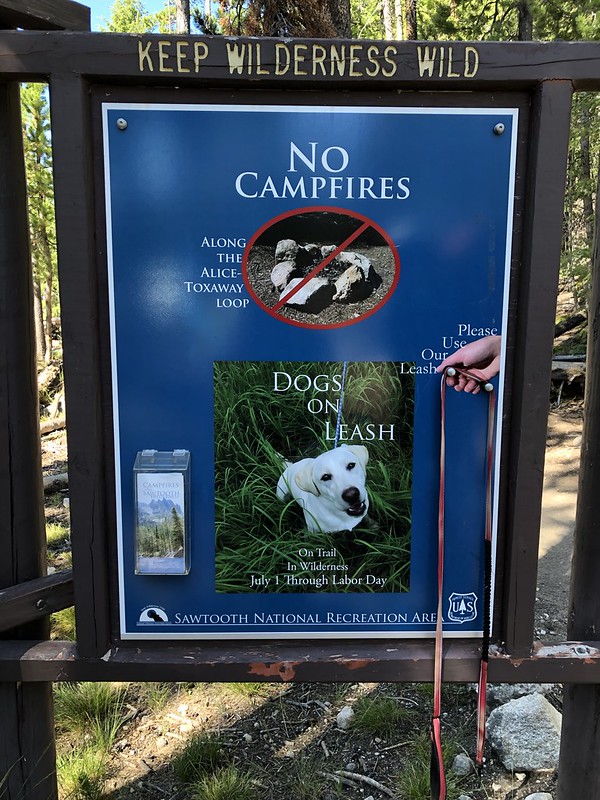
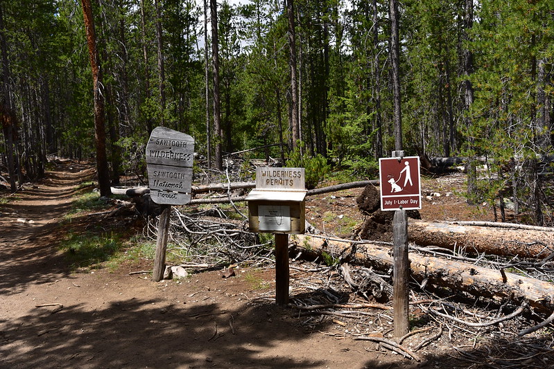
The trailhead signboard was actually well-designed and informative. Rather than a long list of rules in 10-point font (or no information at all), the most important information was presented along with photos. I was excited to see that dogs are required to be on-leash in the Sawtooth Wilderness between July 1 and Labor Day, a rule that does not exist at home in Oregon. The sign board was clear and there was even an extra leash there for people to borrow. (Unfortunately during the four days we were out there, all dogs but one were off-leash.)

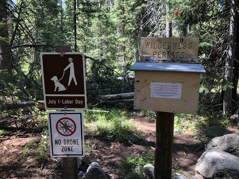
After 1.1 miles we passed the wilderness boundary and the permit box:

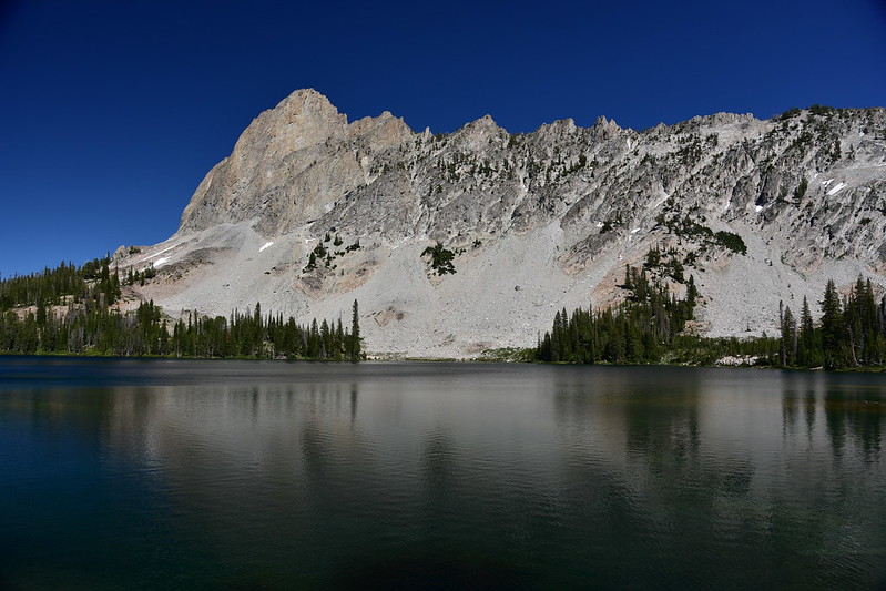
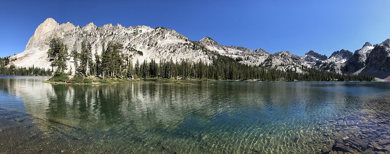
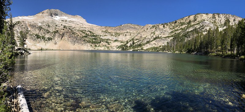
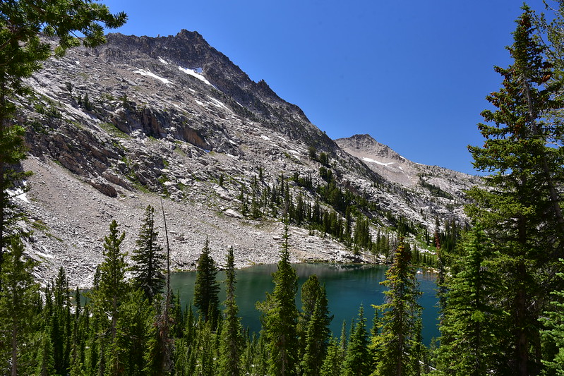
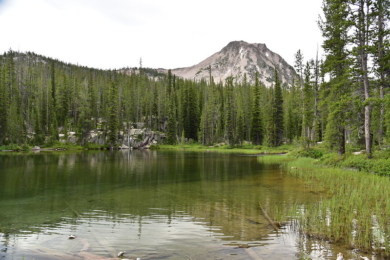
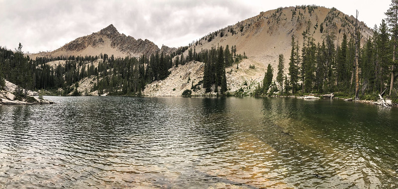
The trail follows the north shore of Pettit Lake, with views across to McDonald Peak:
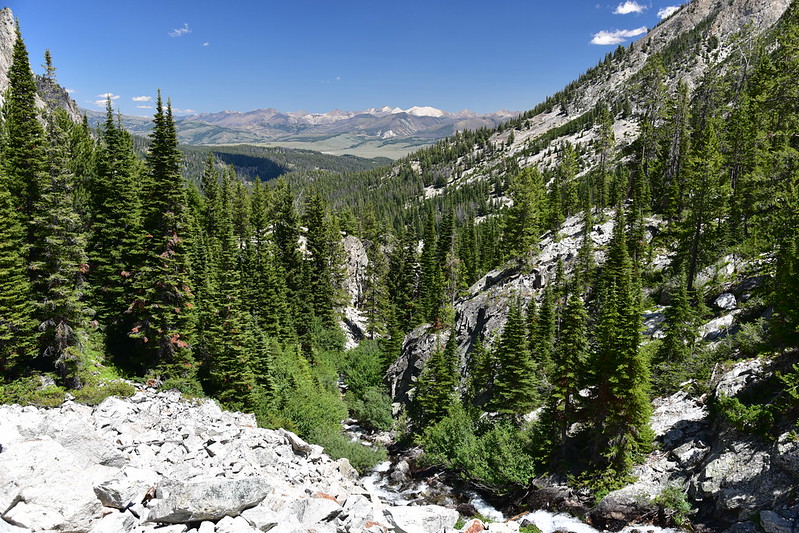
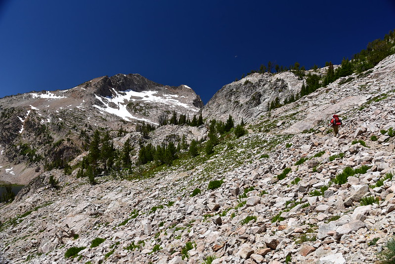
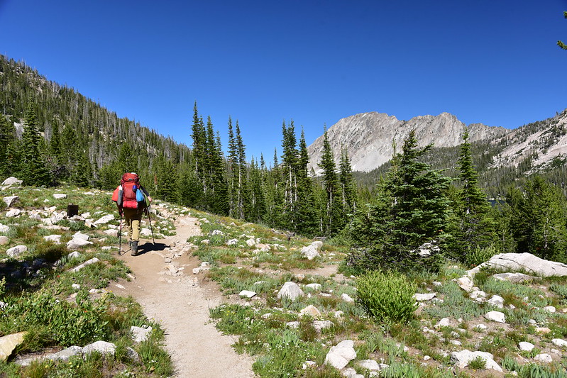
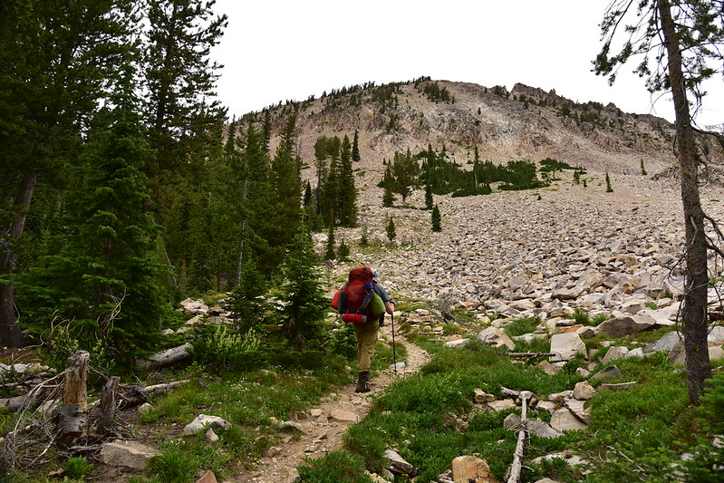
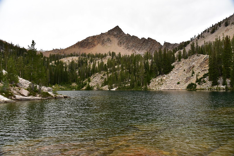
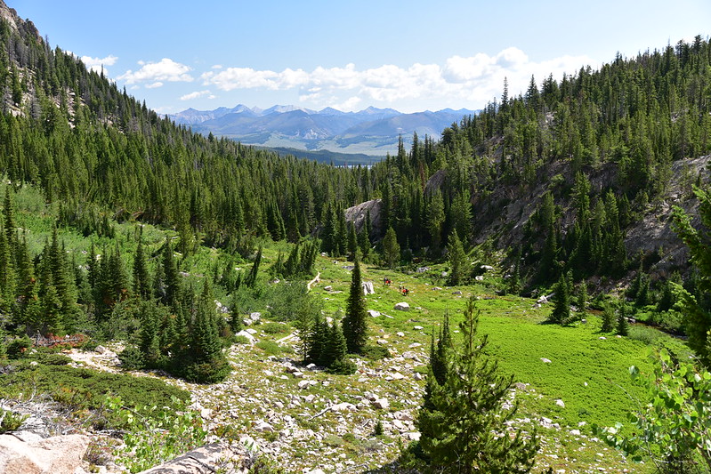
After 1.7 miles of pretty flat hiking, we started climbing and getting some dramatic views:

We stopped to admire this patch of mint:

Greg got a shot of this hummingbird, whose coloring made him blend in with the leaves:


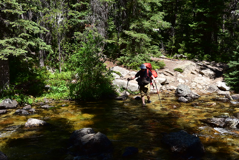
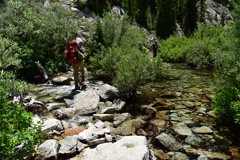
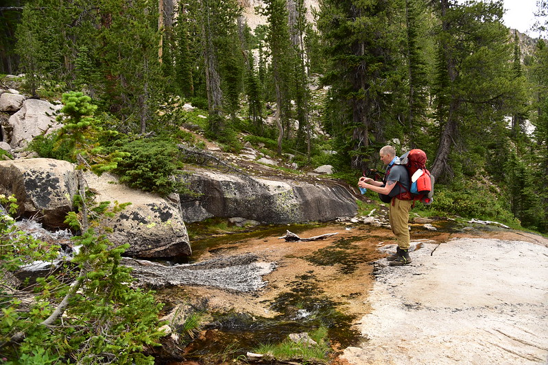
Shortly after that we had our first creek crossing. This creek does not have a name on any map I’ve looked at, but the trail is called the Pettit Creek Trail, so that’s what I’ll call it. We changed into our crocs and waded across:
At the second creek crossing there was a log we were able to balance on:

This was a really pretty spot near that second crossing:

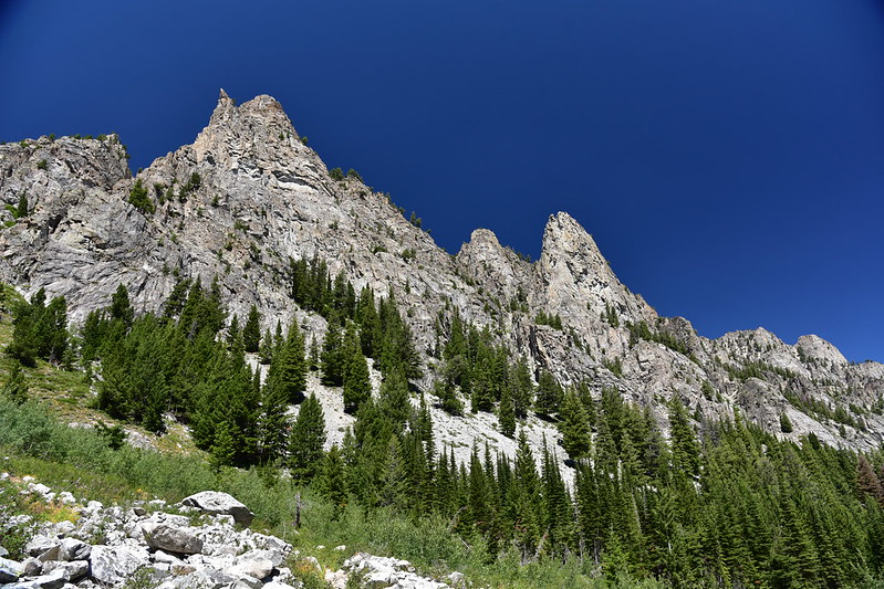
The mountains rose above us:
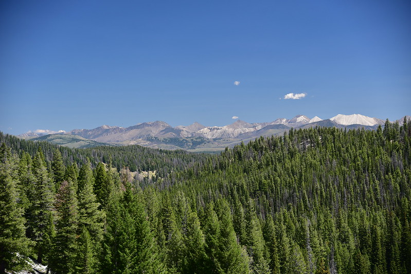
Behind us we started getting better and better views of the White Clouds:

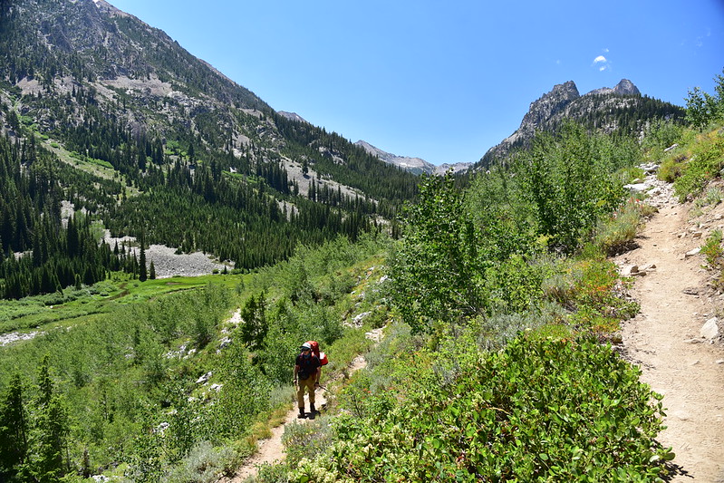
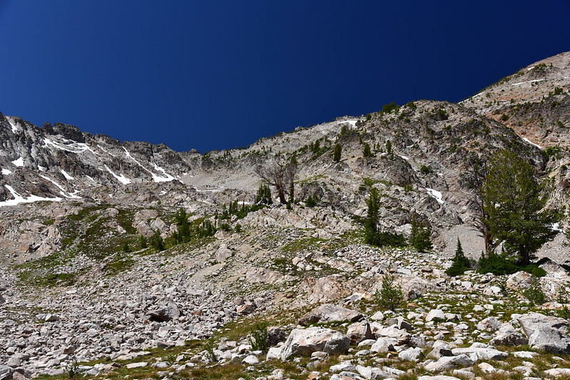
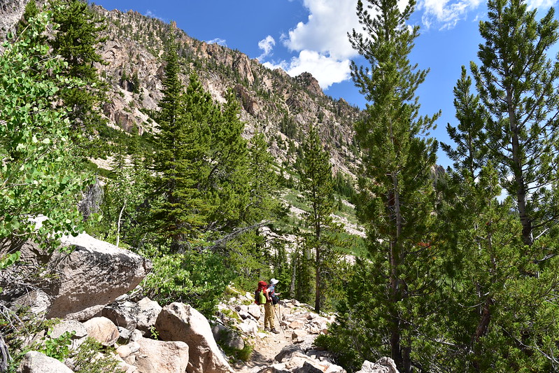
The trail was pretty well-graded and not steep:
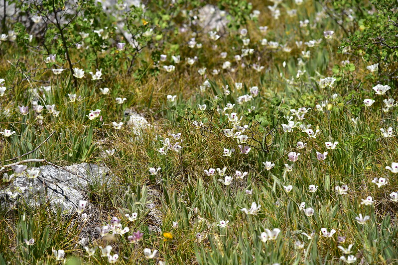
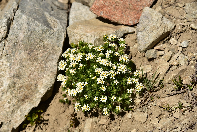
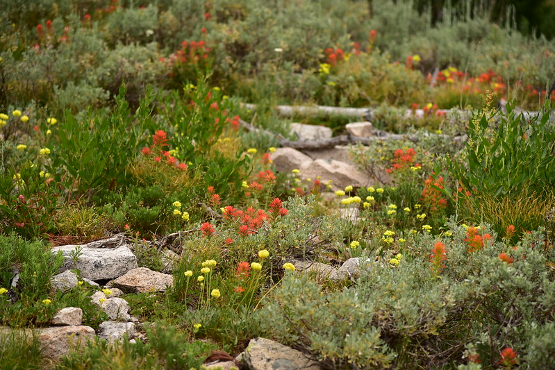
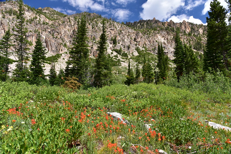
We saw some nice wildflowers, including this stretch of calichordis:
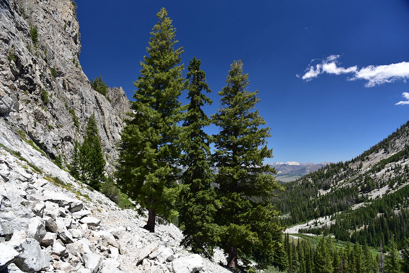
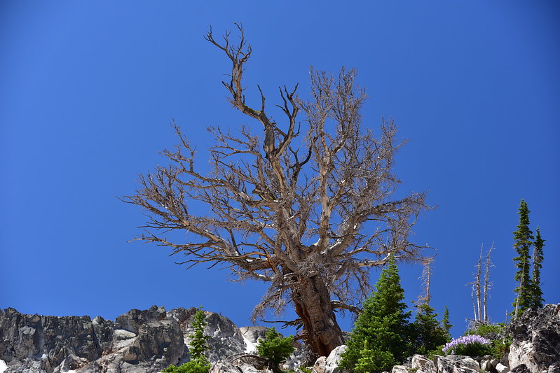
We passed these three huge trees growing on the slope. Trees at this elevation don’t often grow this big, so it was cool to see:

At the third creek crossing we were once again able to use rocks and logs. I almost got knocked into the water by an off-leash dog approaching from the other side who charged into the water. The owners seemed oblivious:
Look how clear that water is!

Fourth creek crossing:
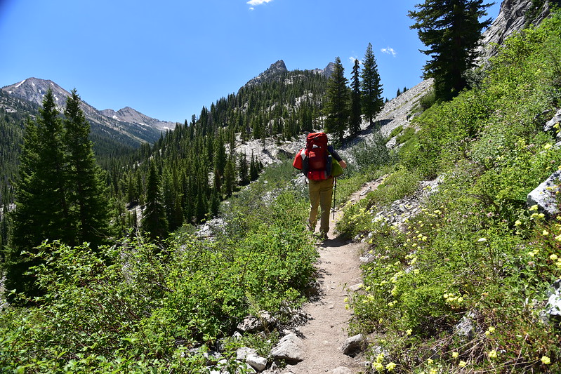
I had trouble focusing on the trail beneath my feet because I kept gawking at the mountains:

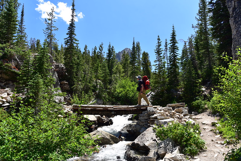
The next creek crossing actually had a bridge!
Someone with an off-leash dog passed us from behind and a short while later we heard frantic barking. Then we saw horses coming around the bend. We stepped aside and let them pass:

Our sixth and final creek crossing, the fifth one without a bridge:

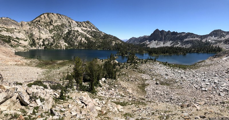
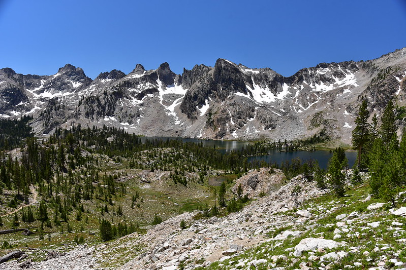
We passed the first of two unnamed lakes downstream of Alice Lake, which were pretty beautiful in their own right:

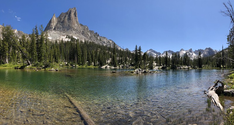

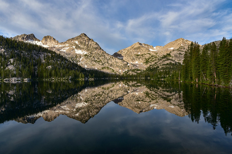
We made it! There’s Alice Lake!
We found a campsite towards the far end of the lake and set up our tent:


This was the view from the shore near our site:
My Sawyer Squeeze filter refused to work. (I later learned that it was because I did not backwash it first, something I should have done before the trip. Once we got home and I did that, it worked again.) Fortunately we had water treatment tablets. These take time, but were better than not filtering at all:


We were on a peninsula and I went across to the other side to get the view over there:

A panorama from the tip of the peninsula:
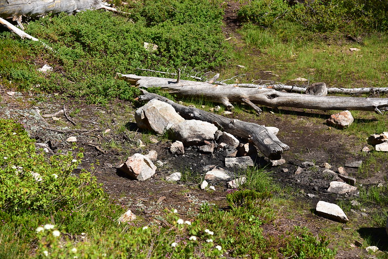
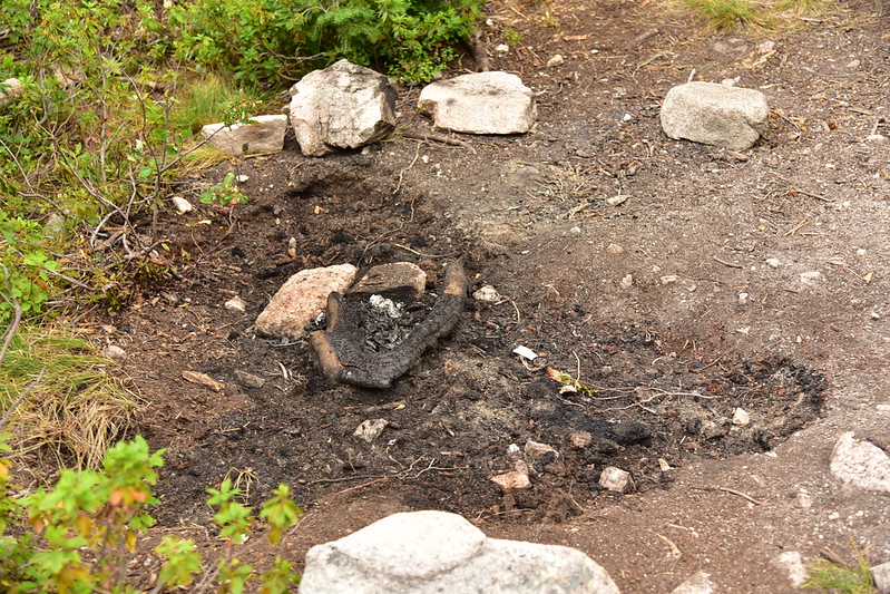
I found evidence of a campfire, even though they aren’t allowed here:
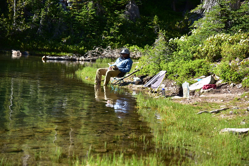
We sat by the lake for awhile, but it ended up being a tad too warm so we retreated to the shade of our site:
The day transitioned into a beautiful clear evening:

We had expected the mosquitoes to be really bad here, but they weren’t. They were around, for sure, but not the swarms we were expecting. We ate dinner with this as our view:

Mileage today: 6.9 miles
DAY 2
Our Alice Lake campsite was in shade for awhile this morning as we watched the sun slowly spilling down the face of the mountains:

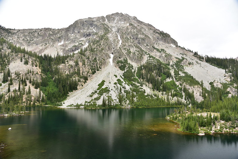
This lake is absolutely gorgeous. This may very well be the most beautiful place I have ever camped:

After breakfast and a leisurely morning of enjoying the scenery, we hit the trail at 10:20:


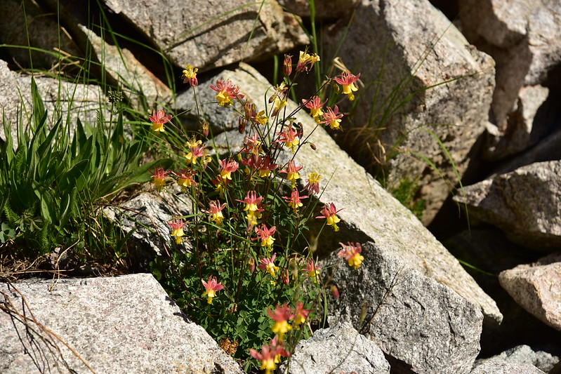
We saw some nice wildflowers including Rocky Mountain Columbine:
And Nuttal’s Linanthus:
Rydberg’s penstemon:

We reached the junction where we headed to the left for Twin Lakes. If I’m reading the map correctly, this is where Pettit Creek Trail #095 ends and the Alice Lake – Redfish Lake Trail #092 begins, which we would be taking over Snowyside Pass to Toxaway Lake:

But first we descended down to Twin Lakes. It was quite peaceful here:


We hiked the isthumus between the two lakes to the other side where we discovered the most delightful gurgling snowmelt stream lined with wildflowers. Pictures don’t really do justice to how utterly charming this spot was:


While Greg continued to take pictures I set off to find the geocache, which was the reason we came over to this side of the lake in the first place. It was hidden at the base of a big old dead tree, which is in the dead center of this shot:
Better look:

Almost there:
This is the view from the tree looking down at Twin Lakes:
Can you see Greg?

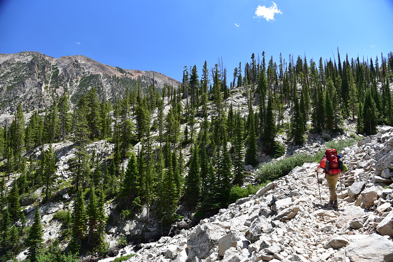
Back on the main trail we continued climbing:
We had good views looking down on Twin Lakes:
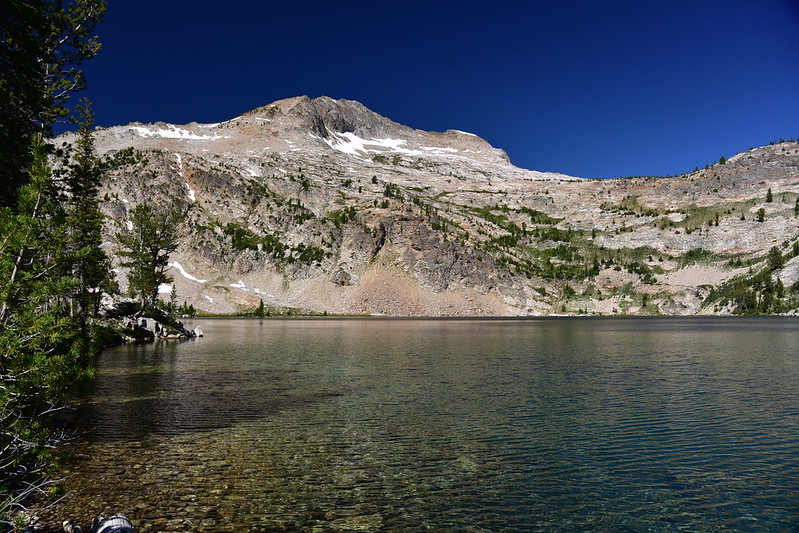
We reached Snowyside Pass at 1:30. Damn, the view up there was great! There was a small patch of snow here, the first we’d encountered on the trail so far. We hiked up that trail you see on the right, and would be hiking down the other side to the left:

We had a nice view of the area we’d just left, including Twin Lakes:

And a tiny bit of Alice Lake:
This was the view down the other side, where we are headed:

Looking up at Snowyside Peak above us:

After a break we left the pass and started down the other side:

This would be a really hot shadeless ascent if we were going the other direction. But cruising downhill we were able to enjoy the gurgling snowmelt streams and wildflowers near the trail:
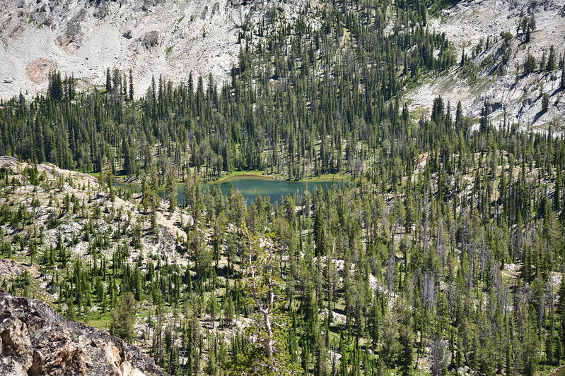
We passed three unnamed ponds:

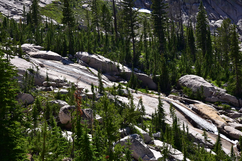
The creek flowing out of the ponds eventually spilled down a smooth granite rock face that was super cool-looking:
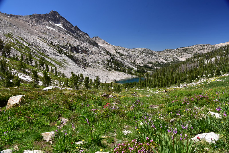
We kept descending and then crossed that creek shortly before reaching Toxaway Lake:


Almost there:
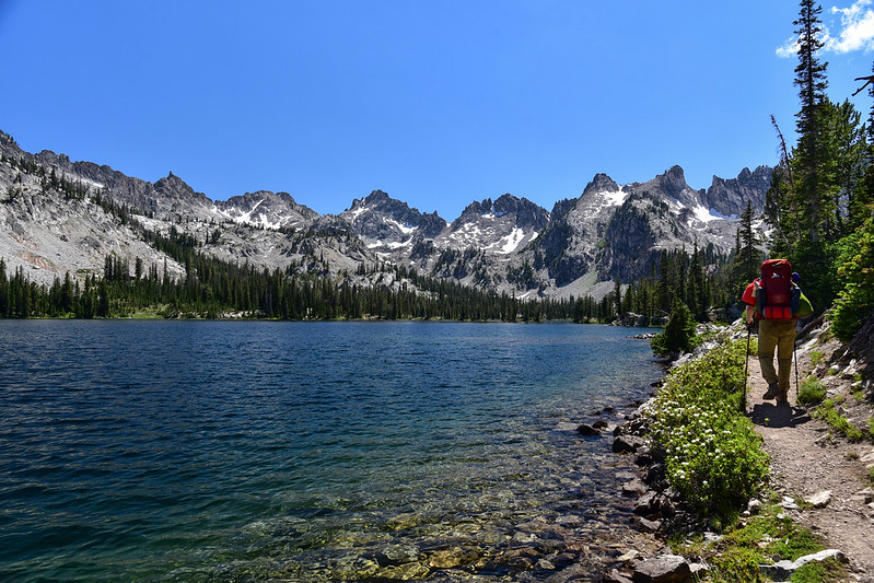
The trail travels high above Toxaway Lake, with occasional side trails down to campsites (or not, as we discovered). It took us awhile, but we finally found a site near the water with a good view:


There were definitely more mosquitoes here than at Alice Lake, or maybe the wind was a little more subdued at Toxaway. I’m glad we treated our clothes with permethrin.
Mileage today: 6.6 miles
A note: I was very curious about the name “Toxaway.” When we got home I found this info in Matt Leidecker’s boo,k Exploring the Sawtooths:
“In 1894 scientists with the Federal Bureau of Fisheries spent three days on Alturas Lake studying salmon as part of a larger investigation of the Columbia River watershed. For the next two summers, a young biologist named Barton Everman led the Bureau’s Sawtooth studies on Alturas and Pettit Lakes.”
“The research team had several impacts on the region. Members of the party explored the canyons upstream from Alturas, Pettit, and Yellow Belly Lakes. Barton named two lakes after his young children, Toxaway and Edith (the former was named after the Toxaway River in North Carolina where Everman had taken a canoe trip several years earlier). Another member of the party was married to a woman named Alice, after whom Alice Lakes is likely named.”
DAY 3
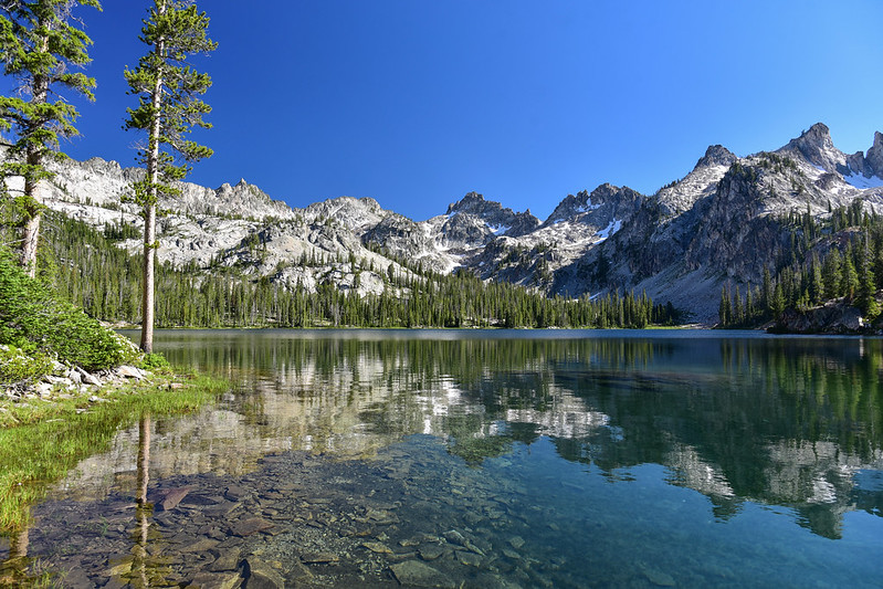
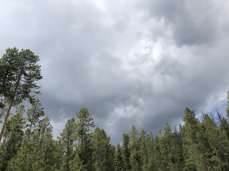
It was a calm beautiful morning at Toxaway Lake, although the clouds were rolling in fast:

We lingered by the lake, enjoying the morning, although I could have done without the nearby kids screaming and and throwing rocks in the lock.
We passed Bowknot Lake, which has no campsites:

Then we passed Lake 8165, which was bigger and prettier than Bowknot. Why it doesn’t have a name other than its elevation, I don’t know. It had a really cool waterfall sliding down the rock into the lake:


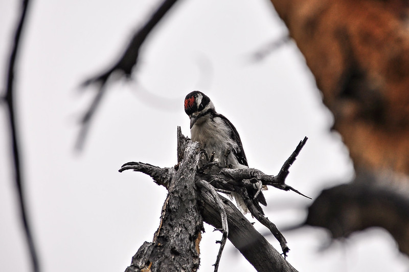
1.6 miles past Toxaway Lake we reached the junction with the Edith Lake Trail. We didn’t have a long mileage day today, so we decided to take this little detour and headed up the hill. We spotted a woodpecker up in a tree and Greg got some good shots of it:

We crossed Edith Lake’s outflow creek several times. This was the first time:
We skirted this huge rockslide where we heard pikas but didn’t see any:
Crossing the creek again:


It was exactly half a mile up the trail to the lake. The overcast skies didn’t make for great photos, but it was a beautiful spot:


Camping isn’t allowed at Edith Lake, we discovered:

I loved this little tenacious tree:

We descended back to the Yellow Belly Trail and continued on. We crossed the foot of the huge rockslide that we had seen the top of earlier on the Edith Lake Trail:

Wildflowers:
First views of Farley Lake:

Since it was now Friday night I was a little nervous about getting a campsite at Farley Lake. We had passed dozens of people heading up to Toxaway Lake this day. Fortuantely we found a good spot with no neighbors and a nice view:

Another lake where campfires aren’t allowed and another burn scar. Looks like this one started spreading in the duff:
It had drizzled off an on all day, but around 6:30 we got a good downpour that lasted awhile. We holed up in the tent waiting for it to pass, then did our evening chores and went to bed.
Mileage today: 5 miles
DAY 4
After yesterday’s clouds and last night’s rain, morning was clear and beautiful:


Knowing this was our last morning in the backcountry, we lingered in camp until 11:30 before finally packing up and starting our hike. We had some nice views as we hiked out:

 /
/
We crossed the remains of an avalanche from the previous winter. It was a mess of tree trunks and branches, but fortunately a path had been trampled through the snow:

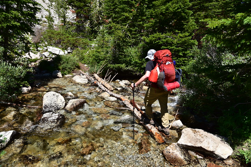
Another bridgeless creek crossing:


We crossed the wilderness boundary:
This is what the last few miles looked like:

We reached the junction with the Pettit Lake Cutoff and turned onto it. Unfortunately this trail goes uphill for a full mile before crossing a ridge and descending down to the Tin Cup Trailhead. On the fourth and final day of your trip when you’ve got cold beer and hot showers on your mind, going uphill is not fun. This is the final mile as we descended to Pettit Lake:

We made it back to the car at 2:15, happy to throw down our packs and take off our boots. A storm rolled in right as we were loading up the car. Good timing!
Mileage today: 5.2 miles
Total mileage 23.7. Let’s call it 24. 🙂
We devoured our cheesy breadsticks and pizza at Papa Brunee’s in Stanley that night:

This was a GREAT trip. The scenery was spectacular and we lucked out with nice weather for three of the four days. We also lucked out with the mosquitoes, which were never terrible. I’m very glad that we did the trip clockwise. If we had done it the other way we would have been at Alice Lake on a Friday night. I imagine that Alice Lake is a total zoo on the weekends and that our experience would have been far less enjoyable with all those crowds. Passing hoards of hikers who were heading in to Toxaway Lake on Friday made me glad that we were able to do most of this trip during the week and that we were staying at one of the less popular lakes on that Friday night. The one disadvantage to doing the loop clockwise is having to go uphill there at the very end before descending back to the trailhead. That was a bit disheartening.


