Sunday, November 11, 2018
In the fourth edition of William Sullivan’s 100 Hikes / Travel Guide: Oregon Coast & Coast Range (2016) a new hike appeared: Angora Peak. It is right next door to Neahkahnie Mountain so wither another gorgeous day in the forecast we grabbed a copy of the page from Sullivan’s book and set out on Sunday. Turns out we should have done more research beforehand, and we were in for a bit of an adventure. (Update: Angora Peak is now in the Oregon Hiker’s Field Guide as well.)
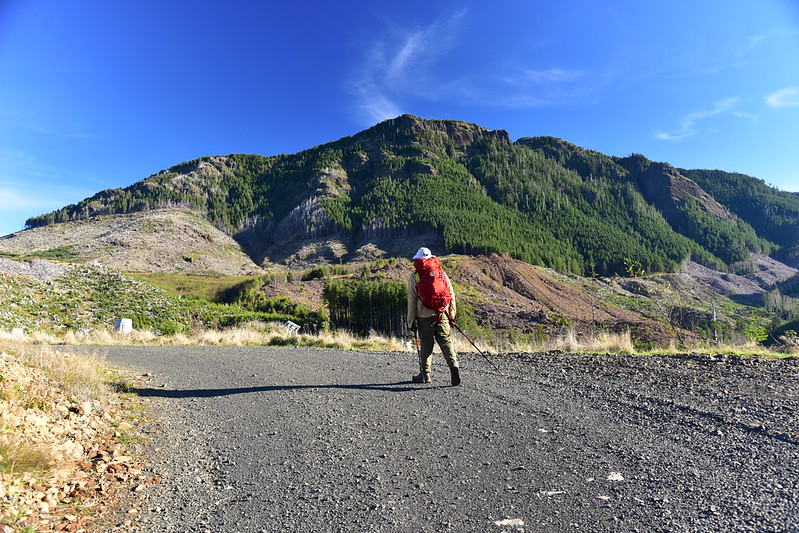
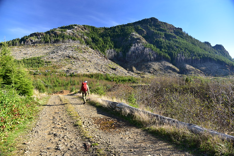
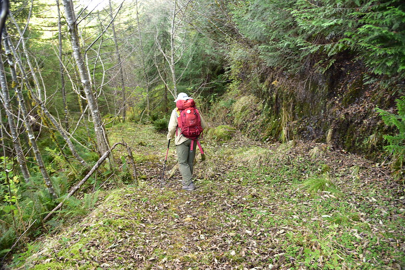
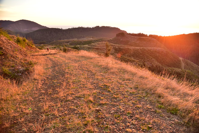
This entire hike is on roads, both old and current. We parked at the gate off Highway 101 and set off:
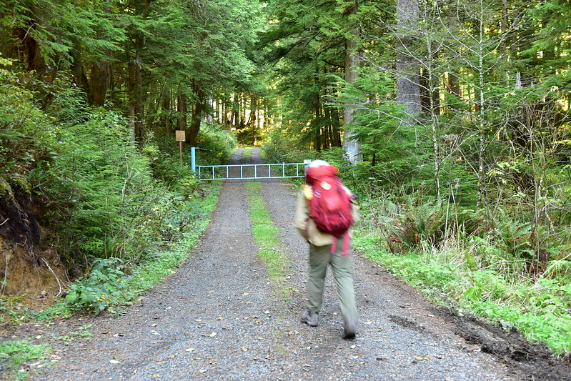
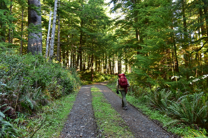
We hiked through the “beauty strip” buffer of intact trees between the highway and the clearcut. There are some nice trees here!
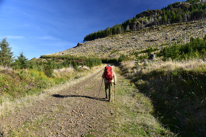
And then we emerged into the hideous clearcut:
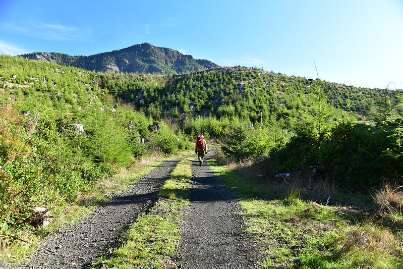
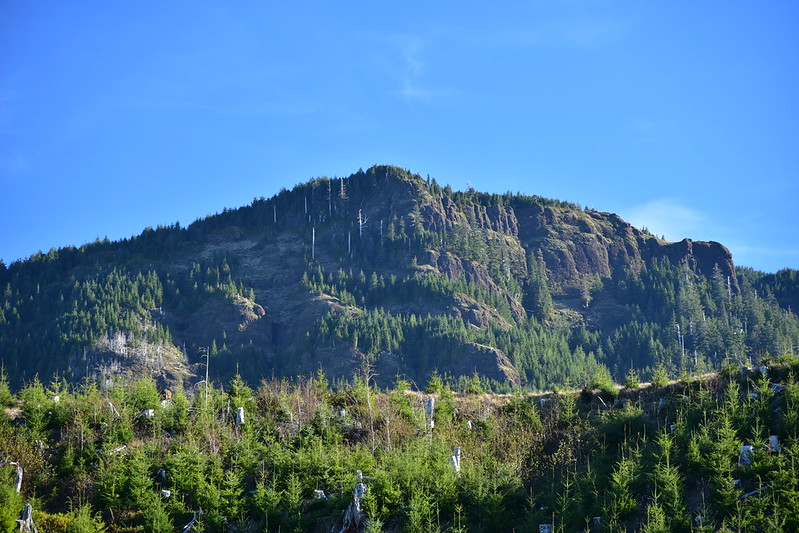
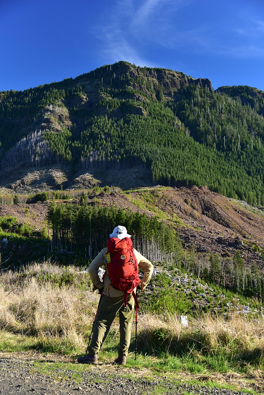
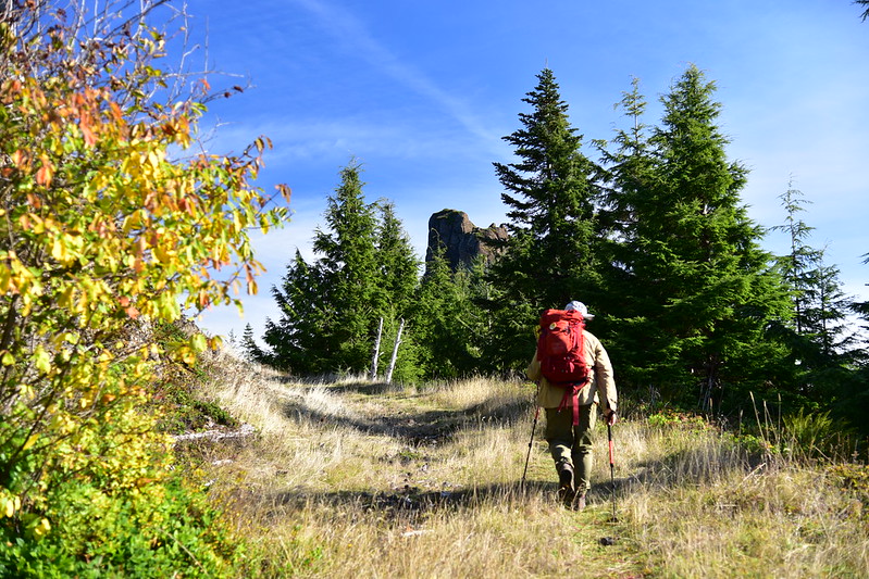
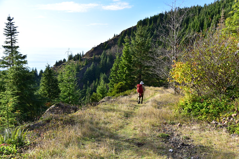
As we followed the road up through the clearcut Angora Peak was ever-present to the east:
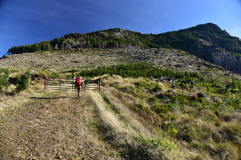
We saw two hunters heading down and exchanged friendly greetings. We continued hiking up the road:
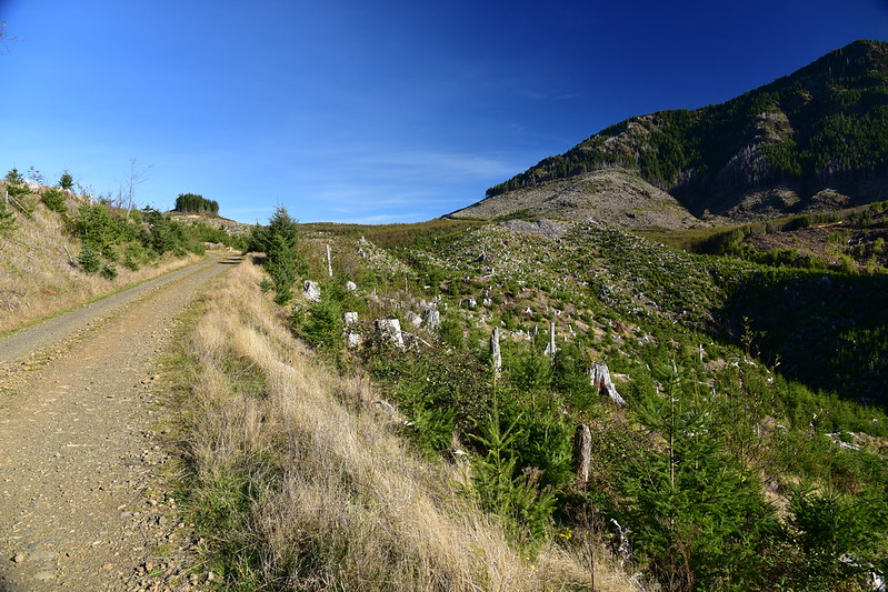
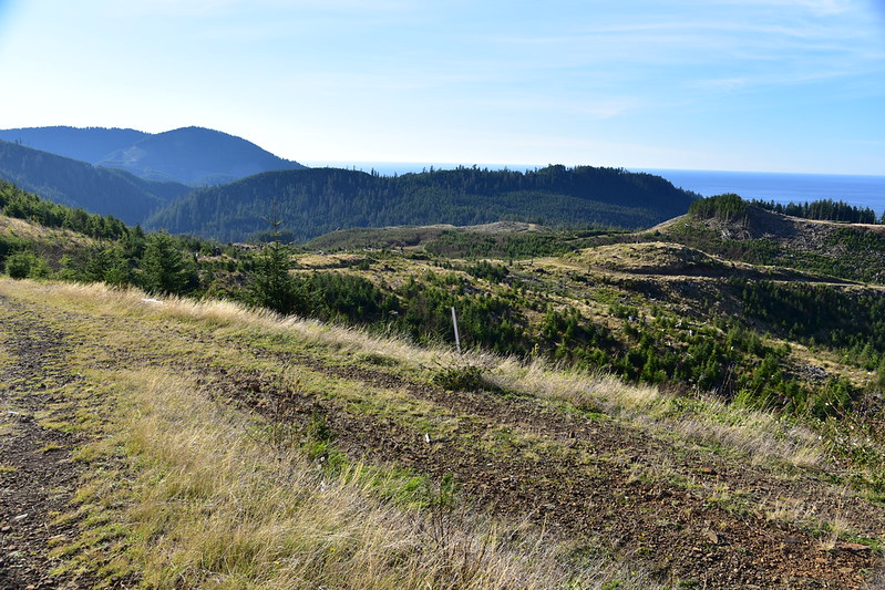
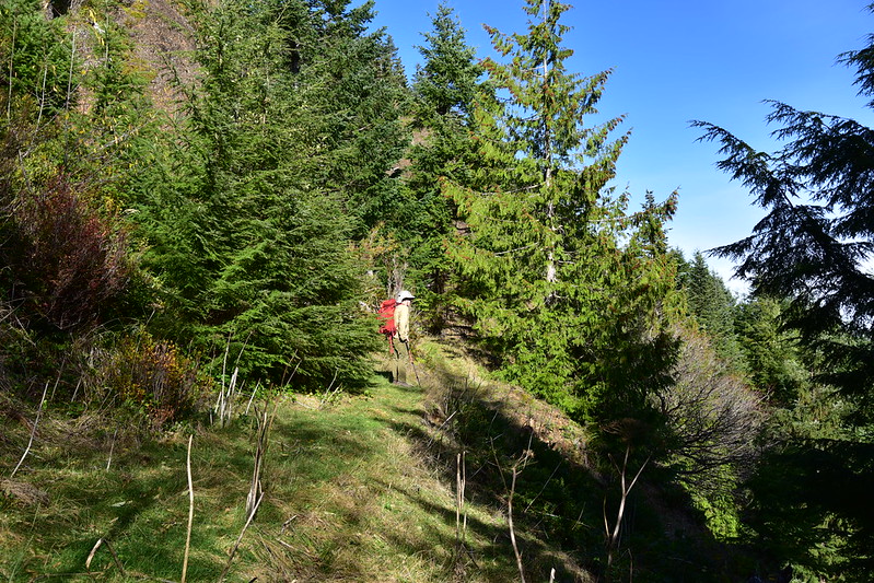
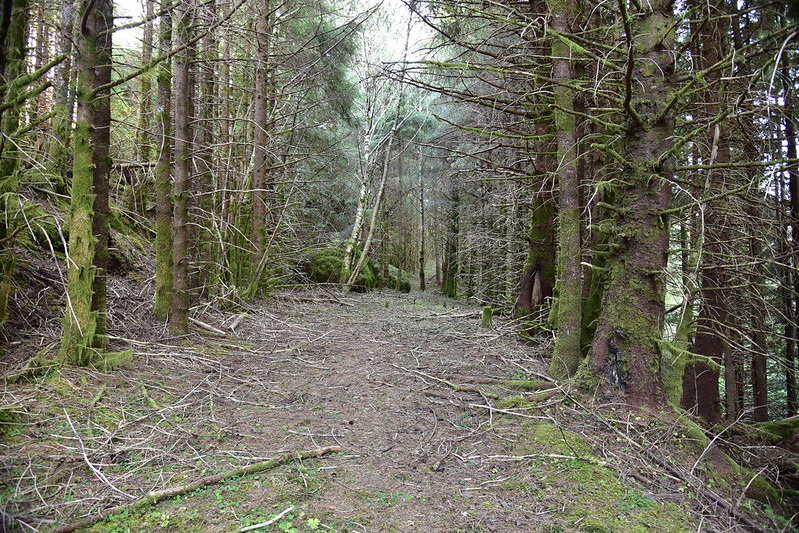
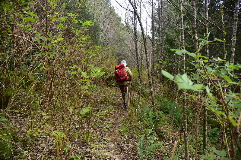
We turned right and passed a gate onto a road that was pretty grassy in places and didn’t look like it had been used in awhile:
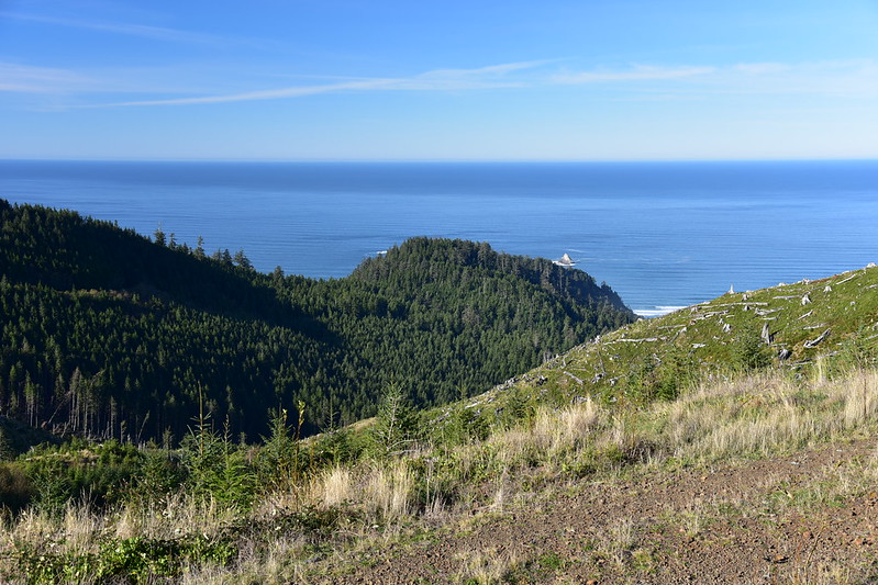
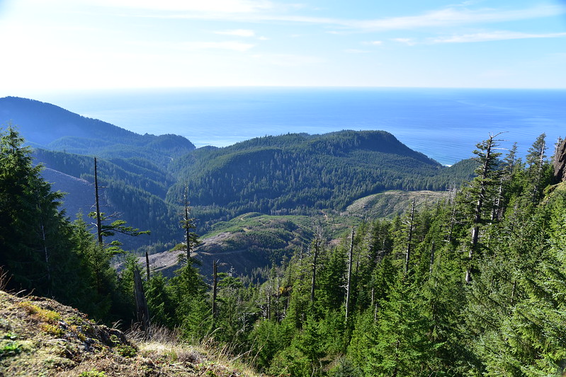
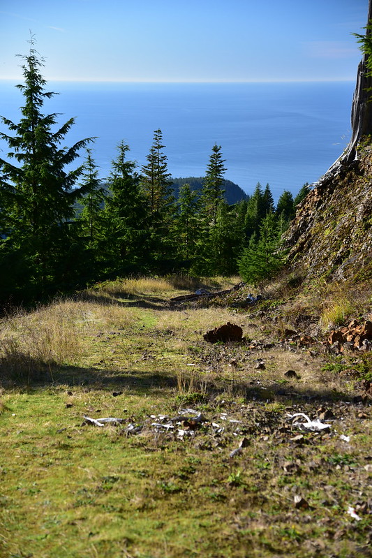
Now that we were getting higher we could see the beautiful blue ocean:
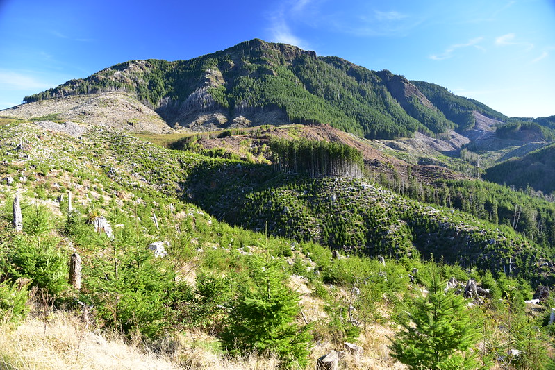
We could turn around and look back down over the area we just hiked through. That’s Neahkahnie Mountain on the left:
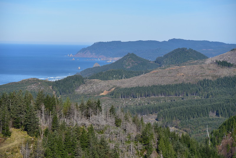
View to the north. Cannon Beach is out of sight behind those two forested humps, but you can see the tip of Haystack Rock:
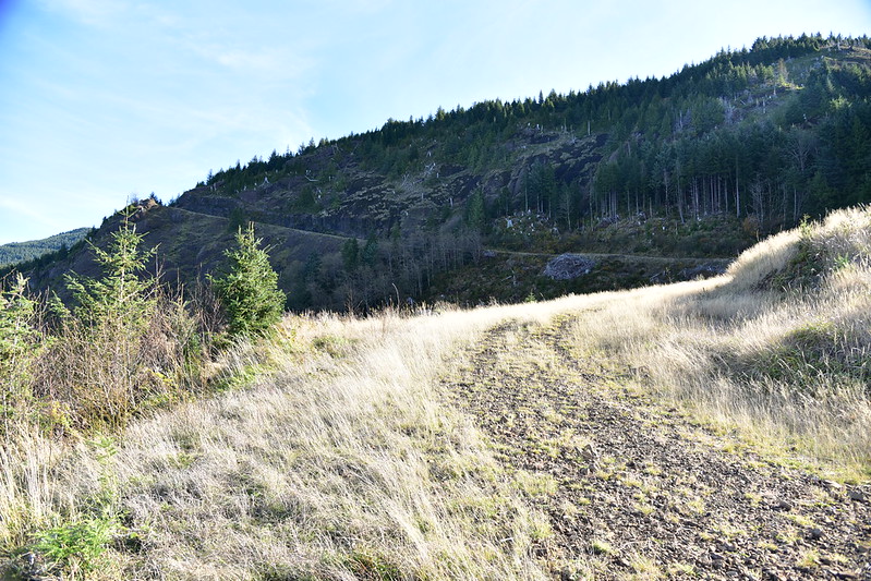
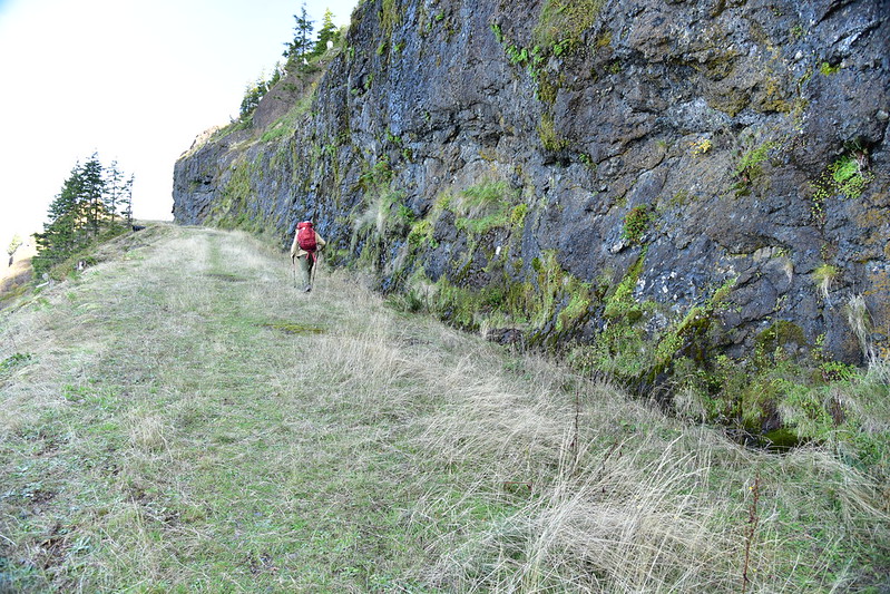
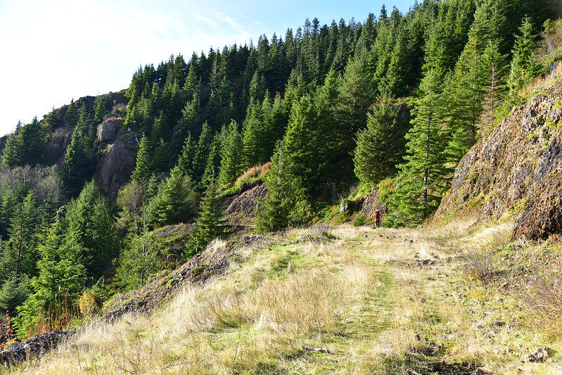
The road climbed up along a basalt cliff. This was a pretty cool stretch. It had gotten very cold the previous night and with the shade we saw patches of frost on the ground:
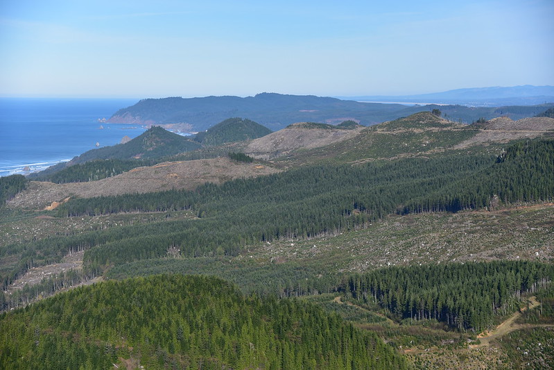
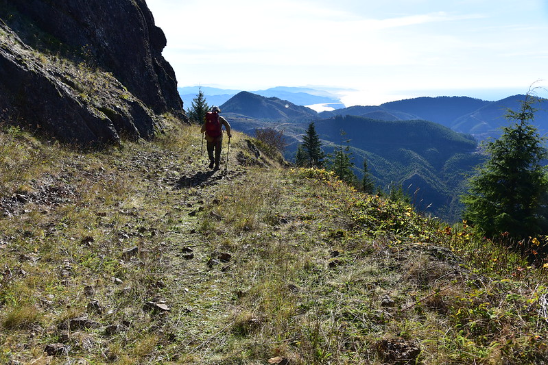
At the two-mile mark we reached another viewpoint at a bend in the road. We were high enough now we could see even further north:
At the viewpoint we saw two hikers heading down and I asked if they had made it to the peak. They said the route had gotten too brushy so they turned back. That worried me a bit, but they were wearing shorts so their tolerance for pushing through the brush would have been low.
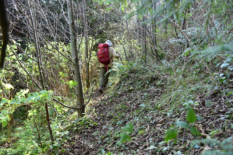
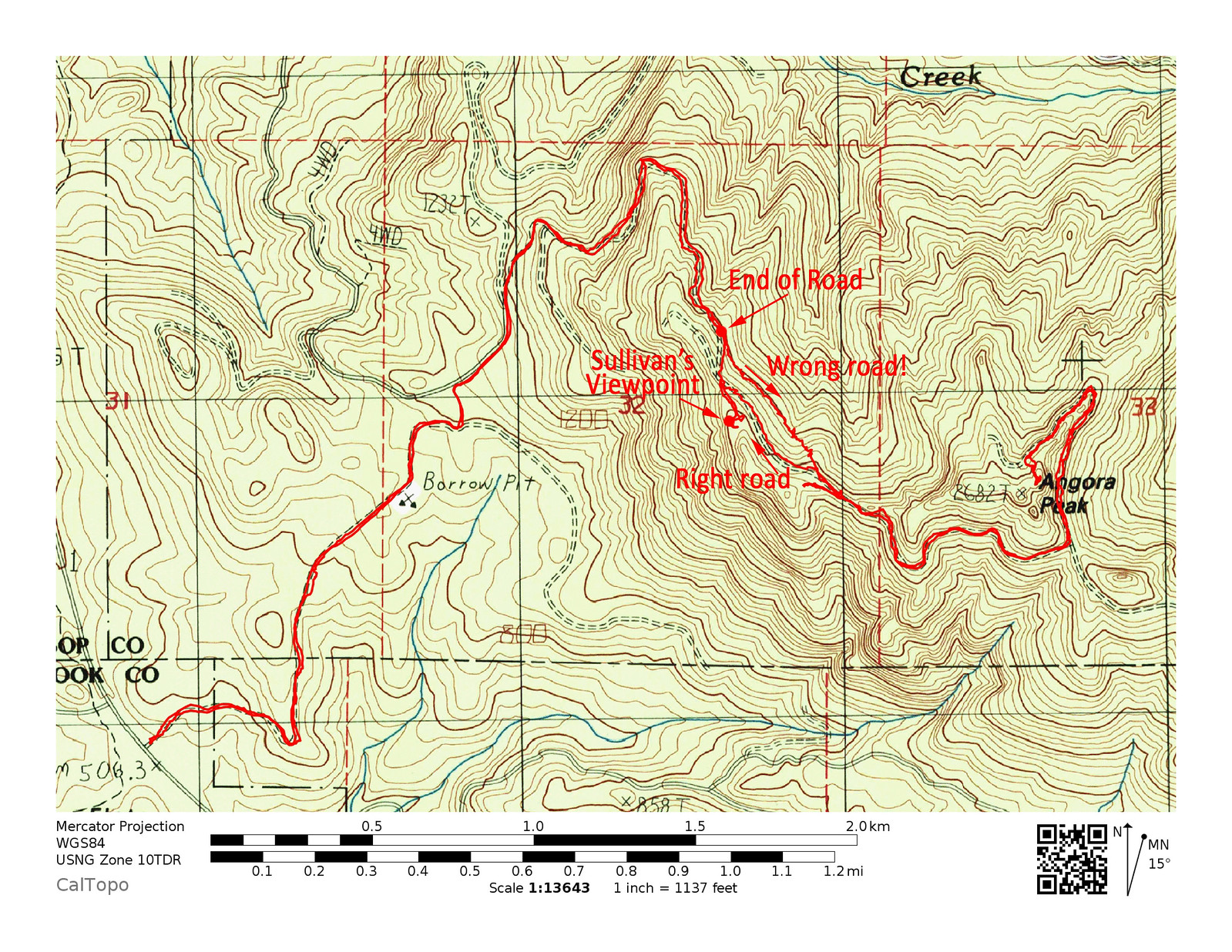
We reached the end of road and here is where we went wrong. Sullivan says “At a small cairn of orange rocks just 150 feet before the grassy roadbed ends, angle up to the right on a faint, brushy deer trail that may be marked with red ribbons”. We saw neither trail nor orange rocks nor red flagging and were now at road’s end (not 150 feet before road’s end). We should have backtracked and looked for the trail, but we saw a trail heading off to the right at road’s end and decided that must be it.
And here’s what that looked like:
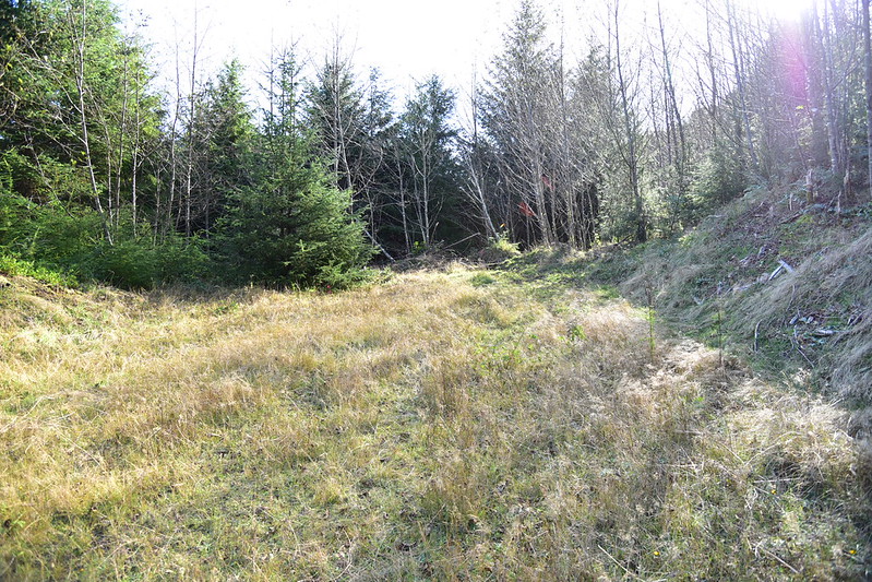
It started resembling an old road. But it was the wrong old road:
We realized that our route and landmarks were no longer matching Sullivan’s description. After some research on the phone, which included looking at the satellite imagery of our location, we realized that there were TWO old roads. They paralleled each other and we were on the lower (wrong) one. It was also at this point we realized that Sullivan does not take his readers to Angora Peak itself, but a viewpoint that is north of the peak. What a rookie mistake, not reading the description carefully enough! [hangs head]
So it was time for a course correction. Rather than backtrack to the end of the main road, we scrambled straight up the steep slope to reach the upper abandoned road, the one that we should have been on and that would take us to to the peak. Fortunately the forest was not brushy here and other than being incredibly steep terrain we had no trouble getting to the upper road, where we turned left (south) and continued hiking.
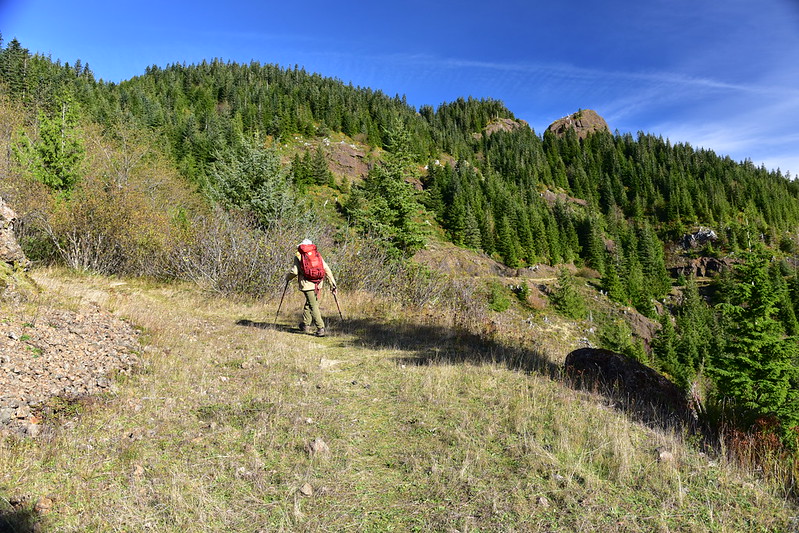
We were soon treated to nice west-facing views:
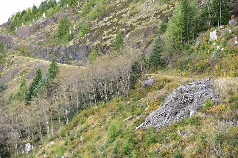
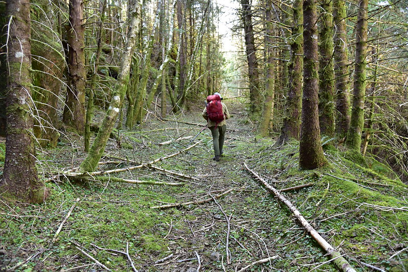
The road headed south along the mountain face before curving east. It had obviously not been used in a very long time, so we were pleasantly surprised to find it in very good shape:
Looking back down the road to the west and the ocean:
The road came to a T intersection where we turned left. Suddenly our easy road strolling was over. This stretch was overgrown and in bad shape:
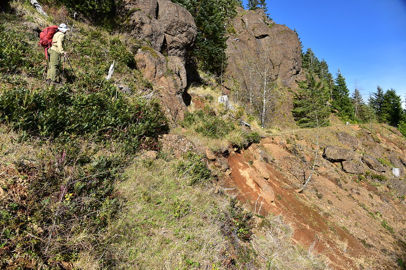
In some spots the road bed was gone, slid away down the mountain in a landslide. As you can see in this photo, we had to scramble up a bit to bypass the washouts:
We took a hairpin turn and kept following the road:
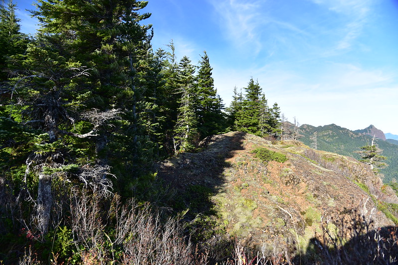
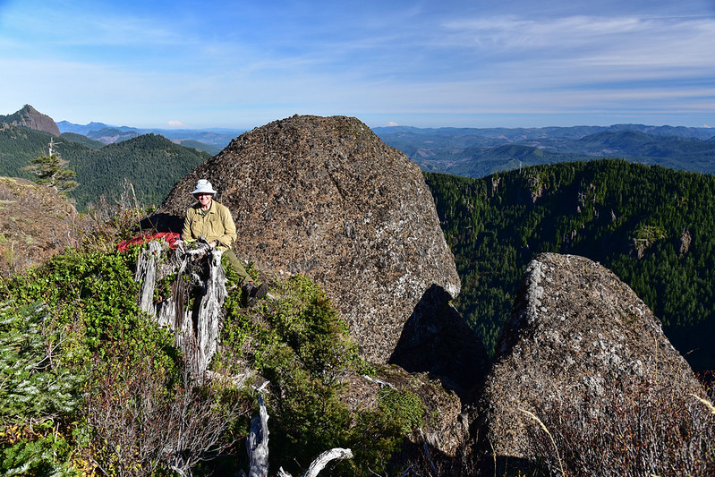
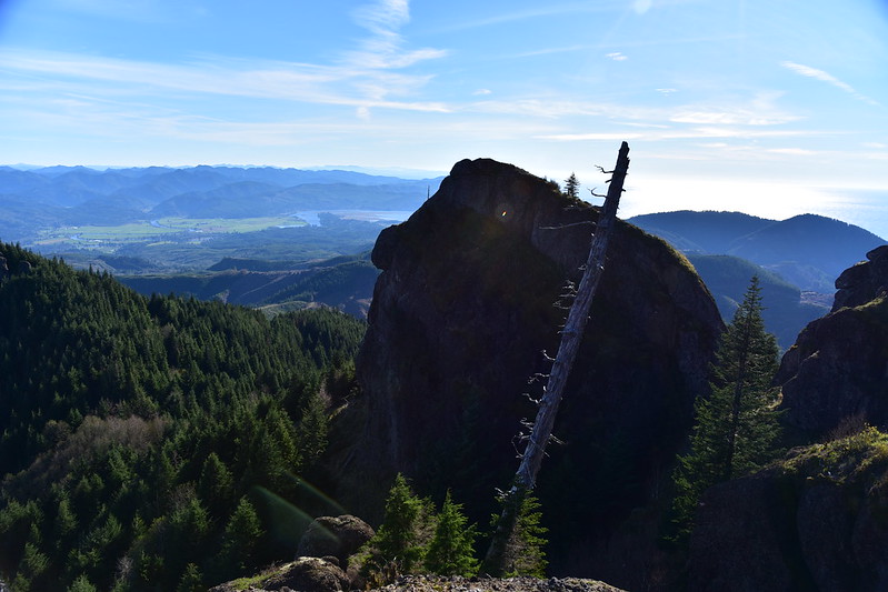
The road passes just below the peak but doesn’t go the summit itself. There is no trail that goes up there, but thanks to a waypoint from a geocacher we knew more or less where to leave the road and start scrambling up. This was another short steep scramble (burning thighs!) and then we emerged out into a summit-like area where there was an open rocky area and some trees. This was not the true summit, but it was very close and good enough for us.
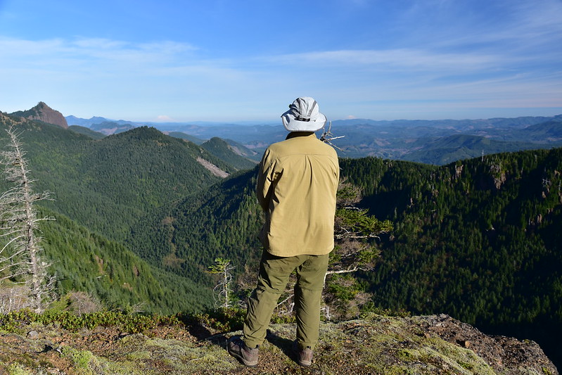
A fierce and raging wind was blowing from the east so we used this rock for shelter:
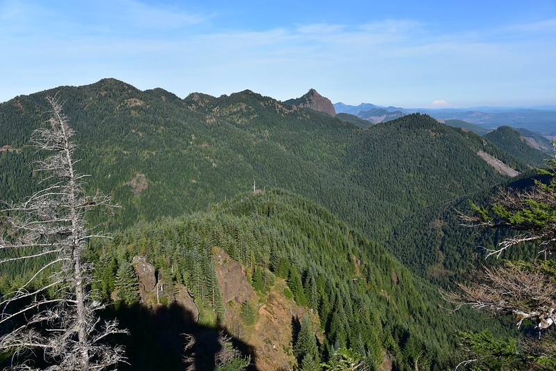
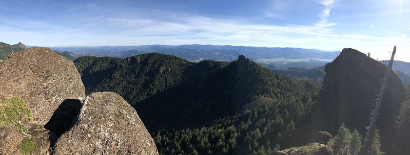
Looking east out over the Coast Range:
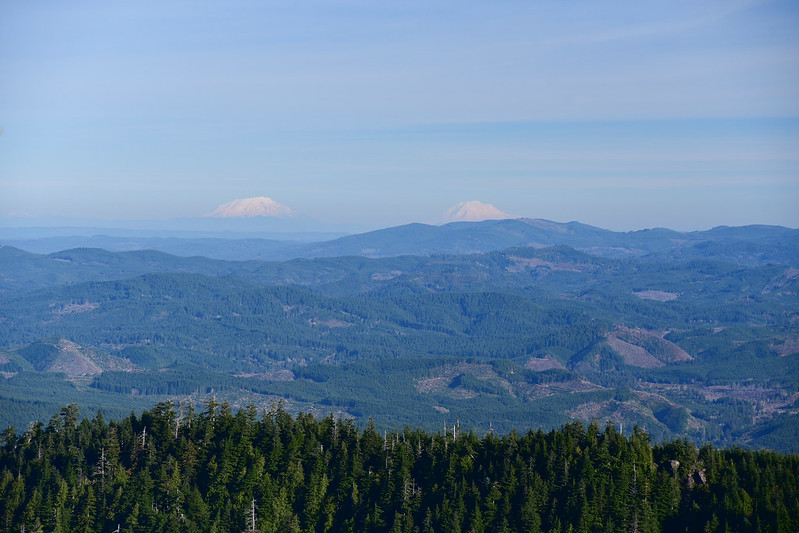
We were very pleasantly surprised to see distant volcanic peaks. Mt. Rainier:
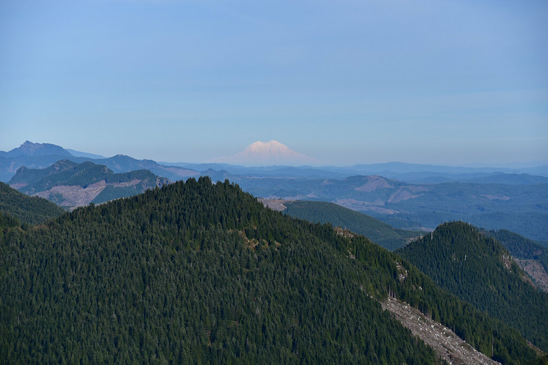
Mt. St. Helens and Mt. Adams:
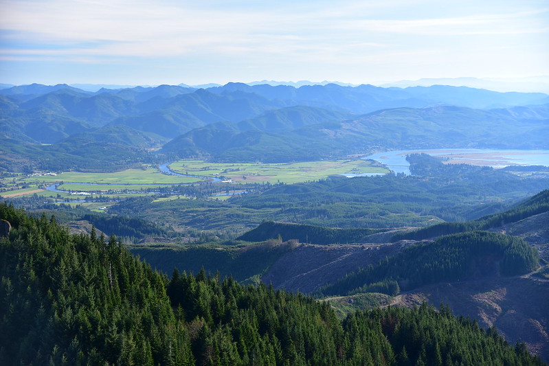
Looking south out over the Nehalem River and Nehalem Bay:
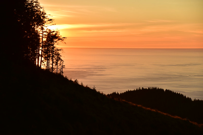
Looking west at the ocean (and straight into the late afternoon light):
We would have liked to stay longer and enjoy the fruit of our efforts, but the days are short this time of year so after 40 minutes we started heading back down:
We experienced a 40-minute delay for Greg to find a geocache (it required him to do some serious bushwhacking while I turned back and waited on the old road) we continued on. We reached the point where we had scrambled up the hill to join the upper road, and continued along that upper road:
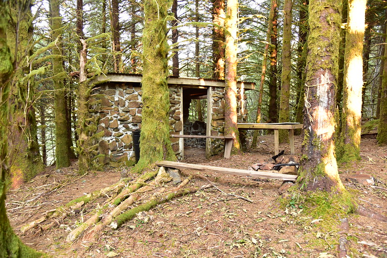
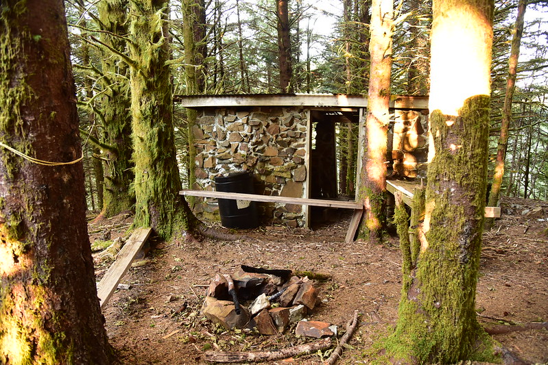
We took a short side trip to check out Sullivan’s viewpoint, which was pretty nice, especially in the late afternoon light:

There’s a stone shelter nearby, probably built by and used by hunters:
Continuing along the abandoned road we emerged out onto the main road and looked back. Well no wonder we missed this on the way up. I didn’t take a picture, but the turn from the main road onto the old overgrown road is not remotely obvious. There is no cairn and no flagging and you can’t tell there’s a path or old road there. Once you’re ON it then it’s easy enough to follow, but finding it would have been difficult. Sullivan had provided GPS coordinates for this intersection and we should have used them. Oh well, it all worked out in the end.
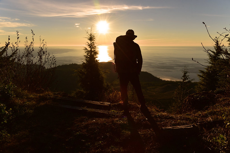
The sun was setting fast and it was obvious we would not be back to the car before the 4:50pm sunset. This actually turned out to be ok, though, and I discovered the usefulness of hiking through a hideous clearcut at this time of day: no trees to obstruct one’s view of the setting sun.
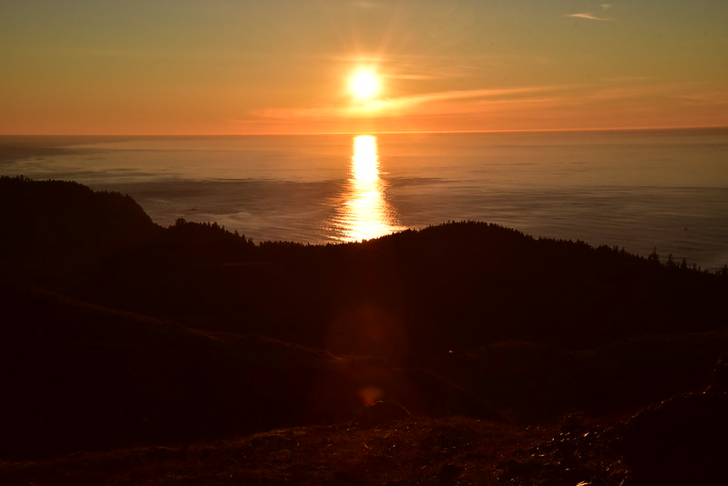
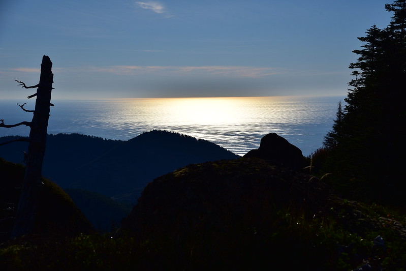
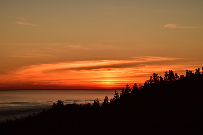
Our timing was actually perfect as we were high enough on the road to see the horizon and the sunset, which was quite pretty. The sunset faded right at the point that we were low enough to not see the horizon anymore, but there was just enough lingering light for us to see our way back to the car. I had my headlamp, but we didn’t end up needing it.
Well that was quite an adventure. We managed to cobble together the correct route (more or less) thanks to Sullivan’s book, the topo map, the satellite imagery, geocaches and their corresponding waypoints, and intel from SummitPost (thank goodness we had a data connection).
An interesting side note: my brother-in-law Karl was also up on Angora on Sunday. I had texted my sister that morning to tell her where we were going and she texted back that Karl was also hiking on Angora. He got an earlier start than us and is a very fast hiker, plus he was doing some side trips that we didn’t do, so he was ahead of us and we never saw him. In fact, other than the two hunters and two hikers we saw early on, we had the place to ourselves. Quite a welcome respite after the crowds on Neahkahnie the day before!
8.5 miles round-trip, 2,100′ elevation gain.
A quick note: this land has changed hands several times but is still owned by a timber company. They allow hunters and hikers in here and let’s help keep it that way. Please practice LNT while visiting Angora Peak.


