Friday, August 3, 2018
Friday was forecast to be cloudy with maybe even a bit of rain, so we decided to hike Deception Creek. The trail goes for nearly 12 miles all the way to Deception Pass. Some people use it to access Deception Lakes (which is actually over by the PCT), but that is about 10 miles one-way. Obviously we’d be doing neither of those. We planned to hike however far we felt like it then turn around.
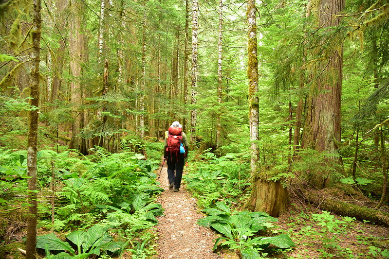
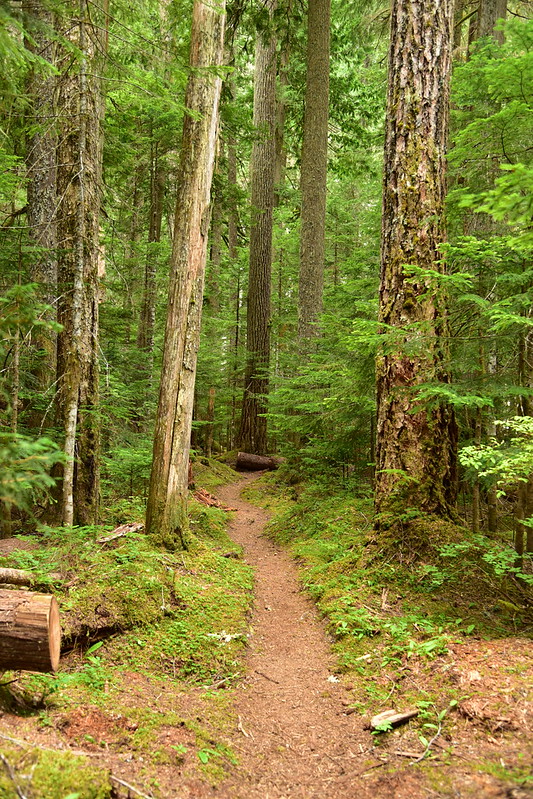
Heading off through the trees:
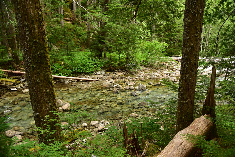
Deception Creek was beautiful and clear:
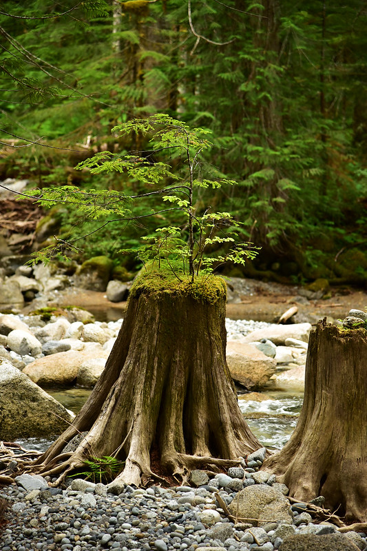
I loved this little nurse stump:
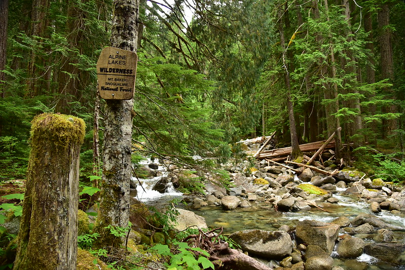
Soon we entered the Alpine Lakes Wilderness:
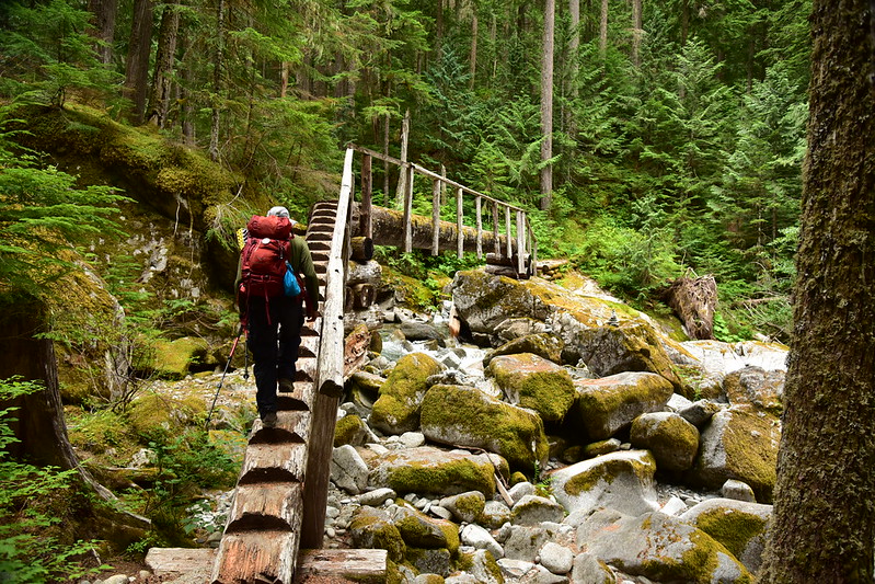
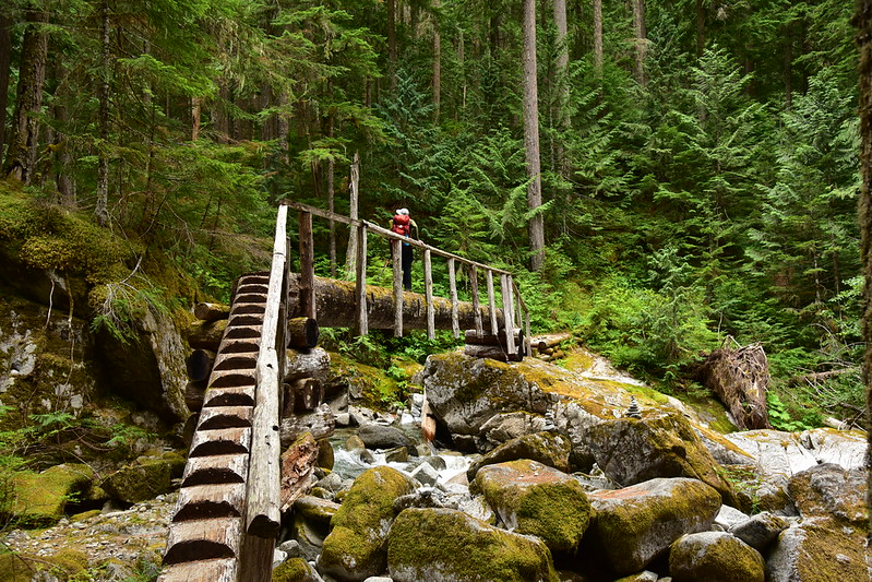
The trail crosses Deception Creek on this very unique footbridge:
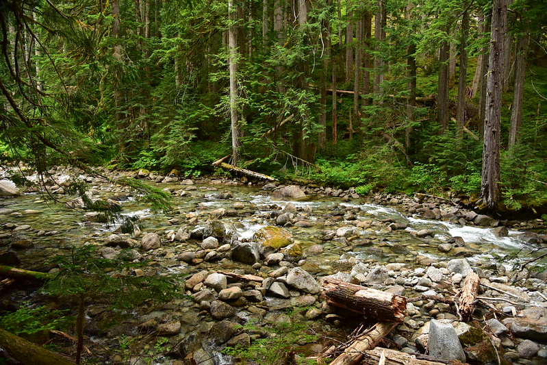
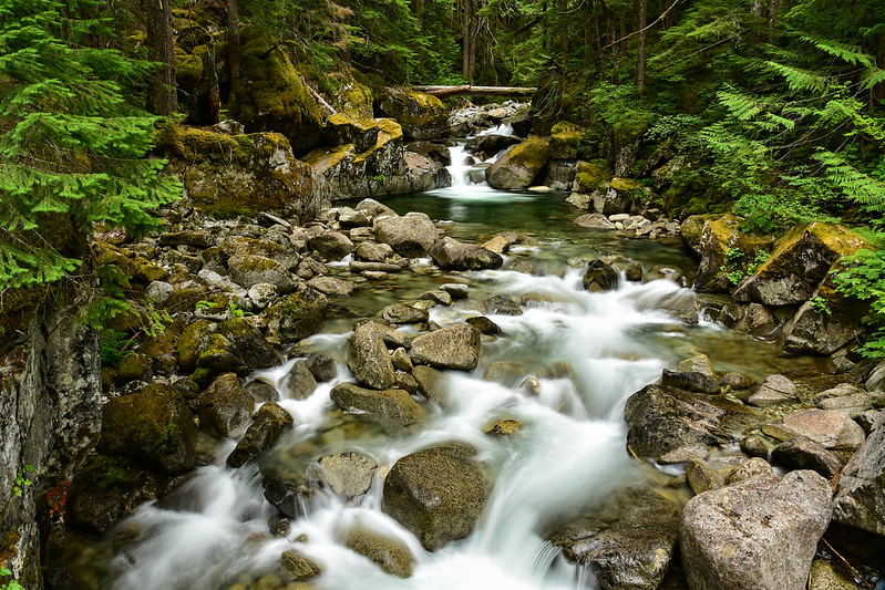
What a beautiful creek:
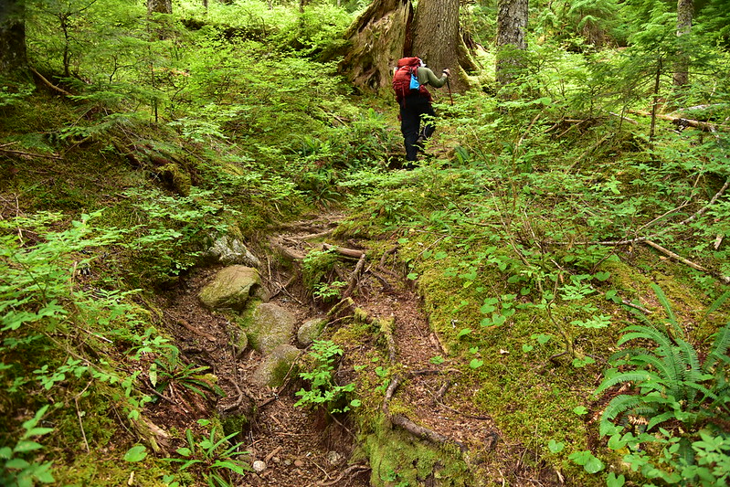
And then things got rough. The trail was in pretty bad shape with many exposed roots and rocks. Sometimes the trail looked like this:
But more often than not it looked like this:
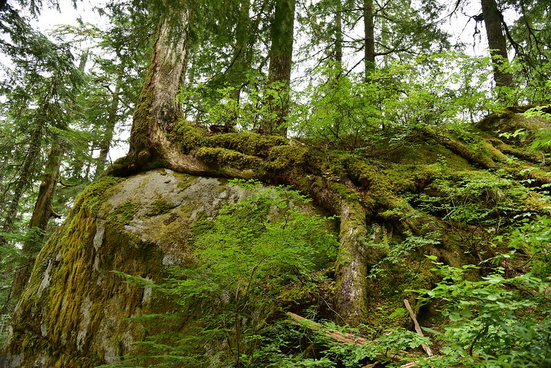
Not only that but the trailside vegetation was wet from rain the night before and it deposited all that water onto our pant legs as we hiked by. Before long we were both soaked from the waist down, including our boots. We decided to turn back after just two miles. It just wasn’t worth it. There wasn’t much to see anyway because the trail had climbed away from the creek. We did see this cool – and very determined – tree:
One quick note: the huckleberries were ripe and there were LOTS of them. That was an awesome silver lining!
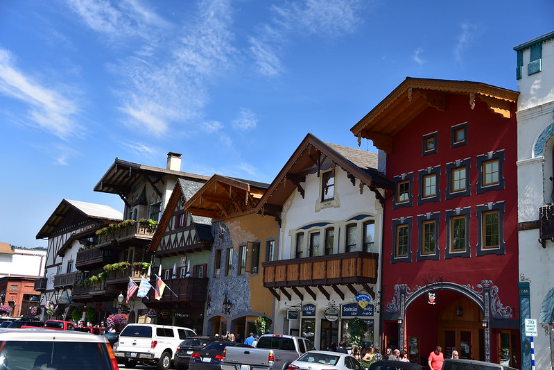
The day was young so we decided to head to the dry side of the Cascades and drove 45 minutes east to Leavenworth where the sun was indeed shining. This is a cute and strange little town. In the 1960s the town was struggling and decided to adopt a Bavarian theme as a way to revitalize the community. It worked and now it’s a booming tourist town.
It wasn’t even the weekend and there were SO MANY PEOPLE everywhere. So we went to a place off the main drag, Blewett Brewing, and had lunch. We walked around a bit and visited the bookstore before returning to the car before our parking meter ran out. We drove down Icicle Road a little ways then turned around and headed back towards the cloudy side of the mountains. On the way back we stopped at the Bygone Byways interpretive site:
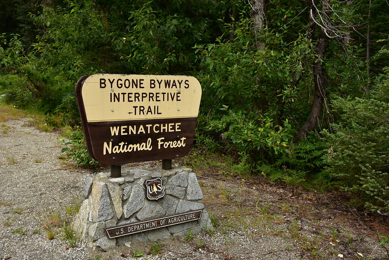
This is a cool little interpretive trail that explores parts of old routes that were once used to traverse this area: an old 1892 wagon route known as the Tote Road, the Great Northern railway line, and the 1925 Cascade Scenic Highway.
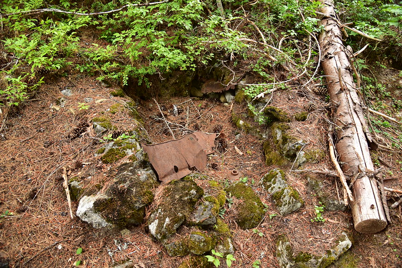
This is the collapsed remains of a stone oven, probably built by immigrant railroad workers from southern Europe to bake bread:
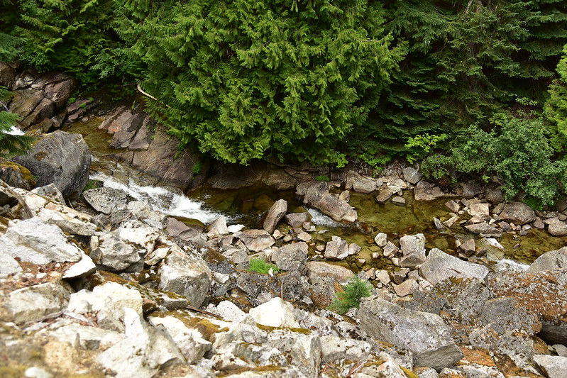
Looking down on Nason Creek:
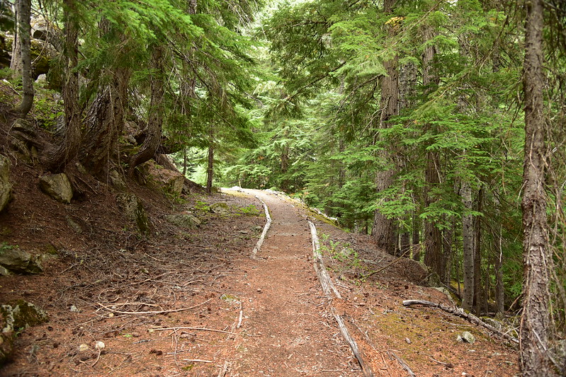
This is the old Cascade Scenic Highway, the first road to cross Stevens Pass. Back when this road was opened in 1925 the drive from Wenatchee to Everett took more than six hours (today it takes 2.5). This segment was abandoned in 1930 and eventually the entire route was replaced by the highway that exists today:
The campground was hopping that night with lots of people arriving in the evening looking for a site. We were glad to have the river right behind us to drown out the noise of our numerous neighbors.


