Saturday, September 28, 2025
Mt. Scott has been inaccessible all summer due to a road closure, but it recently reopened so I headed down there.
I camped in the national forest overnight, then drove into the park. The morning was cool when I set off on my hike:


After the first open stretch the trail entered some trees:

Back out of the trees I started getting some views. This is looking south with Mt. McLoughlin on the right:

Closer view of Mt. McLoughlin

Traversing the open slope:

A good view of Crater Lake:

A view of Mt. Thielsen as the trail cimbs:

First view of the summit and its fire lookout:


The trail crosses a sandy saddle on the final approach to the summit:


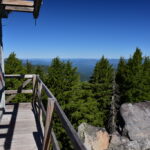
The 1952 fire lookout is a two-story 14×14 structure with a lower level and a fold-up catwalk. It is no longer staffed, but houses USGS seismic monitoring equipment:


The summit of Mt. Scott is promoted as being a place where you can see the entire lake end-to-end. My lens wasn’t quite wide enough to capture that here:

Looking north at Mt. Thielsen:

And distant Three Sisters barely visible:

Looking east:

Looking southwest at Union Peak:

Looking west across the lake at The Watchman:


View northwest of Mt. Bailey:

Heading down:


This hike looks daunting from below, but the trail is well-graded and the views at the top are well worth it!
Gaia stats: 4.5 miles, 1,200′ elevation gain


