Sunday, May 5, 2019
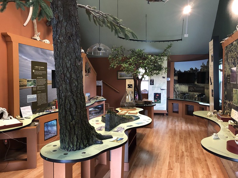
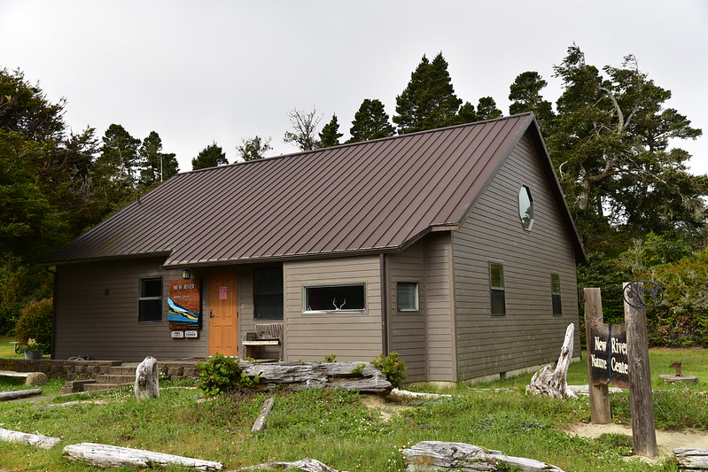
Our first stop this morning was the New River Nature Center. We could find no information about its hours online and there was no recording at the number that’s listed for it. So we took a gamble. When we arrived around 9:15 the place was locked up with no posted hours. A volunteer was inside and heard us. It turned out the place didn’t open until 10am, but he opened the door and let us in to have a look around. He sure was a chatty fellow!
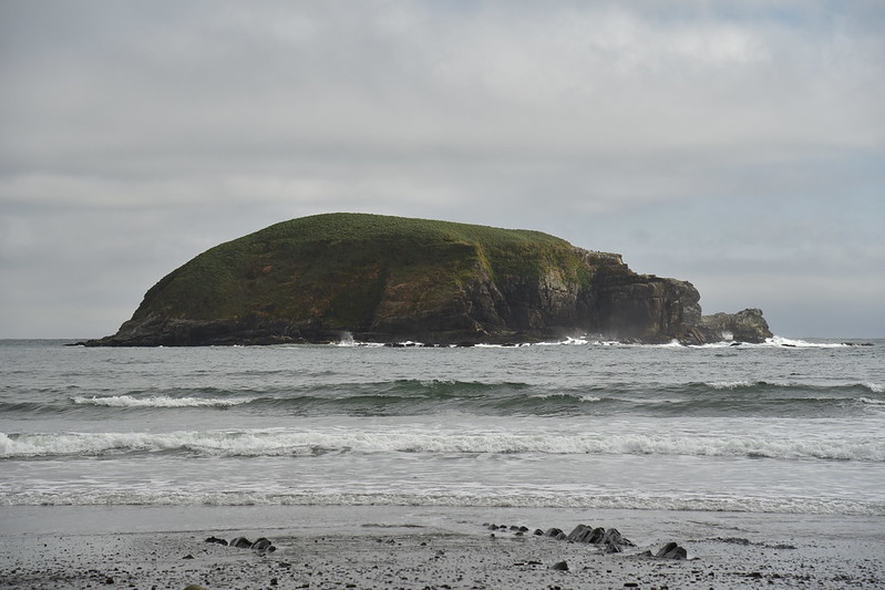
Do you see the resemblance?

We went down to the boat ramp to see the New River, so-called because an 1890 flood created this miles-long “moat” paralleling the ocean:


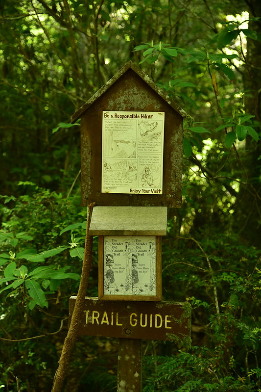
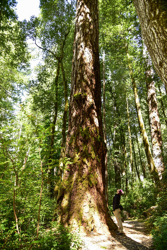
Then we drove south down to the Gold Beach area, and drove inland a bit into the Rogue River-Siskiyou National Forest to hike the short Frances Shrader Old Growth Trail, dedicated to Frances Shrader, a long-time employee of the Forest Service who was instrumental in developing plans for this trail:

As the name of this trail implies, there are some huge Douglas Fir and Port Orford Cedar in here:


This is a scar from a very very old trail blaze:


Our next stop was the nearby Myrtle Tree Trail:

This is the largest myrtlewood tree in the world!


We drove into Lobster Creek Campground, right next to where Road 3310 crosses over the Rogue River. There’s a boat ramp here and a huge gravelly beach. It was pretty quiet here today, but I bet it’s very busy in the summer:

After lunch in Gold Beach, our next stop was the Cape Sebastian State Scenic Corridor. (The name comes from Sebastian Vizcaino, who explored this area in 1602 on behalf of Spain.) This park has the distinction of having the highest overlook reachable by car on the south coast. We parked in the south lot, where we would normally have views, but today it was totally socked in, even though it had been beautiful and sunny just a few miles north in Gold Beach:

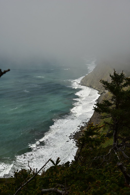
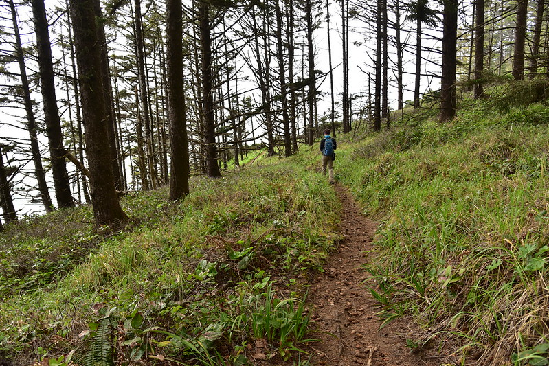
We hiked the trail south (described here):

Red lichen on the cliffs:

The trail started descending and in addition to some poison oak we saw lots of these pretty purple flowers (I believe they are Blueblossom ceanothus):


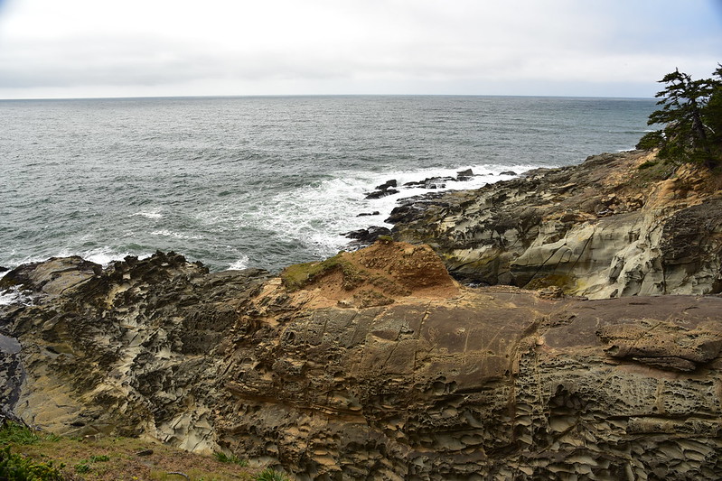
We continued to descend down, down, down:

The rock here is pockmarked, which is known as tafoni:


The trail continued on to Hunters Cove (named for the 19th century hunters who killed sea otters for their pelts):


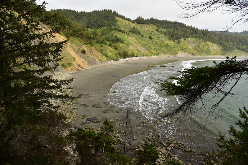
Now we can see the beach at Hunter’s Cove:

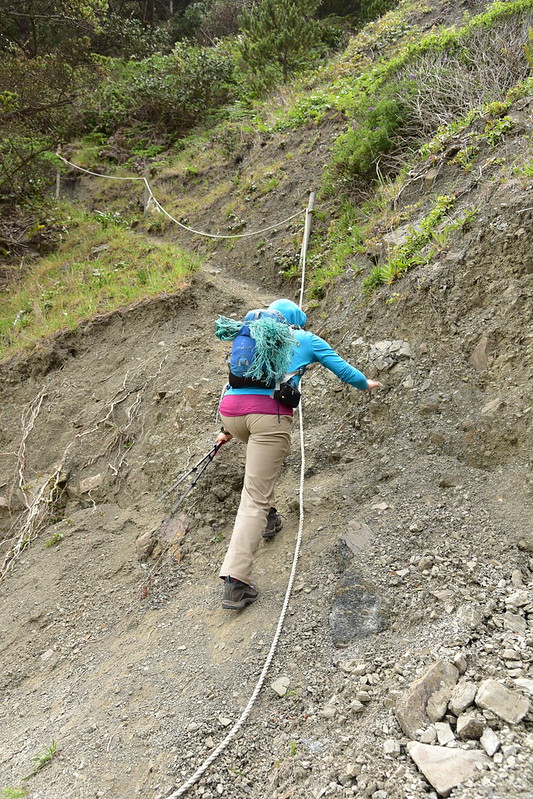
The trail kind of peters out above the beach and you have to scramble down a crumbly slope with the aid of a rope. This is Deb climbing back up when we left:
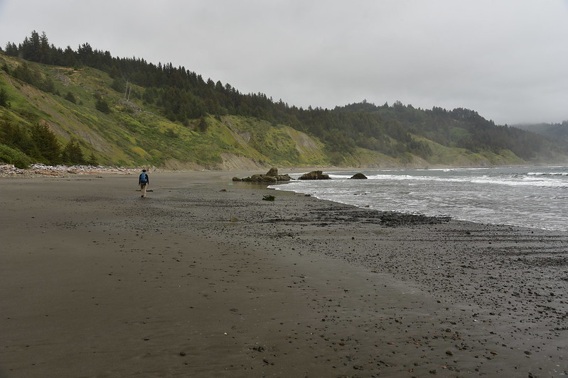
Hunter’s Cove is big and lonely. We walked a short distance on the beach, which was completely deserted:

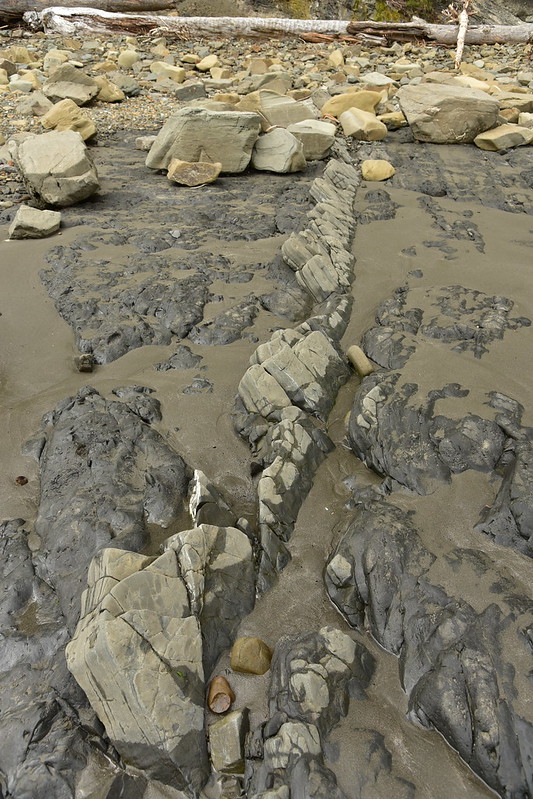
Cool tilted rocks in the sand:
The high tide line goes right up to the base of the cliff, so it’s good we didn’t visit during high tide!

Hunter’s Island looked like a hippo:
Looking south toward Cave Rock and Meyers Creek. If we had the time and inclination we could have hiked on the beach all the way down there:

We scrambled back up to the trail and got one last view of Hunter’s Cove before starting our hike back up to the car:
As we reached the top of the headland and the parking area the clouds FINALLY started burning off and revealing views to the north:
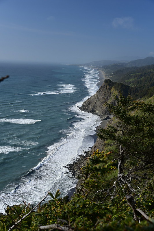
We could see north to Gold Beach, and the distant silhouette of Humbug Mountain:


