In late July 2010 Greg and I went to Mt. Baker. Unfortunately that was the godawful year when the excessively heavy snowpack didn’t melt until Labor Day. We couldn’t get to Artist’s Point and almost all the trails in the area were still buried under snow when we were there.
So we decided to go back. We had a 10-day trip planned; two days of driving there and back, a day of rest, and seven days of day hikes. As you will see, it didn’t work out that way.
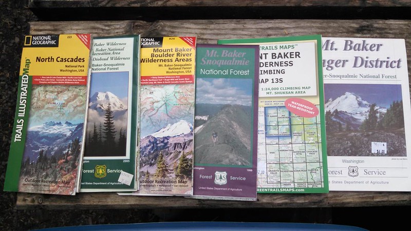
I don’t think we’re going to get lost on this trip. (I may have a slight addiction to maps.)
Friday, August 8: Portland to Marblemount
Traffic: horrendously awful
Time it took to drive 280 miles: 8 hours
Which works out to an average speed of: 35 MPH
Number of sighs I emitted as we crawled across Washington: too many to count
Bags of ice that melted in the two coolers in the hot south-facing back of the car during the day: 6
Number of available campsites at Marble Creek Campground: 0
Kindness of camp host who let us pitch our tent in the campground’s picnic area: greatly appreciated
Rewarding moment of the day: hearing an owl hooting nearby just before we went to sleep
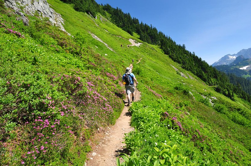
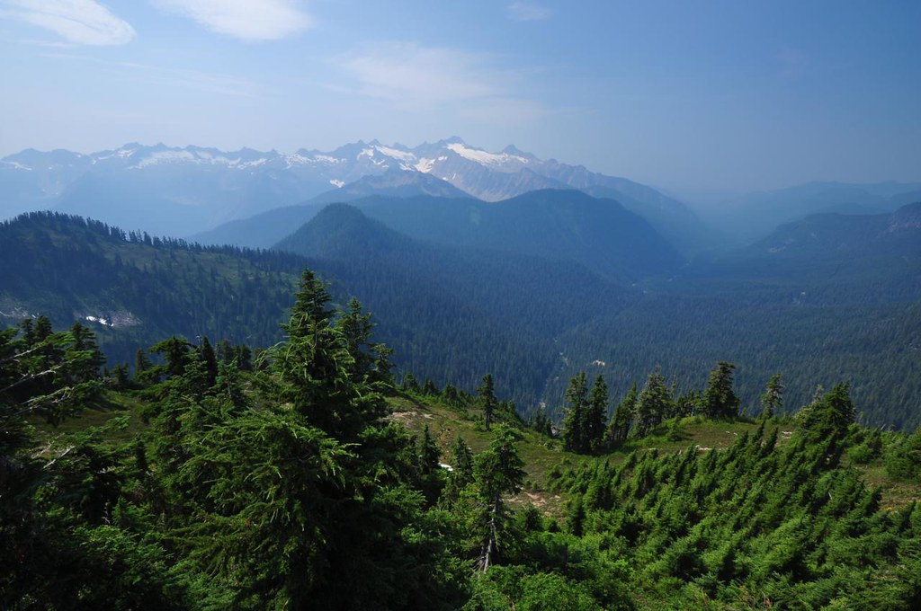
Saturday, August 9: Hidden Lake Trail
9 miles round-trip
3,300 feet elevation gain
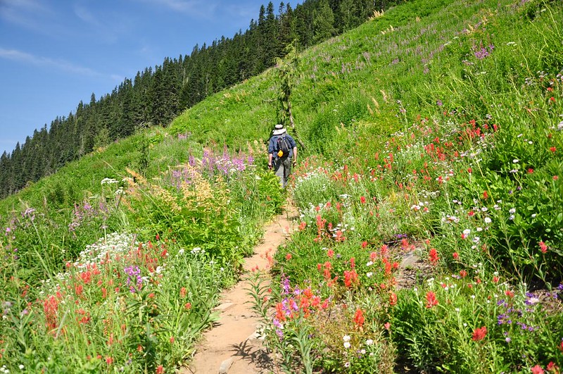
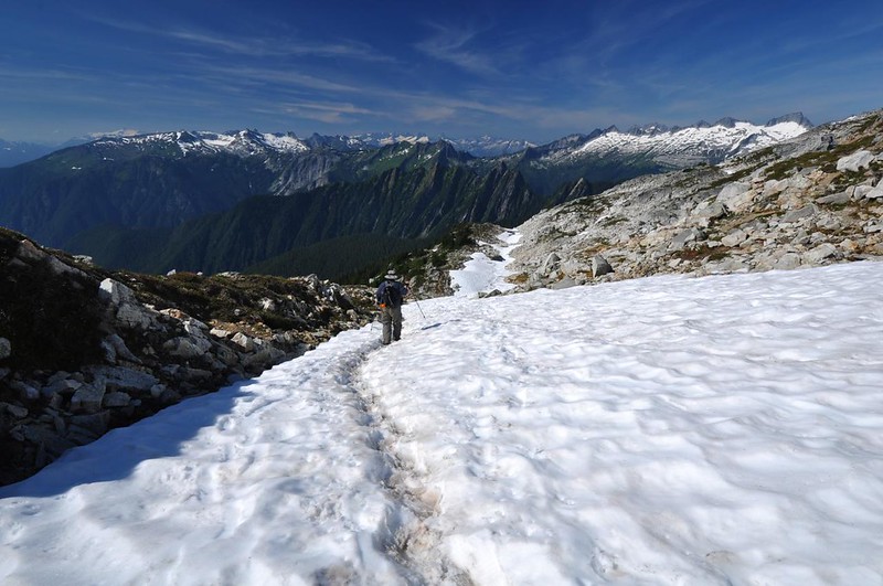
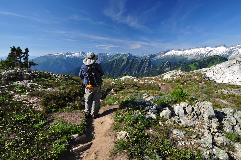
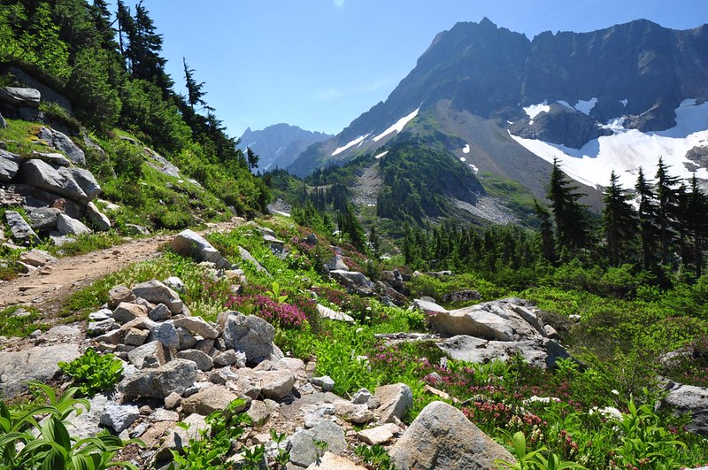
After driving several miles on a steep, rough, narrow road (better hope no one is coming the other direction!), we hit the trail about 10:15. You start out in the trees for about a mile, then break out into a big meadowy bowl up which the trail switchbacks. As we climbed, we started to see lots of wildflowers.
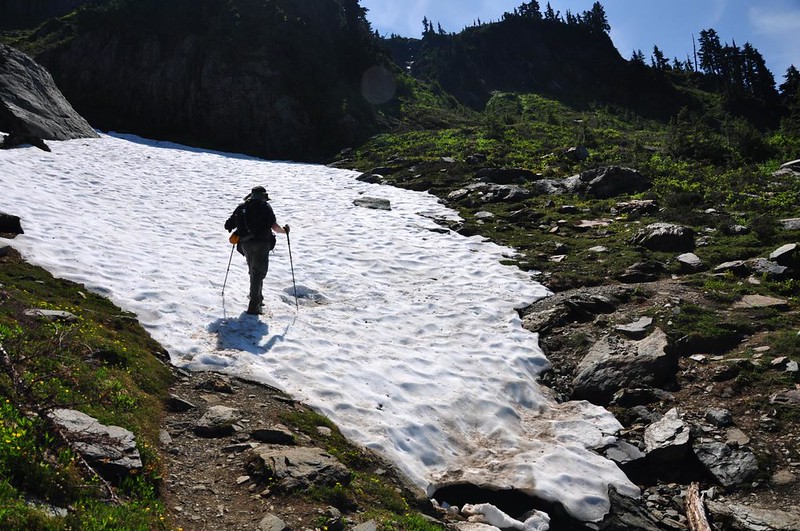
The hiking books all talk about a steep snowfield that is dangerous to cross early in summer or in years of late snowmelt. I assume this was it, even though it was extremely tame.
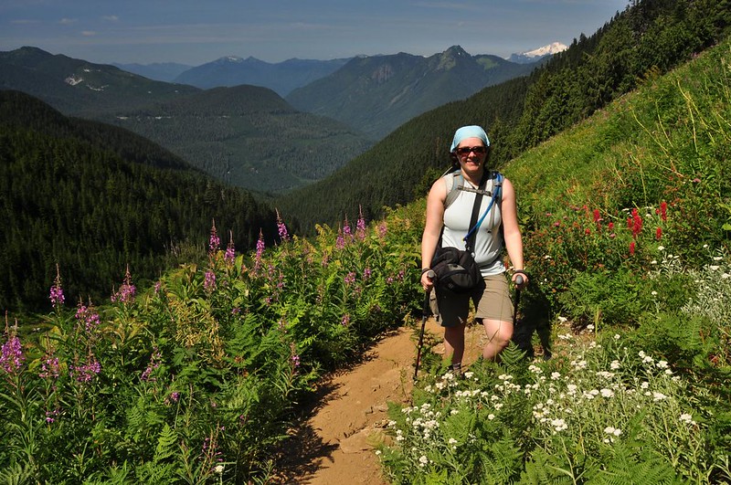
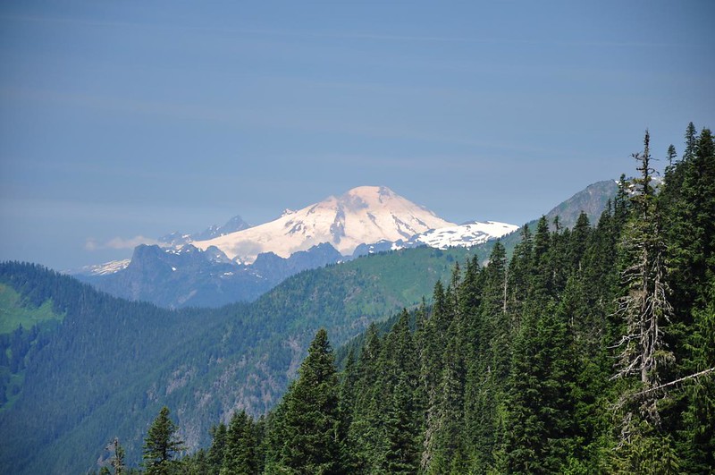
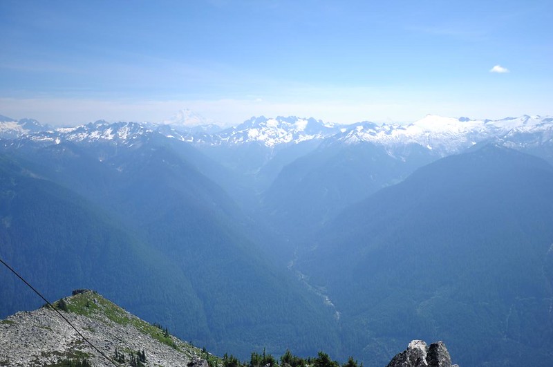
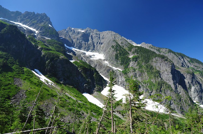
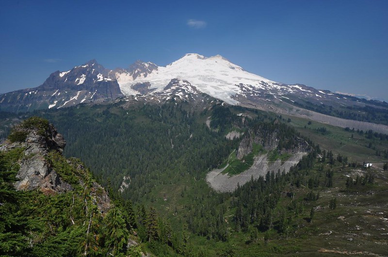
As we climbed, we started seeing more and more mountains, including Mt. Baker, which was shrouded in smoke from wildfires.
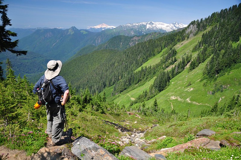
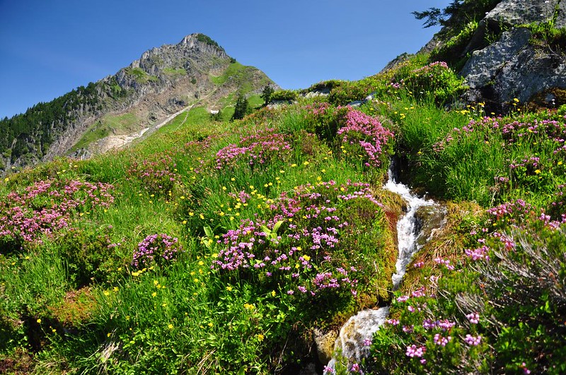
We were hiking through an alpine wonderland and as luck would have it we just happened to catch the heather at peak bloom. It was absolutely glorious!
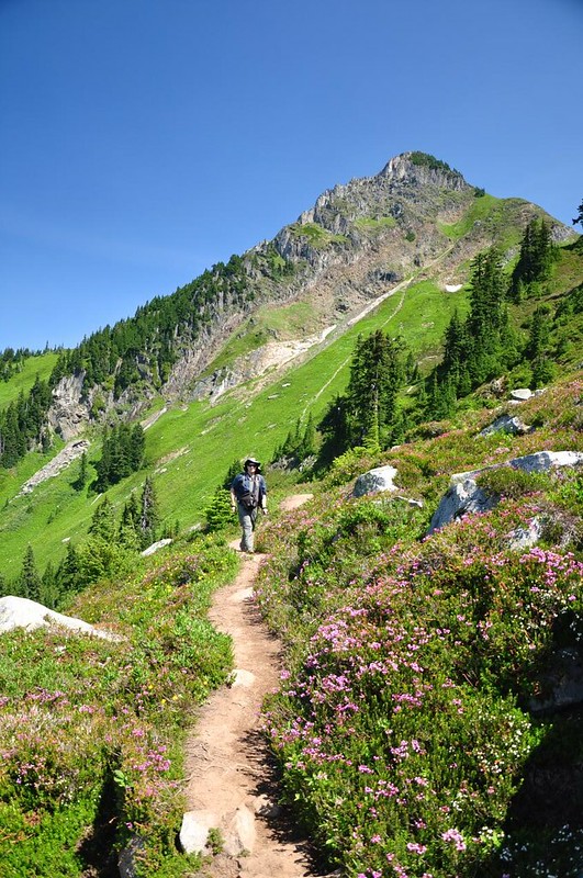
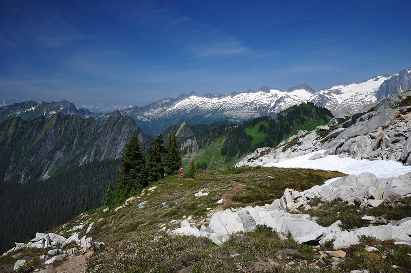
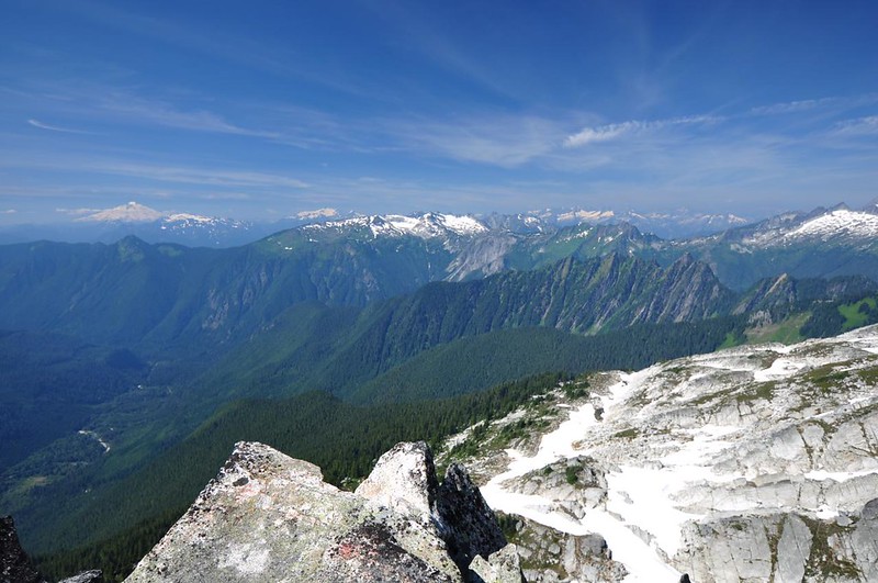
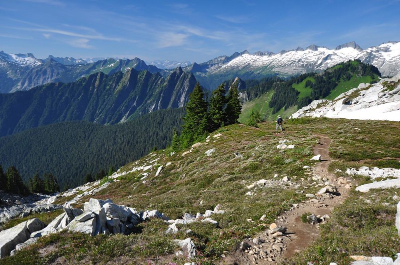
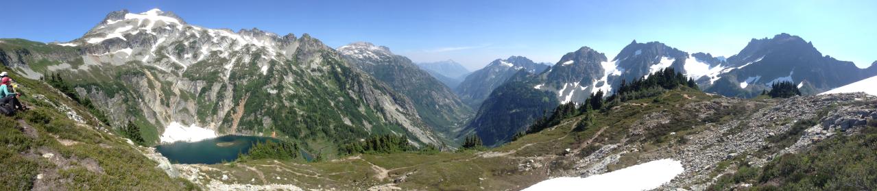
Greg’s foot was bothering him, so we’d been keeping a pretty slow pace. Also, he’s a very methodical photographer, and there was a lot to photograph, so at some point he fell behind and I kept going. I came around a corner and finally saw the lookout atop Hidden Lake Peaks, at center below (the other part of the peak is out of sight from this angle).
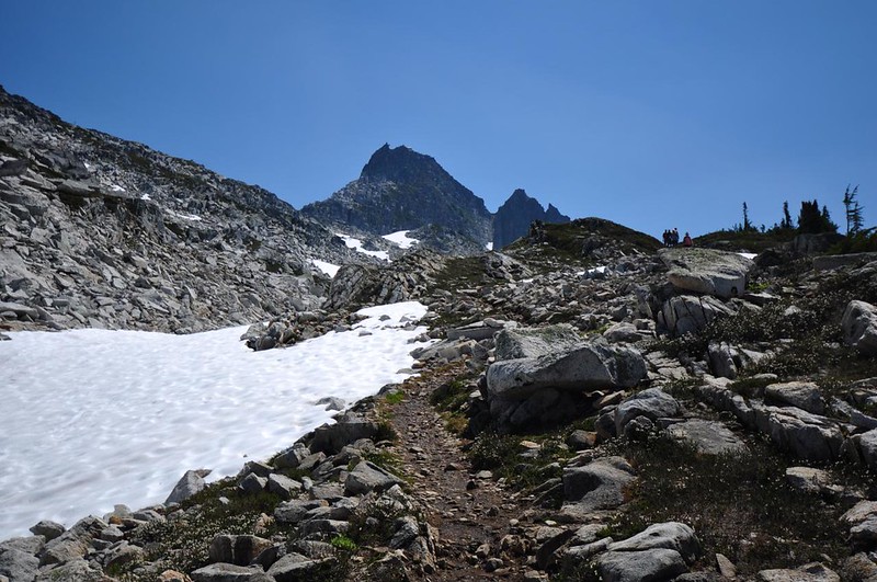
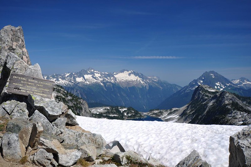
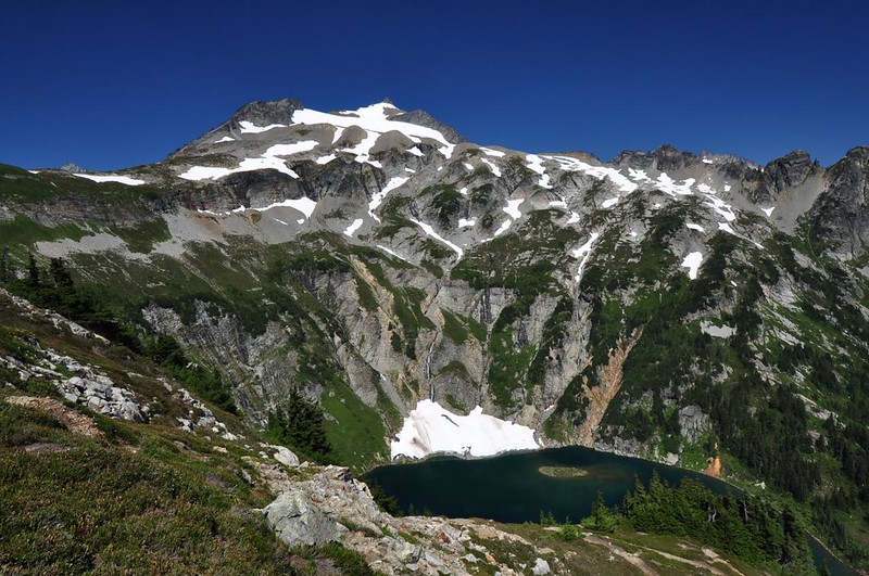
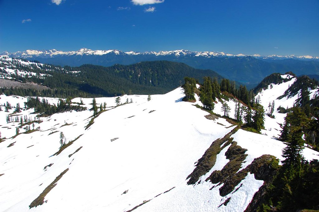
It was still really far away! This was a very disheartening moment. I had done so much climbing already and there was still so much further to go. But I pushed on, crossing several large snowfields that had yet to melt. FINALLY I reached the saddle between the two peaks. The trail officially ends here, although you can scramble up either of the two summits or down to the lake. A sign informs hikers that if they proceed they’ll be entering North Cascades National Park.
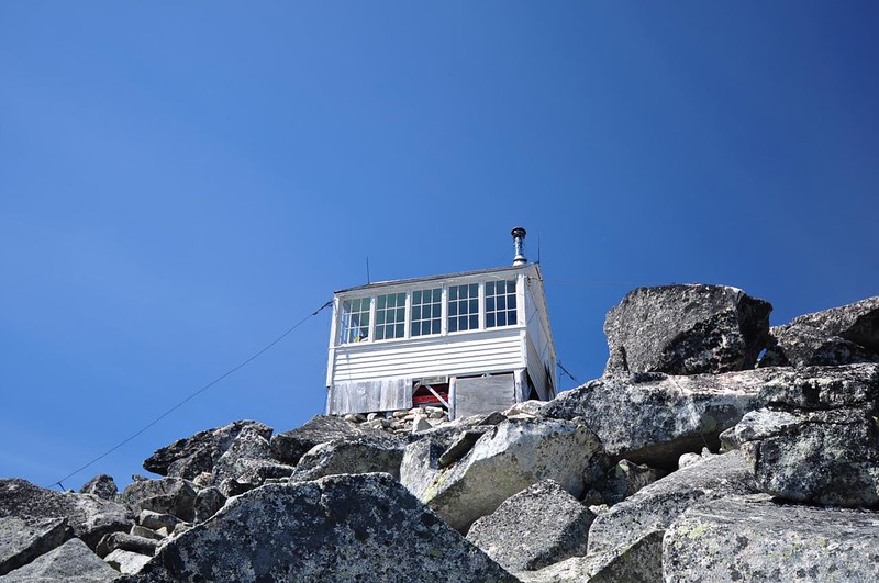
By now I hadn’t seen Greg in quite a long time and I figured his foot and stopped him from continuing and he was waiting for me somewhere back on the trail. So I made a quick scramble up to the lookout to find the geocache and photograph the lookout. There is a trail for a bit, then you have to scramble over enormous boulders to get to the top.
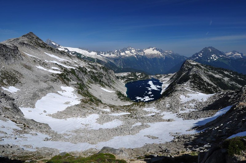
The geocache was gone, but the views were intact! 😀 Looking north:
A very smoky view to the south:
Looking down on Hidden Lake and the very rugged mountains of North Cascades National Park:
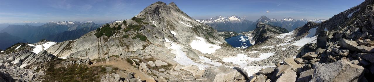
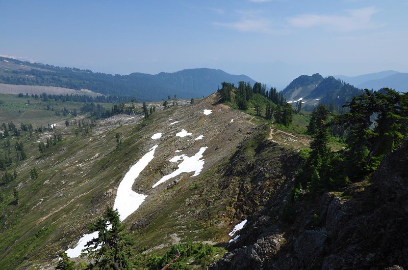
By the way, there are some really ominous peak names in these parts, including Forbidden Peak, Damnation Peak, Mt. Terror, Mt. Fury, and Mt. Despair. Sheesh! Makes you wonder if all these peaks were named by the same person, and what was going through their mind! After a few quick pictures I headed down and was surprised to find Greg waiting for me at the saddle. He had made it that far before “running out of gas” he said. Here is an iPod Touch pano he took from that spot (the foreground peak at of center is the other part of Hidden Lake Peaks; the lookout is on a peak behind us):
We sat and enjoyed the view for awhile before heading back down, enjoying the expanse of mountain views as we descended.
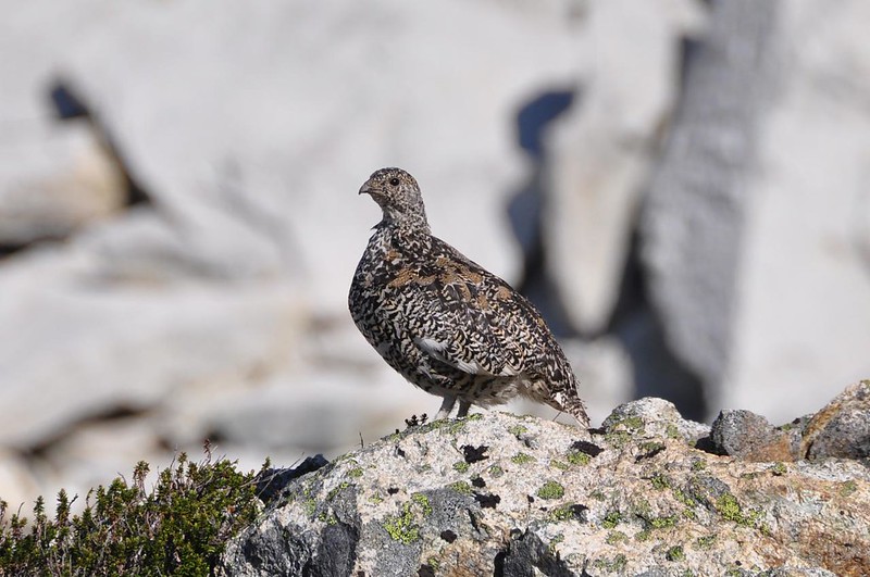
On the way down we saw a grouse family! We kept our distance but watched the four babies and snapped pictures. Here’s one of them:
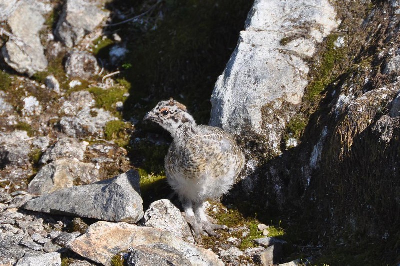
Mama kept a wary eye on us.
Nine hours after starting out we got back to the trailhead at 7:15, tired, dusty, and hungry. This was a VERY tough hike due to the elevation gain and the fact that you are hiking in open sun for most of the time. But the scenery was spectacular! I’m glad we did it.
Sunday, August 10: Cascade Pass
9.4 miles round-trip
2,600 feet elevation gain
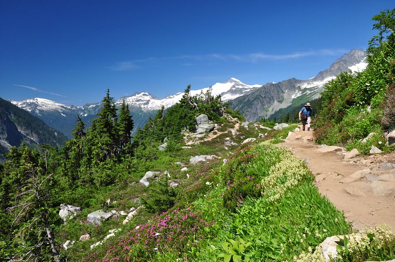
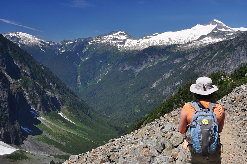
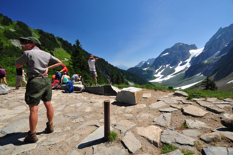
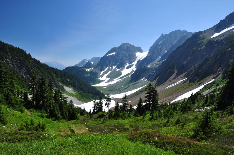
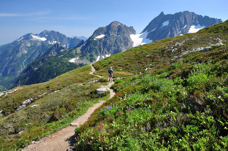
The trail up to Cascade Pass is the most popular hike in North Cascades National Park, despite the fact that you have to drive 23 miles down Cascade River Road (more than half it gravel) to get to the trailhead. We knew it would be crowded on a Sunday, but we were leaving the area that evening, so it was now or never. The views start at the trailhead, where mountains tower above you in every direction. As I read somewhere, it is Washington’s most scenic parking lot. 😀
After gaining a lot of elevation via 33 well-graded switchbacks in the shady forest (where we had PLENTY of mosquitoes for company), the trail breaks out above the tree line. Let the gawking begin!
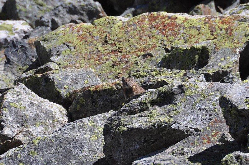
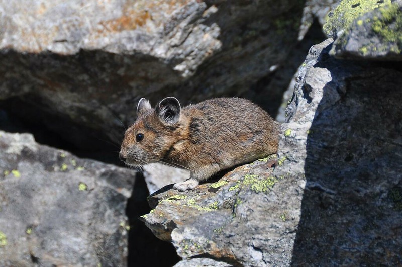
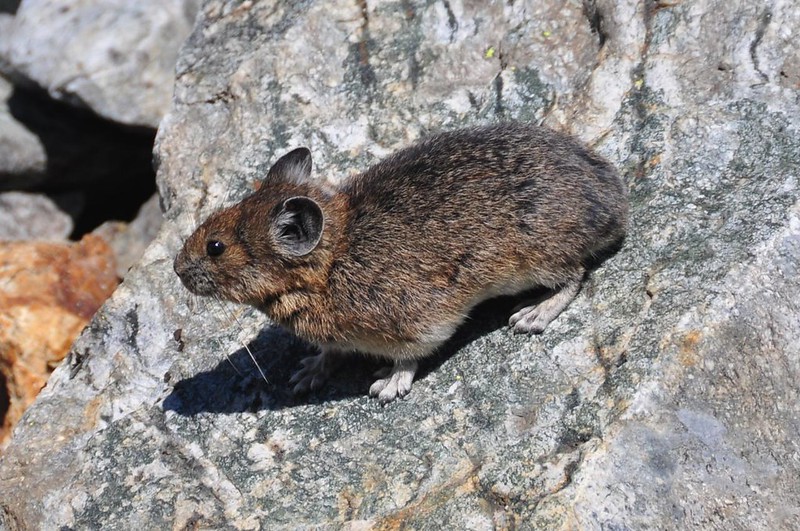
Of course we heard pikas in the rockslide areas. We always do. But it’s rare to see them, and even rarer to see them for more than a few seconds. But to our delight this little guy acted curious. He started out on the rocks high above us, then eventually made his way down to trailside until he was about two feet away, where he scampered around for several minutes posing for us (or so it seemed). Greg (the pika papparazzi!) got these great pictures. We couldn’t believe our luck!
On to the pass! It was pretty crowded there, as we knew it would be. We hadn’t gone more than 10 minutes on the trail without seeing other hikers.
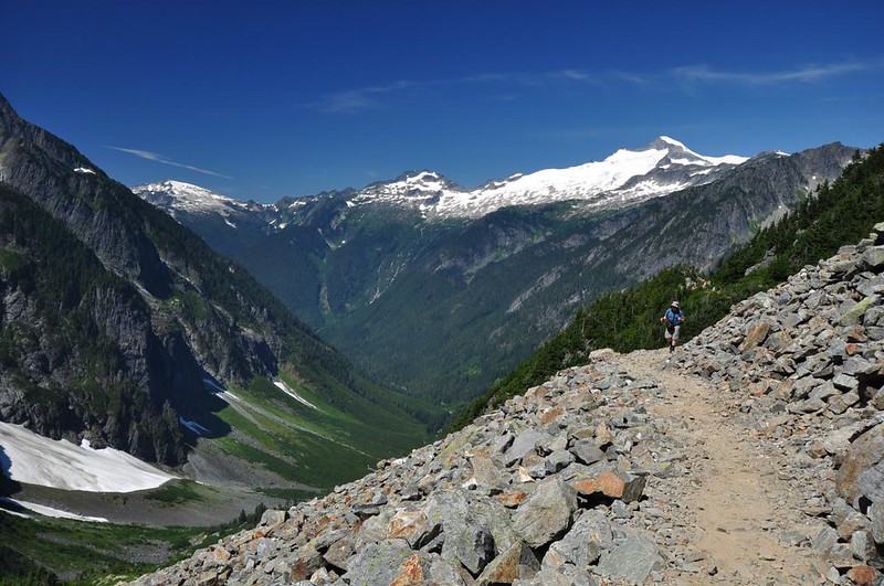
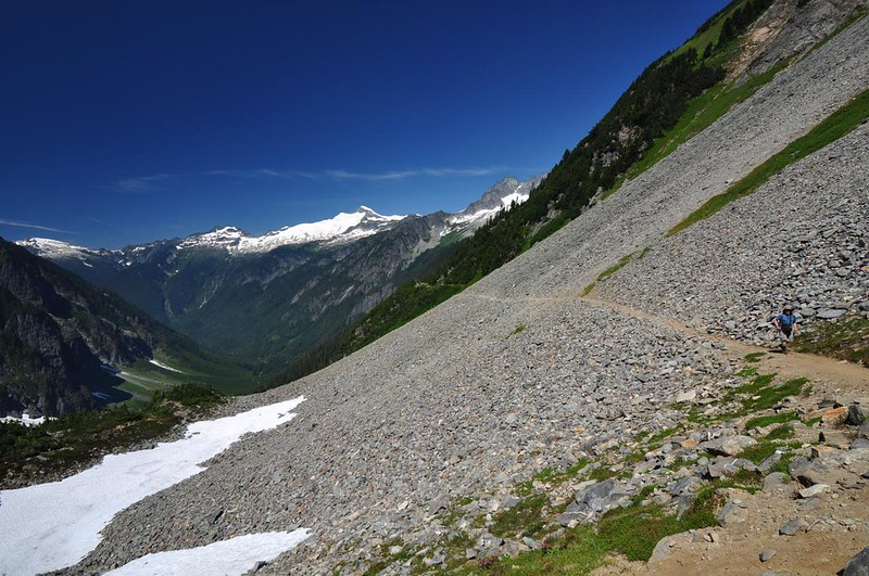
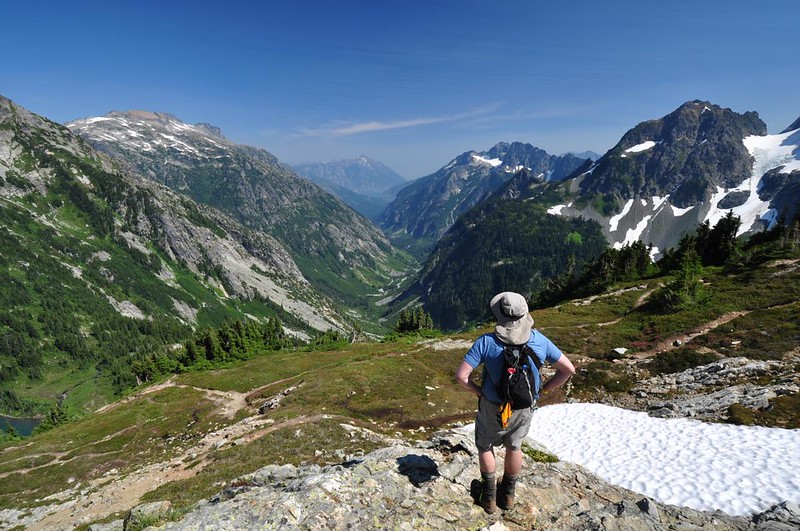
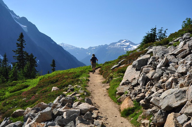
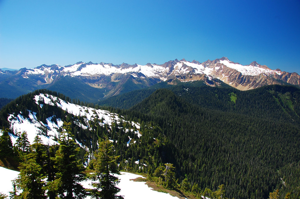
The views were great at Cascade Pass, but we decided to continue one mile further up Sahale Arm for even better views. I could use a lot of inappropriate expletives to describe this “trail” (ha!) but I’ll keep it clean and just say that it was rough, rocky, and steep and that it SUCKED. (Although it WAS scenic, I’ll give you that.)

Finally we reached our destination: the viewpoint over Doubtful Lake (we didn’t have the time or energy to go down to the lake or to go all the way to the end of Sahale Arm). Views were spread out at our feet. WOW.
Here is a pano Greg took with his iPod Touch:
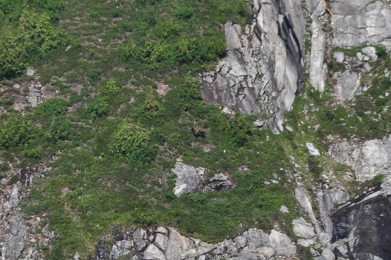
Earlier at the pass we had heard hikers tell a park ranger that a bear had been seen swimming in the lake. She said it was probably a black bear because there really aren’t any grizzlies in the park. By the time we got up to the lake viewpoint the bear was no longer swimming, but he was roaming on a steep grassy slope above the lake. He was REALLY far away, but you can just make out a brown blob in the center of the photo below. That’s him (or her).
We sat and ate our snacks and soaked up the jaw-dropping scenery before tearing ourselves away to head back down to the pass, then back down the trail to the car. So hard to leave.
That evening we moved camp over to Boulder Creek (near Baker Lake) to be close to our next hike. We had a signal briefly and saw that the weather forecast had changed dramatically from the last time we had seen it. After Monday the rest of the week was not looking good at all. This put a big damper on the jubilant mood we’d had from two days of breathtaking hikes. We decided to carry on with our plan for Monday, and check the weather again on Tuesday, which was our rest-and-shower day.
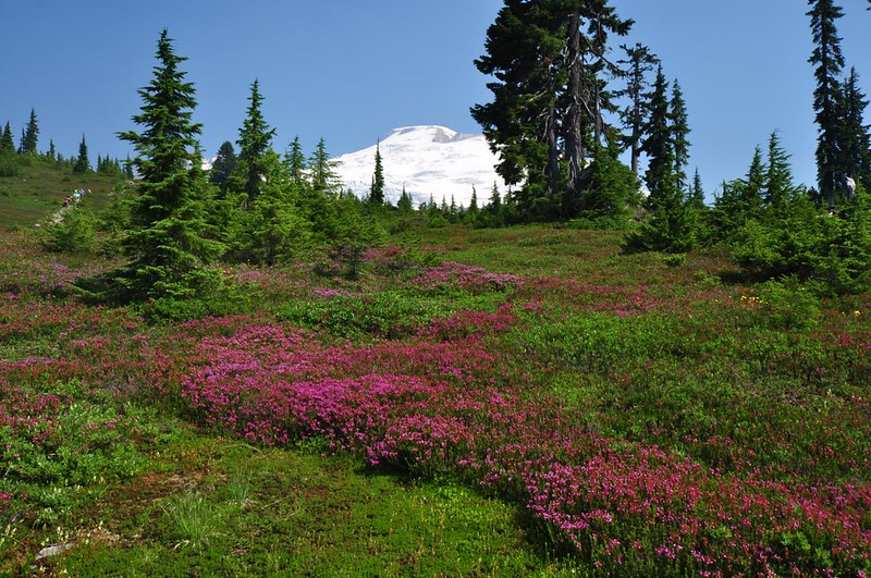
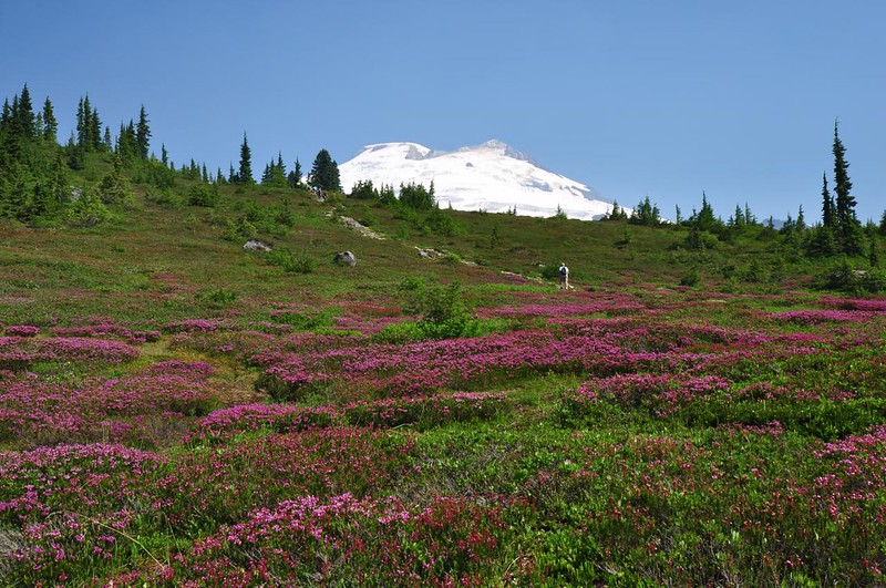
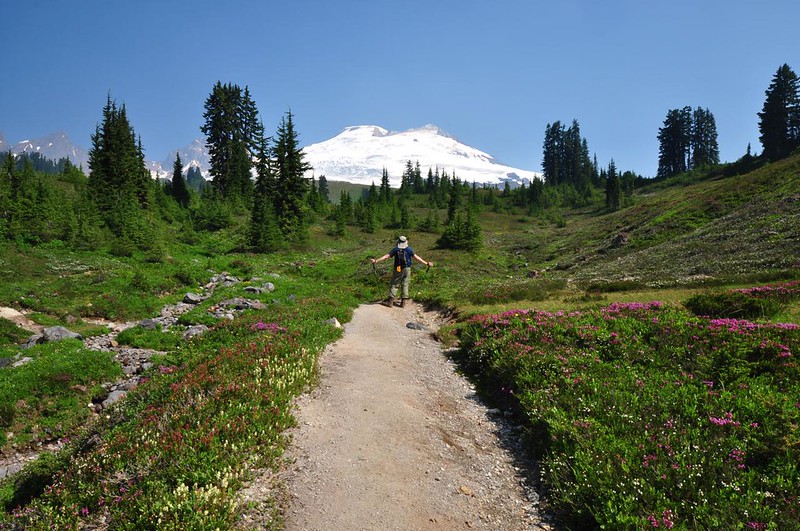
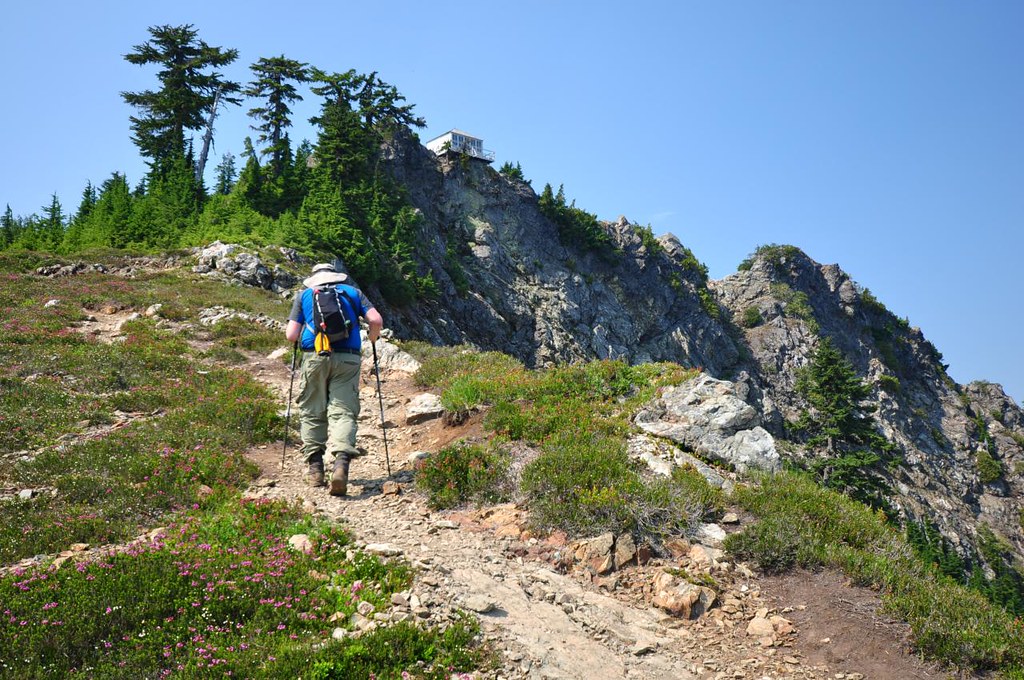
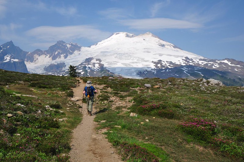
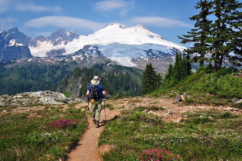
Monday, August 11: Park Butte
7.5 miles
2,200 feet elevation gain
When we did this hike in 2010 the upper parts of the trail were totally buried under snow. So we were looking forward to doing this hike again, sans snow. We also got to enjoy a MUCH less crowded weekday hike here this time around.
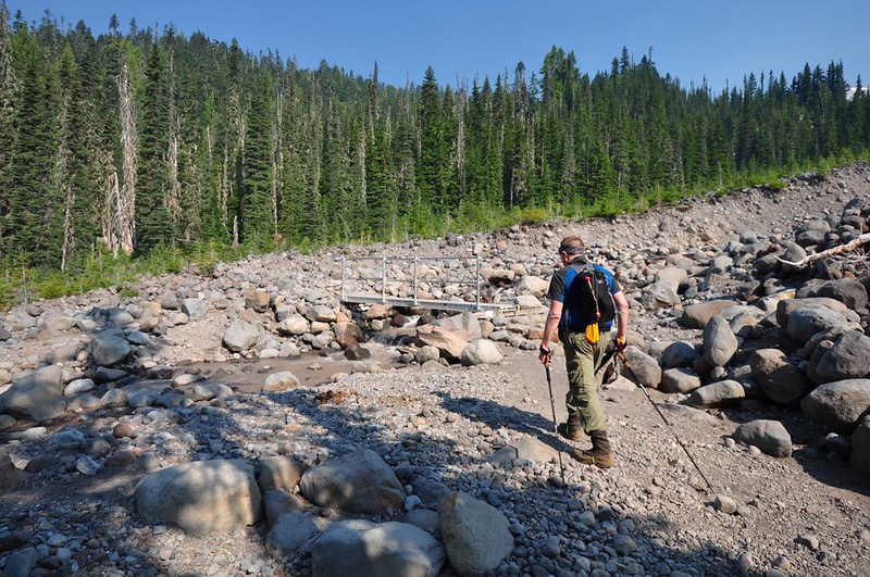
We could see and smell smoke right from the trailhead, which would not really let up for the whole hike. Rocky Creek was bridgeless three years ago, but has a bridge now.
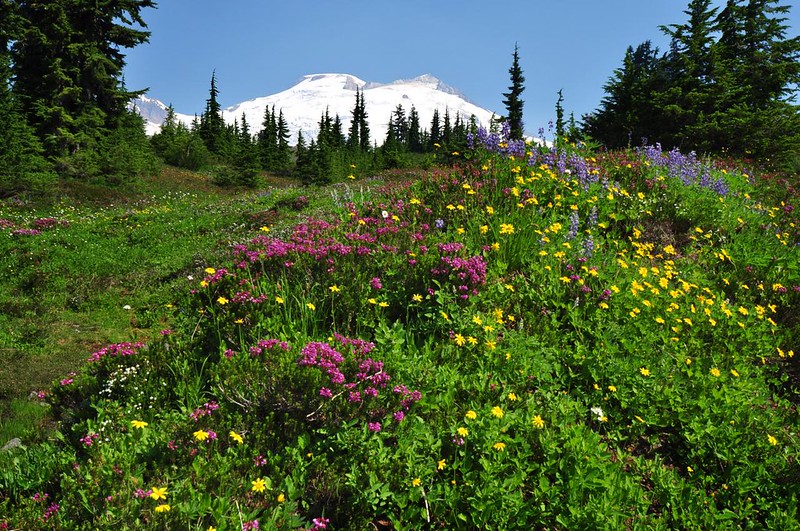
After climbing up, up, up through the trees (where huckleberries made for tasty snacking) the trail breaks out into the alpine meadows. In addition to the in-your-face Baker views there was heather blooming EVERYWHERE, as well as some other wildflowers. This was all buried under several feet of snow last time so we were blown away with this flower display.

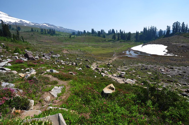
The trail crosses a big depression/bowl before climbing again. Here is the bowl on July 24, 2010:
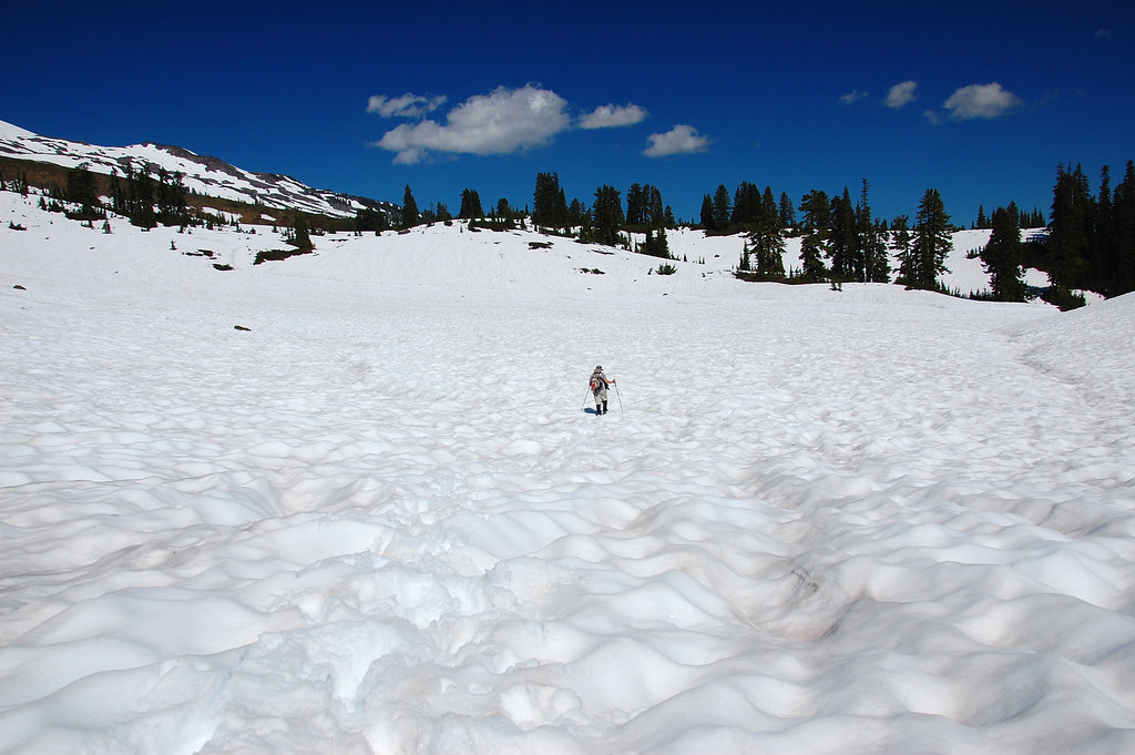
A MUCH different look on August 11, 2014:
We took a side trip to the famous mountain-reflecting tarns (buried under snow last time) where we rested for awhile and soaked in the awesomeness before moving on.
Almost there!
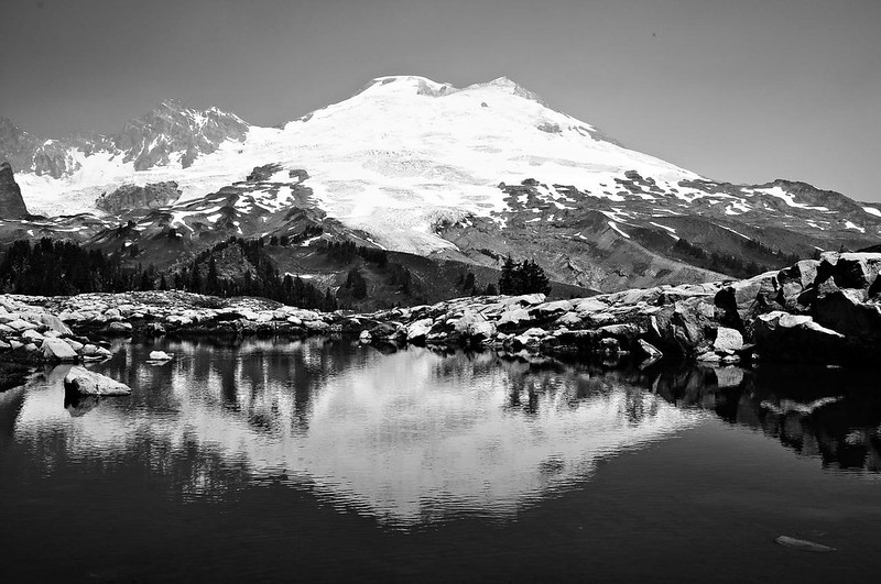
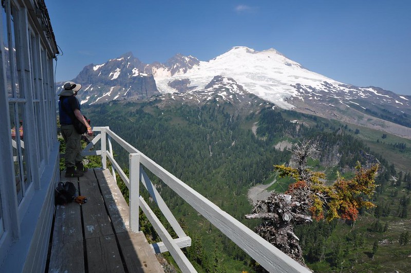
The lookout has a MIGHTY fine view of Mt. Baker:
There are also supposed to be stunning views in the other directions, but due to wildfire smoke drifting around us we didn’t get to see those views this time. Here’s what the view to the east looked like in 2010.
This time:
Looking west at Twin Sister Mountain in 2010:
This time:
Somehow we managed to get lucky and except for one woman and her dog we had the lookout all to ourselves for the 40 minutes that we were there. We sat on the catwalk facing Mt. Baker and just soaked it all in. Amazing!
Heading back we had Mt. Baker looming above us.
Great hike! No wonder it’s so popular. If you’re lucky enough to get the combination of blooming meadows and clear skies, then all the better.
Tuesday, August 12: Showers!
This was our planned rest-up-and-take-a-shower day. In Sedro-Woolley we checked the forecast again, which had not improved. Our plan was to spend the rest of the week along the Mt. Baker Highway doing the Chain Lakes loop, Lake Ann, Yellow Aster Butte, and Skyline Divide, all of which had views that we weren’t going to get with the clouds that were rolling in.
We tossed around several backup plans. Vancouver, BC (a city we love) was oh so close, but of course we didn’t have our passports with us. The Okanongan National Forest east of us was probably drier, but it was probably also very smoky from the wildfires. We’ve been wanting to go to Mt. Rainier for awhile, but the forecast there was no better. So we decided to stick to our plan and hope that the weather system would skedaddle after a few days and we’d get a few good hiking days afterward.
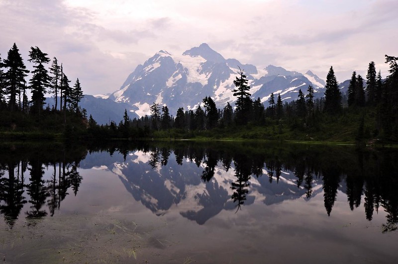
We set up camp at Silver Fir Campground and made dinner. Then we drove up to Picture Lake to see that classic view of Mt. Shuksan. The mosquitoes kept us company, along with two guys who had flown in from somewhere to visit the area. I felt bad that the weather wasn’t going to cooperate for them.
Wednesday, August 13: Home
It poured down rain most of the night. We had one 30-minute thunderstorm but other than that it was just a January-like downpour. In the morning mud was splattered all along the lower walls of the tent.
My phone had a signal just long enough to download the weather forecast. Instead of getting better, the forecast was getting worse. Our four remaining hiking days had a 30-60% chance of showers. And all four days repeated the dreaded phrase “mostly cloudy.” Neither of us wanted to waste our time and effort doing hikes that were supposed to give us sweeping mountain views that we weren’t going to get.
It has been an immensely stressful year for me and I really needed my long-awaited week in the mountains. But I did not need four days holed up in a tent in the rain. So with crushing disappointment we decided to pack up and head home. I felt cheated, especially since snow kept us from doing this hikes once before. It’s a long drive to get up here, too far for a weekend, and who knows when we’ll have a chance to come back. I know that I’ve chosen a hobby that is subject to the whims of Mother Nature and I just have to accept that, but it’s small consolation when you’ve used up every last hour of vacation time on a trip that has been cut short.
I’m pretty bummed about the hikes I missed out on, but glad for what I did get to see. This area is just breathtakingly spectacular. You could gather a dozen adjectives from the dictionary to describe this place and still not come close. I look forward to going back someday. Third time’s the charm, right?


