Labor Day Weekend 2018
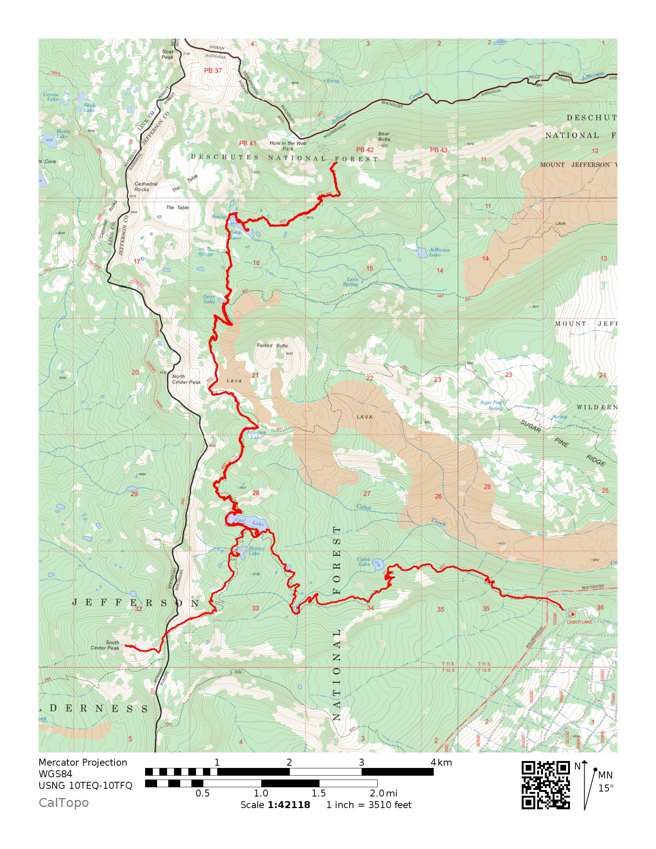
I spent the long weekend exploring some of the east side of the Mt. Jefferson Wilderness, which I’ve never visited before. I started at the Cabot Lake Trailhead, hiked into Carl Lake and stayed there the first night, then hiked to Table Lake for the second night and hiked an abandoned trail up to a viewpoint above Hole-in-the-Wall Park. Then I hiked back to Carl Lake for the third night and did a side trip up to South Cinder Peak. It was great!

Table Lake
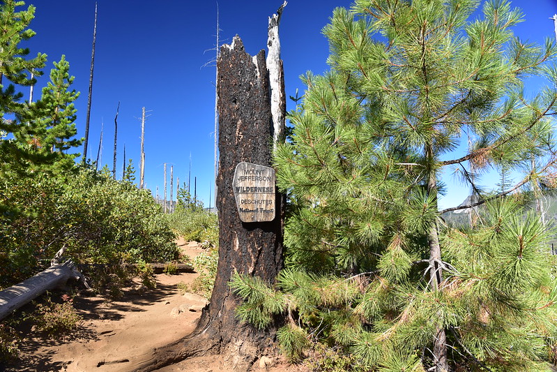
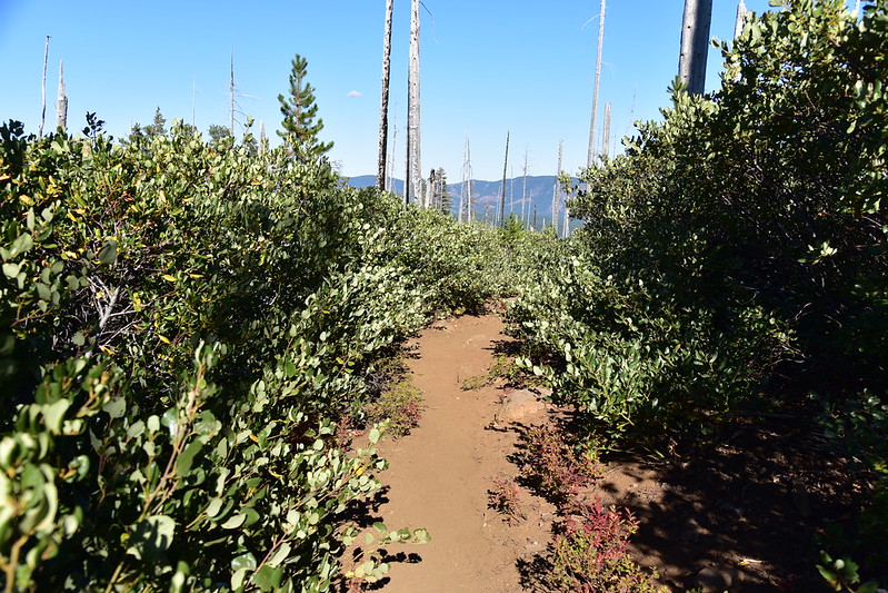
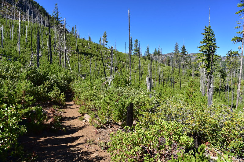
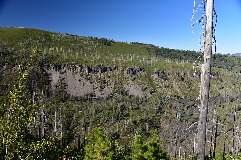
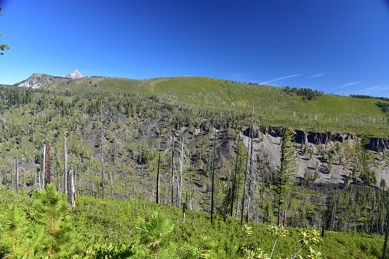
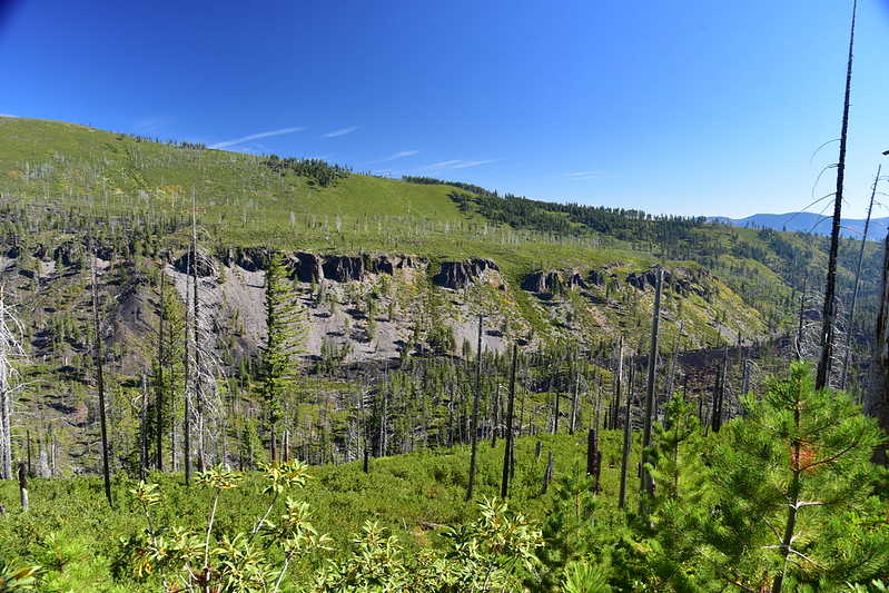
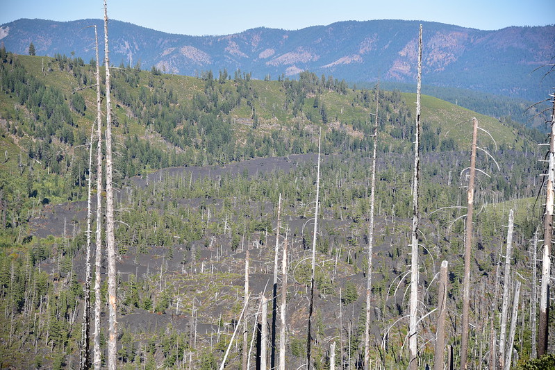
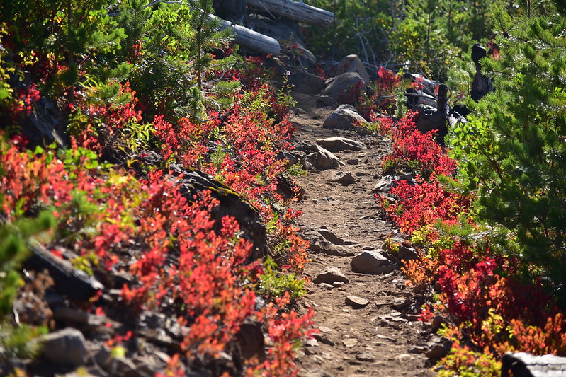
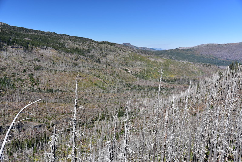
I got off work at 1pm on Friday and went straight to the trailhead. I started hiking at 4:30. This area was burned in the 2003 B&B fire, so I was surrounded by a stark burnt landscape. The fact that the wind was blowing so hard that it whistled made everything all the more eerie. Most of these photos are from my hike out on Monday when the light was better:
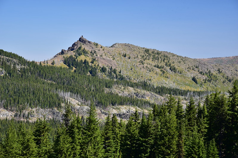
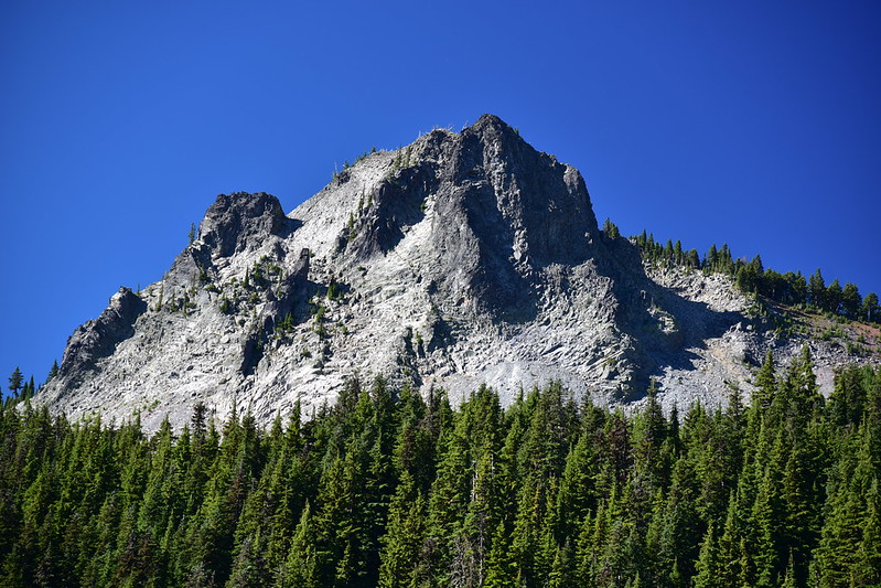
To the north I had a good view of Sugar Pine Ridge. Before the fire there was a trail up there, but it’s totally impassible now:
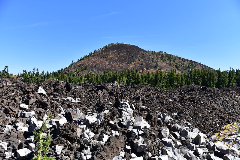
Lava:
Fall is well underway up here:
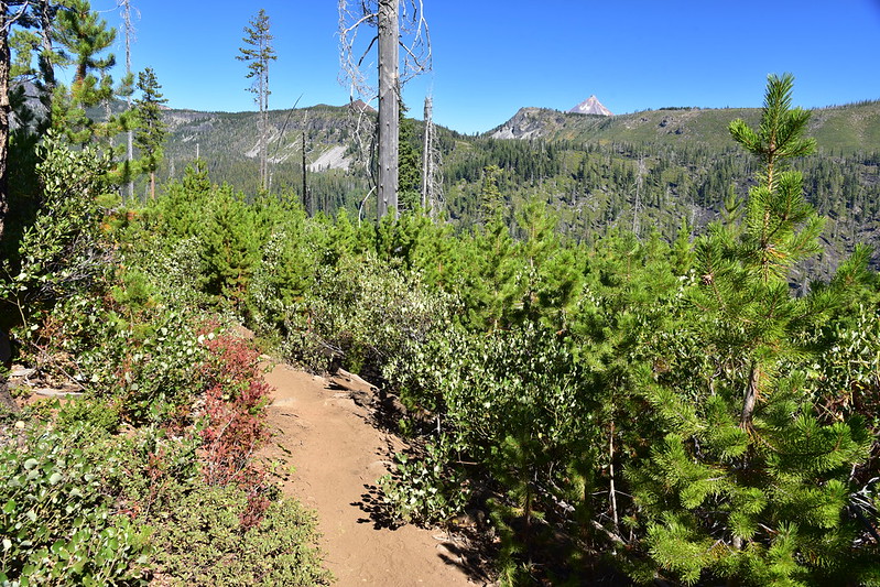
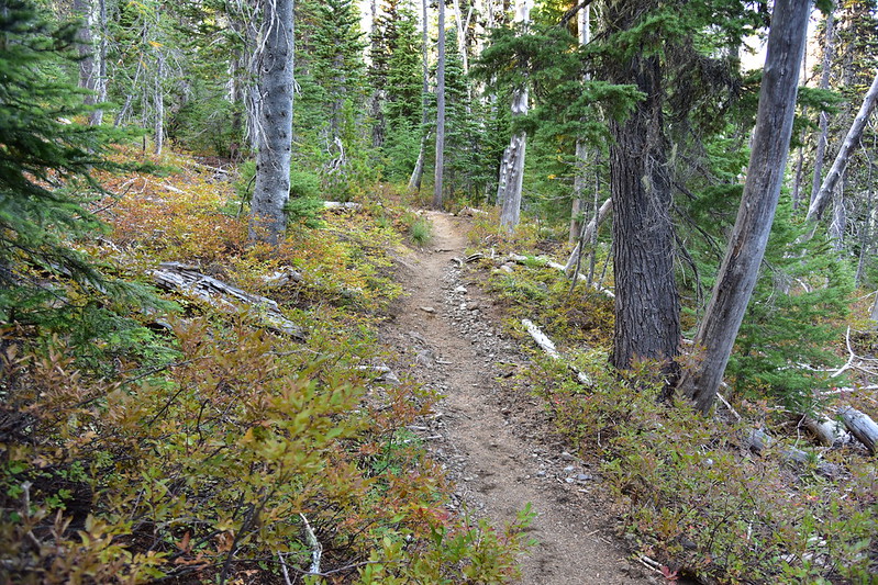
At the 1.5-mile mark I left the burn zone and entered the trees:
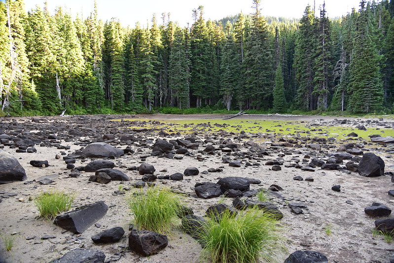
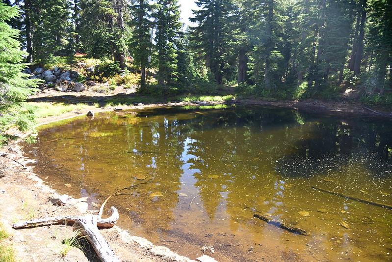
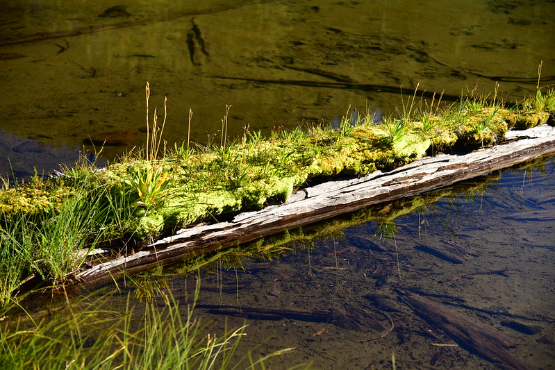
The trail passed this huge dry pond:
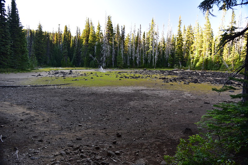
Then I passed some other ponds:
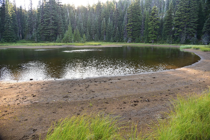
Below is a shot from Monday of the pond above, with Mt. Jefferson peeking up through the trees:
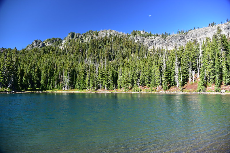
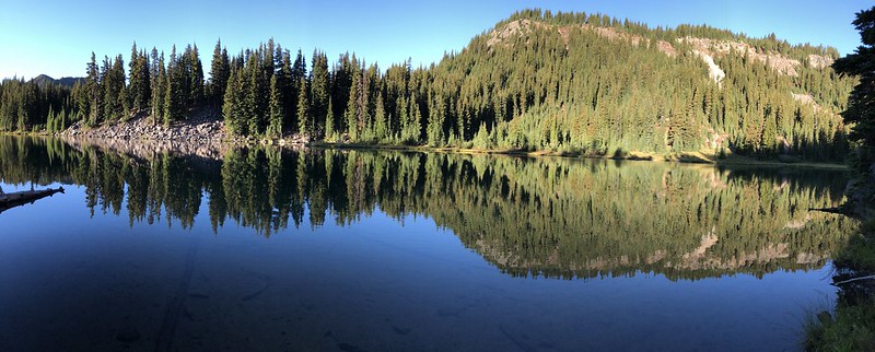
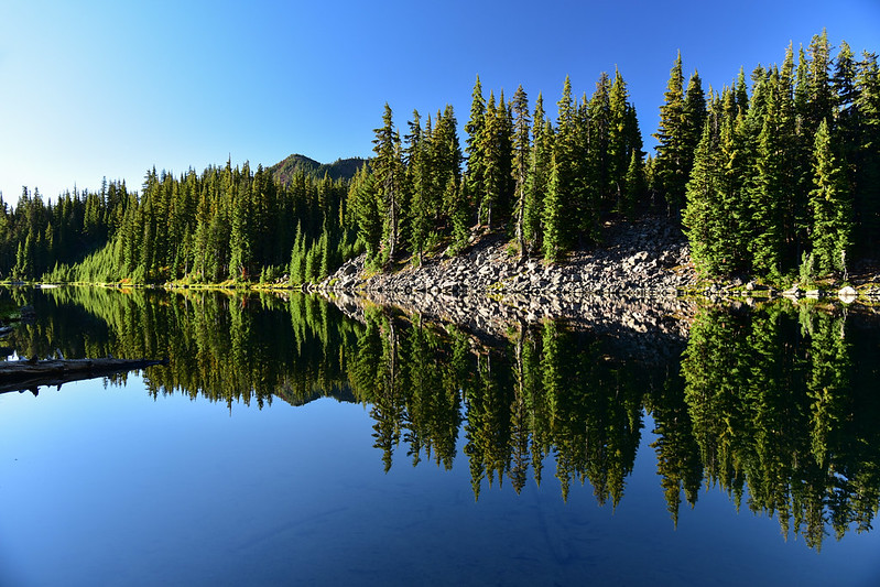
I reached the east end of Table Lake at 6:50. The wind was coming from the west and blasted off the lake with such force that it nearly knocked me over:
Normally I pick campsites based on how scenic they are. This time I was looking for one that was protected from the wind. Success:
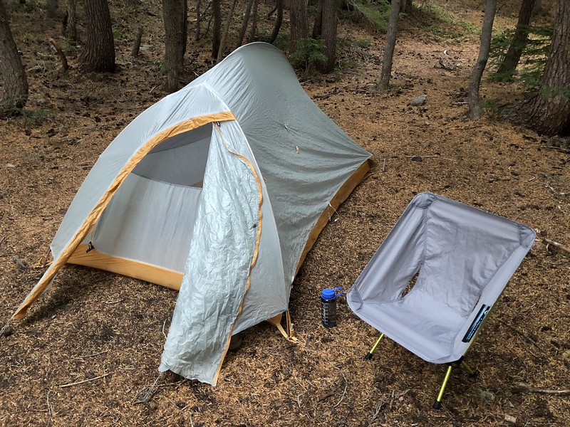
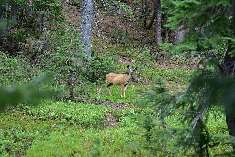
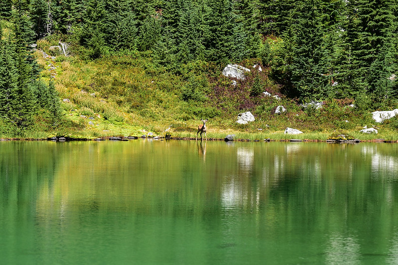
The wind blew all night long. My tent was protected so it wasn’t flapping, but the wind still made a racket. Thank goodness I brought I earplugs! While getting ready Saturday morning I saw two deer pass through near my campsite. Got a photo of one of them:
Carl Lake in the morning. Still pretty windy:
I packed up and headed off for Table Lake. The trail climbs up above Carl Lake:
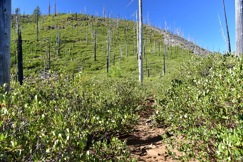
Passed through a small burn area:
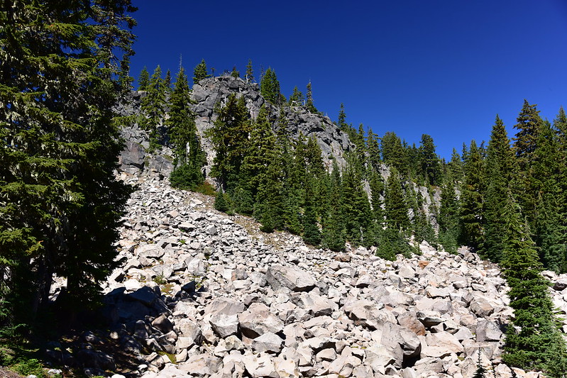
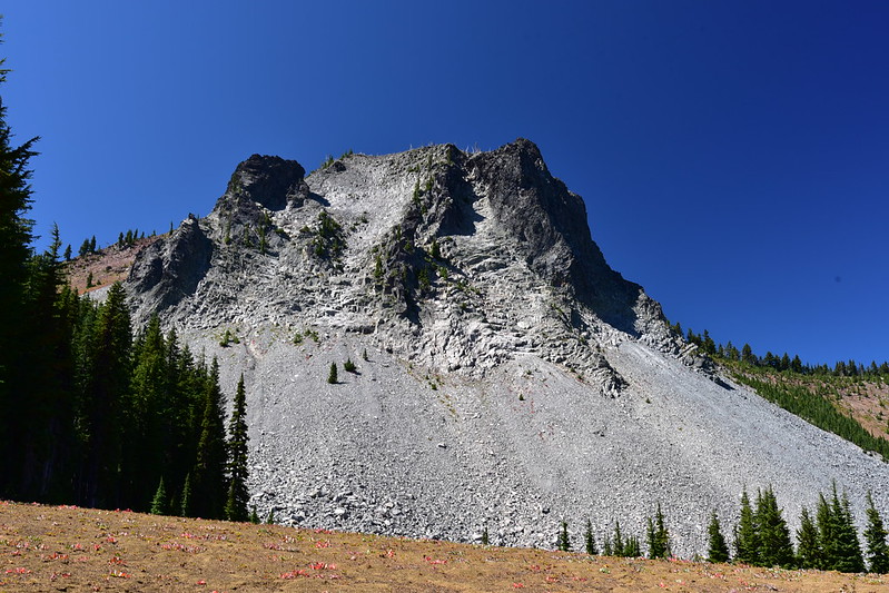
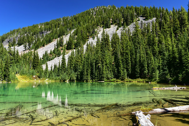
Huge rockslide:
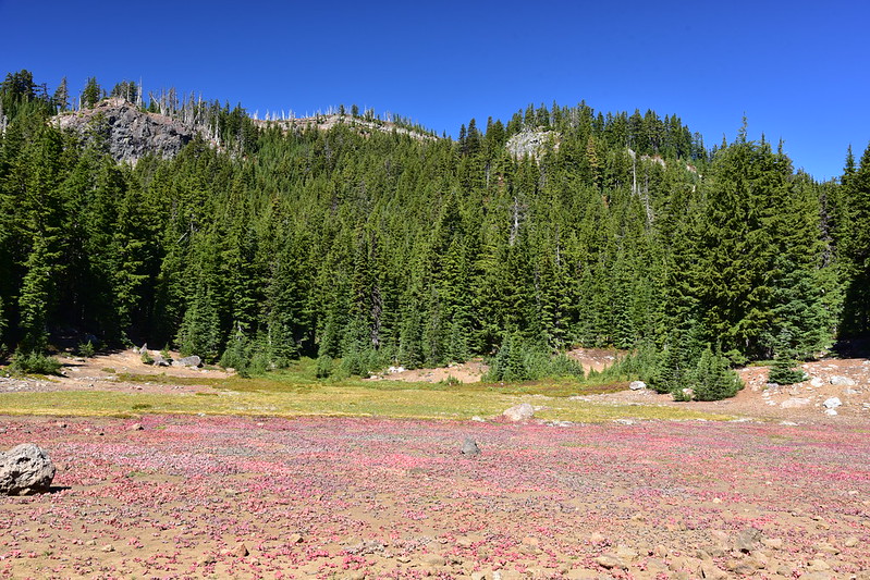
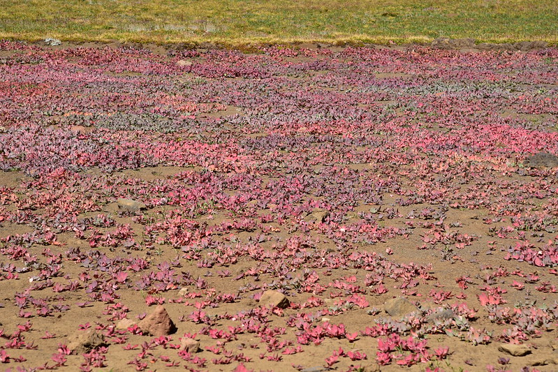
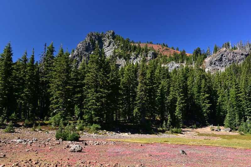
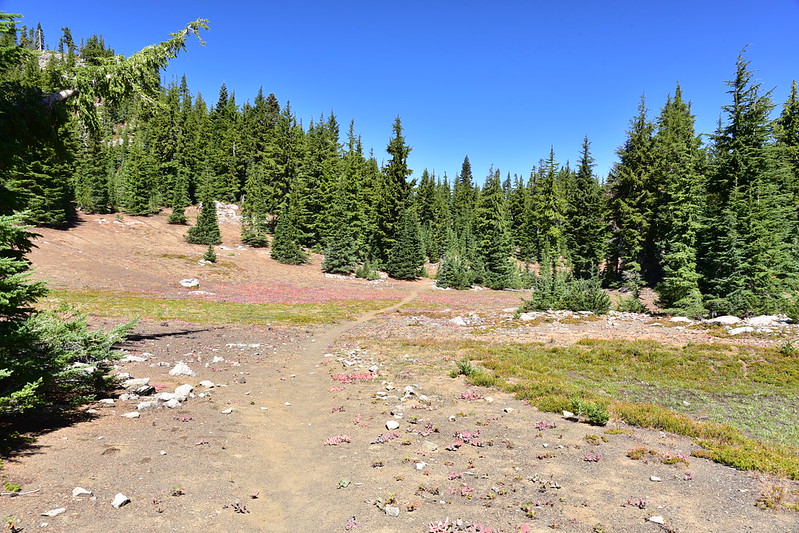
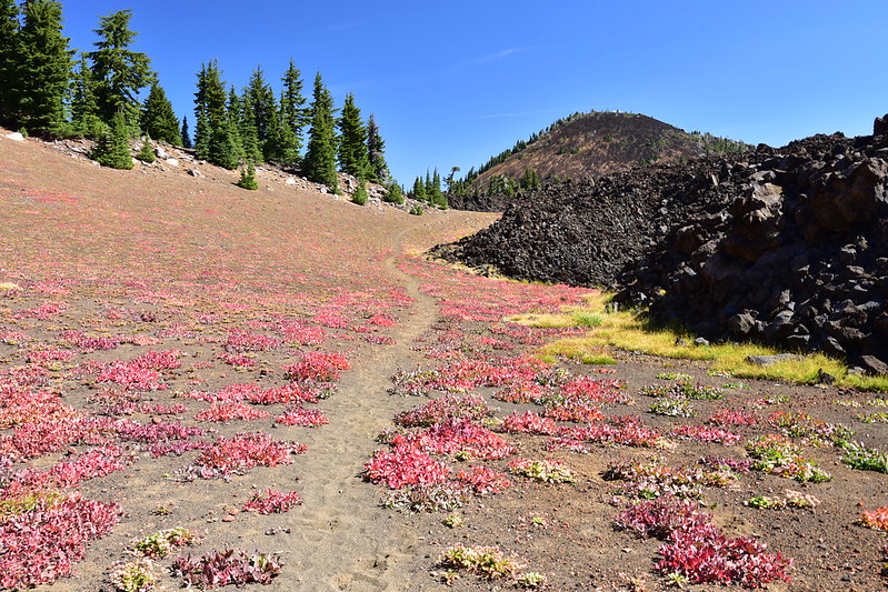
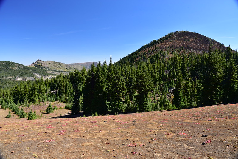
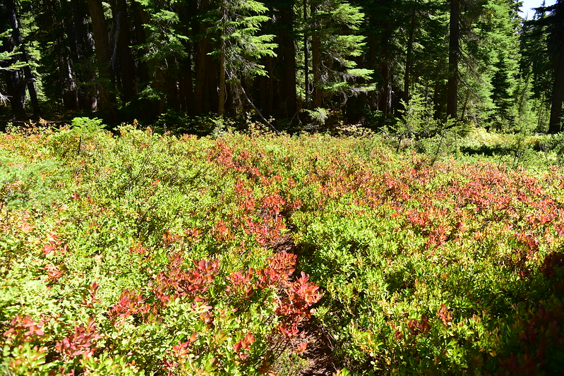
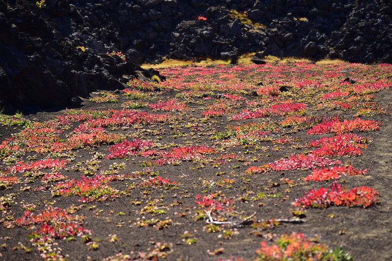
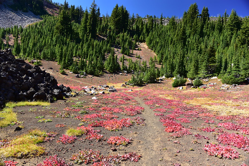
The low-to-theground Newberry polygonum was turning fall color and it made the ground look pink:
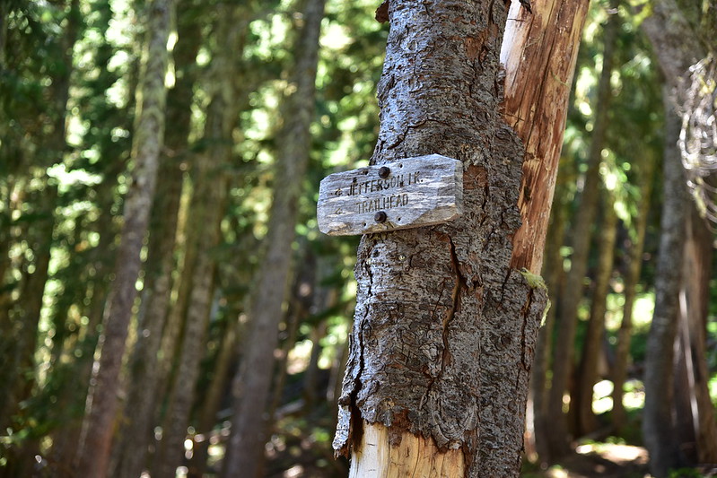
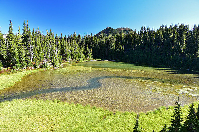
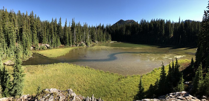
This little pond is known as Junction Lake. By no stretch of the imagination is this a lake, and I think the only reason it got a name at all is because the junction with the Sugar Pine Ridge Trail used to be here until that trail was abandoned:
This is the only indication that a trail once started here:

When my friend Brad hiked here in 2012 that signboard held a “trail not maintained” sign, but it’s gone now:
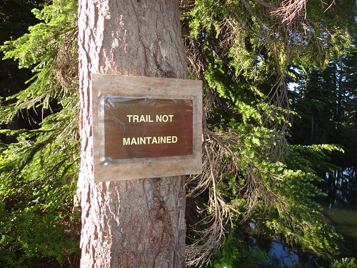
Photo by Brad Rasmussen
By the way, Brad’s report is worth reading, if for no other reason than to see what happens when a trail is abandoned after a fire.
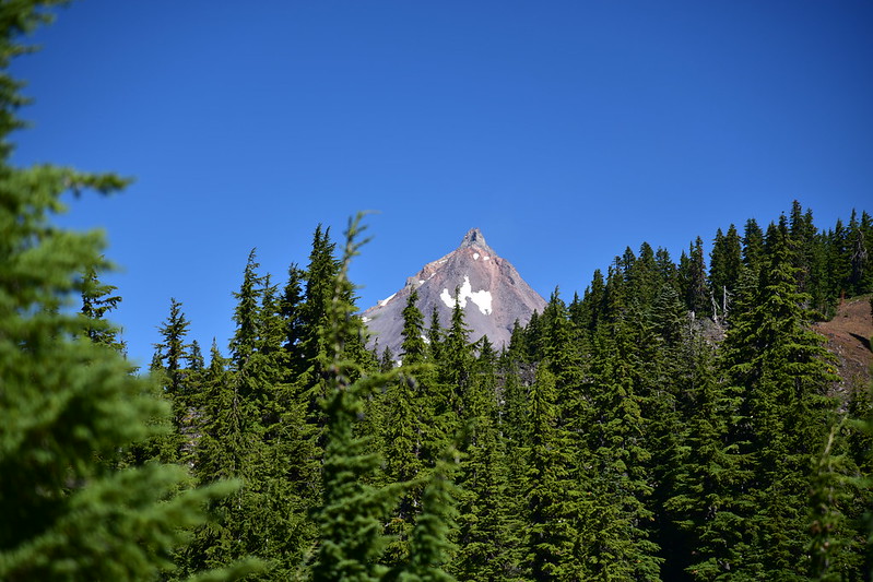
From here I could see the tip of Mt. Jefferson. I didn’t know it yet, but better views were soon to come:
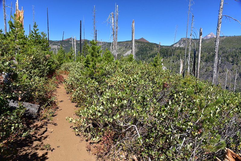
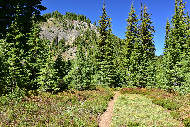
The trail continued passed Junction Lake through some pretty lovely scenery:
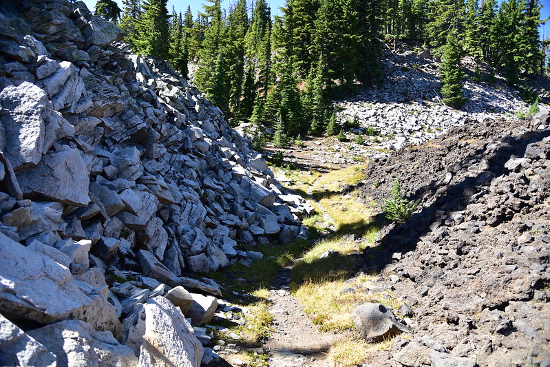
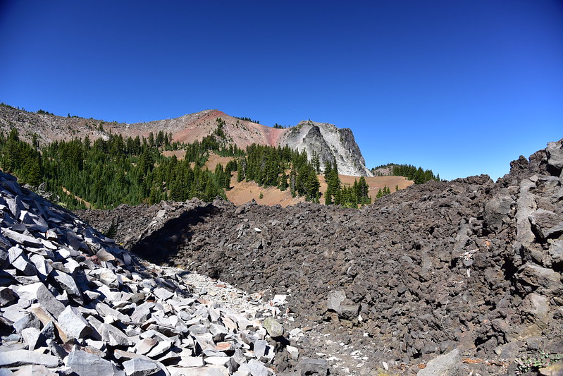
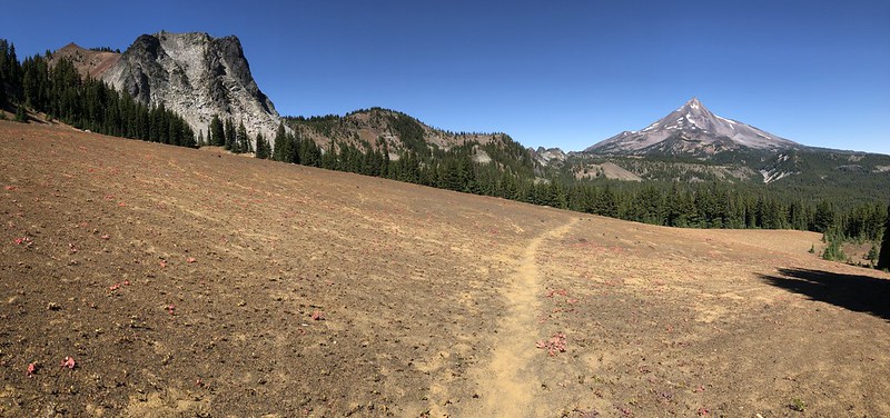
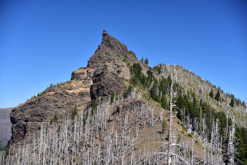
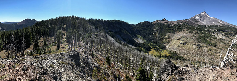
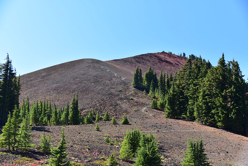
This is some pretty cool terrain. Here the trail is squeezed between two different kinds of rock (that’s North Cinder Peak in the second photo):
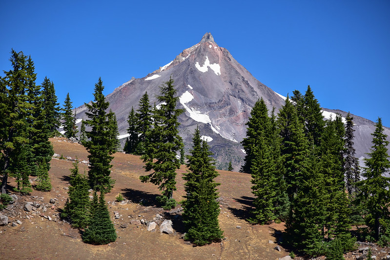
Mt. Jefferson views improving:
Forked Butte in the background. Notice the mixture of rocks in the foreground:
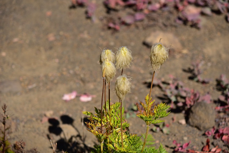
I was surprised to see western pasque flower so late in the season:
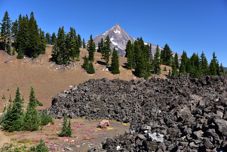
This stretch was so cool! That’s Forked Butte in the background:
The trail reaches a pass before descending down to Patsy Lake. Here’s North Cinder Peak:
The view of Mt. Jefferson from the pass is partially blocked by trees:
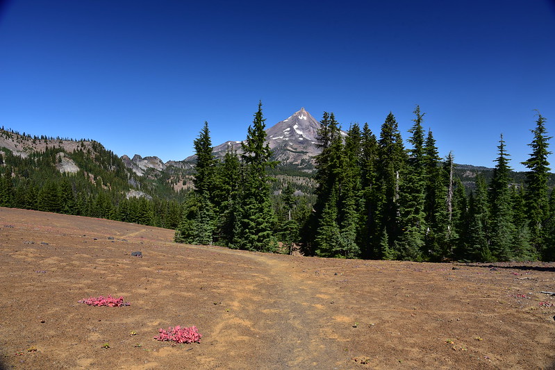
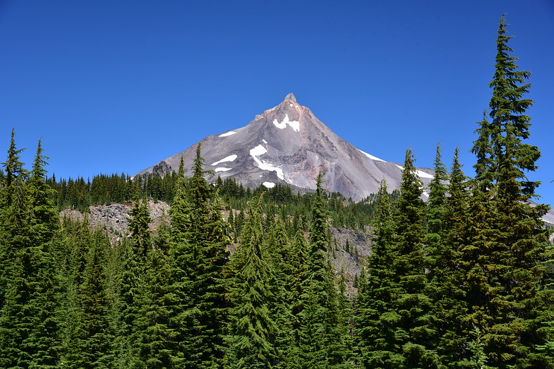
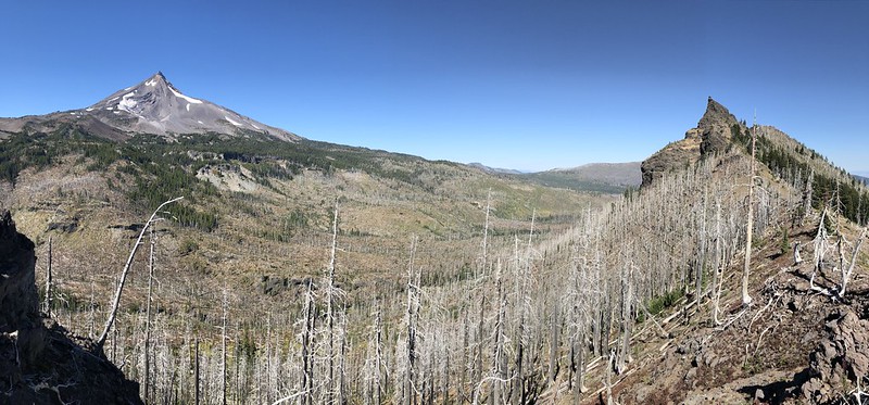
But just down the trail there is a full-on view of the mountain. WOW!
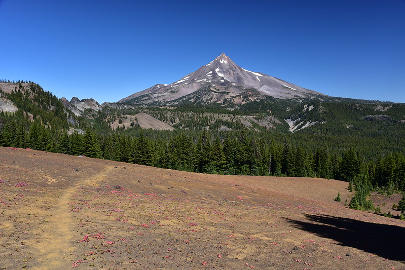
Bear Butte is the distant pointy peak; Forked Butte on the right:
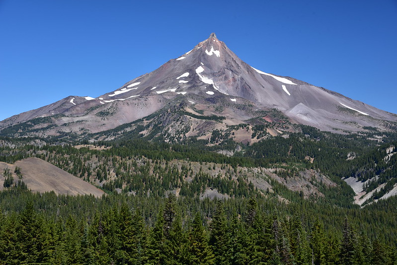
A closer look at Bear Butte:
From the pass the trail descends through the forest down to Patsy Lake:
Patsy Lake is also the junction with the Jefferson Lake Trail. Sadly after the fire the Deschutes National Forest abandoned that trail to its fate, just as they did the Sugar Pine Ridge Trail. Its super brushy, being very overgrown with snowbrush. You used to be able to do a nice loop involving those two trails, but it’s impossible now that they’ve been taken back by Mother Nature.
The trail climbs again. Looking down on Patsy Lake:
Looking east from a spot above Patsy Lake. The abandoned Jefferson Lake Trail is somewhere down there:
The trail continues
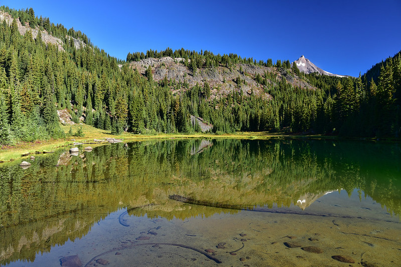
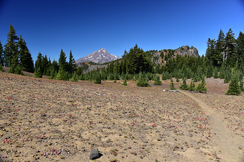
One last view of the mountain before reaching Table Lake:
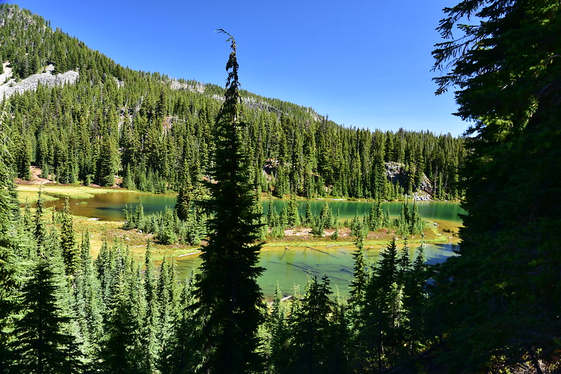
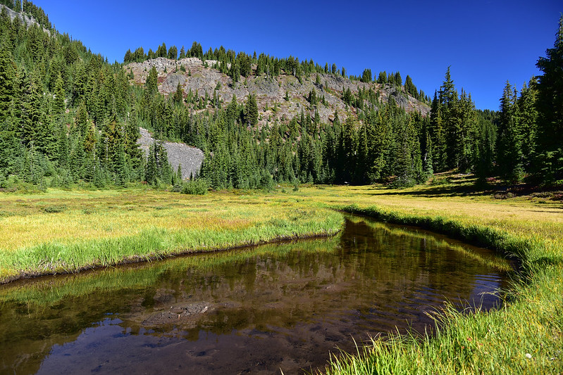
First look at Table Lake:
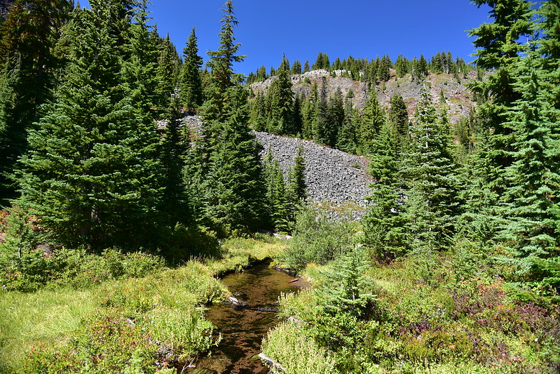
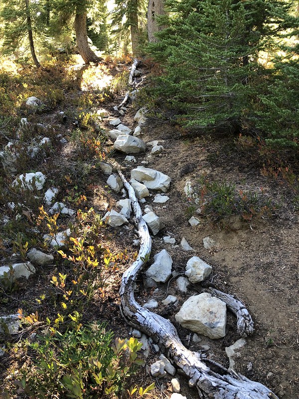
The trail crosses the inflow stream:
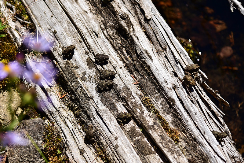
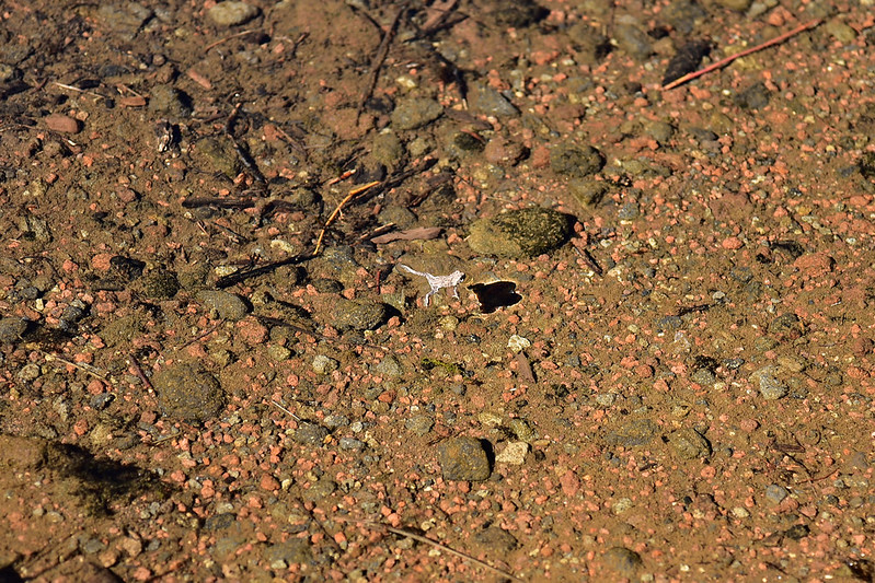
There were hundreds (heck, probably thousands) of these little frogs all around the stream:
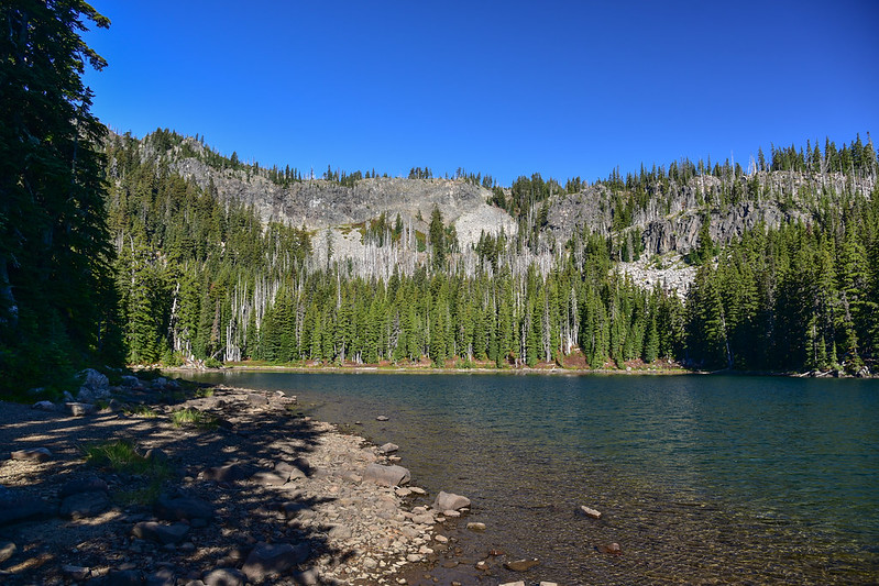
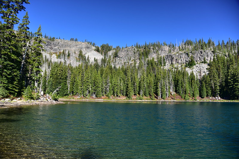
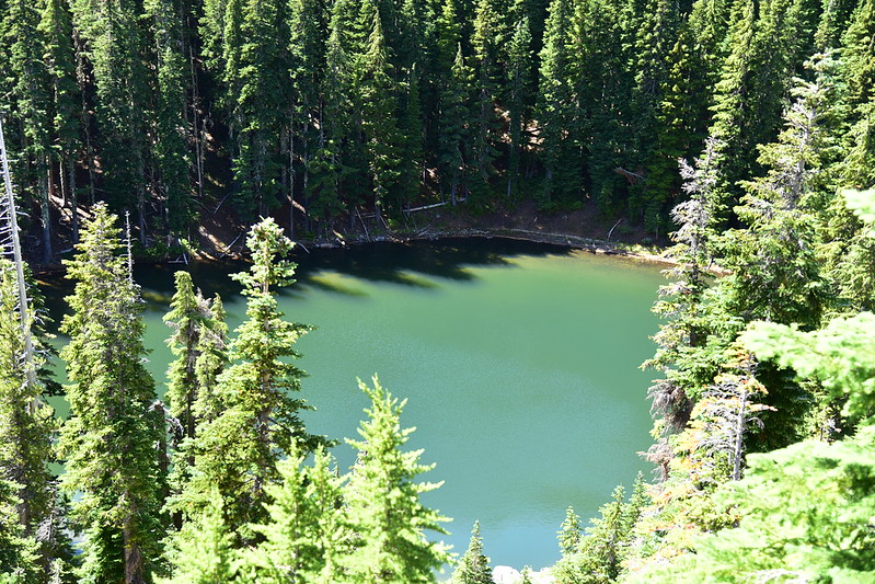
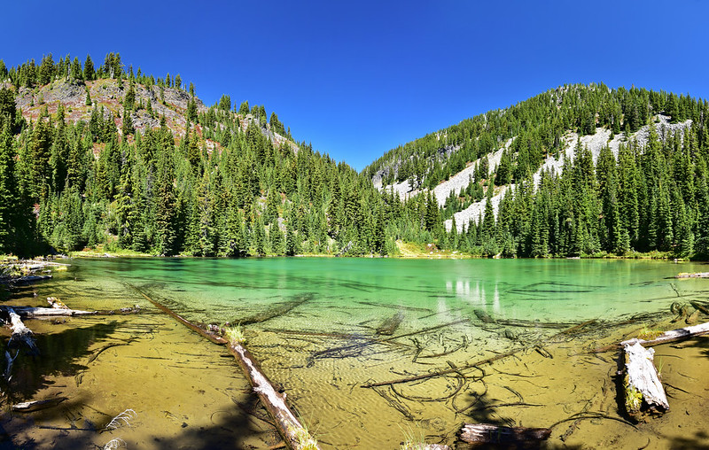
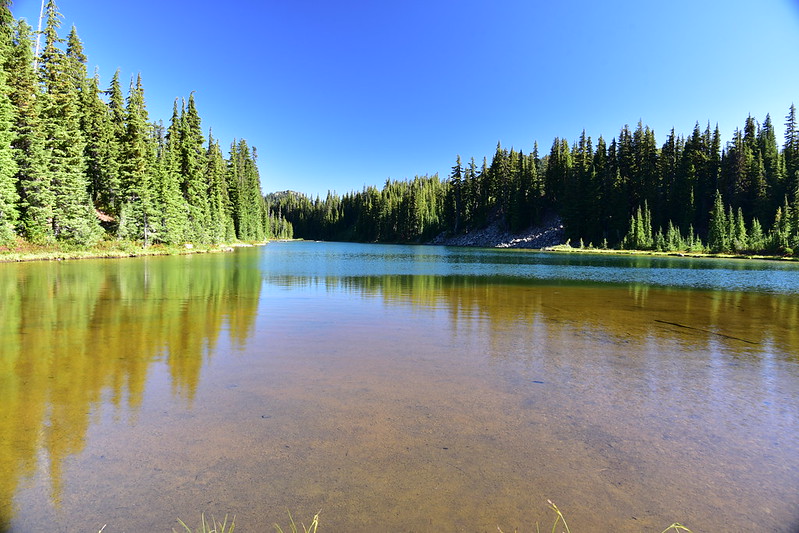
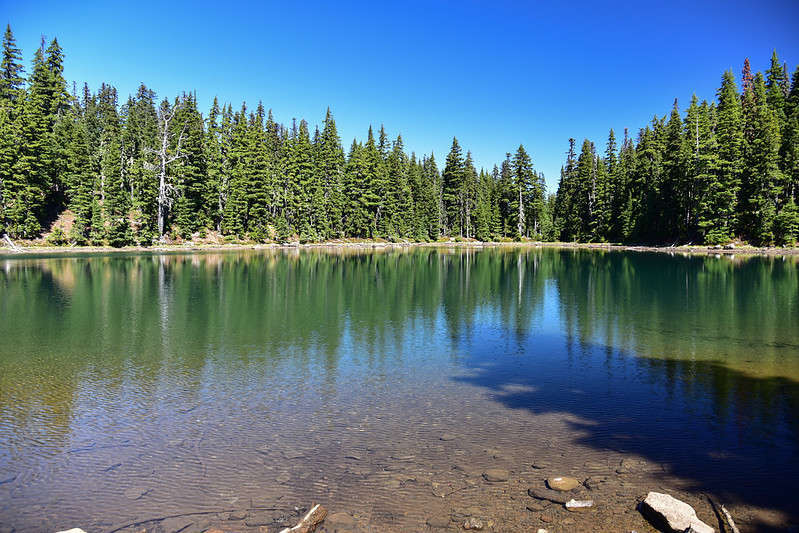
The water here is a beautiful color:
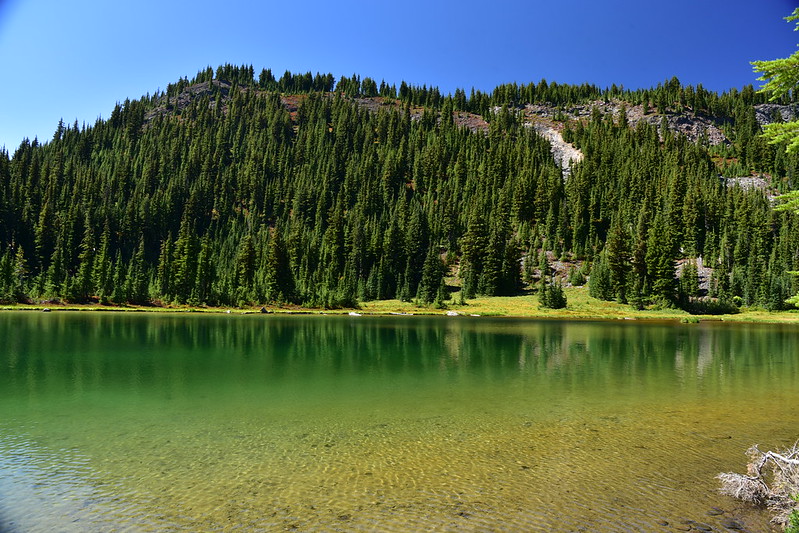
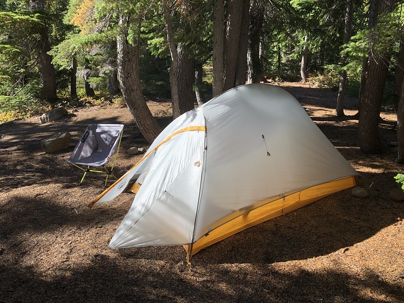
I picked a campsite:
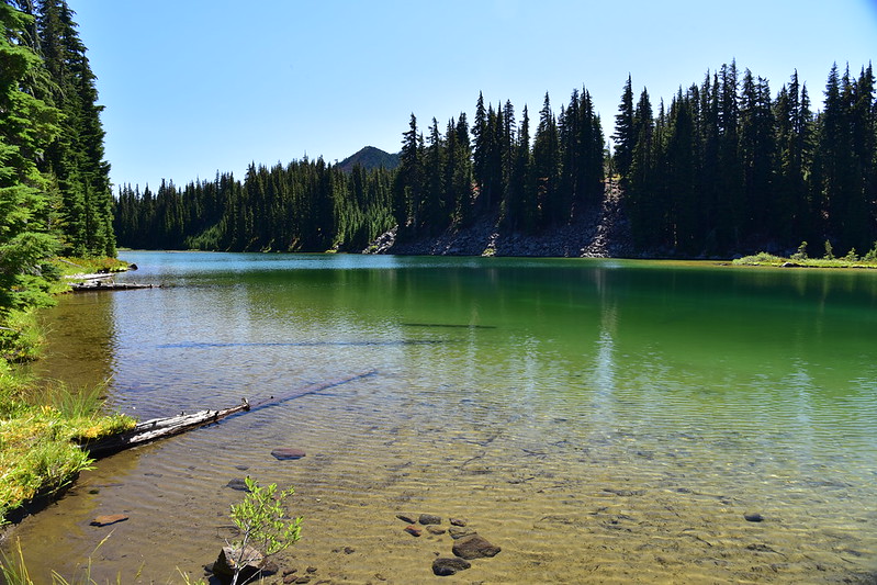
Then I went off to find Upper Table Lake. This little lake is GORGEOUS!
I saw two deer across the way and got a photo of one of them:
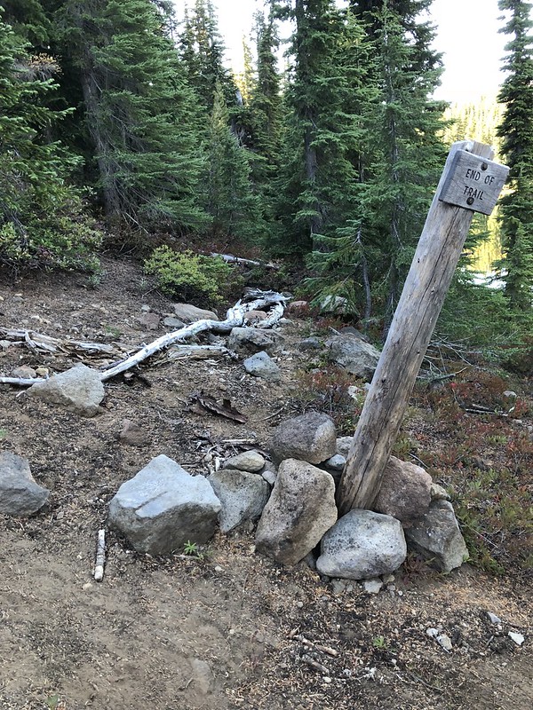
I set off for a viewpoint beyond Table Lake. The topo map shows the trail continuing, but the Forest Service has put up a sign at Table Lake that says “end of trail.” As you can see beyond the sign, they’ve covered the trail with rocks and logs:
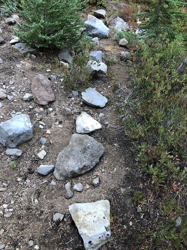
The trail DOES keep going beyond that sign. Then it heads off into the trees away from the lake. Here also the Forest Service has covered the trail with debris:
Once you get past those annoying obstacles the going is pretty easy. The trail is obviously abandoned and not maintained anymore, but it was pretty easy to follow, even though it was overgrown in many spots:
You can see the old trail blazes on the trees, which is how they used to mark trail routes:
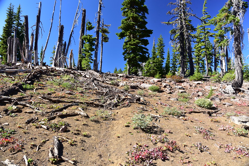
As the trail approaches a pass before descending down into Hole-in-the-Wall Park, it gets pretty faint. With some good route-finding and the help of my GPS I stayed on course. The last stretch to the pass enters the edge of the burn zone and there are downed trees and branches covering the trail:
And then I reached the pass where this old “viewpoint” sign somehow miraculously escaped the flames 15 years ago:
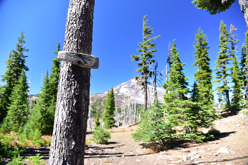
I turned right off the trail towards the viewpoint, seen here on the left (Bear Butte is the pointy peak on the right):
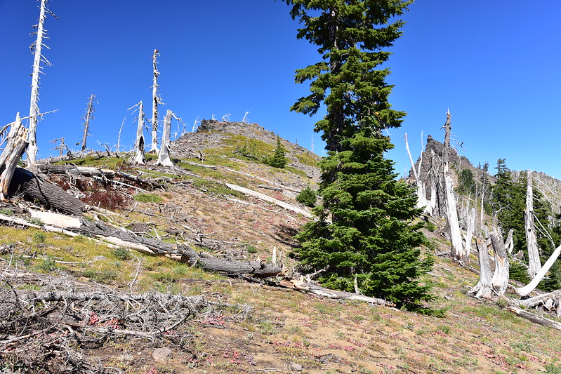
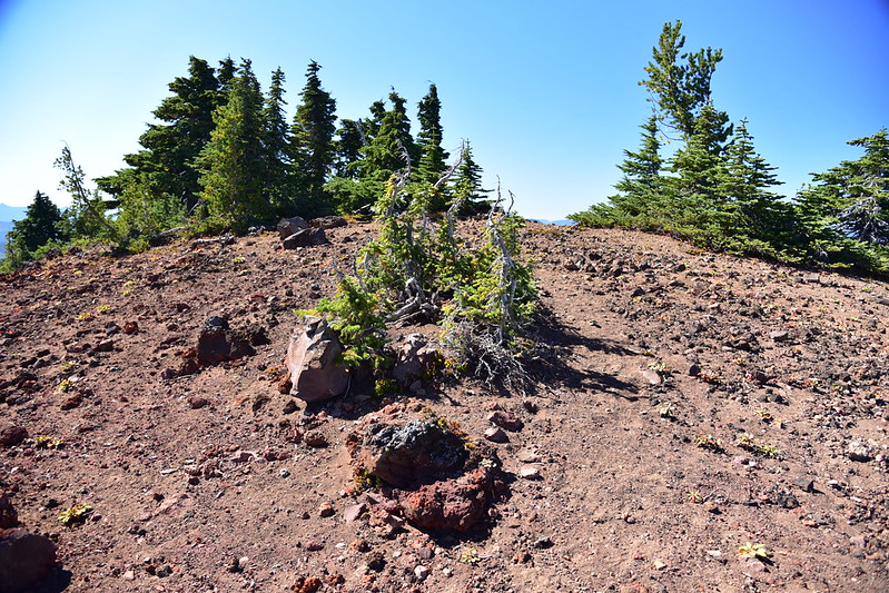
Any semblance of a side trail that once led up here is totally gone in the wake of the fire, but the distance is short and it’s easy to make your own path to the rocky viewpoint, where a few gnarled dead trees stand:
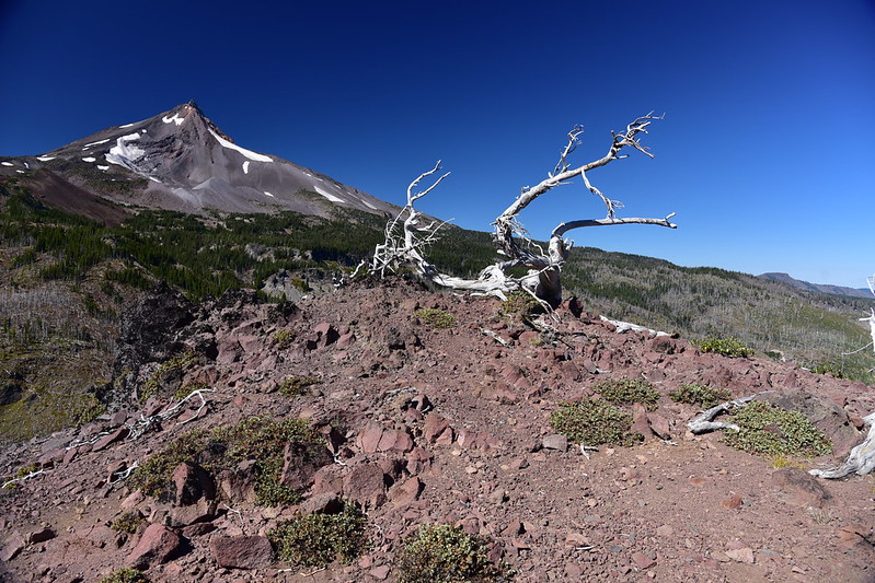
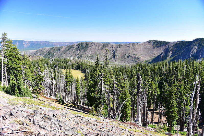
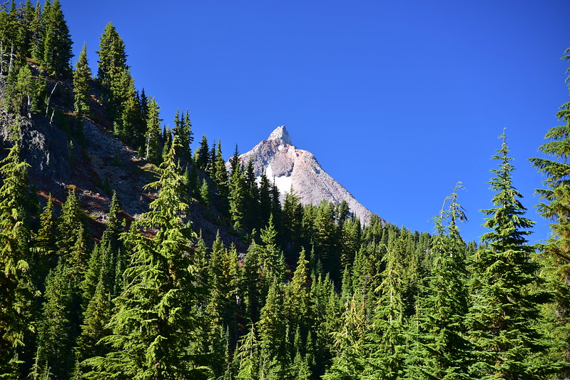
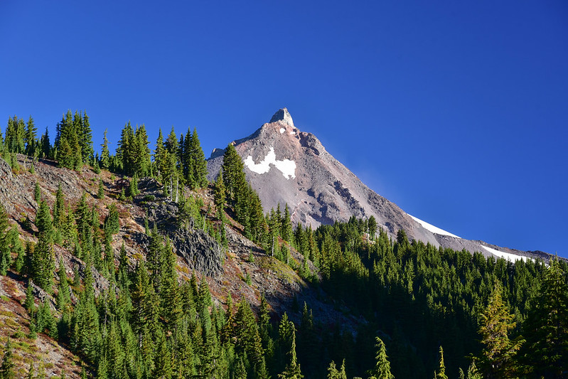
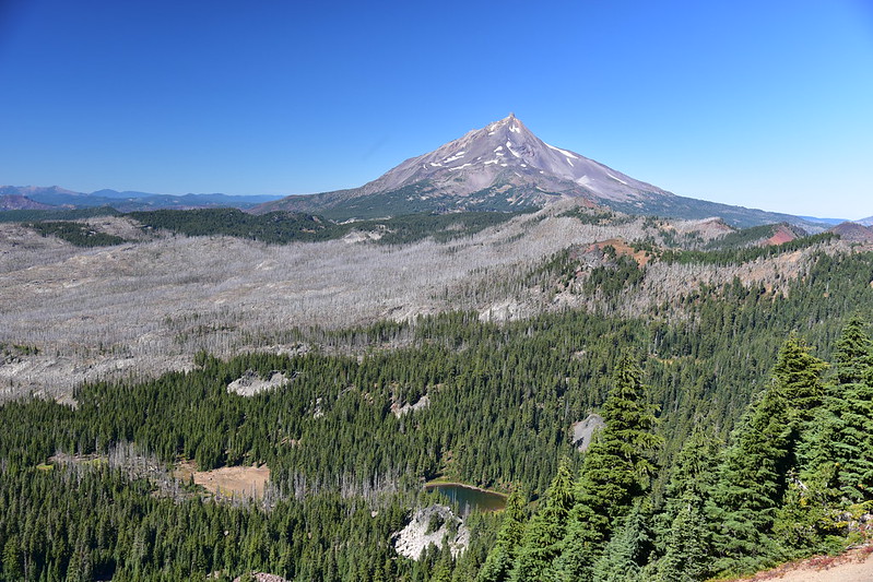
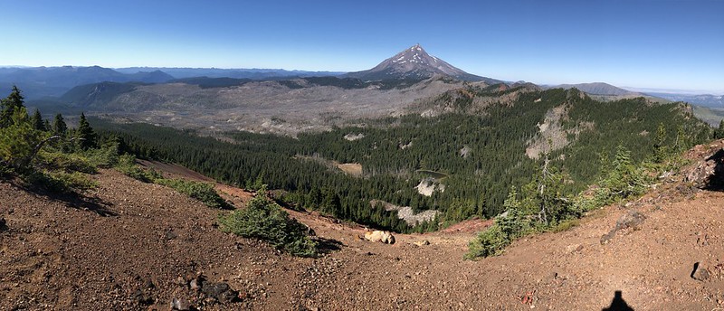
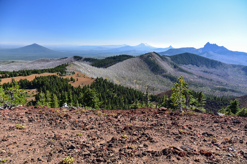
The views up here are AMAZING. That’s Goat Peak and Mt. Jefferson:
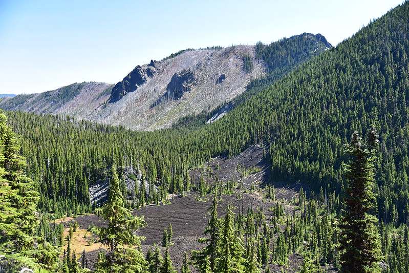
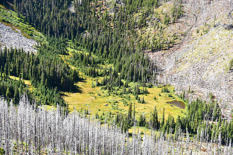
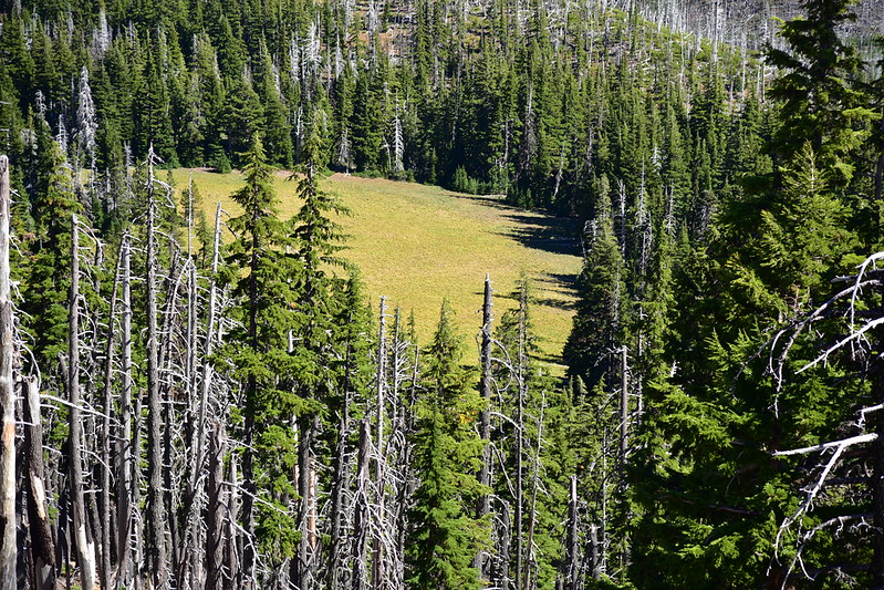
That meadow down there is Hole-in-the-Wall Park. You won’t find much about this place online (I found just one online report from someone who had hiked down there) so here’s what I’ve learned. This is from The Mount Jefferson Wilderness Guidebook (1983), by Tony George:
Hole-in-the-Wall Park is over 10 miles from the nearest trail head, and few people take the time to see it. Tucked in a very deep steep-sided glacially carved canyon, the “Park” is an intricate network of wet meadow, ponds and streams. There is a very good viewpoint overlooking the Park on the ridge west of Bear Point. From here, it is easy to see how Hole-in-the-Wall Park got its name.
This is from Northern Oregon Wilderness Areas (1992), by Donna Aitkenhead:
The Forest Service wishes to keep HITW pristine and plans on stopping all maintenance of the trail leading down to this unique region in the near future. One hiker said she thought the area looked “like Shan-ri-la” from the saddle and rushed to enjoy its many splendors. We thought the same, but instead found lots of mosquitoes and other insects. She found the same. Hiking in mid-September, we wondered what the place was like in July or August when the pesky critters are “supposed” to be bad.
I could understand why the Forest Service might abandon the trail down to the park, but it doesn’t make sense why they have abandoned the trail to this magnificent viewpoint. In any case, both of those descriptions are of course pre-fire. Here is what Matt Reeder has to say in 101 Hikes in the Majestic Mount Jefferson Region (2016):
The Cabot Lake Trail does indeed continue down into Hole-in-the-Wall Park but the trail has fallen into such a state of disrepair that it’s not worth even attempting. Hole-in-the-Wall Park itself is a boggy marsh without a view of Mount Jefferson – so again, it’s not worth it.
Not wishing to lose elevation that I would have to regain, and also lacking a desire to deal with an unmaintained trail through a burn area, I admired the meadow from above and did not venture down there.
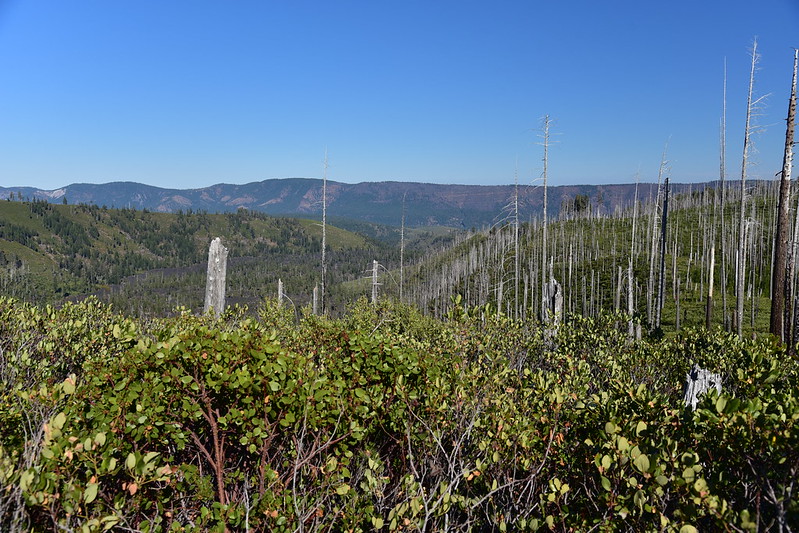
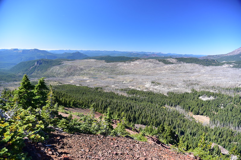
Looking northeast. The Warm Springs Reservation boundary is at the base of the slope I’m standing on, so none of that is public land out there:
Bear Butte to the east. Somewhere around here is where the Bear Butte Fire started in 2003, later joining with the Booth Fire to form the B&B Complex Fires, which ended up burning over 90,000 acres:
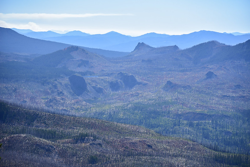
Looking southeast:
A closer look at that huge meadow down there:
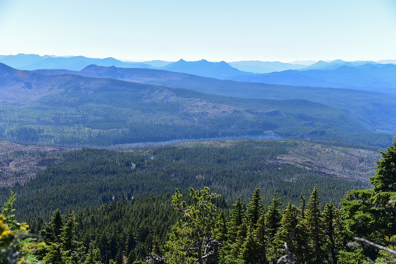
Three Sisters to the south:
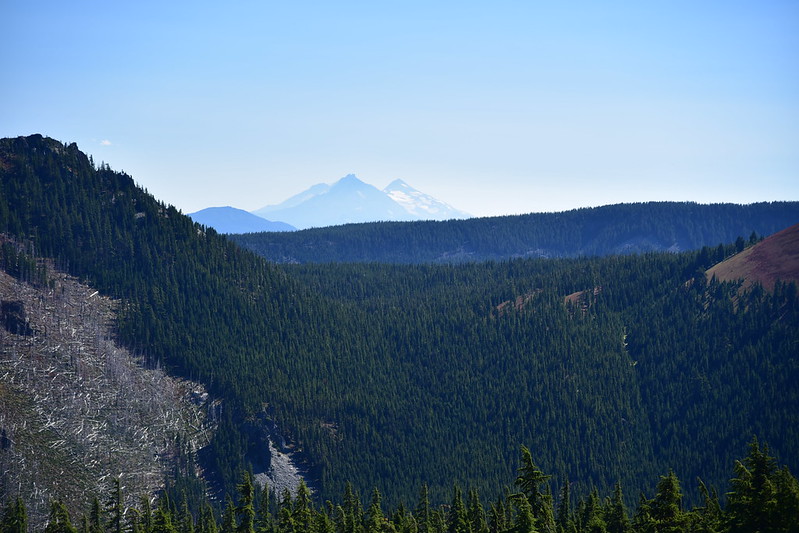
Table Lake is out of sight down there. My route up here came out of the trees and up the slope in the foreground:
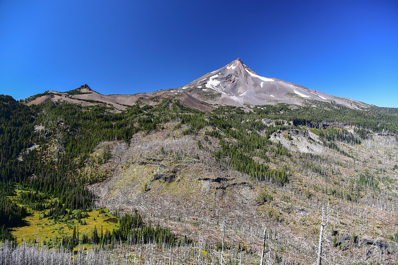
A panorama looking west. The trail from Table Lake comes up from the left then drops down the slope at center to Hole-in-the-Wall Park where it ends:
It was SUPER windy up at that viewpoint, so as much as I would have loved to linger I turned back after spending 25 minutes admiring the view and headed back down. When I got back to Table Lake I made my way over to the west end of the lake to this cool viewpoint. Two guys I had seen earlier said they had camped at this end of the lake, in the trees on the left there, but there’s no trail and I was tired so I didn’t go that far to check it out:
Looking down on Table Lake:
I spent the rest of the afternoon reading Where the Crawdads Sing on my Kindle and enjoying the beautiful warm weather:
I discovered a spot near my campsite where I could see the tip of Mt. Jefferson:
The sun disappeared behind The Table at the early hour of 5:30 and the wind started dying down. (By the way, there is no trail up to The Table but next time I come here I want to go up there and explore.) Just when I thought I’d have the whole place to myself that night, a family of four showed up around 6:40. I chatted with them a bit and it turns out that hiked in via the Jefferson Lake Trail. I expressed my surprise since that trail isn’t maintained anymore and the dad said, “Oh yeah, it sucked.” They said it was incredibly brushy and they got pretty scratched up. He said 20 years ago he used to be a wilderness ranger here, but of course that was pre-fire so everything would look a lot different now.
The family went off to find a campsite and shortly after that a couple with a black dog arrived. They had hiked all the way over from the Marion Lake Trailhead, via the Swallow Lake Trail, which resulted in a very long day.
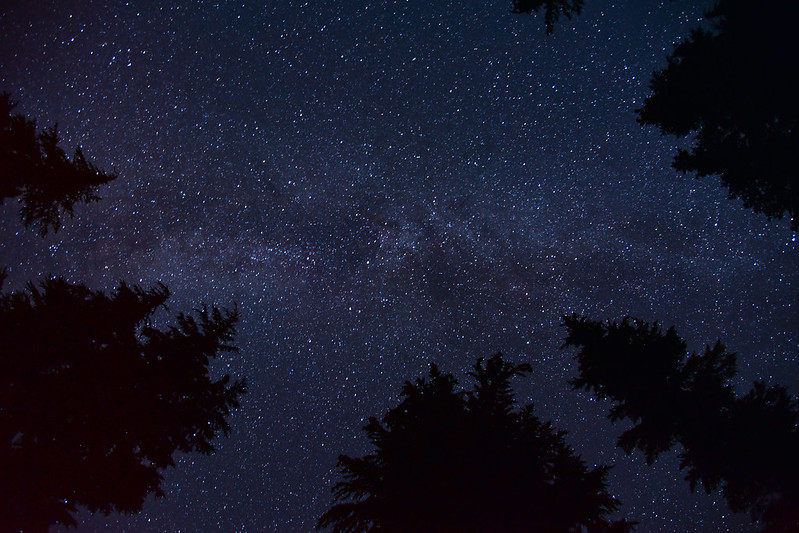
That night when I got up at 11:30 the wind had totally died down (thank goodness) and the stars were out. I had not brought my tripod, so I just put my camera on the ground pointing at the sky and gave it a shot:
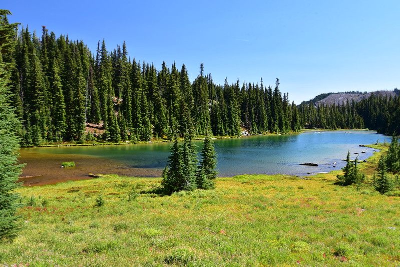
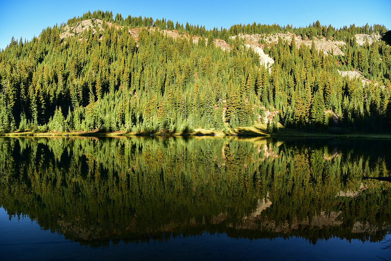
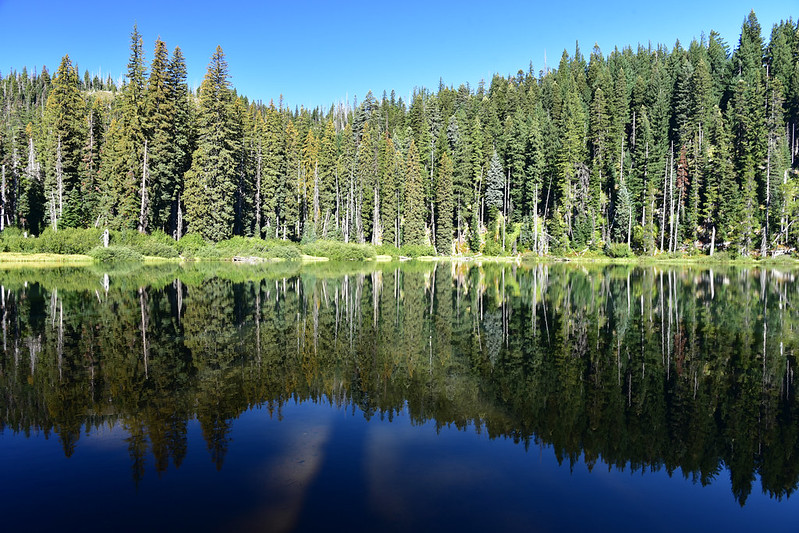
The overnight reprieve from the wind lasted into the morning, which was such a relief. The lake looked beautiful on this calm morning:
Loved this mossy log:
Stream flowing into Table Lake:
Floating frog (there were so many of these guys all around the creek):
I definitely loved Table Lake better than Carl Lake. I had one more night and I really wanted to climb South Cinder Peak (which was closer to Carl Lake). Plus I didn’t want a 10-mile hike out on Monday. So I reluctantly packed up and headed out. There is a way to make a loop with the PCT, picking up an east-west connecting user path just a bit south of Table Lake, then heading south on the PCT, then picking up another connecting path just north of Carl Lake. About 0.3 mile from Table Lake I saw this path on the left heading off into the heather (main trail at right) and it seemed like it would be correct, but I decided not to try it today and just head back on the Cabot Lake Trail.
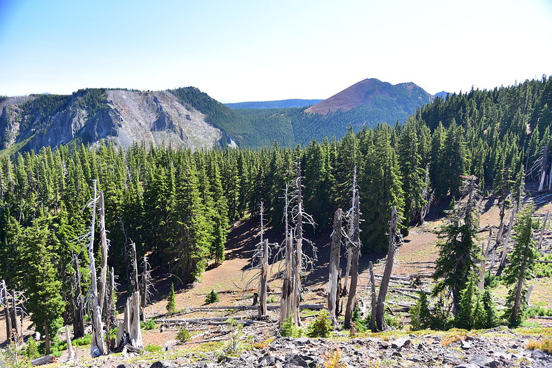
Got a good view of North Cinder Peak above Patsy Lake as I descended down:
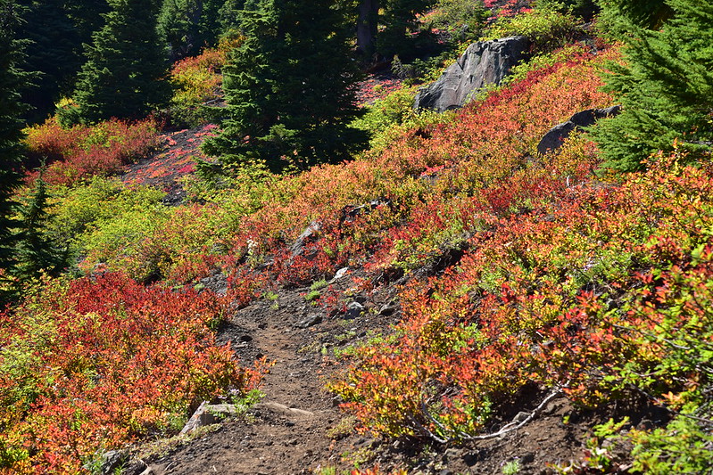
The long climb back up to the pass from Patsy Lake was not fun, but I finally made it. More fall color:
Descent to Carl Lake:

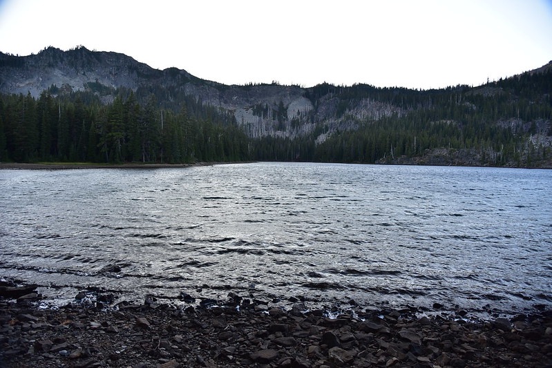
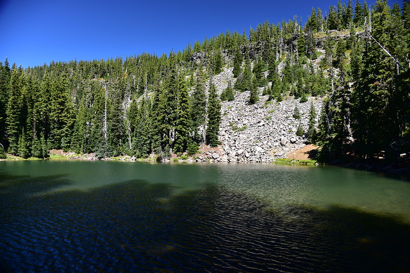
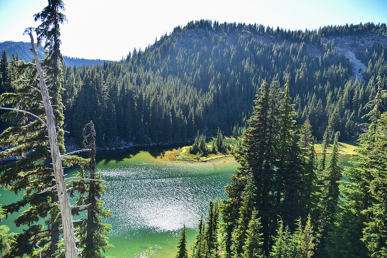
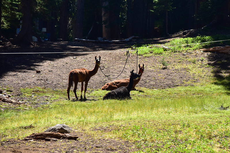
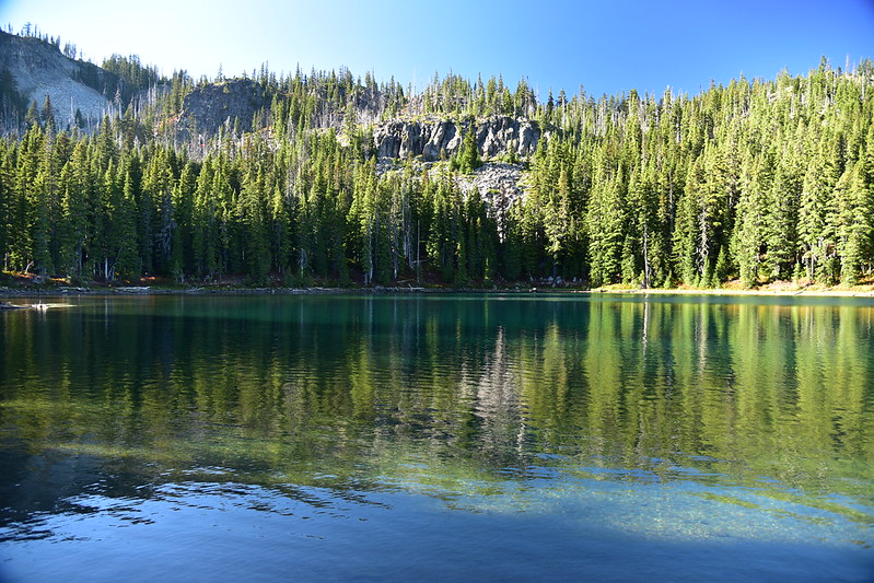
As I feared, since it was Sunday of a holiday weekend, Carl Lake was FULL. I had trouble finding a campsite. I was on my to Shirley Lake to look there when I found a flat spot near a pond on the right side of the Shirley Lake Trail. I made camp and headed south towards South Cinder Peak. I topped to check out Shirley Lake on the way:
Someone camped there had llamas!
More fall color as I trudged up the Shirley Lake Trail towards the PCT. It was warm and I was tired:
I reached the PCT and crossed it, heading west on the Swallow Lake Trail. My first view of South Cinder Peak:
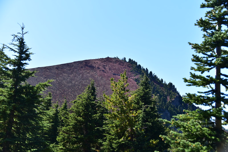
A better view of South Cinder Peak from Swallow Lake Trail, my path up clearly visible now:
View of Mt. Jefferson from the spot where I left the trail to head up the peak:
It was a hot trudge up that shadeless peak, but I made it.
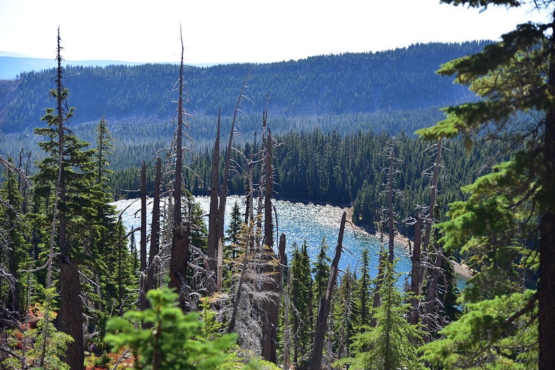
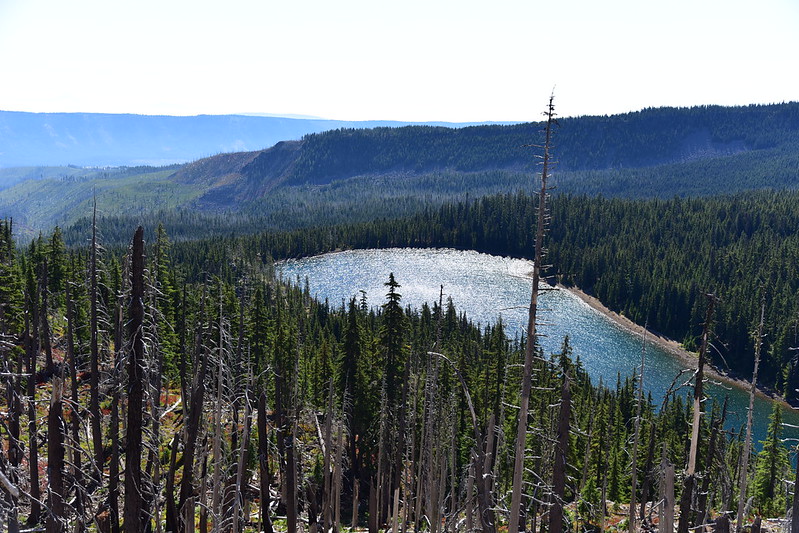
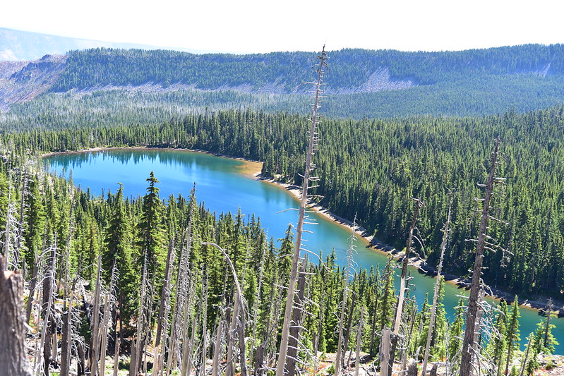
The views were amazing. It’s been such a smoky hazy summer that I almost forgot what clear blue skies looked like. This is looking north at Mt. Jefferson and an unnamed lake far below:
Looking northwest:
Looking west; that’s Marion Lake down there:
Looking southwest; that’s Jorn Lake in the Eight Lakes Basin, where I camped a few weeks ago (the distant smoke is from the Terwilliger Fire):
Looking south to Black Butte, Broken Top, Three Sisters, Mt. Washington, and Three Fingered Jack:
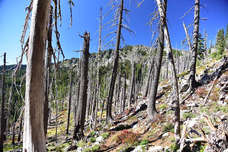
It was sobering to be up here looking down on huge swaths of burned forest from the 2003 B&B fire, which burned such a huge chunk of the Mt. Jefferson Wilderness. It’s one thing to see it from the trail and quite another to see it from above.
I headed back to Carl Lake and filtered water:
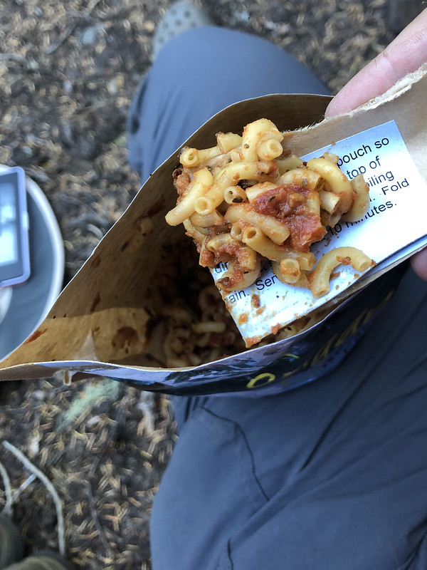
Back at my campsite I cooked up dinner and then discovered my spoon was missing! I turned my pack inside out and searched pockets, but no spoon. I figured I must have set it down somewhere at Table Lake that morning and missed it when I was packing up. (Later my sister said to me “I bet the wilderness is full of people’s lost spoons”.) I had no idea how to improvise eating my pasta. I was not above eating with my hands but that meant burning my fingers on the hot pasta or waiting for it get cold so I could eat it without getting burned. I ended up cutting off the top part of the pouch and folding it into a sort of scoop. It did the job and I was able to eat dinner:
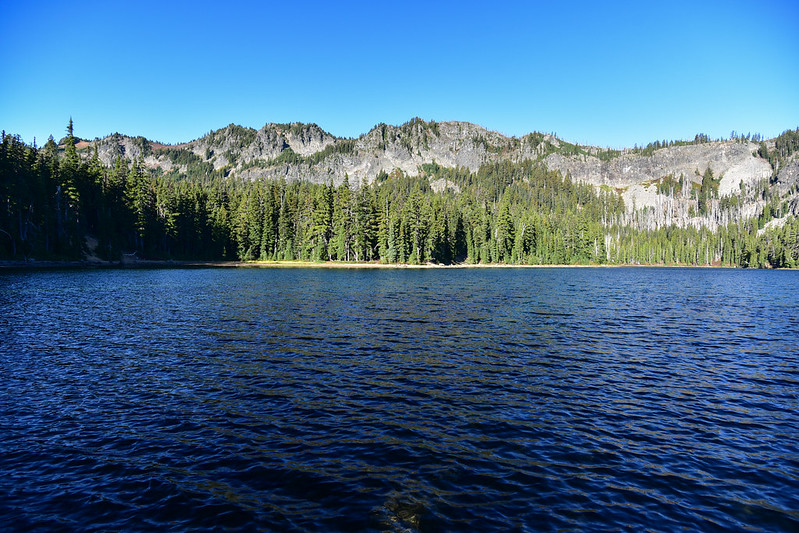
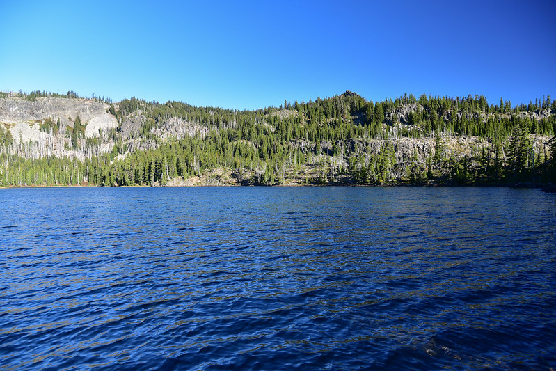
I slept well. I skipped my hot cereal and just had salmon jerky and tea for breakfast. I saw some deer across the pond. Third day in a row I saw deer! I packed up and hit the trail at 8. I stopped at the east end of the lake for photo a on the way out. Once again, it was quite windy. Was it just my timing, or this just a windier lake than Table Lake? I never experienced a lack of wind at Carl:
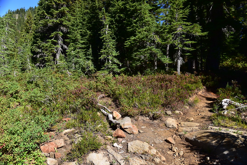
Despite the campfire ban, I caught the whiff of campfire smoke at Carl Lake before I left. Never saw the fires, just smelled them. On the hike out I took the short side trail to Cabot Lake, which I had skipped on the way in on Friday:
I got back to the car at 10:50. My total mileage for the trip was 28 miles, with 4,400′ elevation gain. What a great weekend! It was SO wonderful to have clear blue skies and to see a gorgeous corner of the Mt. Jefferson Wilderness that I haven’t seen before.