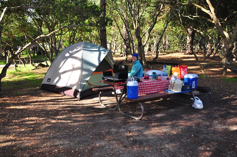
My sis and I recently took a 10-day trip down to Big Sur, a very scenic stretch of coastline south of Monterey, CA. We left town on April 20 after Easter dinner and drove as far as Ashland, then drove the rest of the way to Monterey on Monday. After an unexpected detour to Modesto Subaru because the Check Engine light came on, we set up camp at Veteran’s Memorial Park in Monterey Monday evening.
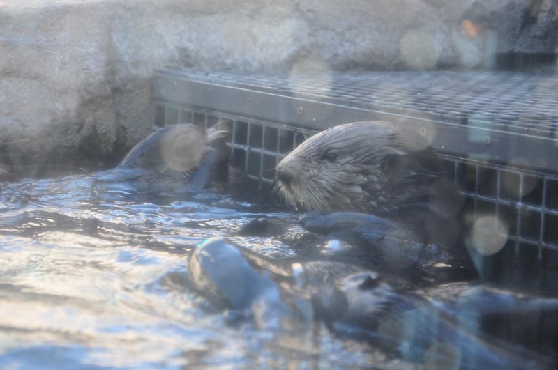
On Tuesday we visited the fabulous Monterey Bay Aquarium. When I visited a year and a half ago the otter exhibit was closed for renovations, so I was delighted to see the otters this time!
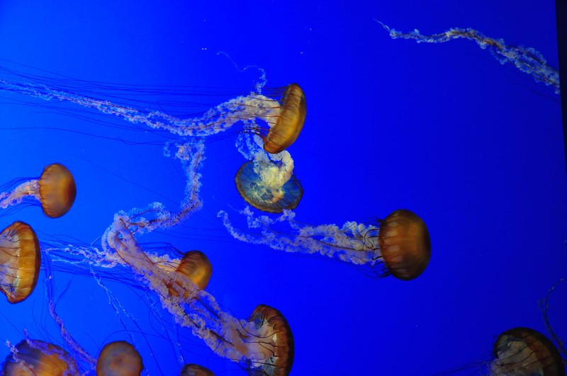
The jellyfish are utterly mesmerizing.
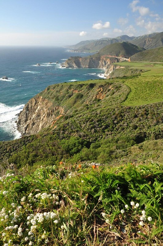
After visiting Cannery Row and Fisherman’s Wharf we headed south on Highway 1. We stopped at one of the many pullouts to check out the VERY windy view north along the coastline. That’s Bixby Bridge in the distance.
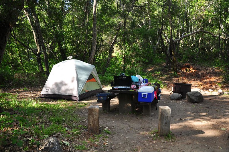
We set up camp at Pfeiffer Big Sur State Park, which has a huge campground along the Big Sur River.
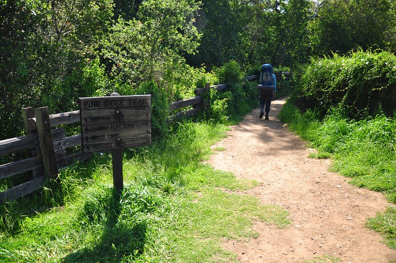
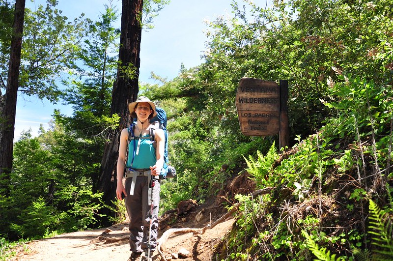
On Wednesday morning we broke came and prepared for our backpacking excursion into the Ventana Wilderness in the Los Padres National Forest. A little bit of history: The Los Padres National Forest gets its name from the Catholic priests who proselytized in the area during the 18th and 19th centuries. It’s one of those forests that comprises two unconnected areas. There is the smaller northern section in Big Sur and then the much larger section down by Santa Barbara. Our destination was Sykes Camp in the 234,000-acre Ventana Wilderness, which was established in 1969. Ventana is Spanish for “window” which refers to a unique notch on a ridge near Ventana Double Cone. Legend says that an arch once existed over the top of the notch creating a true window, but geologists have found no evidence to support that. (You can see a picture on the Wikipedia page.)
We set out from Big Sur Station along Highway 1 at 10:30am under sunny skies.
For the first few miles we could see across the river canyon to Manuel Peak and the trail that climbs it.

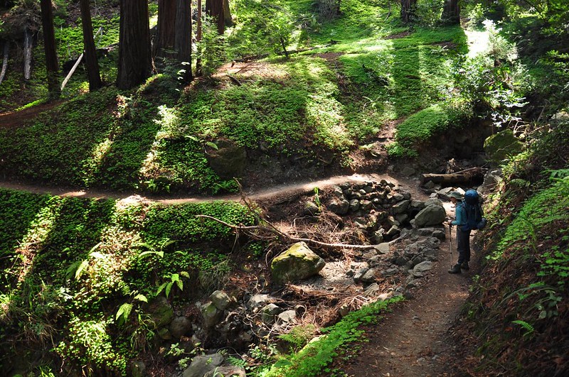
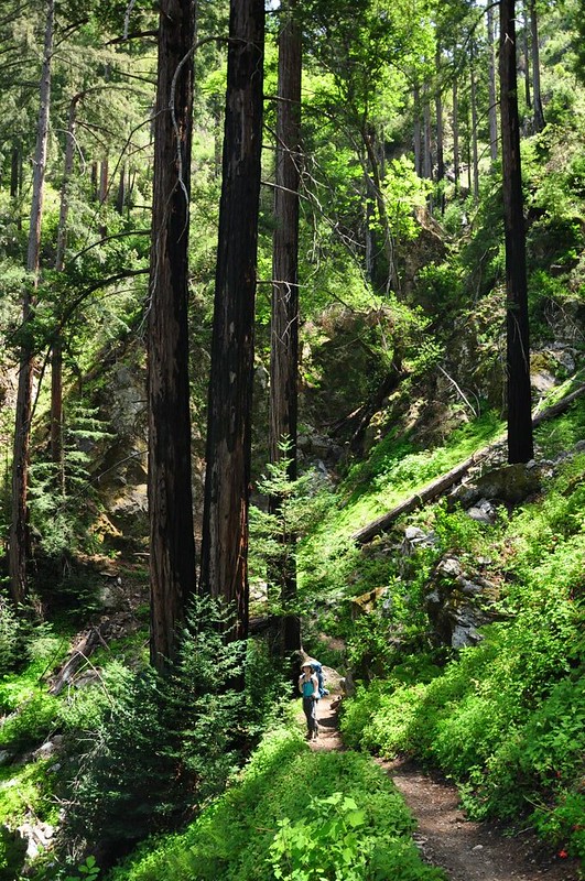
The Pine Ridge Trail does a lot of climbing in the first few miles. Along the whole length it continually passes in and out of different little zones, everything from cool redwood groves to open chaparral with sweeping views.


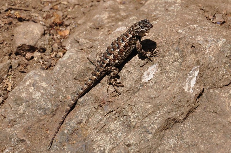
We saw lots and lots of lizards.
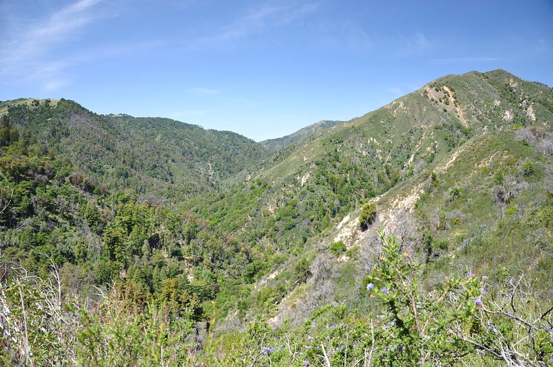
View into the Ventana Wilderness:

After an hour and 45 minutes and 2.3 miles we reached the wilderness boundary.
We saw and heard many acorn woodpeckers and saw their “granaries” in the trees. From Wikipedia: “The woodpeckers create granaries or “acorn trees” by drilling holes in dead trees, dead branches, telephone poles, and wooden buildings. The woodpeckers then collect acorns and find a hole that is just the right size for the acorn. As acorns dry out, they are moved to smaller holes and granary maintenance requires a significant amount of the bird’s time.” Fascinating!


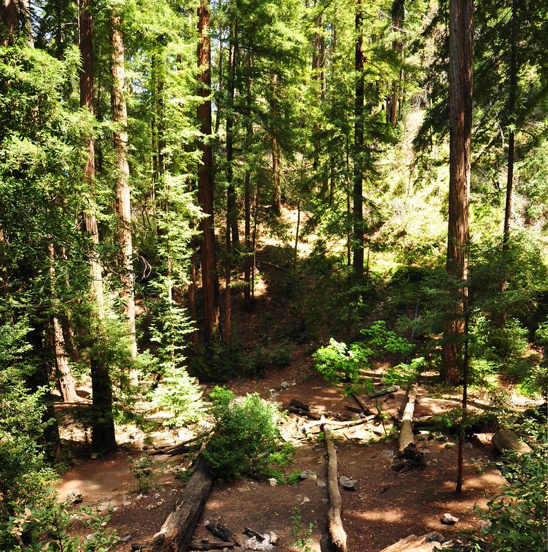
At 2pm after hiking 5.3 miles we reached Terrace Creek Camp, an absolutely lovely spot with lots of big redwoods and a delightful gurgling creek (the first water we had seen thus far). It was so interesting to me to see these lush green forest groves (very reminiscent of what I see when I hike in the Cascades), and then to be hiking through drier open areas just minutes later.

After a long rest here we donned our packs and kept moving.
After a lot more up and down (this trail is the epitome of a roller coaster trail), we descended almost (but not quite) all the way to the Big Sur River where Barlow Flat Camp is located at the 6.7 mile mark. Then the trail climbed up, up, up out of the river canyon, topping out at 8.2 miles before descending all the way back down to the river and Sykes Camp. Sheesh, what were the trail surveyors thinking?
The last two miles downhill to Sykes Camp were tough. I was hurting by this point, being a little out of shape this early in the hiking season and feeling worn out from all the up and down we had done. To top it off there were many stretches of overgrown trail here. I cringed as I passed through these vegetation tunnels, thinking that I would be crawling with ticks by the time I finally got to camp (fortunately that proved not to be true; no ticks whatsoever).

Finally at 5:30pm we reached Sykes Camp. One last hurdle: cross the river. Fortunately we were able to rock-hop across.

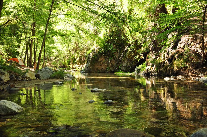
We had deliberately timed our visit here to be midweek when we would encounter the least amount of people. Everything we read said that this place was super popular, with as many as 200 people camped there on busy weekends! 😯 There were a few other tents there but we easily found a nice spot. Here’s a photo from the next morning:
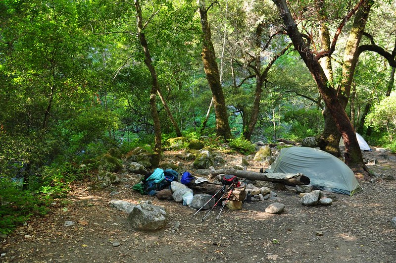
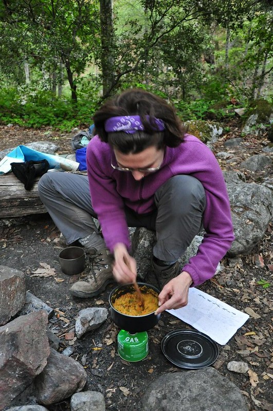
After we put up the tent we quickly set about making dinner. We were HUNGRY!
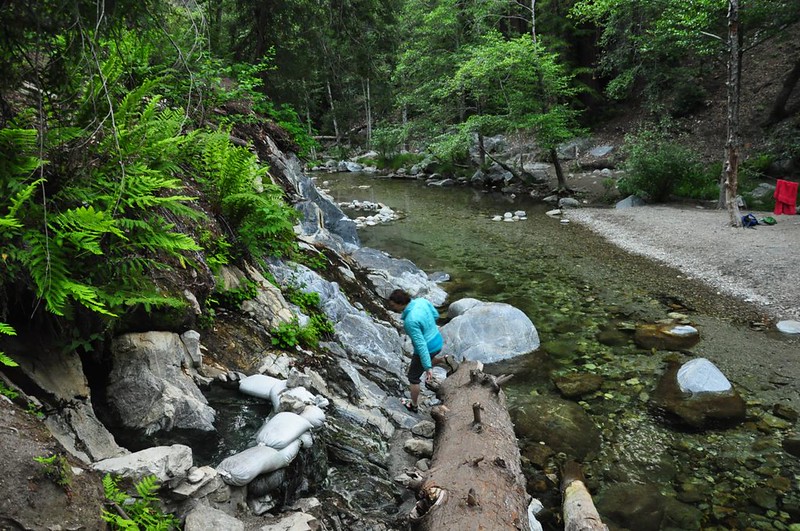
After dinner we set out to find the hot springs. Unfortunately they are a half-mile hike away, downriver. We knew we had to cross the river several times so I wore my Crocs. The “trail” to the springs turned out to be a half-hour obstacle course of fallen trees, rocks, huge boulders, and river crossings, made all the more difficult by my flimsy footwear and the need to avoid the ubiquitous poison oak. Finally we started smelling sulfur. We made it! In the picture below you can see a teeny-tiny pool (no adult could submerge in that) and up ahead a rock-lined pool in the river, which was only lukewarm.
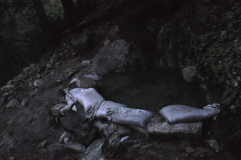
Above that river pool is a pool with much warmer water, but that one was full so we settled in at the upper pool, which we had all to ourselves for the 45 minutes we stayed. Here is a dark and grainy picture of that pool, which is about six or seven feet wide.
I didn’t get a picture of the lower pool because there were people, but there is a picture on this website.
The hot water felt good after the long hard hike, and we both could have stayed longer. But because of the three river crossings and the difficult trail back to camp we wanted to get that out of the way before it was completely dark. Even with our headlamps the way back was challenging since it was well past dusk.
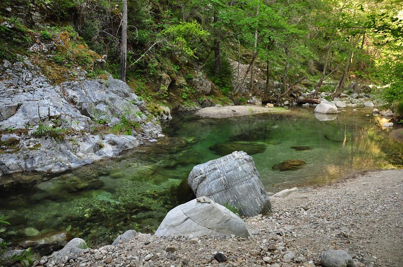
In the morning before hiking out Deb wanted to go back to the hot springs. With a long hard 10-mile hike out that day, I wasn’t up for the hour round-trip hike to the hot springs and back. So while she was soaking I filtered water near a lovely deep green swimming hole…
Enjoyed watching a newt…

And relaxed by the river, enjoying the serene and idyllic setting.
When Deb got back we dawdled a bit, but eventually had to pack up and head out. This is looking down the canyon of the Big Sur River on our hike out.
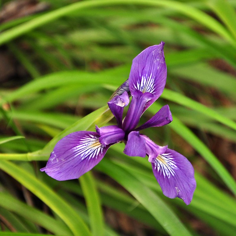
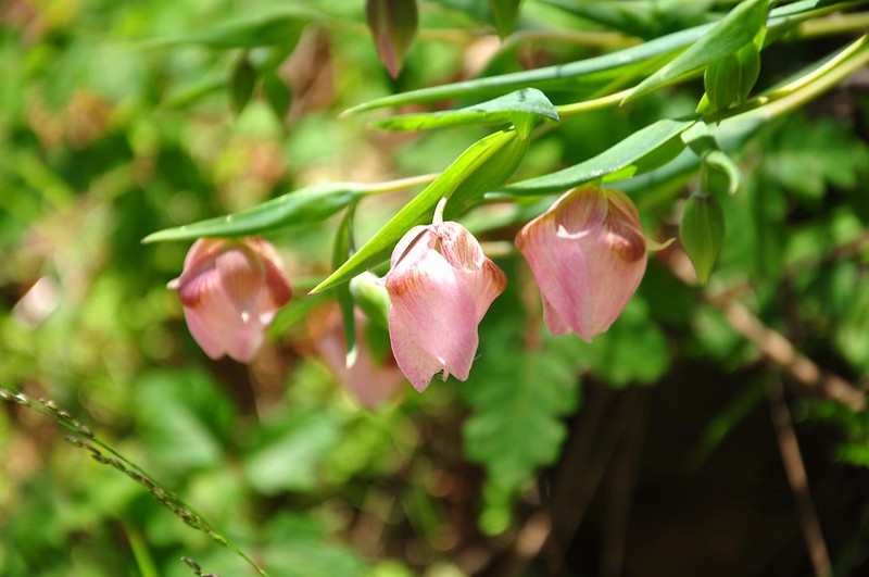
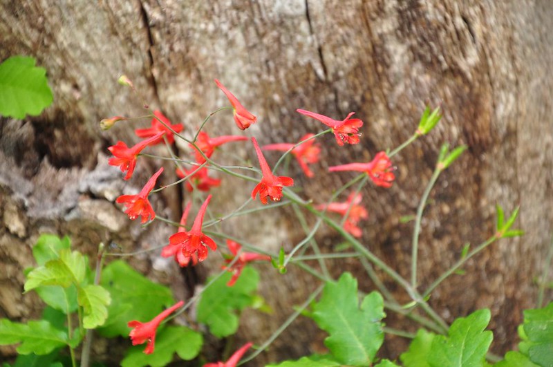
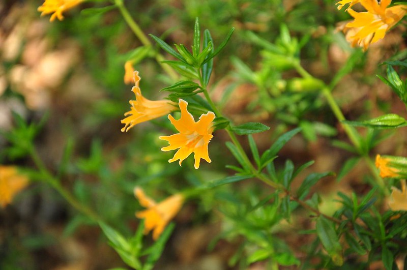
One big bonus on this hike is that we saw all sorts of wildflowers, including LOTS of paintbrush and iris:
Another thing we saw a whole bunch of: poison oak. I saw more poison oak on this trip than I’ve seen in all my life combined up to this point. It was EVERYWHERE. After a few days it became evident that neither of us seemed to come in contact with it, but we felt like absolutely everything we brought with us on the trek must be contaminated (probably not true, but after you look at millions of poison oak leaves over two days you just feel like it must have touched all your stuff at some point). Despite the warnings about the proliferation of ticks, we never saw a single one.
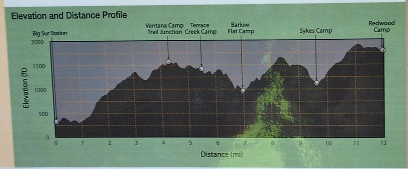
This hike ended up being a lot harder than I expected, and the constant up-and-down was tiring. Here is the elevation profile from the sign at the trailhead.
The last mile of trail before the car was flat and easy but I was so sore and tired that I wasn’t hiking, I was shuffling. I’m sure I looked rather pitiful. If I had to do it over again I would schedule a layover day to enjoy the hot springs, hang out by the river, and just laze around enjoying the beautiful setting. Hiking 20 miles in about 36 hours was pretty tough this early in the season when I’m not in peak physical condition. That said, I’m glad we went and saw this lovely place!


