Two weekends ago Greg and I spent a long weekend up along the coastal section of Olympic National Park. Oregon has beautiful beaches, but the Olympic coast is PRETTY. DANG. STUNNING.
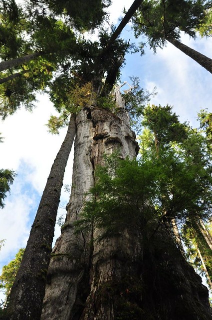
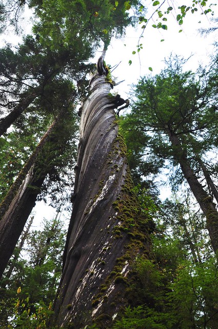
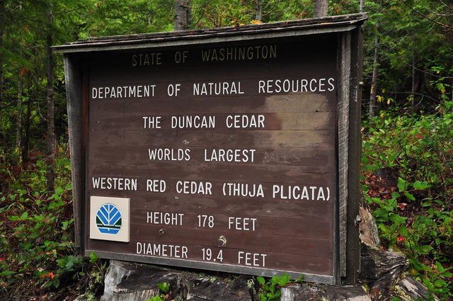
On the drive up on Friday, we drove up along the north shore of Lake Quinault to check out two things. The first was a huge Western Red Cedar that we couldn’t visit when we were here in May due to a downed tree on the staircase. According to two different Quinault brochures (see one of them here), this is the largest WRC in the world (circumference: 63.5′, diameter: 19.5′, height: 174′) but on Saturday we would visit another tree with the same claim.
World’s largest (or is it?):
A pretty sweet nurse log with roots stretching a little further each year to get to that soil far below:
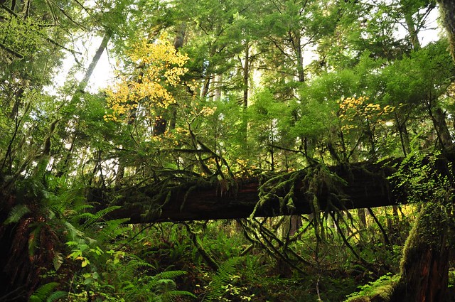
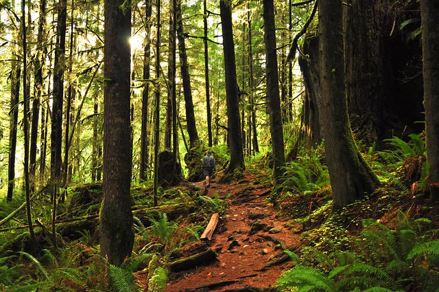
The forest here is so pretty:
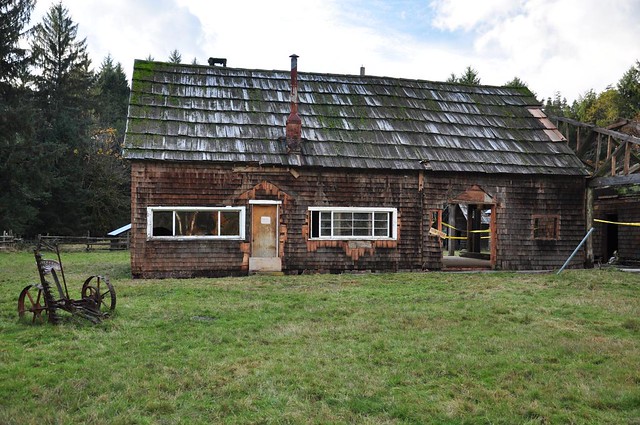
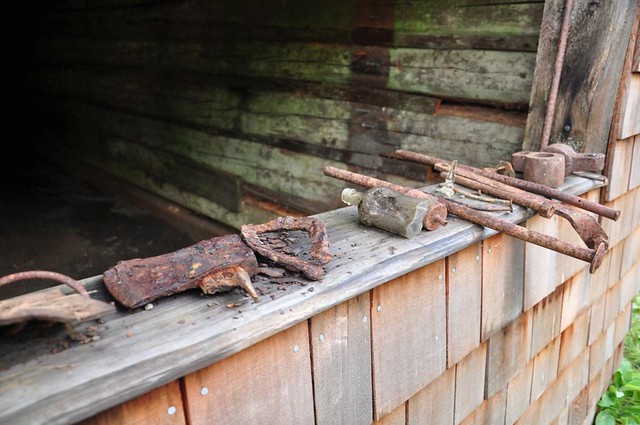
Then we drove a little further up the road and stopped at the Kestner Homestead, which the Park Service is apparently in the process of restoring. You’re supposed to get there via a trail from the nearby ranger station, but with so few visitors around we parked at the end of the driveway for the homestead. I’m not sure the history of this place. I bet we would have found out if we had walked the trail from the ranger station. 😉
It’s a real fixer-upper:
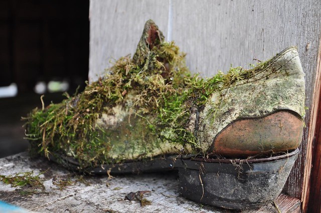
Lots of cool old stuff laying around:
Mossy shoe:
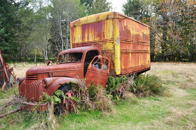
Seen better days:
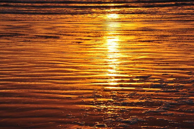
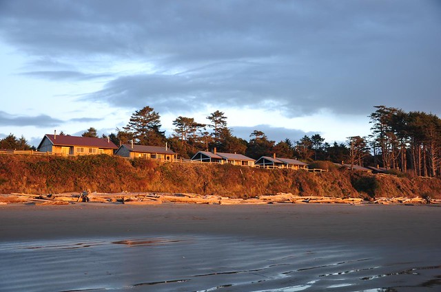
We arrived at Kalaloch Lodge right before sunset and after checking in and bundling up we hurried down to the beach for sunset. Boy was it COLD on the beach!!
The next morning we headed to La Push to visit the beaches there. On the way we stopped to visit two old trees on DNR land. The first one was a cool old corkscrew tree that had no signs whatsoever. We only knew about it because there’s a geocache there. There’s a short trail from the road and even has an old rotting boardwalk. Maybe there was a sign once.
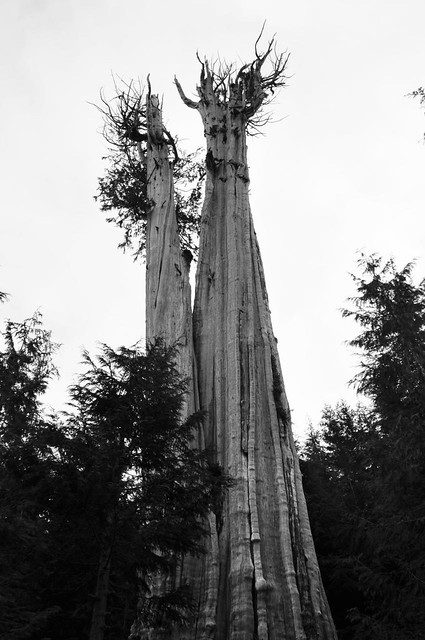
Further up the road was a big cedar which, like the cedar we saw the day before, lays claim to the largest in the world.
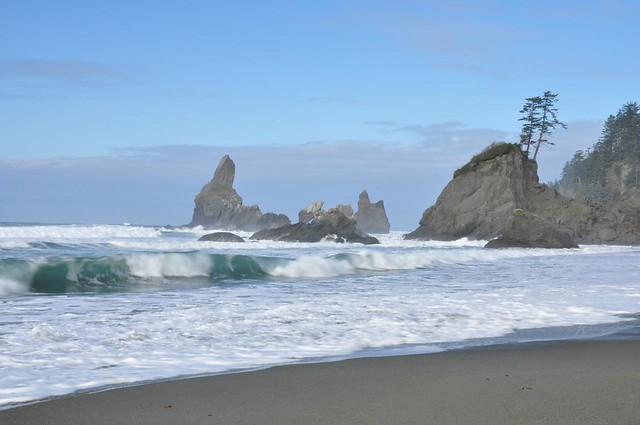
We parked at the trailhead for Second Beach and walked through the forest down to the beach. It was quite cold, but dry. Not too many people around, so it was actually kind of pleasant down there. We walked south along the beach and then turned around and came back. I know it’s cliche, but I do love a good walk on the beach! 😀
The natural arch at the north end of the beach:
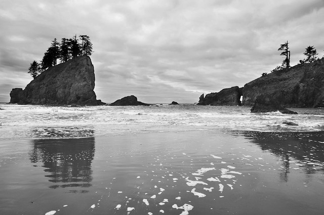
Sea stacks off shore:
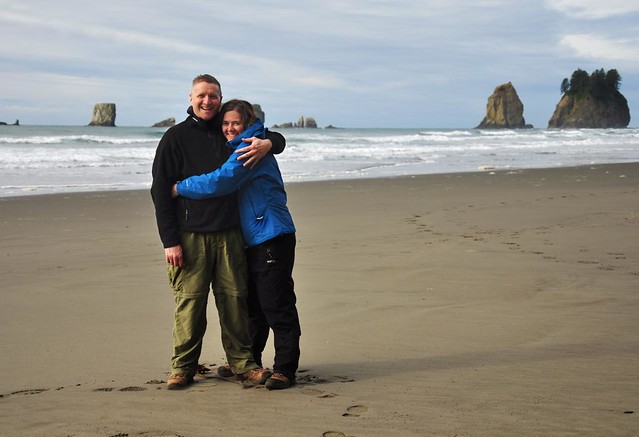
Enjoying the beach:
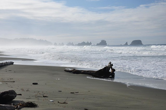
We drove on over to Rialto Beach and tried to walk up to Hole-in-the-Wall. But we found ourselves unable to get across Ellen Creek:
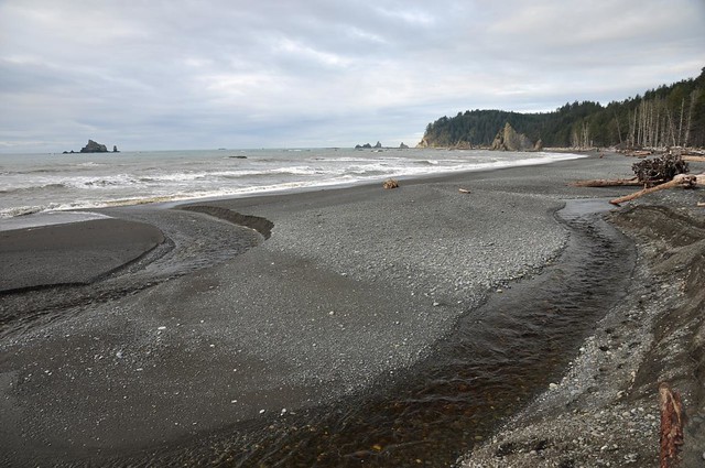
Doesn’t look like much in the picture, but it was just deep enough and swift enough and wide enough that the only way across was to get our feet wet. So we turned back.
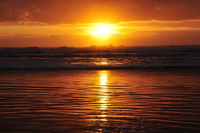
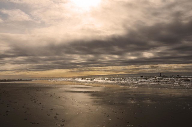
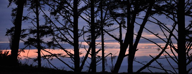
We stopped at Ruby Beach for sunset, but all we got was the faintest smear of pink. I went somewhere where I could put some trees in front of it to make it more interesting.
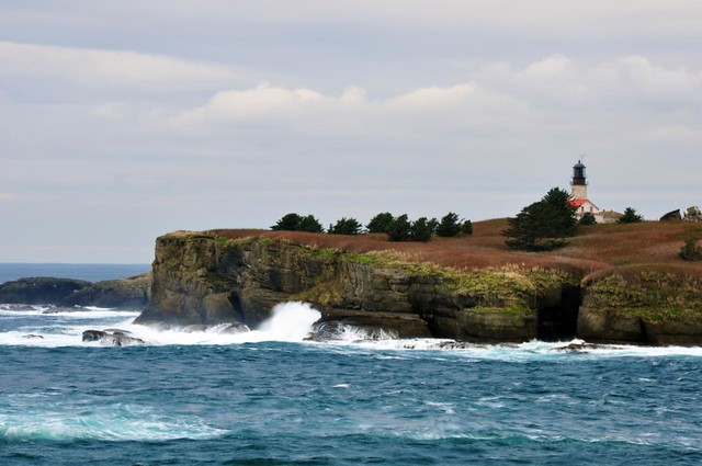
On Sunday we got up at 7:00 and since we hadn’t switched our clocks back yet it was really 6:00. Not easy to do this time of year! We made the LONG (two hours one way) drive up to Cape Flattery, the most NW point of the continental U.S. It’s on the Makah Indian Reservation, so you have to purchase a $10 annual recreation pass in Neah Bay.
A beautiful little cove:
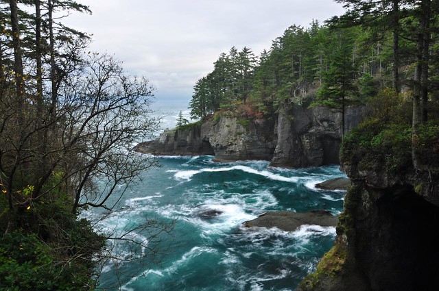
Another beautiful little cove:
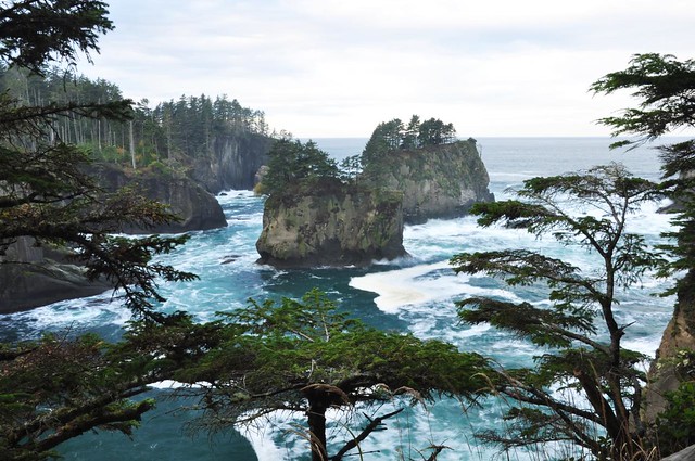
Tatoosh Island and the Cape Flattery Lighthouse:
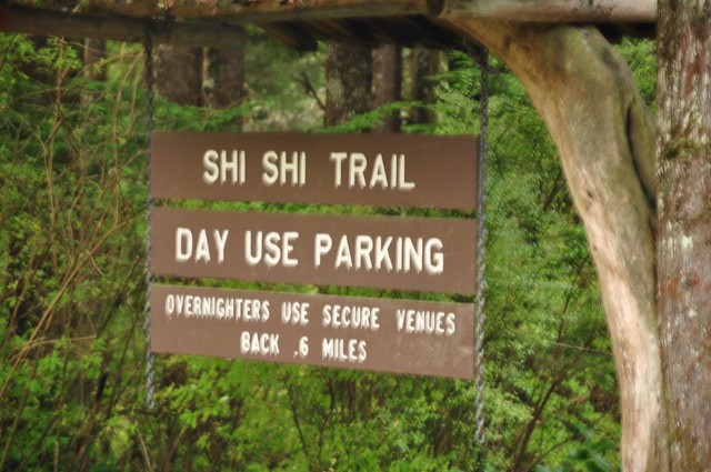
After Cape Flattery we headed to the trailhead for Shi Shi Beach, which we had read was a gorgeous beach. Apparently the money from that recreation pass is not used for monitoring the trailheads. We had seen all these houses along the road advertising “securing parking here” and now we knew the story behind that.
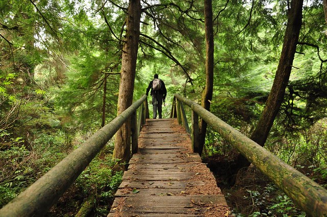
You have to hike a two-mile trail through the forest to get to the beach. The beach is just inside the borders of Olympic National Park, but the trail is on reservation land. Until a few years ago, the entire trail was along an old road and was a huge muddy mess. Then they re-routed the first mile of trail and built bridges and boardwalks.
But the second mile is still along the old road and is one long mudpit. We are talking EPIC amounts of mud. I wish I had sound to go along with the photo below, which was taken at the first stretch of mud. Even from 50+ feet away I could hear the sucking sound of the mud as Greg slopped through the mess.
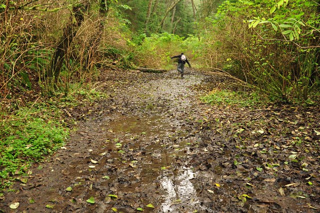
After that first mudpit we discovered that there was so much mud and it’s so persistent year-round that there are very well-established little detour trails in the forest alongside the road. Some of these detour trails were also muddy, prompting Greg to mutter at one point, “Great, the detour has a detour.” 😆
But we were well-rewarded for our efforts. Shi Shi Beach is stunningly beautiful. Not only that but we had it all to ourselves AND the sun came out when we arrived! 😀
The north end of the beach:
Looking south to Point of Arches. We didn’t hike down there this time, but we’ll be back…
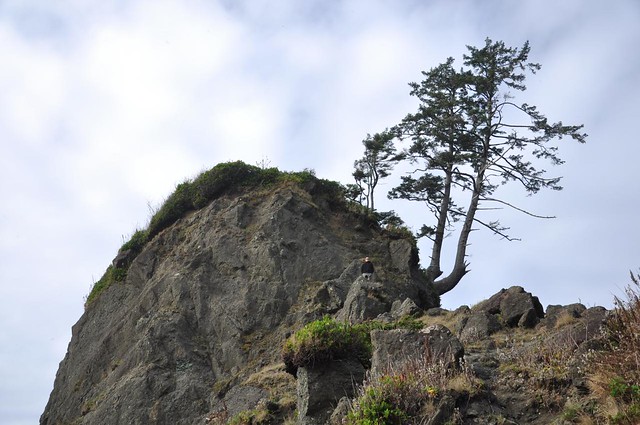
Tiny Greg on a big rock:
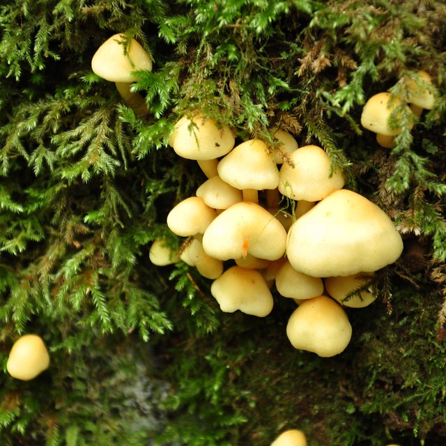
On the way back, on one of the detour trails, I spotted these cute mushrooms growing on a tree.
After slogging back to the car through the mud, we headed back. We had wanted to visit Lake Ozette too, but there just wasn’t enough daylight left. Next time. We stopped at Ruby Beach again for sunset, but it was a bust.
After a cold dry weekend, it started raining on Monday, but we were headed home so no biggie. If you’ve never visited the coast up there I highly recommend it. It’s absolutely gorgeous!


