My sister and I did the McNeil Point hike in 2006 in terrible conditions. I was out of shape and recovering from a bad summer cold. The day was blisteringly hot (in the 90s) and the black flies were biting. I ended up not making it up to the point and waited on the trail for my sis as she hiked the last 1.5 miles up to the shelter.
Sooooo…. I had unfinished business with this hike and was looking forward to finishing what I had started six years ago. When Greg and I arrived at the trailhead just before 10:30 on Saturday we could not believe how many cars were there! I stopped counting at 30 because the cars parked along the road stretched around the corner out of sign. Crazy!
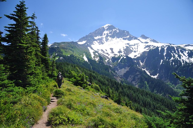
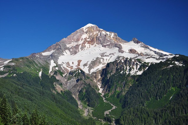
On our way in we stayed on the main trail and didn’t hike around the south side of Bald Mountain, planning instead to hike that part on the way back when the afternoon light on the mountain would be better for pictures. So we had to wait a few miles for our first view of the mountain. Good to see ya, Hood!
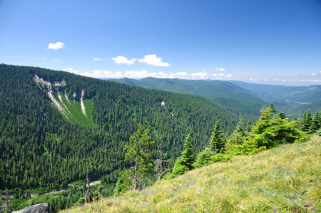
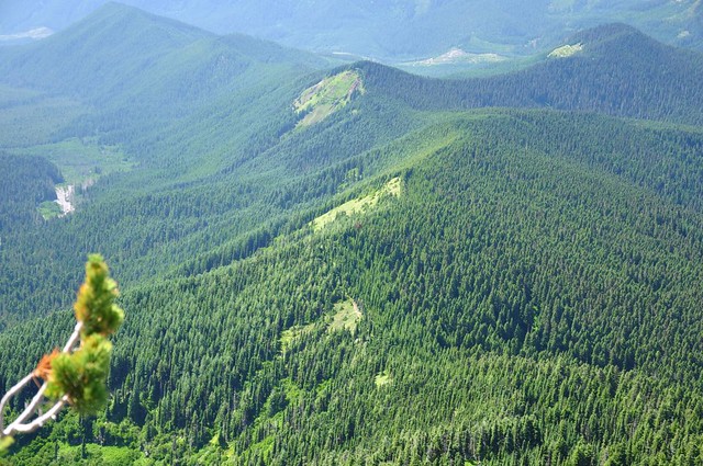
To the south we could see East Zigzag, where we hiked the day before. Behind the foreground ridge, I think it’s the first bump on the left.
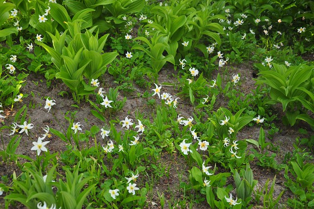
We saw LOTS and LOTS of glacier lilies and false hellebore along the trail.
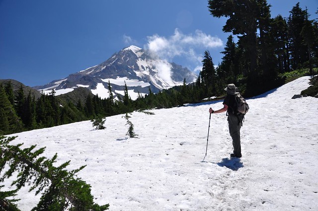
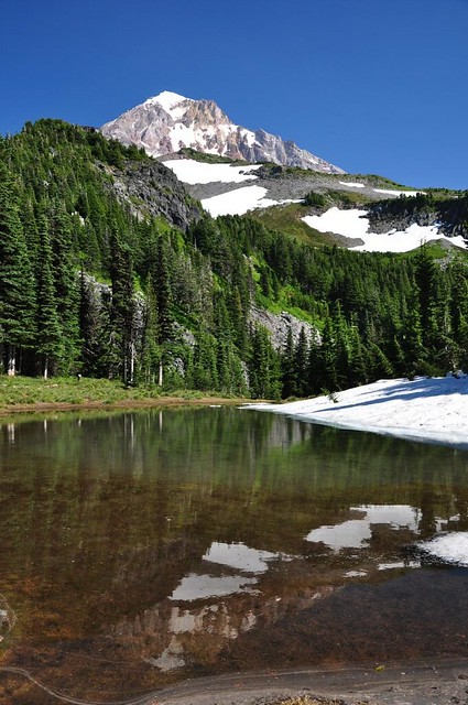
We reached the ponds, which are not yet melted. We had to cross snow at this point. This was not the first snow patch we had to cross and it would not be the last.
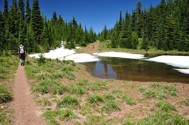
In fact, between the Timberline Trail and McNeil Point there were still LARGE sections of trail that were snow-covered. We were really surprised to see this since recent trip reports didn’t mention all this snow.
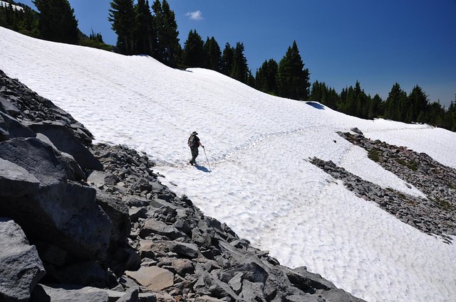
C
rossing the permanent snowfield that never melts.
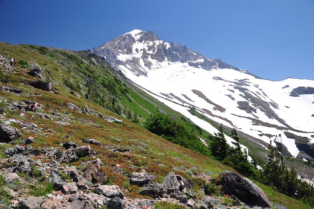
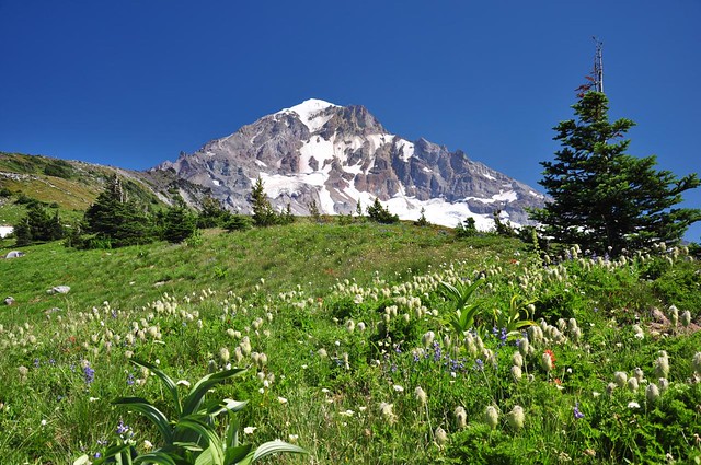
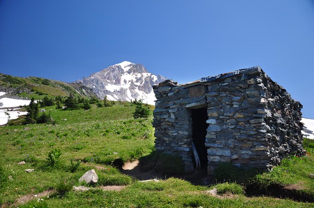
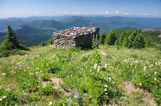
Finally after a long ass-kicking hike we reached McNeil Point! More snow, and the shelter out there beyond. You can also see some tents just left of center.
We hung out on a point above the shelter for a short time before the crazy cold wind put a stop to that. Greg decided to climb up a little further to that “knob” you can see in the photo below.
I headed down to the shelter where it was less windy and enjoyed the views for the hour and a half it took Greg to climb up and get back down to me. I could see the western edge of the burned area from last year’s Dollar Lake Fire.
Lost Lake in the distance. I bet that place was a zoo this weekend.
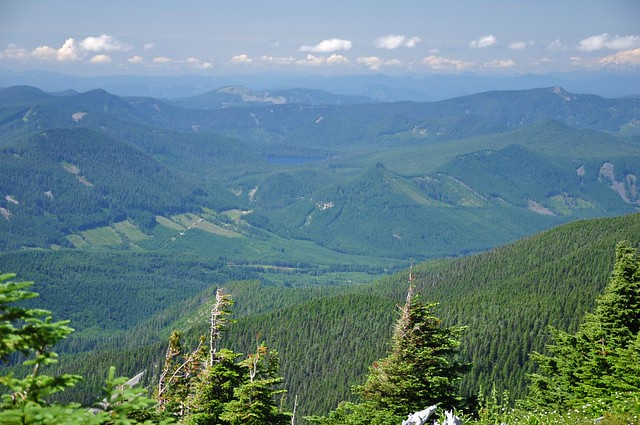
The trail below, and Bald Mountain.
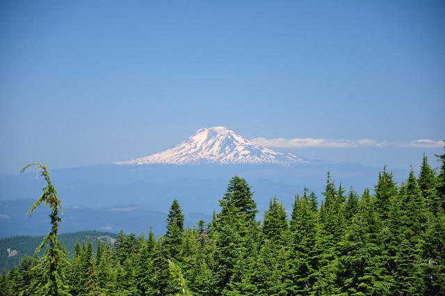
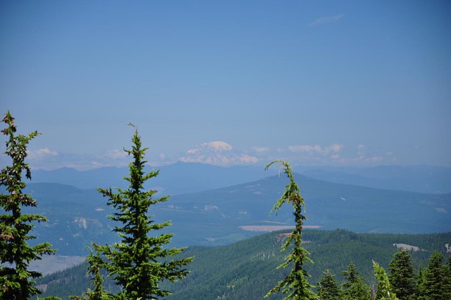
Nice views of Mt. Adams.
And Mt. Rainier:
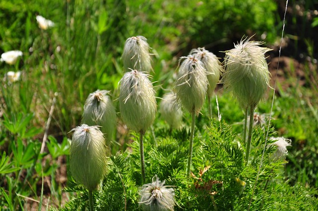
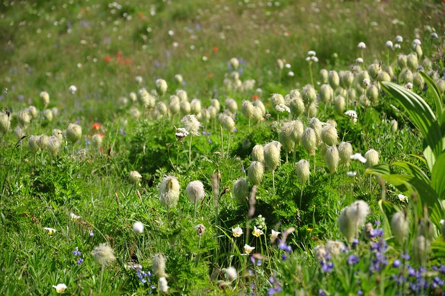
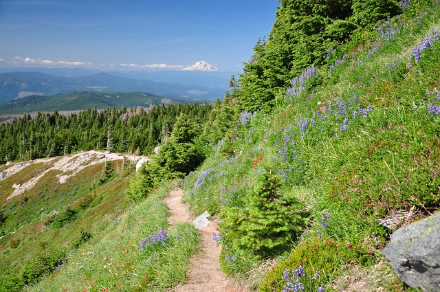
Despite the still-melting snow there were plenty of wildflowers, including those awesome “muppet” flowers known as Western Pasque Flowers.
I think I shot the shelter from every angle possible during my wait.

Wildflowers and more views of Mt. Adams on the hike back down.
We stopped at the ponds on the way back down for a nice reflection shot.
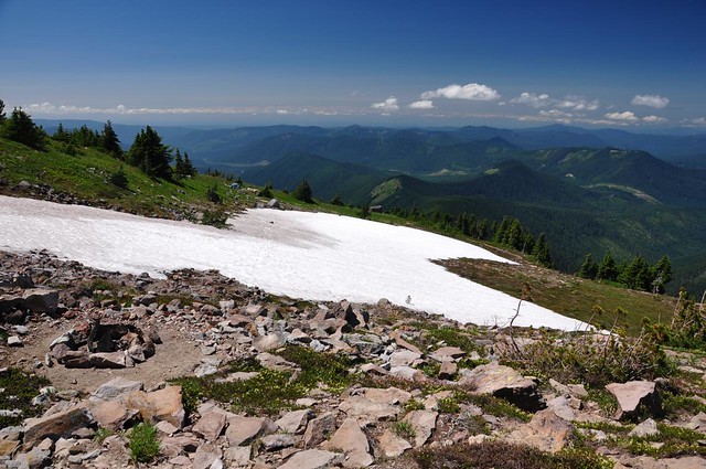
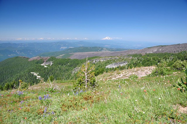
And then after a long tiring trudge we finally reached Bald Mountain and the spectacular Mt. Hood views there. The evening light made it perfect.
Normally I would have loved to hang out there and enjoy the view a bit, but we were getting well into the dinner hour and I was very hungry. So we pushed on. Many of the cars at the trailhead were gone, and their dusty departures had left a fine film of road dust all over my car.
10.5 miles
2,200 feet elevation gain
A little side note: This was sort of an anniversary hike for me and Greg. We were a week short of the five year anniversary of our first hike together. Back in 2007, after a months-long e-mail correspondence, Greg asked if I’d like to go for a hike since we both enjoyed photography, hiking, and wildflowers. We hiked the Vista Ridge trail and visited Cairn Basin. Same area of the mountain almost five years later and we’re still hiking together!


