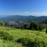
Some geocachers recently placed some caches up in the Fish Creek watershed. I had no idea you could still get up there, but I found out from the geocachers that you can.
The 1996 floods did a heck of a lot of damage in the Fish Creek area. Why? Well, this excerpt from a 7/20/97 article in the Oregonian sums it up pretty well:
Forty-one percent of the old-growth trees are gone, hauled away by log trucks over 140 miles of roads carved throughout the fragile 30,000-acre drainage. Massive piles of logs and rock debris clog roads, and a 110-foot cement bridge is toppled, the result of 236 landslides counted after last year’s massive floods. Wild salmon and steelhead runs, on the decline throughout the Northwest, have been nearly wiped out here.
So the Forest Service decided to decommission every single road in the watershed. (Read more about it at the links below.) However, where Fish Creek Road used to be, there is now a nice wide easy-to-follow path.
Fish Creek: Adaptive Watershed Management in the 21st Century
The Fisheries Program Response to the Floods of the mid-1990s
http://www.fs.fed.us/r6/fishing/regional/habitat/PNW_WWRestRep_Final053.pdf
The starting point is just where Road 5410 starts heading uphill off of the still-existing part of Fish Creek Road. Where 5410 goes uphill, Fish Creek Road goes straight for a few hundred feet before dead-ending. That’s where we parked.
The path was wide and flat and easy to follow.
However, because of the downpour the previous day, every dip and depression had become a huge puddle. Some of them had to be bushwhacked around. And the first creek crossing was a doozy. Rimrock Creek had gouged out a huge gash where the trail was supposed to be.
It was easy enough to get down to the creek just a bit upstream from that spot. But before tackling the creek crossing, we started looking for a geocache that was supposed to be hidden nearby. I quickly gave up when the GPS signal proved less than helpful. So while Greg looked for it, I took some pictures of the creek.
After all the rain the day before, getting across the without getting wet was no easy matter. We spent 10 minutes building a bridge so we could get across. A group of about a dozen people showed up at this point, which was a big surprise. We didn’t expect to see anybody else back here. Overhearing snippets of conversation, it almost sounded like they were with some organization like Oregon Wild or something. The leader seemed to be describing the history of the place to the rest of the group. Anyway, while they were downstream checking out the washout, we built our bridge and made our way across. (At one point during the bridge building, Greg roared in frustration at the constantly tumbling rocks, which kept being shifted by the rushing water. One of the people from that group – who were out of sight but still within earshot – came to make sure we were okay. Nice of him to check on us! I felt bad that we alarmed him!)
After being high above Fish Creek for awhile, we finally got a good look at it. I loved the fog hovering in the treetops across the valley!
There were many many streams to cross. I’m sure that most of them – if not all – would have been a cinch to cross if we hadn’t come the day after a torrential downpour. But there were some very tricky crossings and to get across the creek known as Second Creek, we had to use this giant log that was just downstream of the trail crossing.
I crawled across the entire way. I didn’t trust my balance on that thing. It was big and sturdy, but it was also wet and slippery. Crawling, it turned out, worked just great! My knees didn’t like it, but it was better than falling into the creek!
There were LOTS of maples along this hike. Unfortunately, all the leaves had already fallen. This would have been a very beautiful walk two weeks ago. But unfortunately in the mountains winter has already blanketed the world with its brown, dead, colorless cloak of ugliness. The ground was totally carpeted in an ugly rotting mess of brown leaves. This section, it looks like, would have been quite delightful a few weeks ago. But not so pretty now.
After about 2.5 miles we reached the junction with another decommissioned road, Road 5430. It headed off to the west, where it very shortly crossed Fish Creek on a big concrete bridge. Unlike Fish Creek Road, it doesn’t look like 5430 is very walkable. Looking up the hill, it appeared to be very overgrown with many mounds of dirt and fallen logs.
Fish Creek was more like Fish River. It was as huge and roaring as the Clackamas, no doubt because of all that rain the day before. This is looking downstream from the bridge.
We made this our turnaround point. By the time we finished lunch it was 1:30 and if we continued upstream to find the other caches we would be walking back in the dark. So we decided to come back in a prettier season on a day when it wasn’t dark by 5:00.
On the way back we found a much easier way around Rimrock Creek. On the south side of the creek we spotted a trail heading uphill parallel to the creek. It dumped us out on Road 5420, another decommissioned road which ran parallel to Fish Creek Road just a short ways uphill. Where 5420 crossed Rimrock Creek, it was a little easier to get across, although still tricky with the high creek. 5420 dumped us out on 5410 just uphill from the car.
Since it’s been more than ten years since the road was ripped up, I didn’t know what to expect in the way of conditions. It isn’t overgrown at all and looks like it is frequently used. We saw tire tracks in a few places and since the tread of the path is so wide I’m thinking this must be a popular spot for ATVs. Still, I didn’t see the kind of damage you’d expect in ATV country. In any case, this clearly gets used pretty often. It’s an easy hike and if you don’t go after a big rainfall it wouldn’t be challenging at all. We’ll go back next year and explore further upstream.


