On Labor Day, I had to get out and go hiking and enjoy the gorgeous day. So I decided on the 7.2 mile round-trip hike to Potato Butte. The trailhead is on Road 380, off of Road 46, on the west end of the Olallie Lake Scenic Area. I’ve never driven down that far before. It takes a LONG TIME. Two hours from Portland. But it’s such a beautiful drive, I didn’t mind.
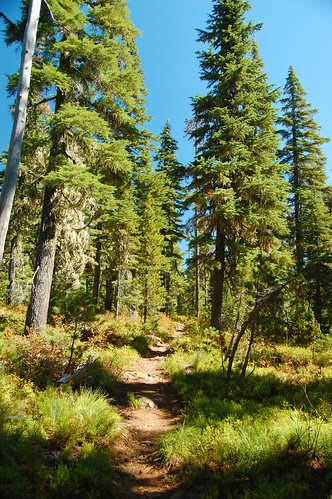
Anyway, onwards to the hike! The trail starts climbing up right away and the first mile (approximately) is through old growth forest with some vine maple, rhododendron, and beargrass. Then suddenly, you’re in a different kind of forest, a lot more open, and the understory is almost completely dominated by beargrass and huckleberries (but I found not a single berry!). So in a good beargrass year (which wouldn’t have been this summer!), this would be quite the hike, equal to Silver Star Mountain in the abundance of blooming beargrass.
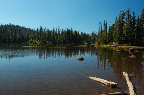
The first lake you pass is Red Lake, a muddy-bottomed but clear-watered lake with plenty of campsites hidden back in the trees, I think.
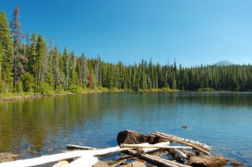
The next lake is Averill Lake, with yet more pleasant campsites along the lake.
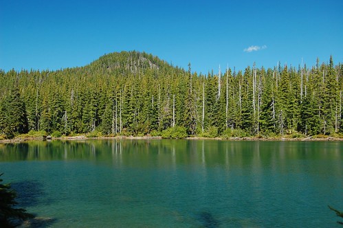
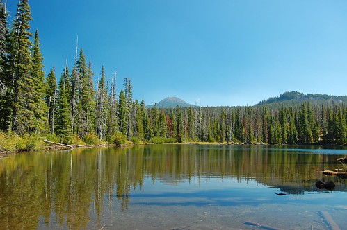
And then, my favorite of the four lakes, Wall Lake, with a view of Potato Butte.
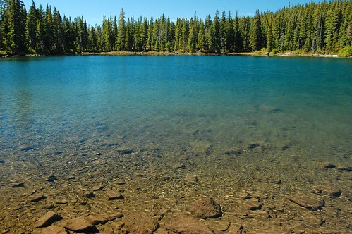
And then, one last lake to pass before heading up Potato Butte. Sheep Lake:
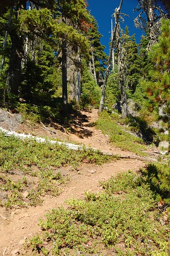
The trail up to the top of Potato Butte is not signed for hikers coming from the west, so you have to keep your eyes open for it. Once you’re on it, when the trail gets to a meadow, there is no signage and you have to know that you’ve got to walk through the meadow briefly before picking up the trail again. Then, as the trail really starts climbing, the quality of the trail deteriorates. It is very steep and the trail surface is loose dirt and gravel. Going up is hard, coming down is even harder. Thank God for hiking poles!
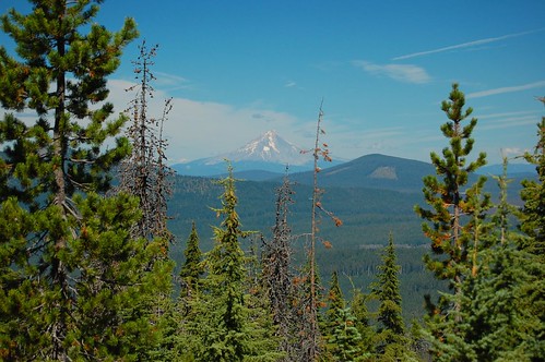
At the top, you can see Mt. Hood (below) and Olallie Butte, but the trees block the view in all other directions.
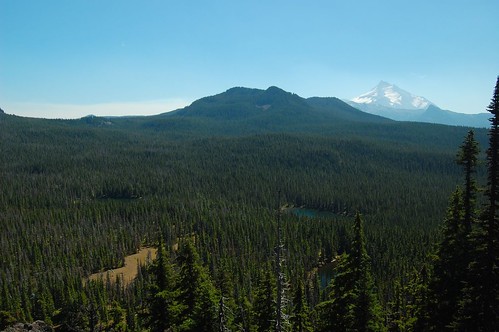
But on your way back down, not too far from the top, you’ll notice a spur trail going off to the left. This takes you to the top of a boulder field from which you can see Mt. Jefferson, as well as some of the lakes in the forest below. The mid-day light was terrible for taking good pictures of Jeff, but the view was worth the hard climb up here. If I did this hike again I’d make sure to come later in the afternoon for better light.
After scrambling my way down the treacherous trail (and not falling!), I hiked back towards the trailhead, stopping for a refreshing wade in Wall Lake. Ah, it felt good! (By the way, with perhaps the exception of Red Lake, all these lakes are great for swimming.)
See the rest of my pictures here.
There had been about six or seven cars at the trailhead when I got there about 10:30. As I hiked, I passed group after group of backpackers heading out, so all those cars were gone when I got back. This area is definitely good for backpacking. You could choose one of these closer lakes, or go off exploring the numerous other lakes in the area, of course. I was delighted with this lovely area. I’ve never done any hiking here. Now I plan to do more!


