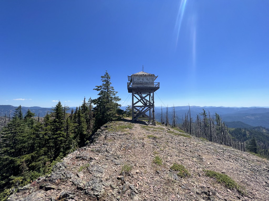
Type: Cupola and 20′ L-4 tower
Status: Abandoned
Elevation: 5,392′
Visited: July 15, 2023
The short spur road to the Illahee Rock Trailhead is easy to miss since a tree is growing up around the sign:

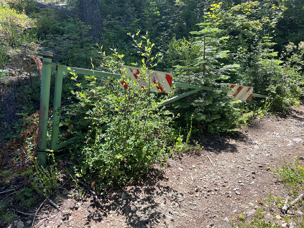
The gate looks like it may stay permanently open these days:
The road is getting a big overgrown:

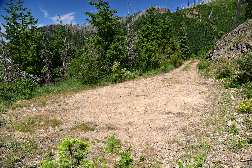
The road ends at a small unsigned trailhead parking area:
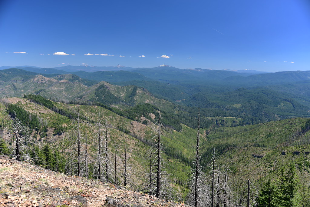
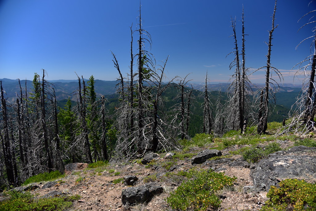
It’s a short 0.9 mile hike from the trailhead to the lookout. (Read more about the hike here.) Much of this area burned in the 2017 Happy Dog Fire:


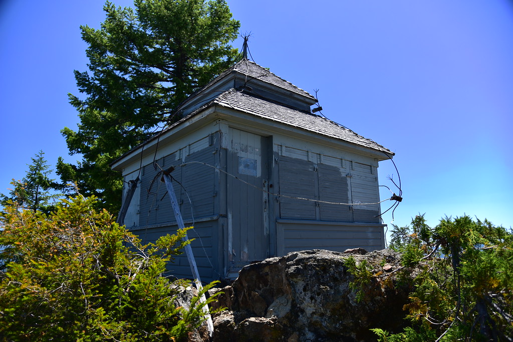
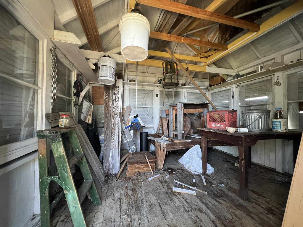
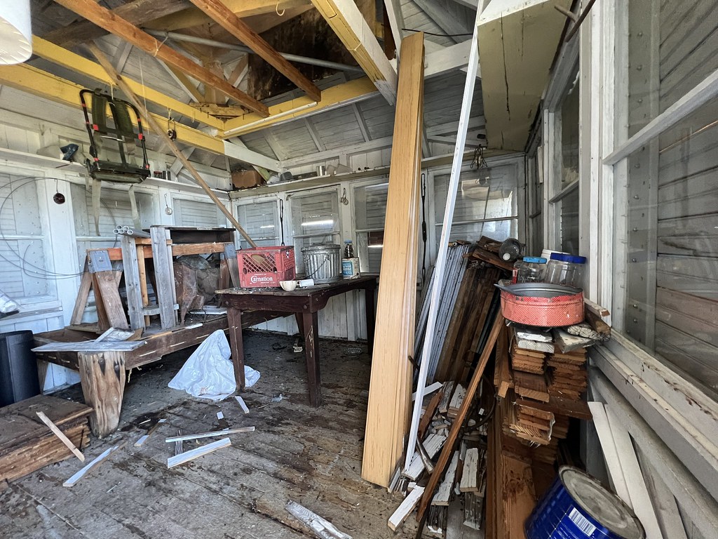
There are two fire lookouts on Illahee Rock. This is a 1925 cupola lookout that had its cupola lowered at some point:


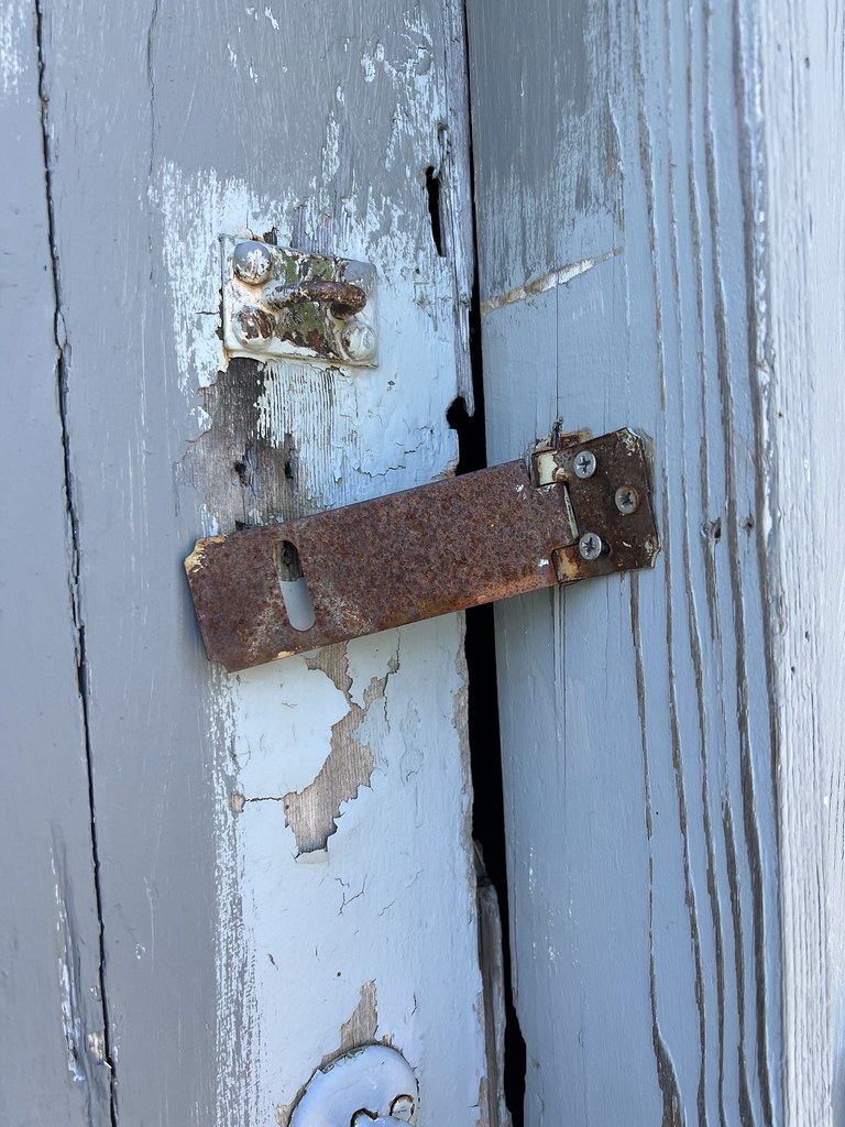
It wasn’t locked, and in fact the latch on the frame and the door no longer line up:
It appears it was being used for storage:

The lightning protection system is broken:

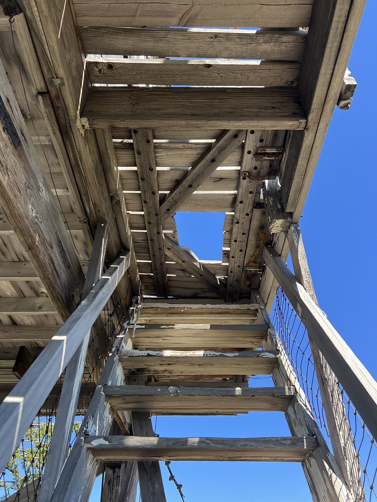
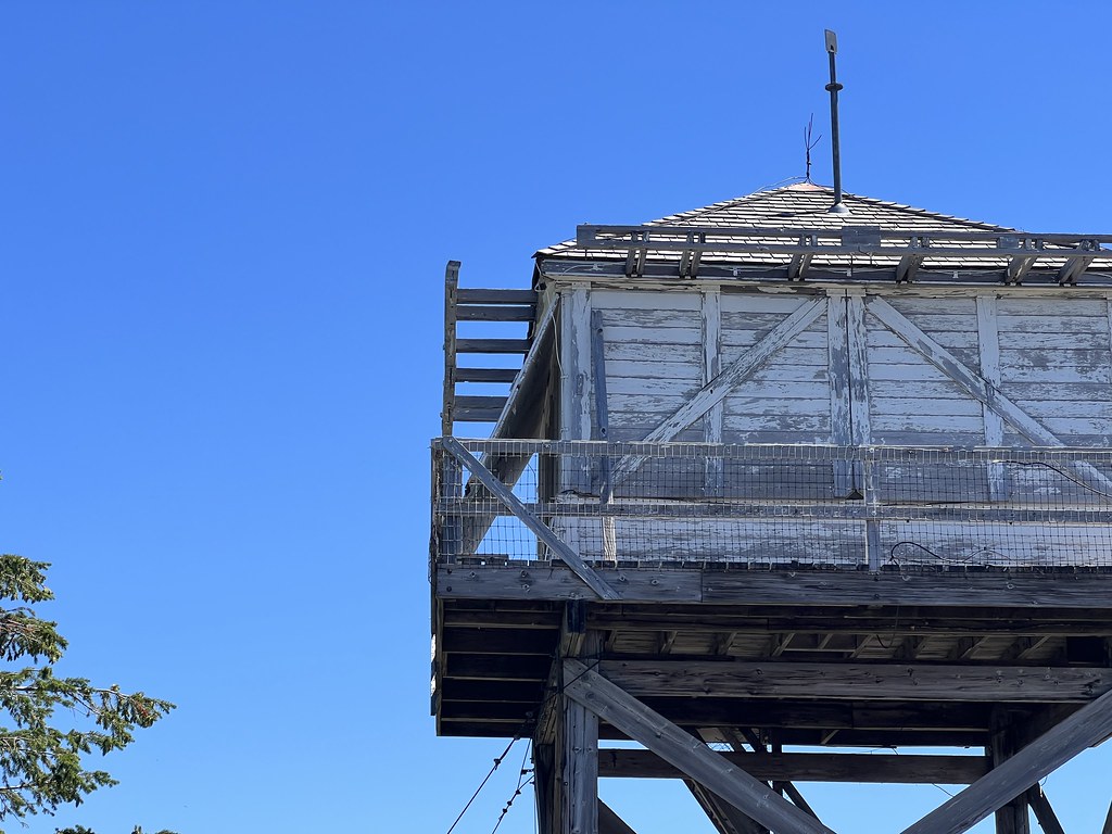
There is also a 20′ tower that was once staffed, but not anymore:


The trapdoor to the catwalk is locked, but someone cut a hole in it at some point to gain access. It’s not a very big hole, though. It would be a tight squeeze:

The lookout is quickly deteriorating and there were pieces of wood everywhere:


The shutters on one side have come undone:

I have no idea what this was used for:

View to the south. The big rounded hump right of center is Twin Lakes Mountain:

Mt. Thielsen and Mt. Bailey to the southeast:

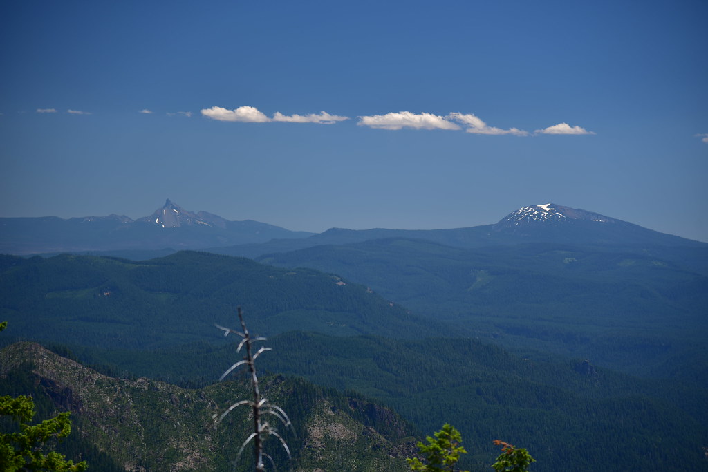
Harding Butte and Spring Mountain to the northeast, with Diamond Peak in the background:
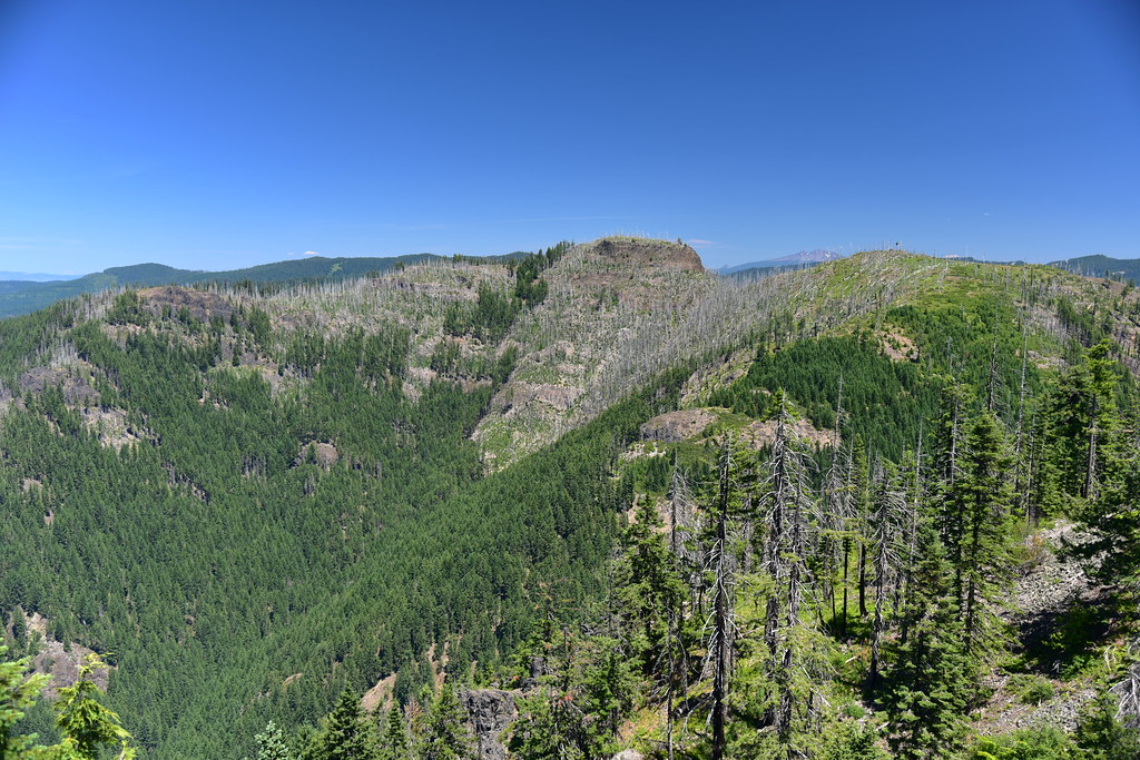

Bohemia Mountain and Fairview Peak to the north:

View to the west, with burnt trees from the fire:
This must be a helicopter landing pad:

More information
Forest Lookouts
Rex’s Forest Fire Lookout Page
National Historic Lookout Register
Peakbagger
Panorama Photos
Geocache
Directions
From Highway 138 turn north onto Road 4760. Drive 1.4 miles and stay straight at an intersection. 7.7 from the highway miles bear right on road 100. Drive for 1.2 miles, then turn left up Road 104 for 0.2 miles. Park at the end of the road and follow the trail 0.9 miles to the summit.
History
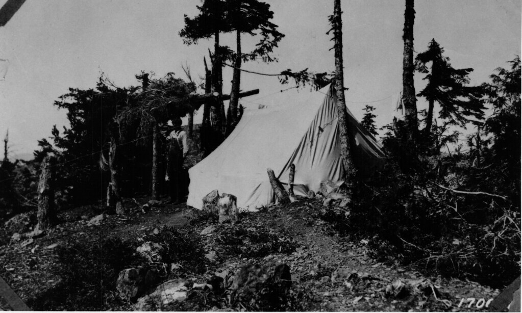
A tent camp was established on Illahee Rock in 1922:
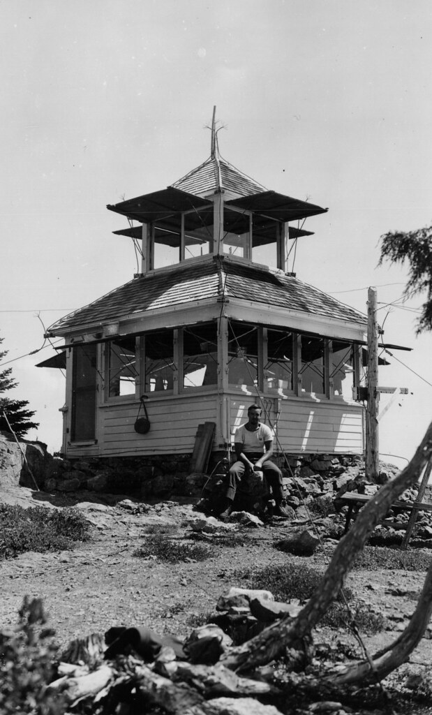
A D-6 cupola was built in 1925, pictured here in 1941:
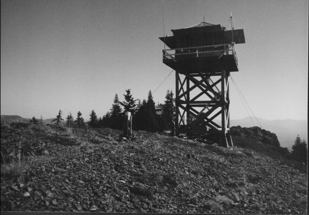
In 1956 a 20′ L-4 tower was built, pictured here in 1988:
At some point the cupola of the first cabin was lowered, pictured here in 1988:

According to the spring 1997 issue of Lookout Network Magazine (issued by the FFLA), “During the Spring Fire on the Umpqua N.F. last summer, the Illahee Rock Lookout was evacuated twice. Neither structure was damaged and restoration is still planned for the old cupola lookout.” Eight years later the spring 2005 issue stated that the Umpqua National Forest received $39,375 of RAC funding to maintain the tower and to complete repairs to the 1925 D-6 ground house to “bring it to acceptable standards for rental.” Converting the cabin into a rental obviously never happened, for reasons that are unclear.
I believe the tower was last staffed in 2015. I found a geocache log from September 2015 when a geocacher talked to Lise, the woman staffing the lookout. I found a July 2016 photo on Facebook from the Glide Flower Show and the lookout is locked up with a remotely-monitored camera on top. This photo from June 2017 shows the same. All of that equipment is gone now.